Showing posts with label Waterfalls. Show all posts

Thursday, May 27, 2021

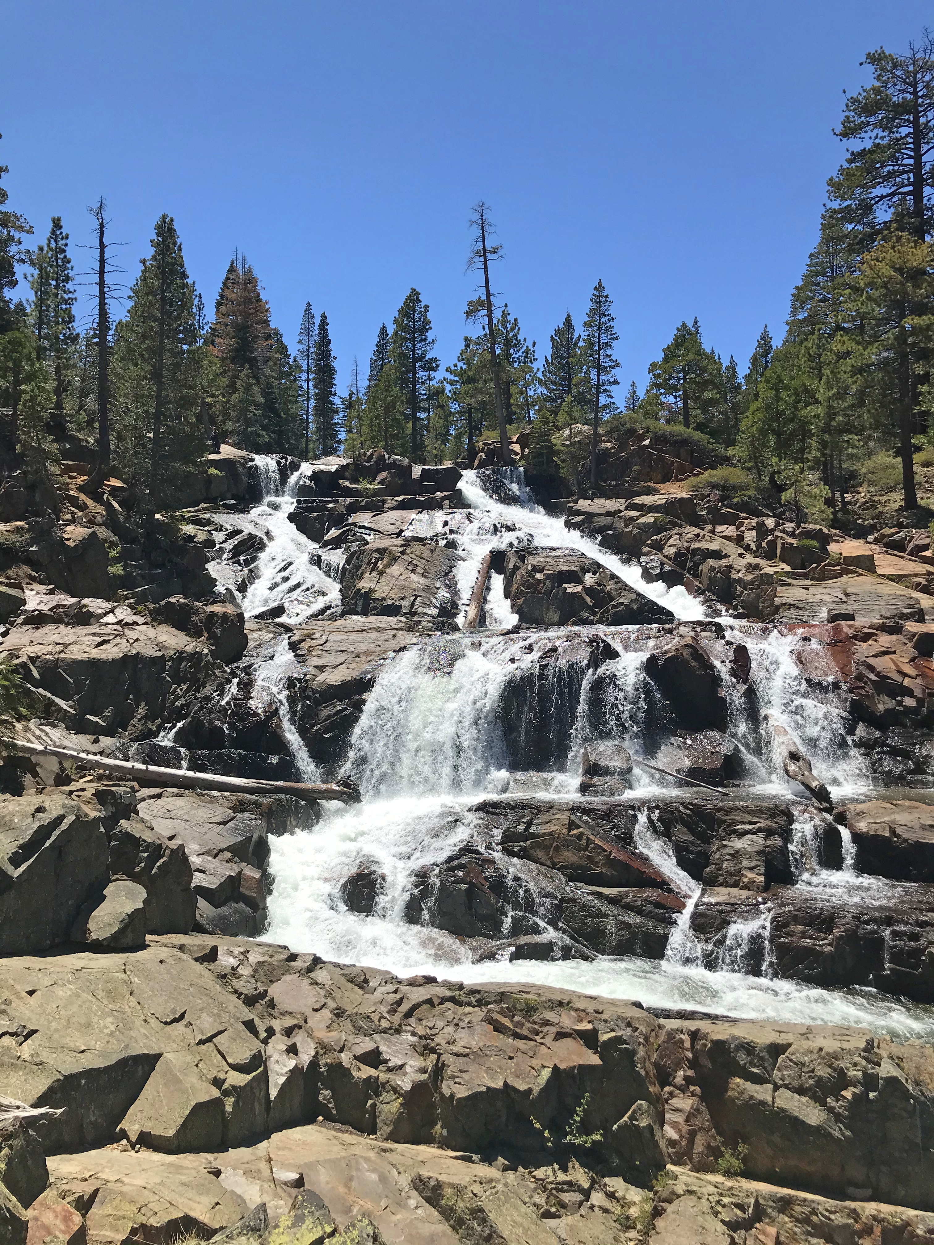
Glen Alpine Falls / Eagle Point

DATE: Thursday, May 27, 2023
DISTANCE: 3.97km / 2.47 miles
ELEVATION GAIN: 98m / 323’
TIME TAKEN: 1:21
ELDORADO NATIONAL FOREST
EL DORADO COUNTY, CA
STOLEN WASHOE LAND
SOUNDTRACK:
Taste: Over The Glen

PHOTO ALBUM
MAP 1 - Glen Alpine Falls
MAP 2 - Eagle Point


TRIP REPORT COMING SOON!


Wednesday, May 26, 2021

Eagle / Cascade Falls

DATE: Wednesday, May 26, 2021

EAGLE FALLS
DISTANCE: 1.9km / 1.19 miles
ELEVATION GAIN: 76m / 250'
TIME TAKEN: 1:09
EMERALD BAY STATE PARK

CASCADE FALLS
DISTANCE: 3.51km / 2.18 MILES
ELEVATION GAIN: 128m / 421'
TIME TAKEN: 1:28

ELDORADO NATIONAL FOREST
EL DORADO COUNTY, CA
STOLEN WASHOE LAND
SOUNDTRACK: Hüsker Dü: Everything Falls Apart

PHOTO ALBUM
MAP


TRIP REPORT COMING...?


Monday, April 5, 2021

El Salto Falls

DATE: Monday, April 5, 2021
DISTANCE: 3.74km / 2.33 miles
ELEVATION GAIN: 602m / 1976'
TIME TAKEN: 1:25
TAOS INDIAN RESERVATION
TAOS COUNTY, NM
SOUNDTRACK: Unwound: Below The Salt

PHOTO ALBUM
MAP


FULL HIKE REPORT COMING SOON!


Monday, February 15, 2021

Wednesday, February 3, 2021

Murrieta Falls

DATE: Wednesday, February 3, 2021
DISTANCE: 12.37km / 13.28 miles
ELEVATION GAIN: 1277m / 4191’
TIME TAKEN: 8 hr
DEL VALLE REGIONAL PARK
OHLONE REGIONAL WILDERNESS
ALAMEDA COUNTY, CA
SOUNDTRACK: Tyrranicide: Facing Reality

SUMMITS:

• Rocky Ridge: 739m / 2426’
• Schlieper Rock: 939m / 3080’

PHOTO ALBUM
MAP


FULL HIKE DESCRIPTION COMING SOON!


Friday, January 15, 2021

Death Valley '21: Short Hikes

DATE: Friday, January 15, 2021
TOTAL DISTANCE: 13km / 8.13m
TOTAL ELEVATION GAIN: 446M / 1,462’
SUMMIT: Dante’s View Peak: 1739m / 5704’
DEATH VALLEY NATIONAL PARK
INYO COUNTY, CA
SOUNDTRACK: G.B.H.: Valley Of Death


PHOTO ALBUM
OVERVIEW MAP

• Father Crowley Overlook: 0.56 miles
• Darwin Falls: 2.27 miles MAP
• Badwater Basin: 1.73 miles MAP
• Natural Bridge Canyon: 1.49 miles MAP
• Dante’s View Peak: 1.02 miles MAP


FULL HIKE DESCRIPTION COMING SOON!


Sunday, January 3, 2021

Top Five Waterfall Hikes Of 2020


1. ALAMERE FALLS
• January 26
• December 21
I actually visited Alamere Falls twice in 2020, the first time in January, the quick way, via the Palomarin Trail (9.34 miles). In January, we didn't time it hit the low tide, so I only saw the falls from the top. The second visit, via a much longer approach from Five Brooks Trailhead (17.2 miles roundtrip), about 11 months later, on the winter solstice, hit at a low tide morning, and I was able to see and photograph the falls from the beach below. (Pictures and report from the second hike coming soon!) This is one of the very few California coastal waterfalls that pours directly onto the beach. 


2. MAPLE FALLS: February 7
Maple Falls is a good 6.5 mile hike out into The Forest Of Nisene Marks State Park, near Aptos. A really picturesque little falls, way out in the redwoods. It probably slows to a trickle or disappears, or diminishes to a trickle in summer, but in February it was flowing pretty well.


3. DONNER FALLS: April 7
Seasonal waterfall on the north side of Mount Diablo, pours down from Wild Oat Canyon. A Bay Area "must see" in winter and spring!


4. FEATHER FALLS: May 4

Reputedly one of the tallest waterfalls in California outside of Yosemite. Whether or not this is true, it is a spectacular site, and well worth the 9.7 mile round trip hike. Sadly, this whole ares was burned by the North Complex Fire, so the area won't look the same next time.


5. HORSETAIL FALLS:
• July 4
• July 24

I hiked to Horsetail Falls twice in 2020. The first time, as part of my 12.3 mile hike up to Pyramid Peak on July 4, and the second time, on July 24, it was just the 2.87 mile hike to the falls' plunge pool. Whether you just go to the bottom of the falls, or climb the cliffs and go over the top, you will be in the presence of one of the best "Yosemite Style" falls outside of Yosemite.

Monday, December 21, 2020

Firtop / Alamere Falls

DATE: Monday, December 21, 2020
DISTANCE: 27.68km / 17.2 miles
ELEVATION GAIN: 935m / 3068’
TIME TAKEN: 8:48
SUMMIT: Firtop: 404m / 1324’
POINT REYES NATIONAL SEASHORE
PHILLIP BURTON WILDERNESS
MARIN COUNTY, CA
SOUNDTRACK: Mythic: Winter Solstice

PHOTO ALBUM
MAP


FULL HIKE DESCRIPTION COMING SOON!


Friday, July 24, 2020

Horsetail Falls

DATE: Friday, July 24, 2020
DISTANCE: 4.62 km / 2.87 miles
ELEVATION GAIN: 206m / 675’
TIME TAKEN: 2:24
ELDORADO NATIONAL FOREST
DESOLATION WILDERNESS
EL DORADO COUNTY, CA
SOUNDTRACK:
Hysteria: Night Closing In

PHOTO ALBUM
MAP


...continued.

…and woke up at 1:30AM! My body hates me! It will not allow me to go to bed early, so I can wake up early. I just lay there, until at least 4:30, tossing and turning on the van seat, pausing occasionally to stare at the stars. Can’t get up and watch a movie or something when you have insomnia in the woods. Finally got back to sleep, and because of the interruption, slept in until about 9AM, again crushing my plans to rise and hike before or at sunrise. Ugh, I’m bad at this. I decided to head to Kyburz, where I was to meet up with Amber, and maybe find a short hike to do along the way. I took Highway 4 to 89. Stopped in Meyers, south of Lake Tahoe, for supplies. People were streaming into the lake area, and almost every trailhead I had passed looked slammed. Friday in July! During a pandemic! What a curious world. Luckily I as headed to a private campsite, and could be away from the crowds. 


In Kyburz, Amber was already established in the camp, with guests Melanie and James. I almost instantly had a shot of rum in my hand, fun times ahead, but bad news for hiking motivation! After hanging out, swimming and eating dinner, I motivated the gang of city slickers to do a shirt hike. Amber chose Horsetail Falls as the destination, and Melanie and James came with. It was a sunset hike, starting at about 7:15PM. Pyramid Creek and Horsetail Falls seemed to be much more raging than my previous visit on July 4. From summer thunderstorm rain? The granite canyon was lit pink from the sunset light, and magic filled the air. We hiked up to the base of the main falls, and it’s plunge pool. It was cool to re-visit a favored area so soon again. We returned to the trailhead by flashlight with minimal difficulty. Back at Kyburz Camp, it was to be a night of high revelry and merrymaking on the South Fork American River.

...to be continued.

FURTHER READING
•Alltrails: This is basically it
•Tahoe South: And again
•Roots Rated: And again


Monday, May 4, 2020

Feather Falls

DATE: Monday, May 4th, 2020
DISTANCE: 15.6km / 9.7 miles
ELEVATION GAIN: 671m / 2201 ft.
TIME: 4:36
PLUMAS NATIONAL FOREST
FEATHER FALLS SCENIC AREA

BUTTE COUNTY, CA
SOUNDTRACK:
Mercyful Fate: Satan's Fall


PHOTO ALBUM
MAP


...Continued

Feather Falls is a majestic waterfall on the Fall River, just before it's confluence with the middle fork of the Feather River, it is rumored to be the tallest waterfall in California outside of Yosemite. I don't recall how Feather Falls came to my attention, but it had been on my list for awhile, and I knew I couldn't miss it if I was in the area. And now I was in the area, camping in Berry Creek. 

The falls is accessed by driving up out of the town of Oroville, past the village of Feather Falls, to a signed, maintained parking lot, which has bathrooms and a few campsites. From the parking lot it is about a  4.8 mile hike to the waterfall. There are two alternate choices of trail , the shorter, steeper one, and the longer, less steep one. So we chose the short one to get there. This trail led through some excellent pine forest, and over the cool waters of Frey Creek, which could have been a destination unto it's self. But we had bigger water features in mind that day. As we continued north, views opened up of the towering granite batholith, Bald Rock Dome, lording over the middle fork Feather River Canyon. This trail, the western one of the two, reached the junction with the alternate, parallel, eastern trail, and then we were getting close to the falls. The trail goes up an incline, and around the end of a ridge. First you hear it, and then finally, you see it! 

Over the north side of the ridge, there's a downgrade on the trail, and you have a choice of going to the civilized, national park style observation platform, or a more rustic trail that goes to the waterfall precipice. We hit the deck first, which is adorned with benches and informational signs, and is perfectly positioned to have an excellent view of the falls and the canyon into which it plunges. Moving on, to the top of the falls, where the rushing river raced to it leap over the edge. There some groups of people hanging out right along here, so we continued upstream, to seclusion, and a picnic was had. There are at least two good campsites in that area if you ever feel like packing in. On the way back out, I made my way down to the very top of the falls, and took made some vertigo inducing videos. The longer, less steep trail was used on the way back, but I barely noticed the difference in grade. It crossed another section of Frey Creek, which had a little waterfall of it's own, a small one for dessert, if you will.  Excellent waterfall hike, highly recommended.

To be continuued...

FURTHER READING
•Norcal Hiker: Good description and photographs
•World Of Waterfalls: Detailed description of the whole hike
•California Waterfalls: Ann Marie Brown: Foghorn Outdoors: pp 100-104


Tuesday, April 7, 2020

Donner Falls

DATE: Tuesday, April 7, 2020
DISTANCE: 6.39 miles
ELEVATION GAIN: 1500 ft.
TIME TAKEN: 4:09
MOUNT DIABLO STATE PARK
CONTRA COSTA COUNTY, CA
SOUNDTRACK: C.O.C.: Canyon Man

Donner Falls Previously Visited
• February 17, 2019
• January 1, 2020 

PHOTO ALBUM
MAP

"THE SEVEN GATES OF DIABLO" #2


It’s hard to keep a regular schedule under Coronavirus lockdown (not that I really had one before). No work, no band practice, no good reason to ever stay up late or get up early, no schedule… but today was ridiculous! I went to bed at midnight, and woke up at 2AM, unable to get back to sleep. I lay there, staring into the void until six, then decided I might as well get up and go for a hike. I had been itching to get out to Murrieta Falls in the Ohlone Regional Wilderness, because the last few days of rain had been decent, and they might be the last of the season for all I know. But what I had working against me was that Lake Del Valle near the trailhead was closed to the public, which would add something like an extra eight miles to the hike, and I didn’t even have a wilderness permit. So I decided to give up on that (maybe next year?) and take another stab at finding my way into the upper part of Wild Oat Canyon / Donner Falls on Mount Diablo.

 Donner Canyon Road, very muddy


I jumped in the van, drove out there, and was parked by the Rialto Drive gate before 7:30 AM. Because Mount Diablo State park is closed to vehicular access, due to the Coronavirus Pandemic, parking outside the neighborhood outside was a must, and conveniently, the Rialto Gate is closest to the waterfalls. TAKE NOTE: There is a two hour restriction on parking in this residential neighborhood on weekends. Through the entrance, and into the green spring grass I went, at 7:31 AM, and by 7:38 I was making my first crossing of Donner Creek. The park was lush, green, quiet, and devoid of human animals. It was a spectacular California spring morning. The weekend of rain had muddied up the roads quite nicely. Soon enough I was off the fire road, and onto Middle Trail, which was less muddy, but a more primitive environment. Wild turkeys and jackrabbits were about. Next it was onto the Falls Trail, and I could hear a dull roar in the distance of cascading water. There was a nice view out to some protruding volcanic rock across the canyon that I had never really noticed before, framed in by cascades of vegetation. The sun had yet to fully clear the rim of the canyon, so I was half in shadow as I made my way in. Going counterclockwise on the Waterfall Loop, I came to the first two minor waterfalls on my left. Light began shining in past the unnamed western shoulder of Mount Olympia above,  (I mistakenly thought this WAS Mount Olympia at first.) and by now I had gained enough elevation at the head of the canyon to have a look back to Clayton Valley and the hills beyond, illuminated in their vernal splendor.

The first major waterfall was soon sighted, as it pours out through a dramatic cleft in the volcanic rock. I came around the bend, and was soon behind this falls, and here is a picture of where the creek pours through that rock cleft and over the edge. A few more minutes and I came to a hairpin turn in the trail, which marked the arrival at the main fork of Donner Creek, and my signal to turn right on a steep, muddy hillside that barely looked like a trail. I had never successfully identified this turn until today, after two previous attempts in the past. Once up past the steep dirt slide, it looks like a trail again, albeit an unofficial one, and It brought me up right alongside upper Donner Creek Falls, which is barely visible from the main trail. Climbing a bit more, I was able to see that there is a single higher waterfall, which pours down into a double, lower one. Next to the big upper one is a sculpted, shallow rock cave. This was as far as the trail took me, but I had been itching for some rock scrambling, and I wanted to check out the volcanic crags that marched up the canyon.

Looking down the canyon again, higher up, Eagle peak in the distance

I walked across the top of the lower falls, past the grotto, and climbed up unadvisable steep hillside that was composed of loose, damp, volcanic rock. I had to pull myself up by a tree root; to my left, I noted a much easier looking way that I could use to come back down. Now I was up in the rocky dreamscape of the canyon. There were faint use trails here and there, from humans or animals, and I wandered around, trying to see if there was yet an even higher waterfall above. I didn’t find one, but I had a good time looking around. I came back down the same way, only to find that my escape route was actually too steep for me to descend safely. Whoops. I had to wander around for another half hour looking for an easier way down. Finally free from the treacherous maze of rocks above, and back on the main trail, I took a moment to eat breakfast.

Clayton Oaks Road

Continuing the loop of the Falls Trail, there were swell views back back at the cascades where I’d been. On the way back out, I took some pictures of the blooming wildflowers, with the intention of expanding my botanical knowledge by identifying them at home. I took a few trails I’d never been to before to get back to the gate: Wasserman Trail to Bruce Lee Spring Trail to Canyon Oaks Road. And that was it! I did not cross paths with a single other person on the trail that day, a successful social isolation hike. I saw two people in the distance on another trail, and I heard voices, but I never saw the source from whence they came. A fine day indeed, I felt a little crazy, but it was probably from the only two hours of sleep I got.

FURTHER READING
Gambolin’ Man: He did just about the same thing I did, but describes it like a true poet. ALSO! I was under the impression that the Native name for Mount Diablo had been lost to time, because the natives were killed off before their name could be learned. But Gambolin has the answer! (Called “Tuyshtak” long ago by Ohlone people, meaning “at the day”)
Bay Area Hiker: Description of the Waterfall Loop hike. Good info.
•Nor Cal Hiker: Another take on the Waterfall Loop hike.

Friday, February 7, 2020

Maple Falls

DATE: Friday, February 7
DISTANCE: 6.5 miles
ELEVATION GAIN: 823 ft.
TIME TAKEN: 3.5 hours
FOREST OF NISENE MARKS
SANTA CRUZ COUNTY, CA

PHOTO ALBUM
MAP 


The Forest Of Nisene Marks is a nearly 10,000 acre state park near Santa Cruz, CA. It's serene redwood canyons belie it's turbulent history: 140 million board feet of redwood trees were removed from the area beginning in 1883, a wholesale massacre that continued until 1924. The present day trees, still impressive, are all second and third growth. The epicenter of the disastrous 1989 Loma Prieta earthquake also sits solidly within the parks boundaries!

Maple Falls is set deep within Forest Of Nisene Marks, where Bridge Creek plunges majestically 40 feet over a rock wall at the end of a lush canyon, far enough out and up a rugged enough trail that a good portion of potential visitors are discouraged!

Killing some time before Deathgrave practice in a San Jose bookstore (okay, not just any bookstore, but the FANTASTIC Recycle Books) I happened upon an exhaustive compendium called California Waterfalls (Ann Marie Brown, Foghorn Outdoors, second edition May 2000) which I bought up right away and began studying. It turned out that Amber and I would both have a free day to hike the next day, so I consulted the book, and chose Maple Falls as the destination. This was skillfully picked so that it could also be done in conjunction with a brunch at one of our favorite restaurants, Gayle's Bakery in Capitola. While at Gayle's, waiting for our number to be called, and perusing the displays of quiche, polenta, and myriad other delights, I ran into my boss from my first job, Melissa, and her husband Tom, from back in Jackson, California, who are friends of my parents and I had not seen in years. It was a really strange coincidence! But I digress.


First bridge

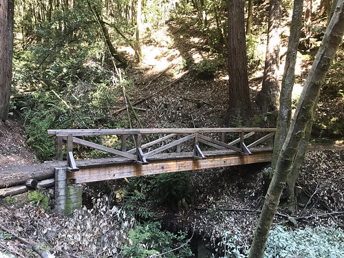
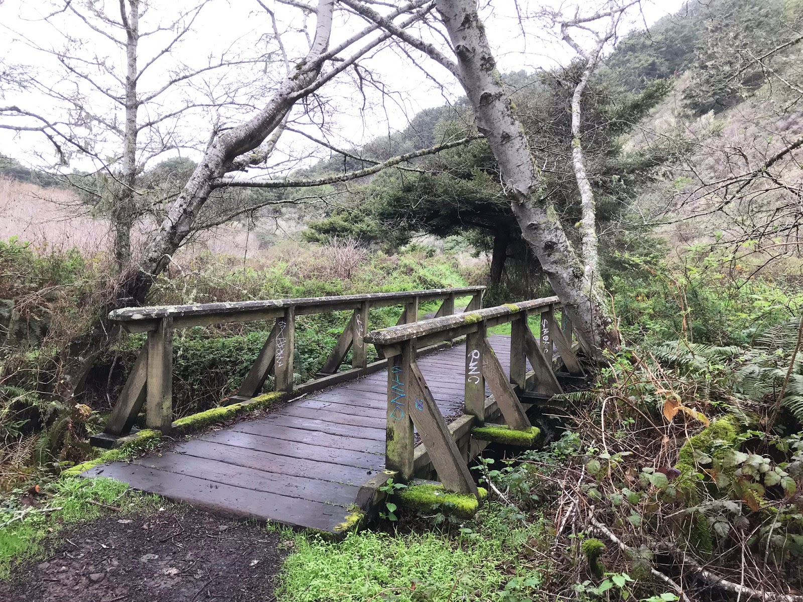
Brunch in Capitola put us near the gate of The Forest of Nisene Marks state park, a threshold neither of us had crossed before. We paid the fee, got the map, and drove up into the lush redwood filled park. The "Winter Gate," which I assumed would be closed, because it's winter, was open, which allowed us to drive an extra mile closer to the trailhead and shorten the trip. There were maybe two or three cars in the parking lot at 11:30am when we embarked from Porter Family Picnic Area. North out of the parking lot, past the gate and down the road, forking left onto Loma Prieta Grade. There were some nice ups and downs, a few footbridges (which I ALWAYS take pictures of), some finely constructed cliffside trail work, and even a brief plank walk, which you don't really see too much of. Here and there were seen the remains of old structures left behind from the logging days, which were slowly returning to the earth. 

Eventually, we veered right onto the Bridge Creek Trail, the most direct path to Maple Falls. Here the trail follows the creek, and as you go deeper, the canyon narrows, eventually coming to a wild section where you have hop across the water a few times, climb over some logs and rocks, and do some light scrambling to continue. Through all this, it is quiet obvious where the trail is. There is a small appetizer falls on Bridge Creek in this section, as well as another one pouring down the hill from the east side. The scramble continues, and not far from this is the true cascade of Maple Falls, a majestic silver ribbon slicing down the middle of a woodland notch, pouring over a mossy rock headwall, and splashing into a serene shallow pool. At the edge, there was a rocky, small "beach" and some logs upon which we sat and ate some of our takeaway food. To the upper right of the main fall, we observed the mystifying effect of small rivulets pouring down through the moss from above, creating the impression of a sparkling, twinkling, living wall!

Maple Falls
 
We remained secluded in the blind canyon for about a half an hour, and began to return the way we came. We had only seen two hikers coming down from the falls on our way up, and ran into four more as we were leaving. They looked like they were about to turn back, so we informed them that they were only at the first (mini) waterfall, and to keep going! I took us on a small detour on the return, a section of Loma Prieta Grade that runs to the west of, but basically parallel to Bridge Creek Trail. Just so we could see something different. It was nice because we got up on the hillside a little bit, out of the dark canyon, and got some sunshine. It was actually SUCH a beautiful day out, for February, that I almost regretted spending it in a shady, dank forest. ALMOST. We did not see another soul on Loma Prieta Grade as we meandered south along the folded, steep earth, and soon reunited with the intersection of Bridge Creek Trail, continuing south, back to the car. It was an excellent dayhike, one of my favorite of the local redwood excursions that I have done so far, owing mainly to the payoff of the elusive Maple Falls!

FURTHER READING
• Open Space Trust: Trail information
• The Outbound: More trail information 
• California Waterfalls: Ann Marie Brown: Foghorn Outdoors, May 2000: pp 324-326

Sunday, January 26, 2020

Alamere Falls

DATE: Sunday, January 26 2020
DISTANCE: 9.34 miles
ELEVATION GAIN: 1408 ft.
TIME TAKEN: 4:55 hours

PHILLIP BURTON WILDERNESS
MARIN COUNTY, CA


PHOTO ALBUM HERE
Alamere Falls: January 26, 2020


Marin County's Alamere Falls is a spectacular waterfall known for cascading down a 30 foot cliff directly onto the beach. It's very popular, blown up on social media, and probably over visited. I could have done it a favor by never visiting at all, but I'm a white American male, and I feel entitled to my piece of EVERYTHING! RIGHT? Errr….. OK, what I  really AM is an enthusiastic waterfall seeker, and this venture has been at the top of my list for quite some time. My brother Alex told me he had Sunday set aside for Alamere, so I penciled it in. I ended up not having to work, so Saturday night I refrained from going to the thrash metal show at Eli's Mile High Club, and just stayed up super late at home instead. At least I didn't get wasted. After about 3.5 hours sleep, I got up at 5AM, got my supplies together, and met up with Alex at his house. He had just bought a Honda Civic, so we were going to save a ton gas and drive THAT to the trailhead instead of my giant van. Accompanied by Alex's co-worker Marisol, we were off by about 6:30.


Tree tunnel
We slipped effortlessly through the dreamy, pre-dawn darkness of the Bay Area. Murky fog, forests, cliffs and suburban homes lurked in the mysterious haze. We were on the trail just before 8AM, with three other cars in the parking lot. Refreshed by an overnight rain, the environment was exceedingly lush, verdant, bursting with life. The muddy trail weaved around forested hillsides, over creeks on footbridges, and back out to some coastal cliffs at one point. Our only company was the the occasional pack of trail runners. ("Does anybody just HIKE anymore?") The damp woods had a mystical sylvan vibe that was enhanced by the presence of many fresh patches of giant mushrooms, many shapes and colors, few which I could name, except the famous Amanita Muscaria. Pink earthworms littered the trail, sparrow and quail darted about, and newts scurried to and fro, nature's ensemble at play.

The coastal trail passes by a few small, unnamed ponds, and then two larger ones, Bass Lake and Pelican Lake. Just past Pelican Lake is the left turn which leads you to the "unofficial" Alamere Falls trail. Even though there is a conspicuous arrow made of rocks that points to it, I walked right past ( I though maybe it was the trail to Double Point or something.) When I got to another footbridge, crossing Alamere Creek, I knew I had gone too far. I turned to Alex and Marisol and said, "Fuck, I think it was actually the arrow back there." So we went back and followed it into the bush. Like I said it's not an official trail, but it's the one that everyone uses to get to the falls. Read HERE why they don't want you to go this way.

A bridge too far
The trail opened up into some brushy meadows and rolling hills, and soon we were atop the muddy chutes that lead down to the waterfall area. This is one of the "dangerous" areas that the park service would like people to avoid. Here you could see Alamere Creek begin it's plunge into a small canyon down to the beach in a series of cascades. Down the chutes, and were atop a brief coastal shelf, which the creek spills across, towards it's final 30 foot plunge over the edge. We had come as early as we could so that the tide would not be high, but the low tides of the day were before sunrise, and after sunset, so when we got there, about 10AM, even medium tide was already too high to walk onto the beach and look UP at the falls, so we had to settle for looking down it. Alex and I had a look at the other "dangerous" part, the chute that leads down to the beach, which is where you could go to look up at the falls if the tide was low enough. It was barely class 3, but slippery from sea spray. I can see it being a little dangerous for an inexperienced climber or drunk teenager.

Pelican Lake
We enjoyed our lunch on the bluff by the falls, and watched as groups of hikers came and went, with more frequency as the hour grew later. Alex couldn't resist taking a bath in the frigid cataract, and I explored what there was of the falls, up into the picturesque rocky middle section. On the way back out, I was looking for the trail up to Double Point, so I could bag a summit, but found what looked like nothing but a nasty bushwhack. I decided to let this one go. We returned to car the same way that we had come, with many MANY hikers now heading for the falls. Puffing and sweating and asking us "is it much farther?" Passing back by the coastal bluffs, I heard an unnatural sound, and soon a red helicopter flew into view. Was someone getting airlifted out after getting injured on one of the dangerous sections? Just after, I returned into cell service range, and I got a notification from BBC news that Kobe Bryant had been killed in a helicopter crash. Weird timing. As expected, the parking lot was absolutely PACKED when we got back. On the return home, I suffered out the waning days of my Beer Free January in a brewery in San Rafael while the others imbibed upon the seemingly delicious local offerings. In summation, Alamere Falls is a magical place, and a spectacular hike to a spot that is probably going to be loved to death.

Map from National Park Service


Alamere Falls: January 26, 2020

Monday, April 15, 2019

Sempervirens Falls

DATE: Monday, April 15, 2019
DISTANCE: 6.9km / 4.3 miles
ELEVATION GAIN: 184m / 603 feet
TIME TAKEN: 3 hours
BIG BASIN REDWOODS  SP
SANTA CRUZ COUNTY, CA
SOUNDTRACK: Thergothon: Everlasting


Sempervirens is an easy destination hike in Big Basin, too easy for me actually, so we turned it into a larger loop. This was only my second visit to Big Basin, the first one being a rather disorganized, poorly documented late start hike with the Owl brothers.

This hike began at the visitor center, and looped counterclockwise through the park, through the spectacular old growth redwoods of the Sequoia Trail, and on to Sempervirens Falls, which is not the largest waterfall in the park, but still well worth a visit! Then it was north-west, over slippery rock, to the Skyline-To-Sea Trail, and back down south along Opal Creek for most of the wat back to the visitor center. A very satisfying little hike through California’s first state park.