Showing posts with label Coast Range. Show all posts

Thursday, May 13, 2021

Chalone Peaks

DATE: Thursday, May 13, 2021
DISTANCE: 22km / 13.67 miles
ELEVATION GAIN: 1047m / 3434'
TIME TAKEN: 9:30
PINNACLES NATIONAL PARK
SAN BENITO COUNTY, CA
CHALON, OHLONE, RUMSEN, AMAH MUTSEN STOLEN LAND
SOUNDTRACK: Church Of Misery: Cerebrate Pigs

SUMMITS:

• North Chalone Peak: 1007m / 3304'
• South Chalone Peak: 996m / 3269'


PHOTO ALBUM
MAP


I was embedded in a party camping trip to Pinnacles National Park, wherein most of the attendees were more interested in dropping acid and swimming in the campground pool. As this was my fourth visit to Pinnacles, I had something more profound in mind (not that dropping acid wouldn't have been profound in it's own way), visiting the high point of the park for the first time. Also, my friend Rob Coons was coming to meet up, and he suggested extending the hike to include the infamous "Pig Fence Trail." And so it was to be. I met up with Rob in the parking lot at about 7:00AM. I knew Rob as an avid photographer of many local punk and metal bands, but secondarily, I knew he was a big time hiker, so it was only a matter of time before we teamed up for an expedition, there being so few punks / metalheads around willing to hike more than a couple of miles or even get up early for that matter. And so, we were off. Going up Bear Gulch past the talus caves and through the patch of giant boulders to the reservoir. Past this point, to me, was new territory. The Chalone Peak Trail was well maintained, graded, and good time was made heading up. Now with elevation gain, views of the High Peaks, to the north, and Mount Defiance to the east. Views then opened up to the west of a thick fog belt settled down over the Salinas Valley. It was just after 9AM when we reached the lookout tower on Chalone Peak North. It was very civilized, for a mountaintop, with a bathroom even. But we were about to go beyond the civilized world to a realm of unspeakable cruelty. JK. Nice view now to South Chalone Peak, too, our next stop. The sign said 1.6 miles. The way that Rob wanted to go had us skipping Middle Chalone Peak, but I didn't lose too much sleep over that.  

We hiked down the fire road, and then cut up a steep brushy hillside to the true summit of South Chalone, where an assortment of unidentifiable garbage was strewn. Among it all, there was actually a small summit register. Nice view back to North Chalone now, and the fog was dissipating over Salinas valley. Just beyond South Chalone Peak was our entry point to the pig fence. It was now 10:30AM. We had discussed the pig fence, and were prepared. The leather gloves came on. There seemed to be a better trail on the other (south) side of the fence, so climbed over and followed it, almost straight due east. The fence is not the boundary of the park. We could see the fence plummeting east over the undulating hills, and we just followed along it. There was usually a trail alongside it, from people coming to work on the fence, presumably, but in some places that "trail" was so steep we had to cling to the fence for dear life. It was nearly 1:30PM by the time we got to the bottom of the thing, and it was hot, dry. We didn't have much water. We had been deposited in a dead zone at the eastern border of the national park, at dry Chalone Creek, there was supposedly a trail there, according to some maps, but it was hard to find or follow, and there was some blundering about. I had been hoping for the relief of a return to a real trail, but that did not come until almost 4PM, when we officially emerged onto to the South Wilderness Trail's dead end. 

It was now wide open to start trucking back ASAP, but it was hotter, we were out of water, and we still had several miles between us and the vehicles. Luckily, a water spigot was soon found when we got close to the road, and from there, refreshed, we continued west on the Bench Trail. Through the valley we went, then up through the Bear Gulch Trail, through a rocky ravine area that was dry now, but I imagined could be quite charming in the rainy season. Not long after that, we were back at the parking lot, it must have been 5 or 6PM, and we went back to snack and drink with the remaining stragglers back at the campground. Amber had already gone home, in disgust apparently: when I caught up with her later that night, I found myself in trouble, because I had basically been absent the whole camping trip by showing up late the night before, and then being gone on the hike all day that day. 


FURTHER READING
• North Chalone Peak on SUMMITPOST and PEAKBAGGER
• South Chalone Peak on SUMMITPOST and PEAKBAGGER
• Stav is Lost
takes on Chalone Peaks

Saturday, May 1, 2021

Mount Saint Helena

DATE: Saturday, May 1, 2021
DISTANCE: 15km / 9.32 miles
ELEVATION GAIN: 742m / 2433'
TIME TAKEN: 6:10
ROBERT LOUIS STEVENSON STATE PARK
NAPA COUNTY, CA
STOLEN WAPPO LAND
SOUNDTRACK: Archon: Helena

SUMMITS:
• Mount Saint Helena: 1324m / 4343'
• Mount Saint Helena South Peak: 1280m / 4200'
• Hole In The Rock: ?

PHOTO ALBUM
MAP


Mount Saint Helena had been on the hit list for a very long time now, it being the crown peak of the North Bay, and the second highest peak of the Bay Area (not to mention the Napa County high point). It required a visit. It was also high time for a hike with my brother, Alex, and since he was a weekend warrior, we set off that Saturday morning, the first of May, I picked him up from his apartment in San Francisco's Western Addition, and we were off, cruising the highways major and minor, arriving at the Stevenson Memorial Trailhead at 9:25AM, We didn't waste any time getting onto the well constructed trail, which had been engineered with well crafted steps and switchbacks, rising through a forested belt of oaken woodland that had been spared from the recent fires. Within 25 minutes, we were getting up out of the trees, and now had views to the east of the table rocks, and Calistoga Valley from the south to the north. In less than a mile, the single track trail ended, and the journey continued on a dusty fire road. At the western point of sharp switchback, we came to a big rock, and decided to do some gratuitous scrambling. This was fun, but also very lucky, because it gave us a view of a feature called Hole In The Rock, which we probably wouldn't have seen otherwise. The landscape in this area had been burned over, and there were faint climber's trails through the brush, so we decided to visit the enticing rock feature in the distance. We plied the rocky tracks and added more class 3 along the way, maybe unnecessary, but there was a fixed rope at one point, which means we weren't the first to go that way by any means. By about 10:30AM, we were at Hole In The Rock, which certainly lived up to it's name. We climbed around, through, and even managed to get on top of the thing. We also climbed, or tried climbing some of the adjacent big rocks. Exhausting the possibilities of the area, for the most part, and feeling the need to move on, we decided to shortcut uphill to rejoin the road, rather than backtrack, and although there was a trail at first, we either lost it, or it just dissolved, and we were dumped into the day's only bushwhack, which wasn't actually too bad, because like I said, the area had burned last summer, or maybe the summer before.

We rejoined the trail / road at about 11:30AM, Hole In The Rock ended up being the coolest part of the day, and was now behind us. The road took us into the upper reaches of some unburned pines, which offered welcome shade in the warm, sunny day. We diligently followed the road now, and saw many other hikers out on the fine Saturday afternoon. One of them complimented us on our facial hair! As if we coordinated it or something? We reached the top of Mount Saint Helena at 12:15PM, and tried to enjoy the surroundings and the views. There were some people doing an annoying thing, sitting, hanging out RIGHT on the actual highpoint of the mountain. I wandered around for a few minutes, pretending not care, and right before I said to them "excuse, I'm going to have to touch the high point of this mountain," they finally moved. Not as bad a move as people sitting down in the middle of the trail, but come on! Confrontation avoided. This time. Now that we had reached the main summit, I informed Alex that Mount Saint Helena had three sub-peaks, and he said

"I'm not going to all of them," and I said

"OK, let's just go to the East Peak?" 

partly because that one is also on the California Coastal Peaks list, but more importantly, I wanted to get a good photograph of the main peak. East Peak was a class one walk up on gravelly rock, to more communications towers. We didn't hit any other peaks after that, but we did take a little jaunt north to a rocky, piney point. This proved very worthwhile, as it actually gave the perfect photograph angle of the main peak that I'd been wanting. By now, it was almost 1pm, and time to head down, so it was back upon the dusty road, amongst hikers of all stripes, many in large groups, perhaps school chums they were. There wasn't much to stand in our way on descent, and we were back at the van at 2:30PM. But the "bros day out" wasn't over yet. We went into Santa Rosa to get some Vietnamese food, then hit one of my all time favorite breweries, Moonlight, and then another brewery! Henhouse! Oh boy. It was hot outside, and the biergarten was crowded, and we were then a little tipsy as we pulled down 101, back into San Francisco, and finally to Owl band practice with our third, youngest brother. 

FURTHER READING
• Mount Saint Helena on SUMMITPOST and PEAKBAGGER
• Mount Saint Helena East Peak on PEAKBAGGER
• MODERN HIKER


Sunday, March 28, 2021

Ventana Cone

DATE: Sunday, March 28, 2021
DISTANCE:
ELEVATION GAIN:
TIME TAKEN:
VENTANA WILDERNESS

LOS PADRES NATIONAL FOREST
MONTEREY COUNTY, CA
STOLEN ESSELEN LAND
SOUNDTRACK: Trouble: Window Pain


SUMMITS:
• Peak 4456': (1358m)
• Ventana Cone: 1441m /  4727'

PHOTO ALBUM
MAP


Full hike report coming soon!


Friday, March 26, 2021

Friday, March 12, 2021

Loma Prieta

DATE: Friday, March 12, 2021
DISTANCE: 24.94km / 15.5 miles
ELEVATION GAIN: 1,299m / 4262'
TIME TAKEN: 5:54
UVAS CANYON COUNTY PARK
SANTA CLARA COUNTY, CA
STOLEN TAMIEN, AMAH MUTSUN, OHLONE, MUWEKMA AND AWASWAS LAND
SOUNDTRACK: Possessor: Dark Mountain


SUMMITS:
• Loma Prieta: 1154m / 3786'
• Nibbs Knobb: 821m / 2694'

PHOTO ALBUM
MAP


Full hike report coming soon!


Thursday, March 4, 2021

Point Lobos

DATE: Thursday, March 4, 2021
DISTANCE: 5.25km / 3.26 miles
ELEVATION GAIN: 132m / 433'
TIME TAKEN: 2:30
POINT LOBOS STATE RESERVE
MONTEREY COUNTY, CA
OHLONE / RUMSEN STOLEN LAND
SOUNDTRACK: Los Lobos: Will The Wolf Survive?


SUMMITS:
• Whaler's Knoll: 73+m / 240+'
• Sand Hill: 30+m / 100+'

PHOTO ALBUM
MAP


FULL HIKE REPORT COMING SOON!


Saturday, January 23, 2021

Monday, December 21, 2020

Firtop / Alamere Falls

DATE: Monday, December 21, 2020
DISTANCE: 27.68km / 17.2 miles
ELEVATION GAIN: 935m / 3068’
TIME TAKEN: 8:48
SUMMIT: Firtop: 404m / 1324’
POINT REYES NATIONAL SEASHORE
PHILLIP BURTON WILDERNESS
MARIN COUNTY, CA
SOUNDTRACK: Mythic: Winter Solstice

PHOTO ALBUM
MAP


FULL HIKE DESCRIPTION COMING SOON!


Monday, April 13, 2020

Mount Vaca

DATE: Monday, April 13, 2020
DISTANCE: 2.2 mi / 3.54 km
ELEVATION GAIN: 233 ft / 71m
TIME TAKEN: 1 hour
SOLANO COUNTY, CA
NAPA COUNTY, CA
SOUNDTRACK: Melvins: American Cow 

SUMMITS
•Mount Vaca: 2819 ft / 859m
•Mount Vaca North Peak 2765 ft / 843 m

PHOTO ALBUM
MAP


Mount Vaca, at 2,819 feet, straddles the border of Napa and Solano Counties, and is the highest point of the Vaca Mountains, a north / south flowing ridge on the eastern edge of the coast range. Most importantly, Mount Vaca is the highest point in Solano County, which is probably what brought me to it today.

I had to go to Fairfield Pick ’n’ Pull to hunt down a part for my van, and since I was in no hurry, I decided to go for a hike in the area, provided I could find something suitable. There are several interesting peaks in the area, but almost all are on private property, with limited access. Mount Vaca is also on private property, but apparently, this is not taken too seriously. So after the junkyard, I drove a little north toward Vacaville on Interstate 80, exited at Cherry Glen Road, continued north on Plesant Valley Road, and then took a left on Mix Canyon Road, which I took all the way to the top of the ridge. 4.7 miles up Mix Canyon Road, there is a a turnoff to the left, which is marked “private property, no trespassing, violators will be prosecuted, etc.”

Mount Vaca and Mount Diablo in the distance

My paranoia of getting locked inside the gate had me parked outside on the main road, and I walked inside. It was about .3 miles to Mount Vaca’s North Summit, a flatened patch of earth crowned with a radio antenna. I was startled at first, and then amused, as a voice came over a loudspeaker:

“You are TRESPASSING!  Please leave the area immediately! Your image is being recorded on video!” It was a robot voice, probably triggered by a motion sensitive camera. After this magnificent summit achievement, I pressed on for my crowning goal of the day. On down the road, as I approached the main crest of El Vaca, I heard the rumbling of, and soon saw the sight of, a big white truck coming up the road. “Oh great,” I thought, “this is the part where I get yelled at.” But it was a guy from The Governor’s Office Of Emergency Services, and he just asked me if that was my truck up ahead blocking the road. (There was another big white truck up ahead, blocking the road.) Proclaiming my innocence, I continued on my way. The top of Mount Vaca is flattened, and topped with three communications facilities, one of which looks unfinished and abandoned. The area is littered with various debris, suggestive of some kind of tweaker situation, or perhaps a weed grow facility long abandoned. If you can look past the shabby surroundings though, there are good views of the surrounding area, Mount Diablo to the south, Lake Curry and the Twin Sisters to the West, Mount Saint Helena and Cobbs Mountain off to the north, and series of wild, jagged peaks to the northeast. I’m sure that on a clear day, you would be able to see much more, but it was rather hazy.

Lake Curry and Twin Sisters beyond

A local couple was wandering around, and the guy assured me that he drives up here all the time and never gets hassled, and they never lock the gate at the entrance. Good info. As I walked back, mission accomplished, I saw that there were now three trucks from the Governor’s Office, (let’s call them Gavin’s Guys) congregated at one of the towers. Perhaps to broadcast some kind of massive Covid-19 emergency bulletin to the public. I got back to the van, no incident,  and careened back down Mix Canyon road, past multiple secluded ranch residences and even a llama farm!

FURTHER READING
•Summitpost: All the crucial info and facts
•Quincy Koetz: A winter ascent
•Bob Burd: Tackles Mount Vaca

Map background by the USGS


Monday, February 17, 2020

Marin Headlands

DATE: Monday, February 17, 2020
DISTANCE: 5.31 miles
ELEVATION GAIN: 1044 ft.

ELEVATION LOSS: 765 ft.
TIME TAKEN: 2:51 hours
GOLDEN GATE NRA
MARIN COUNTY, CA


PHOTO ALBUM
MAP


Add this to list of places I can't believe I've never been to before, in twenty years of living in the Bay Area! I suppose I always avoided the Marin Headlands because it's choked with tourists year round. But the winds blew me here today, and it was a nice leisurely walk on an unseasonably warm February afternoon. Even though it was a Monday, people were out in droves. It's one of the most picturesque and most photographed locations in the world. I'd driven over the Golden Gate Bridge many times, but never walked on it, so that was accomplished. Then some explorations of the various battery stations and a descent to the very picturesque Kirby Cove. Anyway, I won't write too much this time. The pictures speak for themselves.

FURTHER READING
• 10 Adventures
• Hiking Project
• The Outbound

Looking west to infinity

Saturday, February 15, 2020

Devil's Slide / Pedro Point

DATE: Saturday, February 15, 2020
DISTANCE: 5.44 MILES
ELEVATION GAIN: 1024 ft.
TIME TAKEN: 2 hours
SUMMIT: Point San Pedro Headland,  620 feet
POINT SAN PEDRO HEADLANDS
SAN MATEO COUNTY, CA

SOUNDTRACK: L7: Slide

PHOTO ALBUM
MAP 1
MAP2


I was traveling solo to meet up with Deathgrave at the Poseidon's Revenge Festival in Pacifica. Most of the gear was backlined, so I didn't have to bring much, or participate in a load in. I knew there were a lot of trails and hills around Pacifica, so I decided to hike up something before the gig. In my minimal research, I settled on exploring Pedro Point Headland, the massive bluff overshadowing Devil's Slide, but didn't exactly know the best way to get there. It being a stunningly beautiful Saturday afternoon on the California coast, there was traffic everywhere, I didn't know where to park, and I got a bit flustered and drove out of town,  through the Tom Lantos Tunnel down Highway 1. I decided to walk up the old Devil's Slide Highway, and check that out as well, but the parking lot right by the tunnel was totally full. I drove down the highway to the next parking lot, Gray Whale Cove State Beach, which had some open spots

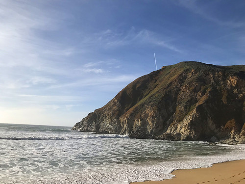
Looking up at the bluffs from the beach

Walking back up along the coast to my destination, I saw a cool looking trail, with a wooden staircase, leading down to the beach. I found it irresistible and went down. It's a really cool beach beneath towering cliffs, and it was pretty crowded. Back up, I continued my march up the road toward's Devil's Slide. Which honestly kind of sucked, even though it was incredibly scenic,  because Highway 1 has barely any shoulder in this stretch, and cars were zooming by me within inches!  This didn't last too long, and soon enough I was at the entrance to the Old Devil's Slide Highway. 

HERE is a little history of what Devil's Slide was and is. 

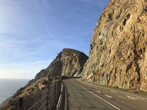
Off onto the old Devil's Slide highway

Devil's Slide was the old course of Highway One. Not surprisingly for a place of that name, the old road used to fall into the ocean all the time. So they built a tunnel through the mountain and re-routed the highway through there. But they also retained the old road as a bicycle and pedestrian path, for all to enjoy. Now you you can take a leisurely stroll along this magnificent stretch of coastline, which is exactly what I did. The last time I was on this road is hidden back in the murk of my childhood memories, so it was nice to see it again with my adult eyes, and be able to enjoy it on foot, not from a speeding automobile. There was a mix of hikers, bikers, dog walkers and pram-pushers up and own the road. 

North to Pedro Point

Now for my next trick… there didn't seem to be a trail on any map that connected the northwest corner of Devil's Slide Highway to the trail system up in the Pedro Headlands. So it looked like I would have to walk all the way down to new Highway One, and catch the South Ridge Trail at the bottom, losing a lot of elevation, and then have to climb all the way back up again to the headlands. OR perhaps there was an unofficial trail or a not too bad bushwhack that would take me up to my destination. Just after Devil's Slide Highway makes a turn to the east, there's chain link fence with an open gate, and just on the other side of it, a steep use trail goes up the hill. My prayers were answered! It was a loose pebbly track, with brush growing close in, but it served it's purpose and delivered me up at the South Ridge Trail. I had gained sufficient elevation to see out to the east. Turned left on that, and then took the Bluff Trail all the way to the top of Pedro Point Headland. From there, I had a sweeping vista of Pacifica, Montara Mountain, and as far north as San Francisco and Mount Tamalpais. I feel like I'm running out of descriptive words at this point to describe the magnificence of the California coast, so just have a look at the photographs and think of your own. 

I was hoping to find a different way to get back to my point of origin, and I investigated, on my phone, what looked like a fire road on satellite imagery, and google maps had labeled as a trail, branching uphill on the south side of of Old Devil's Slide Highway, but it was blocked off by a very intense locked gate, so I had to retrace my steps down the road. Probably better to get back sooner than later anyway, It was time get to the gig at Winter's Tavern. And I returned back, past the coastal cliffs and waning golden sunlight, back along the no-shoulder treachery of the highway, and back to the van. At Winter's Tavern that night, it was a fun gig and a great party, with lots of free food and bands. We were even hooked up with a hotel room in Pacifica so we didn't have to drive home after the show!


FURTHER READING
•Bay Area Hiker: Devil's Slide
•Hiking Project: Pedro Point Headlands