Showing posts with label Santa Lucia Range. Show all posts

Sunday, March 8, 2020

Whale Peak

DATE: Sunday, March 8, 2020
DISTANCE: negligible
ELEVATION GAIN: 120 ft. ?
TIME TAKEN: 15 minutes
SUMMIT: 300 ft. (+-)
GARRAPATA STATE PARK
MONTEREY COUNTY, CA

PHOTO ALBUM
MAP


...Continued

I was angling to somehow stay in Big Sur for the day and go up Manuel Peak, because the clouds had finally cleared, but Amber had to go home, and I couldn't find anyone else who was sticking around who could give me a ride back to civilization later. Hopefully I will return soon… Big Sur just gets more captivating every time. It's big, it's wild, it's deep, it's mysterious...
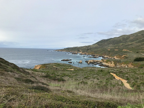
Looking north up the coast

Driving back up Highway 1, I begged Amber to pull over for a few minutes to so I could climb a minor named hill called Whale Peak. The fiend must be satisfied! She stayed in the van, while I took about 15 minutes to scale the pleasant coastal mound. A fine trail with stairs in some parts led to the top which contained a minor south summit, and the higher north summit. The views, as to be expected, were spectacular, not much to complain about in this part of the world. I was back to the parking lot before I was even missed.

FURTHER READING
•Hiking Project: Map and stats about the trail
•Bob Burd: Whale Peak and Clear Ridge

Saturday, March 7, 2020

Buzzard's Roost

DATE: Saturday, March 7, 2020
DISTANCE: 5 miles
ELEVATION GAIN: 900 ft.
TIME TAKEN: 3 hours
SUMMIT: 1005 ft.
PFEIFFER BIG SUR STATE PARK
MONTEREY COUNTY, CA

SOUNDTRACK: Armageddon: Buzzard

PHOTO ALBUM
MAP


…continued.

I awoke in the van late, to the sound of fat raindrops collecting in the redwood branches and splattering on the thin steel above my head. Fumes of various cocktails tainted my breath and bounced around in my brain. My vision was blurred. When I eventually tried to take some steps, they were unsteady. It would be a slow start today. I was trying to figure out what kind of hike to do… Manuel Peak appeared to be inside a cloud, and I didn't want to go all the way up there to see nothing. Also it would have been a late start. I wanted to lead those in the party camp who were willing on some kind of group hike, and the realistic destination of Buzzard's Roost was chosen! And therefore, I was put in the unusual position of "leading" a rather large group on a hiking expedition, because I have apparently gained the (false) reputation of someone who knows what he's doing, and was subject to such taunts as "where are we going, I heard you're the hikemaster?"

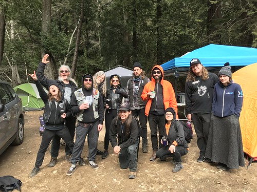
Eleven gathered at the start of the hike!

Ferwood Resort / Campground, among other amenities, has a well maintained trail leading south which connects with Pfeiffer Big Sur State Park, allowing us to walk right out of the campground and not have to drive anywhere. This would not be my first experience with the trail, as me, Amber, and her cousin Allen had stumbled drunkenly down it on a night hike, on the previous year's visit, recounted HERE. Although Amber and Allen were both in the camp today, they did not choose to risk repeating last year's misadventure. Probably wise! This expedition was also a flashback of my first vista to Fernwood, years previous, which included not only Amber, but also Fern and Greg, who are now my bandmates in Deathgrave, but back then they were just good friends. 

Trail out of Fernwood
This is some serious digression, so skip to the next paragraph if you want to find out about Buzzard's Roost. But back in the summer 2014, me, Amber, Fern and Greg had taken some unexpectedly potent mushrooms, and started off to walk to the beach from Fernwood. We had no idea where we were going, maybe Pfeiffer Beach, which would have been a hell of a walk! Anyway, the mushrooms we ate kicked in almost IMMEDIATELY, and hard. We had walked a little bit down the highway, and ducked into the woods, where we found a rustic amphitheater, and played around in the redwoods and in the river river for the rest of the afternoon. We were so psychedelically unhinged that we barely made it half a mile from the campground! In retrospect, it's better that they kicked in soon, because if we had been far from home base when the peak drug experience hit, we might not have made it back! 


Nature's gate
The beginning of today's hike had echoes of that past confusion. There were a few false starts as to where the actual trail to Pfeiffer began, and I led the whole group around in a dumb circle. This is why I don't like to be the leader! I don't mind making mistakes on my own, but dampening the enjoyment of others is no fun, and it makes me feel like a fool! Were down to nine hikers (from eleven) by the time we got to the real trail. And then we were off. Going uphill, through the lush woods, mounting the hillside above the river. Rain threatened all afternoon, but only appeared as intermittent sprinkles. And we pressed on. The more people you hike with, the slower it usually goes, which can be frustrating, but this was compensated for by the camaraderie of friends. Now into Pfeiffer SP, we got the the intersection with the Buzzard's Roost trail, and went up some more. Some people were drunk and/or on mushrooms (myself included, everything in moderation). There was some falling, and dropping of things, and much merriment. "Other" Clint, from Mortuous, was asking all the other hiking parties we saw to give the trail a "Yelp" review of one to five stars. Most of the bewildered trekkers rated it four!

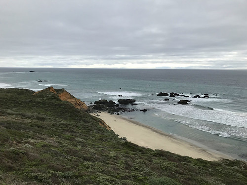
The best view of the sea we got that day

Once we gained some elevation, there were views out of the Big Sur River Valley, but the  mountain tops were all enshrouded in clouds. When we got to the Buzard's Roost loop trail, we decided to loop counterclockwise, and this was the steepest part so far.  Buzzard's Roost it's self is an unremarkable rocky hill, crowned by a minor communications tower, and a cinder block hut. I think BR is a destination mostly for the ocean views it affords. These views were intermittent today, with clouds blowing in out, and occasionally the silvery sea could be seen heaving in the distance. In spite of this, our ragtag group spent almost an hour on the summit, eating our snacks and annoying the others hikers who came up. On the way back, the rest of the group went back the same way we came, and I decided to strike off on my own and complete the loop trail. I didn't tell them, and they were temporarily worried that I had gotten lost in the woods and died, until I met them at the intersection, ten minutes later. We all continued together after that, all the way back to camp, with much enjoyment and laughter echoing through the forest. 

That night back in camp was another doozy, as the birthday party raged on. We lost an hour due to the time change, and before I knew, it was four AM, then five, shattering my plans to get up early and climb Manuel Peak in the morning! Oh well!  

To be continued... 

FURTHER READING
•Outdoor Project: Brief description and statistics

•Little Grunts: The perfect hike to kill time before dinner...

Friday, March 6, 2020

Andrew Molera State Park

DATE: Friday, March 6, 2020
DISTANCE: 8.17 miles
ELEVATION GAIN: 1566 ft.
TIME TAKEN: 3:45 hours
SUMMIT: Clear Ridge: 1,209 ft.
ANDREW MOLERA STATE PARK
MONTEREY COUNTY, CA


PHOTO ALBUM
MAP


An epic Pisces birthday camping trip at Fernwood Resort in Big Sur was to begin on Friday, so Amber (she was one of the celebratory Pisces, not me) and I jumped in her cozy van, and got a head start. We saw Church Of Misery and Black Wizard play at the Catalyst in Santa Cruz the night before, and crashed in the van, after a late night of revelry. I managed to drag myself into consciousness by 7AM, and continued the journey to the familiar pre Big Sur stop of Carmel Safeway, where additional supplies were acquired for the weekend. I continued behind the wheel to the day's hiking destination, Andrew Molera State Park. Neither of us had been there before, but it had come highly recommended to me, by various books and websites. It had a reputation as one of Big Sur's finest coast hikes, but I didn't think it could be comparable to last year's visit to Garrapata. Could anything?

Ridge Trail
The hike began right away with a crossing of the Big Sur river, which required shoe removal and the experience of some rather cold water. I was glad that we were crossing it today, and not tomorrow or beyond, when rains are supposed to pelt the area. Across the river began the Creamery Meadow Trail, which was basically a very flat dirt road. Almost immediately, we saw a bobcat in the middle of the path, and I was too mystified to try and take a picture, having never seen one before in the wild!  Planning to make a loop out of the Ridge and Bluff trails, we had our choice at the intersection, and we chose to do the Ridge Trail first, so up we went. I saw a large and loud group of hikers coming up behind us, so I tried to pick up the pace. It was overcast and rather cool that day, but after some steady uphill, I shed my extra layers and hiked in a t-shirt. Looking back down the trail, we seem to have outrun the large group that was encroaching, but likely, they turned back for some reason. Ah. Sweet solitude. The elevation gain now revealed an excellent view of the coast and Point Sur in the distance. The grassy coastal scrub of the ridge soon gave way to oak forest, then second growth redwood. 

North from Clear Ridge
At the crest of the ridge, which is where there trail turns south, towards the beach, I went uphill a little bit, along the park border line, and found the Clear Ridge benchmark, the high point, I must assume. It sure looked like it. Just over the park boundary, across a fence, one could glimpse a neighborhood of private homes, temporarily disrupting the illusion of the wild coast. What I would call a fire road for the entire hike so far, now became a steeper, narrower and altogether more fun kind of trail as it plunged down toward the foaming waves of the coast. There were a few other hikers out enjoying the mild afternoon. 

We found a nice patch of reddish dirt along the way, to sit, where I devoured my Safeway deli sandwich, and Amber probably ate something much nicer. This was now the Bluff Trail, and it led us back towards our point of origin, parallel to the Ridge Trail, but at a lower elevation, hugging the coastline. The scenery was nothing to complain about! The trail wound us through the coastal undulations, up and down a few ravines, and finally back to the Creamery Meadow trail junction. As Friday afternoon got later, there were were more groups of families on their way into the park. Crossed the river again on the way back, and much much to our delight, we saw the bobcat again (presumably the same one?) in the barnyard of the old Molera estate. We now had the impression that this is probably the "house" bobcat, and he hangs around the area all the time!

The beach

Soon after drying our feet and picking out the sharp little rocks, we were in the van, on the highway, and approaching Fernwood Resort, where a hoard of San Jose and Oakland metal heads and other assorted scoundrels would soon assemble for two nights of food, drink and revelry, the like of which does not need to be described on a hiking website! 

To be continued...

FURTHER READING
Hike Speak: Description of the loop
• The Outbound
• California Through My Lens
• 101 Hikes In Northern California: Matt Heid: Wilderness Press, 2000: pp 24-25