Showing posts with label Alameda County. Show all posts

Monday, March 22, 2021

Fairmont Ridge / Sugarloaf Hill

DATE: March 22, 2021
DISTANCE: 1.82km / 1.13 miles
ELEVATION GAIN: 90m / 295'
TIME TAKEN: 0:43
SUMMIT: Sugarloaf Hill: 358m / 1175'
LEONA CANYON REGIONAL OPEN SPACE
ALAMEDA COUNTY, CA
STOLEN OHLONE LAND
SOUNDTRACK: Thin Lizzy: Sugar Blues

PHOTO ALBUM
MAP 1
MAP 2


Full hike report coming soon!


Thursday, March 18, 2021

Berekeley Highpoint

DATE: Thursday, March 18, 2021
DISTANCE: 10.54km / 6.55 miles
ELEVATION GAIN: 371m  1217'
TIME TAKEN: 2:35
SUMMIT: Berkeley City High Point: 404m / 1325'
TILDEN REGIONAL PARK
ALAMEDA COUNTY, CA
SOUNDTRACK: Blatz: Berkeley Is My Baby

PHOTO ALBUM
MAP


Full hike report coming soon!


Wednesday, February 3, 2021

Murrieta Falls

DATE: Wednesday, February 3, 2021
DISTANCE: 12.37km / 13.28 miles
ELEVATION GAIN: 1277m / 4191’
TIME TAKEN: 8 hr
DEL VALLE REGIONAL PARK
OHLONE REGIONAL WILDERNESS
ALAMEDA COUNTY, CA
SOUNDTRACK: Tyrranicide: Facing Reality

SUMMITS:

• Rocky Ridge: 739m / 2426’
• Schlieper Rock: 939m / 3080’

PHOTO ALBUM
MAP


FULL HIKE DESCRIPTION COMING SOON!


Saturday, January 9, 2021

Barberry Peak / Eureka Peak

DATE: Saturday, January 9, 2021
DISTANCE: 14.81 km / 9.2 miles
ELEVATION GAIN: 796m / 2611’
TIME TAKEN: 5:08
EBMUD EAST BAY WATERSHED
CLAREMONT CANYON REGIONAL PRESERVE
CONTRA COSTA COUNTY, CA
ALAMEDA COUNTY, CA
SOUNDTRACK: Electric Wizard: Barbarian


SUMMITS:
• Barberry Peak: 2709m / 1683’
• Eureka Peak: 2639m / 1640’

PHOTO ALBUM
MAP


Barberry and Eurkea are two little summits in the East Bay hills. Eureka is barely on private property, and I have never attempted to reach it, even though I have hiked close by several times over the past few years. Barberry Peak, a feature which I didn’t even know had a name until last year, is a publicly accessible ridgepoint overlooking the east side of the Caldecott Tunnel entrance. They were both on my “East Bay Hills Obscure Peaks To-Do List,” and both would be visited today.

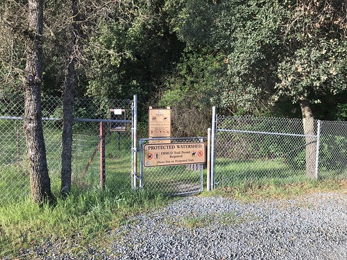
The weekend was here, which means nothing to me, of course, unemployed for almost a year now, but my brother Alex still has a job, and he has weekends off. So as usual, I hit him up to see if he wanted to hike. He also gets the choice of where we go, because his time is much more precious than mine. He had the idea that we would do a warmup hike for our trip to Death Valley, coming the following weekend, so at Big Al’s suggestion, we were at the De La Veaga trailhead in Orinda, to do a repeat, or at least some approximation, of my old “Orinda To Oakland” hike: not carless this time, no use of dirty dog BART. Fearing I would be late for the meetup time, and fighting a hangover from drinking alone at home last night (where else?) I jumped in the van and rocketed myself through the Caldecott Tunnel, to the trailhead. I actually got there first, but Alex was only seconds behind me, and he had to come all the way from San Francisco. We tried to approximate the weight of the backpacking load we would be carrying in Death Valley, Alex with his large pack at 25 pounds, and me with my daypack, stuffed with as much extra weight as I could find, including junk from the back of my van, which got it up to 22 pounds. I followed proper protocol, and singed in at the trailhead with my EBMUD permit number, and we were off, on what has become one of my most familiar trails.

We were soon lost in conversation, and before I knew it, there was a fire road off to the right, and I said “how would you feel about a mild trespass to an obscure East Bay peak?” He was game, and we veered off, contouring along the hillside cow trails, to be away from the view of the house that was right there by the peak, even though we weren’t even trespassing yet. Around this time, we saw three coyotes in the valley below. Cool! We came around the west side of the hill to remain out of sight, and then went straight up.  Then, at the top of the climb, where there was a fence delineating the private property of Eureka Peak, there was one more coyote! Less than 15 feet past the barbed wire fence, and we were on Eureka. A good view of Mount Diablo and Vollmer Peak nearby. Then we went straight down through the fields to rejoin the De La Veaga Trail below, which carried us up the west side of Siesta Valley, into Oakland, and back to civilization, as we heard the roar of cars on Grizzly Peak Boulevard.

Erupting now into daylight now, out of the tranquil Eucalyptus and Bay Laurel groves, we crossed GPB, dodging both motorists and cyclists, and went into the muddy trails of Claremont Canyon Regional Preserve. Not too long after this is my favorite part of the Orinda To Oakland hike, where you come around the bend and the whole of Oakland, San Francisco and The Bay is revealed before you! Magical every time. At this point, there were now quite a bit of people about, coming up from Berkeley, from the west, to enjoy the weekend afternoon. We didn’t feel the need to go all the way down to the bottom of the Berkeley side, because we were not planning on using BART. So we turned around, and headed back the way we came. Back across GPB, and then at the four-way trail intersection, I said to Alex, “how about we go check out Barberry Peak?” And that was it, off to the next quest.

A short jaunt down the Bay Ridge Trail, and we got to the unofficial track that leads up to Barberry. There was a picnic table there, so we sat down and had a quick snack. Then up the hill. The use trail continued all the way to the top, with classy switchbacks and everything.  The peak had some rocky bits, and an open view of the surrounding area, especially down to the 24 freeway cut. Urban hiking at it’s finest. We decided to make things interesting, yet again, by not returning the way we came, but by looking for a way down the ridgeline towards the California Shakespeare Theater. The idea seemed bunk at first, a potential total bushwhack, but then just like magic, a faint trail appeared that carried us almost all the way down to the bottom of the ridge, where it magically disappeared again with no evident destination, and we had to slide down a steep, slippery hillside, plough through a tangle of brush, and we were finally delivered down at the Cal Shakes Theater.

The facility was officially closed due to Covid (obviously), but the theater was still physically open (no doors), so we went inside and had a look. From there, we decided to take the most direct way possible back to the trailhead, traveling N/NE over two fences, through the EBMUD watershed and cow fields, where we soon found another old trail that led us through a gap in the ridge, back to the more robust system of cow and farm roads on the other side, which funneled us finally back into the De La Veaga Trail. From that point, we were down to the cars on the Orinda side in a matter of minutes. It ended up being a wild variation on the Orinda To Oakland Hike, but highly successful in researching the obscure peaks of the East Bay hills.

FURTHER READING
Oakland Geology:
Some science on Barberry Peak and surroundings
Bob Burd: Bob handles Eureka Peak and many others


Wednesday, September 23, 2020

Gossip Rock

DATE: September 23, 2020
DISTANCE: 8.47km / 5.26 miles
ELEVATION GAIN: 351m / 1150’
TIME TAKEN: 2 Hr.
SUMMIT: Gossip Rock 329m / 1080’
DRY CREEK PIONER REGIONAL PARK
ALAMEDA COUNTY, CA
STOLEN OHLONE LAND
SOUNDTRACK:
Toy Dolls: Idle Gossip

PHOTO ALBUM
MAP


It had been over twenty days since my last hike, California had mostly been a smoky hell, and I was dealing with a not too horrible, but very persistent foot injury that might have stemmed all the way back to  my excessive rock hopping on the Fourth of July. Smokewise, the was was fairly clear, I needed to get outside and do something, anything, and I had some screenprinting supplies to hand off to Amber, so we met about halfway between San Jose and Oakland, and went out for a little hike.

The trail was selected more for it’s central location than any other reason, and it had a named “summit” for a destination, satisfying my requirements. It was a warm day, which we were acutely aware of, not starting until after 10AM. Climbing the fire roads, first through the lower vegetated stream bed, then up into the oak grove savannah, everything dry as a bone. Gossip Rock was not the high point of the area, or even the park, but it was within reach for our quick jaunt, a classic oak shaded rock outcrop in the Bay Area hills. One of the flat rocks appears to be an Ohlone Native American grinding stone. We went back down to the parking lot (mostly) the way we came up, and then went out separate ways!

FURTHER READING
• Quincy Koetz: A nice summary
• East Bay Hill People: Another brief description
• Gossip Rock on PEAKBAGGER


Saturday, May 23, 2020

Pleasanton Ridge

DATE: Saturday, May 23, 2020
DISTANCE: 16.35km /  10.16 miles
ELEVATION GAIN: 579m / 1898 ft.
TIME TAKEN: 4:18
SUMMIT: Pleasanton Ridge High Point: 1,629 ft.
PLEASANTON RIDGE REGIONAL PARK
ALAMEDA COUNTY, CA

SOUNDTRACK: Ramones: Pleasant Dreams


PHOTO ALBUM
MAP


A few days prior to this, I had considered my 16 mile outing in the hinterlands of Mount Diablo to be my last hike of the season in the East Bay Hills, which were increasingly getting warmer and drier. It was time to focus some attention on the Sierra Nevada now!  But out of the blue, an old friend hit me up to go on a hike in Sunol Regional Wilderness. In spite of the fact that it was a pretty hot day, we weren’t getting an early start, and  it was also a Saturday (I usually avoid going out on the weekends at any cost, since I can pretty much hike any day I choose, unemployment has it’s benefits!), I readily agreed to meet up with Bryce so I could catch up with the old buddy and talk music, life, etc.

I tried to meet Bryce at the Sunol parking lot, at the appointed time, but even before I got there, I knew this would be a no go. Even Welsh Creek Road, on the approach, was jammed with cars, trying to turn around and get out, not one parking space in sight. When I got to the gate of Sunol, there was a prominent sign reading “Parking Lot Full,” and I believed it. Just then, I saw Bryce driving out, and he kind of shrugged. We pulled over at a turnout together, back down the road, to consult,  and I suggested Pleasanton Ridge instead. I had never been there before, but it was on my local hit list. This turned out to be a good choice, as we pulled into the Foothill Staging Area, we saw the parking lot was not even half full. Not bad for a beautiful Saturday in late May.

We took off uphill, on a meandering course that began with the Woodland Trail. No particular goal in mind, but I was angling to get to the high point of the ridge if possible. It was typical California rolling hill country, turning from green to brown at this time of year, cowshit country, the beasts were about. But there was a nice breeze and some especially majestic oaks. It wasn’t long before a view opened up to south to Maguire Peaks and Mission Peak. We turned north, and cruised the ridgetop. To our left, the higher, but privately owned,  Sunol Ridge beckoned for some future trespassing. Most of the park seems to be double trails, a ranch/fire road and a complimentary single track trail (or trails) that go alongside it, or weave around near it. We used both of these options alternately as they suited us.

Continuing north on the Thermalito Trail eventually joined us up with the Ridgeline Trail, on which also continued north, through the area which temporarily becomes Augustine Bernal City Of Pleasanton Park. Once through the enclave, you are back in PRRP. Much to my delight, the high point of the the Pleasanton Ridge formation was found, almost by accident. But then verified by smartphone of course. There was a bench, a water tank, and a ton of ducks for some reason. Also, what are these strange little monuments? We took a different was back to the parking lot, creating a sort of grand loop out of the  Ridgeline, Meadow and Sycamore Grove trails. A nice afternoon outside. And bear in mind, friends out there, if you ask me to go for a hike with you, I probably won’t say no. Unless I am already on a hike.

FURTHER READING
BA Hiker: Some general info in PRRP
Redwood Hikes: Big pictures and a little info
Bob Burd: Bob visit the Pleasanton Ridge highpoint


Friday, April 24, 2020

Radio Tower Hill

DATE: Friday, April 24, 2020
DISTANCE: 15.32km / 9.52 miles
ELEVATION GAIN: 426m / 1400 ft.
TIME: 4 hours
SIBLEY VOLCANIC REGIONAL PRESERVE
ALAMEDA COUNTY, CA
CONTRA COSTA COUNTY, CA
SOUNDTRACK:
Black Sabbath: Am I Going Insane


PEAKS
“Grizz-Line Hill” 458m / 1504 ft.
“Radio Tower Hill” 457m / 1500 ft.


PHOTO ALBUM
MAP


I was up in the Montclair District of Oakland this Friday morning to have some body work done on my van (it got a kiss from a telephone pole). When I dropped it off, the guy said it would take about three hours, so I decided to go for a hike, of course. It seemed like the perfect time to check out a few more obscure features in the Oakland hills that I had not been to before, or not in a long time. I started out with getting some snacks, and most importantly, water (it seemed like it was going to be a a warm one), from the 7-11. Then I hoofed it up Thornhill Avenue, which began gently, then grew increasingly steep as I approached the top of the ridge. I enjoyed the shade of the abundant landscaping, and the meticulous angles of the midcentury architecture. It wasn’t a bad walk at all, even though there was no sidewalk, the cars were few and not passing too close. 

Thornhill to Sobrante Road, to Thorndale Drive, to Elverton Drive and finally, as the landscaping and houses began to thin out, I reached Skyline Boulevard. From Skyline, I scurried up a casual trail on the embankment on the side of the road, which brought me to my first destination, Peak 1504’, which I will heretofore call “Grizz-Line Hill,” because it is sandwiched between Grizzly Peak Boulevard and Skyline Boulevard. There is a possibility that I may have been here in the past, but it was long before I kept track so meticulously of my comings and goings. There were fine, open views to the west, of San Francisco and the Golden Gate, and east to Gudde Ridge running through Sibley. “Grizz-Line Hill” would be a fine place to spend some hours, enjoying the view, reading a book, drinking a beer… there’s even a bench placed there which would abet such activities.

West from "Grizz-Line Hill."

I descended another use trail, on the north side of the hill, to get down to Grizzly Peak Boulevard (which will from now on be referred to as GPB), and walked west, and then north-west, along it. My next destination would be the summit colloquially known as “Radio Tower Hill,” which I had certainly not been to before. GPB, in this section, was blessed with an unofficial sidewalk in the grassy area off to the side, so I had some protection from the traffic as a traipsed along. The mouth of the Caldecott Tunnel spilled out to the west, below, and precarious hillside homes lined the sides of the road. At one point, I came across a massive herd of goats “clearing the weeds” (They were mostly just sitting there! Busted! Get to work!) from a vacant piece of land. I knew that goats were employed for this purpose, but I always imagined a team of three or four goats, diligently scouring the property, not forty goats, mostly just lying around, chomping the occasional weed when they felt like it. Perhaps I caught them on their coffee break. 

At a bend in GPB, there is a distinctive outcropping of sedimentary rock, and this was my signal to leave the road and take a use trail up to “Radio Tower Hill.” It was a few minutes up through grass and wildflowers, and then, there I was, at the KPFA transmitter tower, which is a landmark that should be known to anyone who has driven east through the Caldecott Tunnel and looked up. “Radio Tower Hill” indeed! I couldn’t argue. From the top, I had a good look at Barberry Peak, another obscure East Bay hill which I intended to visit soon. Now that I was secure knowing there were no guards on this “private property,” I took the obvious driveway back down to GPB. To continue my journey now, I needed to get back to Skyline Boulevard, which was parallel to GPB, just below, but in order to avoid crawling through people’s backyards, as well as steep hillsides and brush, I backtracked all the way to “Grizz-Line.” It was a nice day out, and I wasn’t in a hurry, so I took my time. 

Rock ourcropping on GPB just below Radio Tower

Back down on Skyline, which also has a pretty good sidewalk/trail along it, I hiked west until I hit Broadway Terrace, went downhill just a wee bit, then went over the guardrail and down a use trail on the grassy hillside. The last piece in the puzzle of my loop, I intended to follow the big power lines down to the bottom of the ridge. It turned out that there was a clear path all the way. The use trail led down until I got to a big water tank on my left. There, it met up with s PGE& access road. There were some workers around there doing some tree maintenance, but if I was trespassing, they didn’t care. At some point I came to a gate in this road, which would have blocked cars, but was easily walked around by a pedestrian. I continued to follow the service road. The PG&E property is kind of a no man’s land in the Oakland Hills, no houses or structures beneath the power lines, no trees either. No inhabitants, but also not a park. Private property, but obviously, regularly trespassed upon by walkers. 

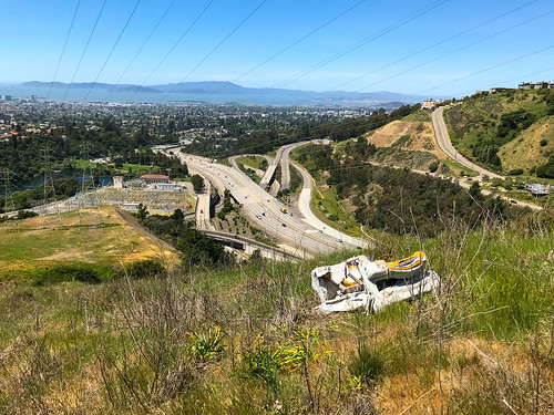
Before too long, I came to another gate, this one wide open. They’re obviously not trying too hard to keep people out of here. The PG&E road came to an end again, or turned off to the south, and I continued on my planned trajectory, following a use trail that led downhill, across a grassy hillside, still beneath the power lines. On this hillside, I found an abandoned, destroyed couch. In the middle of nowhere, and I wondered who put it there, and why? It wasn’t a dumping ground, there was no other trash. Perhaps someone's onetime hangout spot, but a hell of a long way to carry a couch. I was now reaching the bottom of the hill, approaching the terminus of the power lines at the sub-station by Lake Temescal, and it was time to get out of powerline land. There was an access gate to the south, which I went around, and I was on Pali Court, back in the suburban neighborhood of “Glen Highlands,” just north-west of Montclair. I felt like I had unlocked a key to this previously mysterious section of the East Bay hills. By now, I had gotten the call that my van was done, so I walked back through the quaint, hilly neighborhoods to my starting point.

How did THIS get up here?

ON PEAK NAMES
“Grizz-Line Hill”: As far as I know, this bump doesn’t have a name, which is surprising, (to me anyway, I’m always surprised at how many peaks don’t have names) because it’s got a nice bit of prominence and a killer view. “Grizz-Line” is a portmanteau I created of Grizzly Peak Boulevard and Skyline Boulevard, and it is technically within Sibley Regional Park.  If anyone knows a better name for it, please tell me!
“Radio Tower Hill”: I’ve read about it being called this, maybe only on Oakland Geology (see below) so I’m just gonna stick with it for now.

FURTHER READING
•Oakland Geology: A little blurb about “Radio Tower Hill” 


Saturday, March 28, 2020

Redwood Peak

DATE: Saturday, March 28, 2020
DISTANCE: 9.22 miles
ELEVATION GAIN: 1,667 ft.
TIME TAKEN: 3:28
SUMMIT: Redwood Peak 1,619
DIMOND CANYON PARK
JOAQUIN MILLER PARK
REDWOOD REGIONAL PARK
ALAMDEA COUNTY, CA
CONTRA COSTA COUNTY, CA


PHOTO ALBUM
MAP


Redwood Peak is the high point of Redwood Regional Park in the Easy Bay Hills, as well as the high point of a long NW-SE running ridge, which is kind of a northwestern extension of the San Leandro Hills trajectory, the western frontline of hills running from East Oakland to Castro Valley. I had been curious for years what was the highpoint of that ridge up there, because I can almost see it from my front door. A blackish green tree studded prominence in distance, at times sun crowned, at times fog shrouded.

As the world and the Bay Area was reeling with Coronavirus lockdown, I was trying to use my now abundant free time to get some hiking in, to visit some places I’d been meaning to visit over the years.  With Saturday projected as a rainy day, I though it would be a good time to finally pay a visit to Redwood Peak. I knew that the summit is tree covered, so I wouldn’t be missing out on any views due to the clouds, and the waterway of Dimond Canyon, through which I planned to ascend, should be gushing with spring runoff, for a lush riparian hiking experience. The third bonus for which I hoped, was that the rain would keep other people indoors, and I could hike in isolation.

Graffiti gate

Well, it didn’t rain very hard at any point during the day, and even though the parking lot at the Dimond Recreation Center, where I began, was completely empty, I encountered quite a few people out on the trails that day. Various configurations of runners, hikers and dog walkers. Few of them hiking alone. I cursed them all for being out, and then cursed myself for being part of the problem. I began the hike by following the course of Sausal Creek up through Dimond Canyon, a path I have followed three of four times before. This is one of my favorite hikes in Oakland, probably one of the best urban hikes you can do in any city. I did things a little differently this time by remaining in the creek bed the whole way up. There’s an intermittent trail, but mostly a bunch of rock skipping and puddle jumping. The artificial waterfalls created by public works projects past are minor obstacles. Beyond the Leimert Bridge and some hydrological infrastructure, the main trail was rejoined, which carried me out of the canyon, past the desolate Montclair Golf Club, and a temporary return to civilization at Monterey Boulevard.

Canyons of Oakland
The conveniently placed pedestrian tunnel carried me beneath the Warren Freeway, and I reconnected with the park system at Palos Colorados Trail, which took me into one of Joaquin Miller Park’s finest redwood canyons. Up to this point, this was almost a duplicate of a hike I had done with my brother Alex back in January, 2018. Where I diverged from that was when I took a left and headed up the Cinderella Creek watershed, following the trails in a northeasterly direction, gaining altitude and curving around the north of the park, and eventually leaving it as I crossed Skyline Boulevard. Like I said, there were still a lot of people around, but all the facilities, like the PAL camp, and the Chabot Observatory, were closed, leaving a somewhat ghostly shoulder season vibe. Throughout the course of the day, and especially up past the border with Redwood Regional Park, I made a series of wrong turns and meandering loops, which I blame upon the overabundance of trails and roads in this highly civilized park. Not that I was in a big hurry or anything, but I did not take the most direct course! My peregrination led me through gnarled oaks, a magic faery circle, and even a banana slug encounter. Eventually, I found my way up the the top, Redwood Peak. Even though it was completely forested, there was still a noticeable summit (more than I was expecting), a rock outcropping, and a U.S. Coast and Geodetic Survey benchmark. It was a nice spot, which I would have remained at longer if not for the imminent arrival of a party of five adventurous youths. So off I went, back down the mountain.

Magic circle

I took the West Ridge Trail past the observatories, went back across Skyline Boulevard, through a parking lot, and then down the Scout Trail to the Castle Park Trail. This was the only section of the day that had a view out to of the trees. My intention was to cut back down to the Palos Colorados Trail, but I somehow went the wrong way on the Sunset Trail and ended up getting dumped in a neighborhood. Rather than retrace my steps back into the park I decided to walk through the residential area, down Castle Drive to Ascot Drive, past Joaquin Miller Elementary School. For a road hike, it wasn’t too bad. Ascot Drive even has a trail along part of it. I re-crossed the Warren Freeway, and then returned the way I came, back down through Diamond Canyon, back down to the rec center parking lot, which had a few cars in it by now, and couple of people ill-advisedly smoking weed together. Now, when I leave my front steps and look left down the street, which points at a distant redwood covered hill, I know what I'm looking at, and another piece of the grand puzzle is filled in.

FURTHER READING
•Bob Burd: A quick jaunt to Redwood Peak
•East Bay Trails: Another approach to Redwood Peak
•Redwood Hikes: Good photographs and description of Redwood Regional Park
•Oakland Trails: Information on the mosaic trail markers


Map by Alltrails

Saturday, March 21, 2020

Sam's Peak

DATE: Saturday, March 21, 2020
DISTANCE: 12.17 km / 7.56 miles
ELEVATION GAIN: 522 m / 1711 ft.
TIME TAKEN: 3:45
SUNOL REGIONAL WILDERNESS
ALAMEDA COUNTY, CA
 
SOUNDTRACK: Bloodcum: Son Of Sam

SUMMITS
Flag Hill 415m / 1,360ft.

Sam's Peak 434m / 1,423 ft.

PHOTO ALBUM
MAP


I had been hanging out in San Jose for the past couple of days, so Amber gave me a ride in the morning to Sunol Regional Wilderness, where I would meet up with my brother Alex, and we would ride back to Oakland together, after a hike. I felt the door slamming shut of the shelter in place order, like shit was about to get really weird. Indeed, I did not see Amber again for 23 days after that. Alex was still on his way when I got there, so I wandered around for a bit, making sure I knew where the trailhead was at. It was a cloudy morning still, and I could see mists writhing through the green hills as I wandered up Hayfield Road. Alex showed up soon, and we set an agenda for the day, going up Flag Hill, and then whatever we felt like after that. It was Saturday, so the crowds were already intensifying in this popular park. I was still figuring out how to deal with hiking during the Covid -19 pandemic, and I would soon learn to never go out on weekends, except to the most remote locations.

Atop Flag Hill

We dealt with the weekend mobs, and ascended Flag Hill. The sky was opening up to patchy blue, and the views opened up to the south, towards Little Yosemite and Calaveras Reservoir. I don't know what the fuck cows have to do with a "wilderness" area, but their presence was everywhere. Flag Hill was a well formed rocky outcropping which Alex and I had seen from one of our previous brotherly hikes, to Mission Peak the year before. Now we looked at Mission Peak from Flag Hill, and also at another nearby mountain that was kind of pointy and looked cool. We decided to go to it. I misread the map, and we started taking a trail that I thought would go there, but it was the Welch-Flag Hill Trail, and though it was beautiful countryside, it went down into canyon, and we had to backtrack to get on the right path. Now bear in mind that Alex and I, this whole time, due to the misty, rocky nature of the landscape, are bantering in stupid Scottish accents that we learned from watching Trainspotting too many times as young lads.

"It looks like me bonnie highlands of me youth."

"Aye, aye it does. The bonnie crags upon the loch."

Maguire Peaks

It went on like this for quite some time, and you would have not have been amused. But we were. Anyway, we backtracked on the Flag Hill Loop Trail, and turned north-west on an unofficial trail that seemed sure to lead us to the pointy mountain. Whether this trail was hewn by human shoe, or cloven hoof, I know not. It's not on the official park map. In short order we arrived at the summit, and found a benchmark which told us that this fine pointy thing was called Sam's Peak. How epic. Thank you Sam. Allright then. We enjoyed a fine view of the Maguire Peaks from there, and scurried across the rocky highlands under a sky which never became fully sunny, nor did it become fully cloudy again. To the north could be seen Sunol and Pleasanton Ridges, and to the south, Calaveras Reservoir, with a dull shine like a lead mirror. We returned the way we came, passed through the intersection of the loop on Flag Hill, and descended back to the parking lot. Feeling toothsome, we got some falafel in a strip mall in Pleasanton on the way back to Oakland.

ON PEAK NAMES
Flag Hill: It's doesn't have a flag on it, maybe it did at one time, it isn't a particularly flag shaped hill, whatever that would be. But I will accept this name as it is.

Sam's Peak: Falls deeply into the category of "named after an old dead white guy," probably a rancher or prospector. I'm not going to contest this one because I don't have the energy right now. Sam's Peak it will be.

FURTHER READING
Redwood Hikes: Excellent description and photographs of flag hill and lil' Yosemite
Bob Burd: Bob goes to Flag Hill and Sam's Peak
East Bay Wild: A step by step guide with nature and geology information


Monday, March 16, 2020

Leona Canyon

DATE: Monday, March 16, 2020
DISTANCE: 3.75 miles
ELEVATION GAIN: 684 ft
TIME TAKEN: 1:17
LEONA CANYON OPEN SPACE
ALAMEDA COUNTY, CA


PHOTO ALBUM
MAP


Intending this to be the week that I hike every single day, having nothing else to do, my job and most of my social activities eliminated by the Covid-19 Quarantine order, I decided to grab a quick one today on the way home from San Jose. I had never been to Leona Canyon before, but as one of the green blobs on the map of the East Bay, it was bound to get visited someday. And that day is today.

Tree tunnel

At first, I tried to enter from the north end, at Merritt College, but access to the trailhead is cut off there now, because the college is shut, due to Coronavirus, so I drove down to the south end, at the Canyon Oaks Apartments, and entered that way. It was party cloudy, cool, and 4:30 PM, good conditions, and just enough time for a jaunt before I lost the light. At the south end of the park, there is an earthen dam which must exist to control the flow of Rifle Range Branch (the creek that runs through the canyon), and forms a small pond there. Leona Trail is the main track which follows the floor of the canyon from one end to the other, and off I went, through a tree tunnel of oaks, next to the trickling Rifle Range Branch. Moss and ferns painted the canyon floor green on black.

Old chimney

My ulterior motive for being here was try to find a path up Sugarloaf Hill, a prominent East Oakland high point that I'd seen many times before, driving south on 580. I now knew where it was, lodged in the northwest corner of this park, but I didn't know how to get to it. I followed the Leona Trail all the way to Merritt College, past it's abandoned athletic field and solar farm, looking for an unofficial trail to the top, which I guessed would probably be on the north end. I didn't really see anything promising, just what looked like deer trails on the other side of thick tangles of weeds, and I just didn't have the appetite at the moment to plunge into the bushes. I returned the way I came, keeping a sharp eye out to my left for trails that would go up to Sugarloaf Hill, and I followed a few false leads. (I was later able to glean from the internet that the trail goes up behind the storage sheds in the parking lot, looks like I have unfinished business in Leona) The one bonus I got for looking out was seeing the remaining chimney of an old homestead, slowly disappearing under a blanket of damp moss. Then I walked back down the road to the parking lot.

FURTHER READING
• Oakland Geology Blog: Leona Canyon
• "Step back in time in Leona Canyon," SFGate

Map by East Bay Regional Parks District

Tuesday, March 10, 2020

Orinda To Rockridge 2020

DATE: Tuesday, March 10, 2020
DISTANCE: 7.03 miles
ELEVATION GAIN: 1381 ft.

ELEVATION LOSS: 1684 ft.
TIME TAKEN: 2:06 hours
SUMMIT: Skyline Ridge AKA Sprial Knob: 1400'
SIESTA VALLEY RECREATION AREA

CLAREMONT CANYON REGIONAL PRESERVE
CONTRA COSTA COUNTY, CA

ALAMEDA COUNTY, CA

PHOTO ALBUM
MAP 

https://hikingmetalmaniac.blogspot.com/p/carless-hikes.html


I returned from my lovely weekend in Big Sur to find that the Novel Coronavirus (Covid 19) has basically evaporated the industry in which I am employed, almost overnight, so I'm going to try to make the best of it by hiking as much as possible! Today, I decided to keep things in my neighborhood and re-visit the original carless hike, from Orinda BART to Rockridge BART in Oakland. I didn't get out there as early as I would have liked (sunrise) but it was still morning at least. As before, I make this a carless hike by entering the BART system at MacArthur, and going two stops east to Orinda, which puts me on the other side of the hills. Then I hike back over the hills to Oakland, re-enter the BART system at Rockridge, and take the train one stop to home base, MacArthur.

First pedestrian bridge

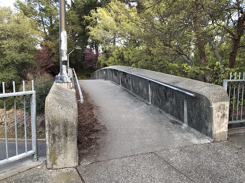
The first time I did this maneuver, I said the most difficult part was getting out of the BART station and across the busy road to the trailhead. Two and a half years later, the intersection of Camino Pablo and Santa Maria Way in Orinda remains a realm of the utmost hostility to pedestrians, but I was able to rely on my memories from the last venture, and streamline the crossing somewhat. Exiting the fare gates Orinda BART at 8:40, I turned right, and then made an immediate left on a pedestrian bridge that crosses a small access road. This path then dipped down and took me northwest, beneath two overpasses. Arriving then at a freeway onramp with no crosswalk, I was asked to turn right, and the path continued to another pedestrian bridge that took me above the freeway ramps and deposited me at the cul-de-sac of Orinda Way. Orinda Way to a left turn at Santa Maria. Santa Maria to Camino Pablo. This time, instead of walking along the north side of Camino Pablo, and running across the freeway-like road opposite the trailhead, I crossed at the traffic light. Even though there's no crosswalk, I walked with the green light and made it across in one piece. And that is the last street crossing for awhile, even though the next one is no less harrowing!

Trailhead

I arrived at the De La Veaga trailhead at 8:48, a gate off of a small gravel turnout, diligently signing the log book with my EBMUD trail permit number, rejecting the scofflaw ways of my past. (HERE'S WHERE YOU GET AN EBMUD TRAIL PERMIT) The De La Veaga Trail is only what I would call a trail for the first half mile or so, and then it intersects and becomes one with a fire road, which seemed to be recently re-graded and widened. The fire road winds it's way lazily up grassy oak studded hillsides and beneath massive high voltage power lines. Views begin to open up back to the east, and soon majestic Diablo comes into view. Eventually the road gains a ridge, and I crossed through another cattle gate (but no cows around today at all). To the south, I looked down into the lush spring green Siesta Valley, with Las Trampas in the distance. To the west, the familiar ridgeline of the Oakland and Berkeley hills played out in front of me. At this point I encountered the only other humans on the DLV trail, three hikers headed in the opposite direction.

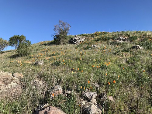
Poppies

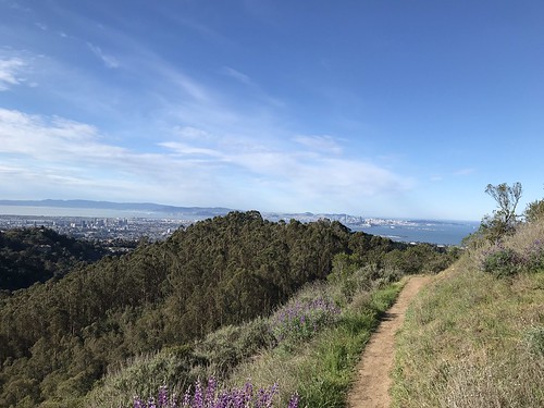
The fire road dipped down into the northwestern end of Siesta Valley, past some poppy speckled hillsides, and then climbed back up the more heavily wooded other side to leave the EBMUD protected watershed and meet the East Bay Skyline trail. This took me on the final stretch, to the crest of Frowning Ridge, where I emerged into sunlight, and made an unprotected mad dash across Grizzly Peak Boulevard. Entering the system of trails that leads down Skyline Ridge and Claremont canyon, there is a change of atmosphere. In a zone that is touched by coastal fog, the vegetation becomes more lush, and non-native eucalyptus trees are a strong presence. Now comes my favorite part, as I descend the ridge, and around a bend comes a fine view of bonny old Oakland! And then San Francisco too!

Oakland and San Francisco

As I made my way west, down the trail, I decided to stop and verify just what was the geographical feature named Skyline Ridge, even though I've been there before. It is the eastern, and higher of the two mini hills (that have side trails leading to them) on top of the main ridge. This particular one has two spirals made of rocks at the top. Hence it's other name, Spiral Knob. Alternately hiking and jogging down towards Berkley now, I officially entered Claremont Canyon Regional Preserve. The farther down I got, the more hikers and joggers I saw, of course. Getting close to civilization. Down the Stonewall Panoramic trail. Bloody steep in places, and lots of loose pebbles! I had to be careful not to end up sliding down it on my ass. Popped out of the bottom of the park at Stonewall Road, took it South to Claremont Avenue, and then College Avenue to Rockridge, where I re-entered the BART system after just over two hours of hiking. I still believe this is probably one of the finest urban hikes you can do in the Bay Area, and one of the few in the world where you can ride the subway to the trailhead! Please leave a comment if you know of any other ones!

Map by Google

Saturday, December 21, 2019

Las Trampas Regional Wilderness

DATE: Saturday, December 21, 2019
DISTANCE: 12.49 miles
ELEVATION GAIN: 3172 ft.
TIME TAKEN: 5:07
LAS TRAMPAS REGIONAL WILDERNESS
ALAMEDA COUNTY, CA

CONTRA COSTA COUNTY, CA

SUMMITS
LAS TRAMPAS PEAK: 1827 ft.
VAIL PEAK: 1787 ft.
ROCKY RIDGE HIGH POINT: 2024 ft. 

PHOTO ALBUM HERE
Las Trampas: December 21, 2019


Las Trampas Regional Preserve is 5,778 acres of wilderness near the East Bay towns of Dublin, San Ramon and Moraga. It's main topographical feature is two parallel ridges, trending northwest-southeast: Las Trampas Ridge and Rocky Ridge, separated by Bollinger Canyon. Rocky Ridge, with a high point of 2024 feet, has the distinction of being the highest point in the North-East Bay outside of the Mount Diablo massif. I had seen it over the years, poking out above the crest of the Oakland Hills, and wondered what it was. Las Trampas is Spanish for "The Traps" or "The Snares." According to Erwin G. Gudde's California Place Names, traps were once set in the chaparral of the hills to catch elk. I had never been to Las Trampas before, and I was intrigued by it's  wild and rocky appearance, compared to the cow field walks of most other parks in the area. A large network of trails snaked for miles throughout, and I planned my visit with a loop that would take me to all the highest points.

It was the winter solstice, and I had planned to go on a hike with my brother Alex, but based on a text I had received from him at about 4am, I assumed he would probably be in no condition to meet me, so I decided to continue on my own. I don't think I even got started until 10AM or later... it was not early. I drove the van from Oakland to the main staging area in the middle of the park, which was central to everything I wanted to do. It was  a Saturday, so it was far from abandoned, but I didn't have to go far from the trailheads to escape the masses of humanity.

Las Trampas Ridge
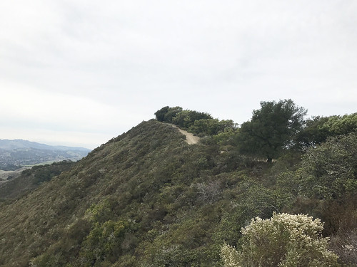
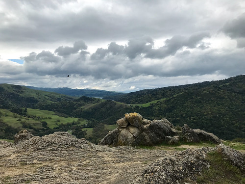
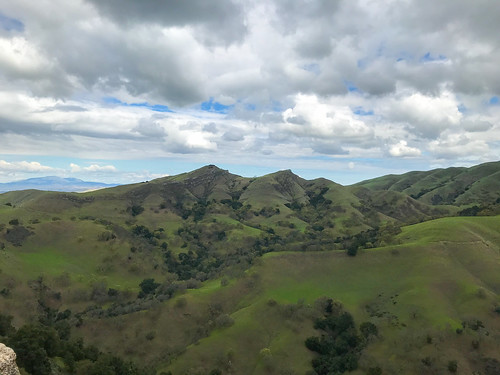
I began my twelve and a half mile walk throughout the park on the south side of the Bollinger Creekworld of oak (regular and poison), Bay Laurel, and the riparian habitat of the streambed. It wasn't too long before I gained some elevation, got out of the trees, and was able able to have a look back south, down Bollinger Canyon. One I got up to the Las Trampas Ridge Trail, I followed it northwest, where it basically clung to the top of the undulating crest. Landscape changed to scrub chaparral, and the fire road / trail roller-coastered along the top of the ridge to the eventual high point, Las Trampas Peak, at the north-west corner of the park. Mount Diablo was now clearly visible to the east, and a murky haze filled the valley below, out to Concord and beyond. The top of Las Trampas Peak was a patch of dirt next to an oak tree, a nice place for a picnic perhaps, under different circumstances. The view southeast along the the ridge top looked too wild to be anywhere close to the middle of the East Bay suburbs, and the other rugged high points of the ridge were in plain sight. Rocky Ridge, my goal for the second half of the hike, was openly visible to the west.
Loop, which got me immediately into the damp, earthy

Bridge on Mahogany Trail
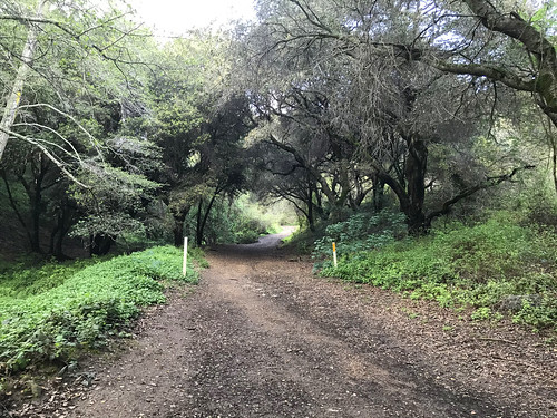
I frolicked back down the Las Trampas Ridge Trail, towards the pointy looking peaks that had captured my attention. Vail Peak and Eagle Peak. The woody trail dove down into the vegetation, through mature oak and madrone,  and Vail Peak was a short side trip up a slippery, brushy hillside. By the time I realized that I should have taken a left on the Corduroy Hills Trail to reach Eagle Peak, I was already so far past that I didn't feel like doubling back. I guess I'll save that one for another day. I charged south-east on the Chamise Trail, which led down a ravine past some gnarly rock protrusions, and then back into the woods on the Mahogany Trail, which fell quickly under the spell of arched oaks along the streamed, and carried me over a most picturesque stream bed. Soon after this, I made a brief return to civilization, such that it is, and temporarily joined Bollinger Canyon Road, a real car road, to continue my large loop. This led near the horse stables and equestrian staging area, aromatic with a tang of dung and straw.


Attaining Rocky Ridge
I left  the road at my earliest opportunity, plunging back into the bush on the Elderberry Trail, which ledRocky Ridge, parallel to but, much different in landscape than it's sister ridge, Las Trampas. Rocky Ridge lived up to it's name, and it had enough prominence that I could now see San Francisco Bay to the west, illuminated by the sleepy winter solstice sun. Coming from this direction, I first reached the southern highpoint of Rocky Ridge, which is 1,877 feet elevation, and has an EBMUD benchmark. There's also a park bench up there, upon which I took short break, indulging in water and trail mix. At this point, I could have had a hell of an easier day if I had just remained on Rocky Ridge Trail, and followed the crest north-west. But, like a cat that's easily distracted by a shiny thing, I saw a sign for Devil's Hole Trail (Cool!), and just couldn't resist. So down I went, losing all that hard earned elevation, through a landscape of mostly grassy, somewhat rocky hillsides. It was not blatantly apparent what Devil's Hole was, but maybe it was THIS formation. It was a a scenic detour to be sure, and there were more of the Las Trampas Ridge style brushy, pointy hills to be admired. I took a wrong turn at the bottom, and ended up at the south west corner of the park, at a boundary gate. It was pretty deeply vegetated down there, and dark, and then I startled a herd of what was probably wild pigs… the animals ran off quickly through the bush I couldn't get a good look at them.
first gently, and soon steeply, up to the long crest of

West to a solstice sunset
Back out and up. Time to pay for my visit to Devil's Hole (no one goes for free) with some punishing elevation gain to regain Rocky Ridge, up the Sycamore Trail. To the west, I was able to identify Ramage Peak. And beyond, the undulating series of ridges that stack up behind San Leandro, The Bay glimmering in the distance. Maybe the Sycamore Trail is punishingly steep, maybe I was running out of steam at the end of the day, maybe both. But the landscape is worth it, I would consider this the "dark" side of Rocky Ridge. Rocky, pointy little peaks, no other humans in sight. A good push got me back up on top of the ridge, and I continued to the high point, labeled as "Rock 2" on the map, at 2024 feet. Good views of The Bay at this point. Personal energy and sunlight were low by now, so I hightailed down the hill back to the parking lot, on a semi paved road. And now, I'm low on words to say, so if you want more, try these!

FURTHER READING•
•BA Hiker "Las Trampas Regional Wilderness is the tough guy of the East Bay Regional Park District."
•Redwood Hikes (nice, big photographs)
•KQED (good notes on geology)









Las Trampas: December 21, 2019