Showing posts with label Santa Clara County. Show all posts

Monday, April 26, 2021

Mount Isabel

DATE: Monday, April 26, 2021
DISTANCE: 12.23km / 7.6 miles
ELEVATION GAIN: 634m / 2081'
TIME TAKEN: 3:20
GRANT RANCH COUNTY PARK
SANTA CLARA COUNTY, CA
SOUNDTRACK: Unrest: Isabel
TAMIEN NATION, OHLONE AND MUWEKMA STOLEN LAND

SUMMITS:

• Mount Isabel: 1289m / 4230'
• "Mount Isabelita" (Peak 3312): 1009m / 3312'

PHOTO ALBUM
MAP


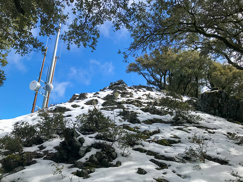
*Note: The header photograph of Mount Isabel was taken from Mount Hamilton on March 20, 2020, and does not reflect the conditions of the Mount Isabel hike on April 26, 2021.


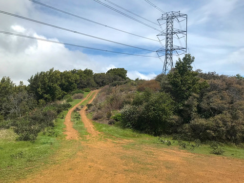
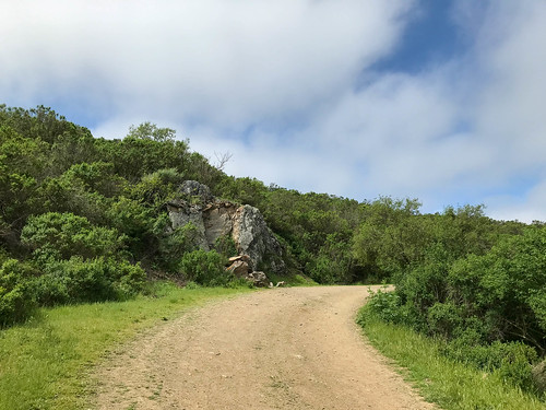
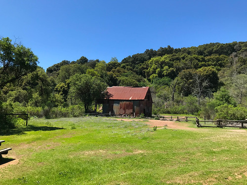
Still in San Jose, I took another opportunity to tackle one of the local hikes I had on the list. Today, Mount Isabel, the highest peak in Santa Clara County outside of the Mount Hamilton massif. I didn't get an early start, but it wouldn't be needed for this short hike. Luckily, I had access to Amber's nimble Subaru Forester while she was away, and I took it up the winding road through Grant Ranch to the Smith Creek Fire Station Trailhead. It was nearly 10AM when I set out, down a bucolic country road that soon became a trail, going alongside the well flowing Smith Creek, which was lush with greenery. In less than 20 minutes, I was at the end of the "trail," and a gate that said "area closed." So, not trespassing, just closed, right? So I continued, because this was my path forward of course. There were wildflowers all around. I continued past the gate on and old fire / ranch road, which basically led all the way to the top of the mountain, only sometimes disappearing beneath a thick carpet of grass, wet grass which also did the job of soaking my boots all the way through.

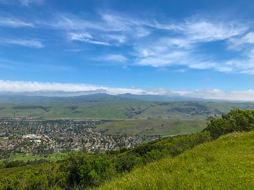
It was beautiful day, partly cloudy, and I kept steadily ascending on the green road. Views of Santa Clara Valley and the Mount Hamilton massif came into sight. Things began to get a little more ominous about an hour in, as I spotted a ripped off deer leg, and I entered the area that had been burned in the Lightning Complex Fire. The burn included the top of the mountain, which looked formerly brushy, so perhaps this was a benefit to my travels. I topped out at 11:30AM, and sat on a rock to enjoy a snack and the view, Mount Hamilton especially, but also the vast lonely hills to the east. I followed mostly the same path back down, which went quickly on the sloping road, the only aberration being to hit the bonus Peak  3312' ("Mount Isabelita"). The return was otherwise uneventful, no more animal parts, and I was back at the car by 1:15PM for a three hour and twenty minute out and back journey. I highly recommend this hike, if you want to do a mountain trail in San Jose, because there's no trail up Mount Hamilton, and this is the next best thing.

FURTHER READING
• Mount Isabel on SUMMITPOST and PEAKBAGGER
• Point 3312' ("Mount Isabelita") on PEAKBAGGER
Bob Burd goes to Mount Isabel


Saturday, April 24, 2021

Bald Peaks (Calero)

DATE: April 24, 2021
DISTANCE: 22.74km / 14.13 miles
ELEVATION GAIN: 840m / 2757'
TIME TAKEN: 4:57
CALERO COUNTY PARK
SANTA CLARA COUNTY, CA
STOLEN TAMIEN, AMAH MUTSUN, OHLONE, MUWEKMA AND AWASWAS LAND
SOUNDTRACK: Deafest: Bald Hill


SUMMITS:
• Bald Peak: 560m / 1838'
• Bald Peak Middle Summit: 494m / 1621'
• Bald Peak East Summit: 467m / 1531'
• Fern Peak: 521m / 1710'

PHOTO ALBUM
MAP


Friday, March 12, 2021

Loma Prieta

DATE: Friday, March 12, 2021
DISTANCE: 24.94km / 15.5 miles
ELEVATION GAIN: 1,299m / 4262'
TIME TAKEN: 5:54
UVAS CANYON COUNTY PARK
SANTA CLARA COUNTY, CA
STOLEN TAMIEN, AMAH MUTSUN, OHLONE, MUWEKMA AND AWASWAS LAND
SOUNDTRACK: Possessor: Dark Mountain


SUMMITS:
• Loma Prieta: 1154m / 3786'
• Nibbs Knobb: 821m / 2694'

PHOTO ALBUM
MAP


Full hike report coming soon!


Thursday, March 11, 2021

Castle Rock State Park

DATE: Thursday, March 11, 2021
DISTANCE: 11.57km / 7.19 mile
ELEVATION GAIN: 507m / 1662'
TIME TAKEN: 4:01
CASTLE ROCK STATE PARK
SANBORN COUNTY PARK
SANTA CRUZ COUNTY, CA
SANTA CLARA COUNTY, CA
STOLEN TAMIEN, RAMAYTUSH, OHLONE AND MUWEKMA LAND
SOUNDTRACK: Ancient Gate: Castle Behind Mist


SUMMITS:
• Varian Peak: 873m / 2865'
• Goat Rock: 890m+ / 2920'+
• Castle Rock (Attempt): 980m /  3214'
• Indian Rock (Attempt): 893m / 2931'

PHOTO ALBUM
MAP


FULL HIKE REPORT COMING SOON


Friday, January 1, 2021

San Vicente Hill

DATE: January 1, 2021
DISTANCE: 11.33km / 7.04 miles
ELEVATION GAIN: 298m / 978’
TIME TAKEN: 3:17
SUMMIT: Peak 1058’ “Calero Point”
CALERO COUNTY PARK
SANTA CLARA COUNTY, CA
SOUNDTRACK: Exhumed: Zip-Loc Body Bag

PHOTO ALBUM
MAP


FULL HIKE DESCRIPTION COMING SOON!


Tuesday, May 12, 2020

Yerba Benchmark / Grant Ranch

DATE: Tuesday, May 12, 2020
DISTANCE: 12.95km / 8.05 miles
ELEVATION GAIN: 429m / 1409 ft.
TIME: 3:35
JOSEPH D. GRANT COUNTY PARK
SANTA CLARA COUNTY, CA

SUMMIT: Yerba Benchmark: 749m / 2457 ft.
SOUNDTRACK: Sleep: Some Grass

PHOTO ALBUM
MAP


This was the second time I'd been to Grant Ranch Park, the first time being only to drive through it on the way to Mount Hamilton a few months earlier. Joseph D. Grant County Park, as it's officially known, is the largest of the Santa Clara County Parks, situated between East San Jose and Mount Hamilton. I had been going on quite the tour of San Jose Parks this spring, so it was inevitable that I would end up here at some point. Specifically, to reach one of the high hills.

Amber and I arrived on a cool, mostly cloudy morning, and parked at an old barn near the beginning of the San Felipe trail. Now, they call these trails, but what they really are is old ranch roads. I steered us south, secretly hoping to mount the provocatively name Panochita Hill. On the way, we passed the decrepit Snell Barn, had views of the higher mountains to the east, and plenty of rolling oak meadows, still green at this time of year. The sight of Snell Campground jogged Amber's memory of an epic night of camping many years ago. Eagle Trail to Brush Trail. The sun never fully emerged, but nor did it ever rain. At the southern border of the park, the Dutch Flat Trail took a sharp turn to the west, and I did not see a clear path (or any path at all) up to Panochita Hill, so I silently abandoned that project. Now came the best part of the hike, as we climbed up to the ridge that forms the west side of the park. Over the crest of the hill, the Valley came into view, sprawling out beyond. The high point of the ridge "Yerba Benchmark," was found along the way, as we moved north along the ridgetop. Though I didn't find the USGS benchmark plaque, there was a sitting bench, and I had climbed at least one hill for the day's outing. At this point, we had almost returned to our starting point, and we closed the loop, descending east now onto Dutch Flat Trail, leaving the ridge, and arriving back at the car in short order.

FURTHER READING
•Bob Burd: Bob visits YB and many others
•Alltrails: Here is a loop very similar to the one we did


Monday, April 27, 2020

Sanborn County Park

DATE: Monday, April 27, 2020
DISTANCE: 7.24 km / 4.5 miles
ELEVATION GAIN: 391m / 1,283 ft.
TIME TAKEN: 2:00
SANBORN COUNTY PARK
SANTA CLARA COUNTY, CA
SOUNDTRACK: Wizzerd: Forest


PHOTO ALBUM
MAP


On another one of my visits to San Jose, this was a hike in Sanborn County Park, just outside of Saratoga. Amber and I made a good 4.5 mile loop out of the main parking lot, using mostly the Sanborn Trail and the San Andreas Trail. No summits, no waterfalls, just a nice walk in the woods. This would be a decent one any time, even on a hot day, due to plenty of tree coverage. There were so many fantastic trees, in fact, that I decided to climb one! We had a look at the camp sites, for future reference. At one point we did gain enough elevation to see out across the Santa Clara Valley, through the trees. Two hours round trip, then it was time for dinner and a movie back at the old homestead.

View out over Santa Clara Valley from Sanborn Trail

FURTHER READING
•Bay Area Hiker: Large photos and a good description of the park
•AllTrails: Here, someone else did the exact same hike as us
•Outbound Collective


Friday, April 17, 2020

El Sombroso

Date: Friday, April 17, 2020
Distance: 19.5 km / 12.1 miles
Elevation Gain: 843m / 2,766 ft.
Time: 3:47
Summit: El Sombroso 914 m / 2,999 ft.
Sierra Azul Open Space Preserve
Santa Clara County, CA

Soundtrack: T.S.O.L.: Beneath The Shadows


PHOTO ALBUM
MAP


El Sombroso is a high point on the front ridge of the Santa Cruz Mountains. Looking from the north, as I usually do, it tends to disappear in front of the larger Mount Umunhum, but you can see it if you know where to look. It’s not known as a very nice hike: steep, unshaded fire roads, up to a summit who’s main feature is a run of high tension power lines.

I was still in San Jose, but Amber was busy today, so I did my third South San Jose Hills hike alone, which was fine, because I did this one as something of a speed run. Unceremoniously dumped at the Kennedy Trail head just before noon, I asked to be picked up in four hours. This would leave no time for screwing around on the twelve mile hike. The fire road / “trail” meandered upward through a landscape of wildflowers, oaks and brush. The wideness of the road kept it only partially shaded, as did the patchy cloud cover. I hiked fast, because the landscape didn’t change much, and there weren’t too many views out into the valley, or natural features of note, therefore no reason to stop and take pictures every five minutes like I usually do. One notable exception was an extremely majestic mature oak that had been left growing right in the middle of the road. I was at the junction with Priest Rock Trail in just over an hour. I kept on the Kennedy “Trail,” which was now undulating along a ridgeline, south-west toward El Sombroso, slippery gravel bits to be avoided on the down hills parts.

More Umunhum

Mount Umunhum was now coming into view, wreathed in strands of coastal fog. After about an hour and forty five minutes after starting out, I had reached the intersection with the Limekiln Trail, and soon after that, the Sombroso summit was in sight. There is a big set of power lines running right over the top of it. The arrogance of man’s attempts to dominate, control and diminish nature will never cease to amaze and offend me. I mean, I use electricity, I like electricity, I know we need power lines, I get it. But put them somewhere else! It was probably the shortest line from point A to point B, over the mountain, and unlike roads, they don’t have to worry about the steepness of the grade, but like I said, oh, the arrogance… rant completed.

The road to El Sombroso

I got to the crest of the road, and then crawled several yards into the bushes, north-east, to reach the true summit of El Sombroso. Crawling back out, I contemplated: the best part of the hike? Probably the excellent view of Mount Umunhum. I could also see out across the Santa Clara valley in certain spots, but it was a bit hazy / cloudy. It had taken me almost exactly two hours to reach the top, and it took a little less than that to get down, because, unusually, I jogged some of the downhill. I am definitely not a speed hiker, so this one was kind of an anomaly, one of the quickest hikes on my resume, averaging over three miles per hour.

FURTHER READING
•Alltrails: This is same as the hike I did
•Bob Burd: Bob incidentally hits Sombroso on the way to Umunhum

ON PEAK NAMES
El Sombroso: "The Shadowy"

Thursday, April 16, 2020

Coyote Peak

DATE: Thursday, April 16, 2020
DISTANCE: 8.24 km / 5.12 miles
ELEVATION GAIN: 336m / 1101 ft.
TIME: 2:30
SUMMIT: Coyote Peak: 352m / 1155’
SANTA TERESA COUNTY PARK
SANTA CLARA COUNTY, CA

SOUNDTRACK: Goatsnake: El Coyote

PHOTO ALBUM
MAP


Thursday morning, in the second of my three day South San Jose hiking streak, Amber and I parked just outside of Santa Teresa County Park, because it doesn’t have a parking lot in that area. It was our second visit to that park. Last time, I had been foiled in my attempt (OK, I didn’t actually try, I just wanted to go, but it had been getting late) to visit the high point of the park, Coyote Peak. Today, I would make it. As we strolled the Ohlone Trail, Amber regaled me with tales of devious South San Jose childhood days in this very park. It had practically been her back yard. The day began fully overcast, but by the end of the hike, it was almost full sunlight, wispy clouds across an azure sky. The trail wound through oak groves that were rather lush this time of year, and on the wildlife spectrum, it wasn’t long until a Cooper’s Hawk and a rather large “Leopard Slug” were spotted.

Rocks guard the road

Our path wound around the east side of the mountain, became the Coyote Peak Trail, and went past some exposed sedimentary rock layers. The clouds had begun to part at this point, revealing a view off of the mountain, and a spectacular spring day. While there was a pretty good vantage from Coyote Peak (it’s the highest point in South San Jose that’s not in the Santa Cruz Mountains), there were the typical communications facilities up there. We came back down on the Hidden Springs Trail, composing a fine loop through the eastern part of the park. There was a good view from there back up at Coyote Peak.

Mount Hamilton and Mount Isabel in the distance

At the bottom of the hill, but before we rejoined the Ohlone Trail, we temporarily detoured on and old, abandoned paved road, two lane blacktop, falling apart. Weird. Not on the map. Soon, we were back at the beginning of the hike, but instead of departing the park, we extended the the trip by going up the Laurel Canyon Nature Trail, where there are little signs to help you identify the plants. I studied them diligently, hoping that some enhanced botanical knowledge will increase my credibility as an outdoor writer. The canyon was verdant and shady, and at the end was a tiny waterfall pouring down over the rocks. Amber said she used to come here to smoke weed, a pretty good place for it.

FURTHER READING
HIKING PROJECT: A good description of the trail
SANTA TERESA PARK FRIENDS: More detailed info on the hike


Wednesday, April 15, 2020

Mine Hill

DATE: Wednesday, April 15, 2020
DISTANCE: 8.53km / 5.3 miles
ELEVATION GAIN: 412m / 1,352 ft.
TIME TAKEN: 2:41
SUMMIT: Mine Hill: 527m / 1728' 
ALMADEN QUICKSILVER COUNTY PARK
SANTA CLARA COUNTY, CA
SOUNDTRACK: Quicksilver Messenger Service

PHOTO ALBUM
MAP


After over three weeks of socially isolating, me and my girlfriend decided to see each other, neither of us had been sick, and we had barely interacted with any other people, besides our household members. So I went down to San Jose to pay her a visit, and ended up spending three days, during which time I got in three short hikes hikes in the hills of south San Jose. The first, on Wednesday, April 15 began with my first visit to Almaden Quicksilver County Park, which had not been closed by Coronavirus regulations. Amber and I took a walk which carried us through some of the historic mining infrastructure, and up to the high point of the park, the strip mined remains of a feature called Mine Hill. It was 72 degrees, clear and very springlike, with abundant wildflowers.

Remaining structure of the mining camp

During the hike, I got to thinking that over the course of it's lifetime, the New Almaden Quicksilver Mine must have been extremely profitable. But because the area was left polluted by mining activities, not much could be done to it in modern times besides turn it into a park. How much more money would the land have been worth had it left to be developed into suburban homes? As part of the new California gold rush: REAL ESTATE? But we were saved from even more stucco McMansions by the mining pollutions from the days of yore, and now have this urban escape to enjoy.

FURTHER READING
•Bob Burd: Bob tackles Mine Hill (and several others)
•BA Hiker: Lots of good information and history on Almaden Quicksilver Park
•Redwood Hikes: Great Photographs and detailed map, as usual


Friday, March 20, 2020

Copernicus Peak

DATE: March 20, 2020
JAMES LICK OBSERVATORY AREA
SANTA CLARA COUNTY, CA


SUMMITS
•Copernicus Peak: 1329m / 4360 ft. 

•Tycho Brahe Peak: 1280m / 4200 ft. 

PHOTO ALBUM


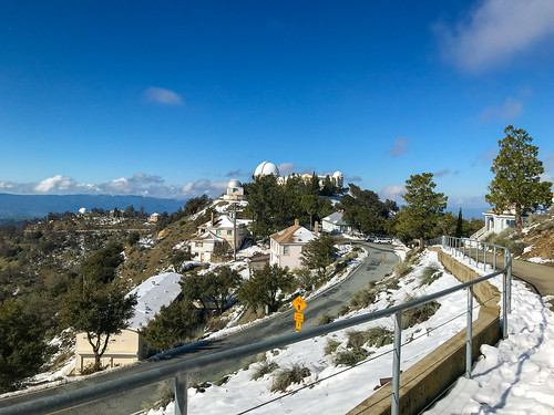
I was down in San Jose, just before the Coronavirus got really serious. Social distancing was already in affect, but not shelter in place. Or at least I wasn't sheltering in place yet. There had been some pretty heavy weather lately, so Amber offered to give me a ride up to Mount Hamilton to see the snow that had accumulated there. I had never been up to Mount Hamilton in the snow before. I had never been to Mount Hamilton at all! She knew I wanted to visit the place very badly. So we took the long and winding road all the way up, a drive that would have been cumbersome in my giant passenger van, but was a breeze in her nimble Subaru. Past 4,000 feet there was still some snow left on the ground from a storm that had brought only rain to the lowlands. We parked the car and just walked around the area. Due to Covid-19 (or other reasons?) The James Lick Observatory, which normally has visitor hours, was closed. As was the parking lot of Mount Hamilton proper. So I didn't even visit the feature that the whole area is named for. But I had loftier goals in mind. Apparently, the massif which is generally called Mount Hamilton is actually divided into eight sub-peaks, including Mount Hamilton proper (AKA Observatory Peak), and the seven others, all named after astronomers throughout history. The actual highest point of them all is Copernicus Peak, the highest point in the Santa Clara County and the highest point in the nine county Bay Area region. As a "summit oriented" hiker, you can understand why I wanted to visit it so badly. Here are the eight sub-peaks in order from highest to lowest:

1. Copernicus Peak: 4360+
2. Hipparchus Peak: 4240+
3. Kepler Peak: 4240+
4. Mount Hamilton / Observatory Peak: 4213
5. Tycho Brahe
6. Gailleo Peak: 4177
7. Huyghens Peak: 4160+
8. Ptolemy Peak: 4040+


HERE is a map that lays them all out

A citadel of science

We walked around the summit area, down the roads and stuff, looking at the telescopes, the astronomer's facilities, taking pictures. There was a ghostly vibe because the astronomers sleep during the day, and work at night when the stars are out. Aside from two other casual visitors, we did not see anyone around. I later surmised that during our wanderings, I unintentionally crossed over Tyco Brahe Peak along the way. Although I was aware at the time that the eight different sub-peaks existed, I wasn't trying to tag them all: maybe if I come back alone some time. Visiting all the sub peaks seemed like a tedious task at the time, and I wasn't trying to test Amber's patience, though I'm sure she would have understood. She DID understand why I had to walk up a gated, "no trespassing" road, through the snow, to reach the top of Copernicus Peak. She waited at the bottom. The top was crowned with an old lookout tower and some radio equipment. I took a few pictures and came back down the same way I came up. 

Looking up Coppernicus peak

It was a crisp, clear day, and there were good views all around, Mount Isabel to the south, Santa Cruz Mountains to the southwest, and the mysterious private property peaks of the Diablo Range to the north. All in all, I was stoked to finally reach the highest point in the Bay Area, and see the Mount Hamilton area , a self contained astronomer's village within sight of San Jose, but a world apart. In the snow, it felt even more removed from the reality of the valley below, akin to visiting an arctic research station.
Much later in the day, an outing was made to the Calero Creek Trail in San Jose, a few photos of which can be seen here.

FURTHER READING
Bob Burd: Bob tags all the sub peaks of Mount Hamilton
Summitpost: Information On Copernicus Peak
Will Hite Web: Info and pictures of Copernicus Peak
Hiking Project: Information on the Calero Creek Trail

Monday, January 27, 2020

Santa Teresa Hills

DATE: Monday, January 27, 2020
DISTANCE: 3.66 miles
ELEVATION GAIN: 579 feet
TIME TAKEN: 1:33 hours
SANTA TERESA COUNTY PARK
SANTA CLARA COUNTY, CA


PHOTO ALBUM
MAP


The Santa Teresa Hills are an east-west oriented ridge on the south side of San Jose. They were inhabited in succession by Native Americans, the Spanish, cattle ranchers, quicksilver miners, and later, suburban homeowners, golfers, and IBM. And on this day, they were temporarily inhabited by me.

After a day of painting a bedroom in San Jose as a favor, I was eager to go outside and get some fresh air. Amber and I ran for the hills, to a trailhead suggested by her intrepid cousin Allen (remember him from Big Sur?). This led us to the southwestern entrance of Santa Teresa Hills County Park, which Amber had actually grown up on the other side of. We started up a rocky (better than muddy!) trail that was signed "closed," but looked very open and very well used. We switchbacked uphill, got some cool views of the Santa Cruz Mountains, and came into an interior valley which is rather hidden from the outside world. Atop the ridge, there were cool rocks, old oaks, and scattered people out for a late afternoon hike, as we were. With not too much time on our hands, we made a tidy loop and went back to the car. Better a short hike than NO HIKE.

FURTHER READING
•Bay Area Hiker: Big photos and good information

Valley in the park

Map from Santa Clara County Parks

Tuesday, June 11, 2019

Bear Creek Redwoods

DATE: Tuesday, June 11, 2019
DISTANCE: 3.4 MILES
ELEVATION GAIN: Minor
TIME TAKEN: 1.5 hours
BEAR CREEK REDWOODS PRESERVE
SANTA CLARA COUNTY, CA


This was a super quickie to go check out the newest Mid Peninsula Open Space Preserve, Bear Creek Redwoods, which just opened this year. Time constraints allowed only a jaunt to the old growth redwoods, consumption of a breakfast burrito in their shadows, and a hasty return to the grind of civilization. 


Tuesday, April 9, 2019

Uvas Canyon

DATE: Tuesday, April 9, 2019
DISTANCE: 1 mile?
TIME TAKEN: 1 hour?
UVAS CANYON COUNTY PARK
SANTA CLARA COUNTY, CA

A super quick one to go see the waterfalls of Uvas while they were in full effect. I really need to come back here sometime and walk through the whole park. A beautiful day with sun dappled, mossy rock hillsides, laughing cascades, and one of my favorite foot bridges. There's a video clip at the bottom of the post, because I feel like a short movie is the best way to see the spirit of a waterfall! 


Tuesday, December 4, 2018

Mount Umhunum

DATE: Tuesday, December 4, 2018
DISTANCE: 7.7 miles
ELEVATION GAIN: 1,187 ft.
SUMMIT: 3,488
SIERRA AZUL OPEN SPACE PRESERVE

SANTA CLARA COUNTY, CA


For years, I wondered what was the deal with the mountain just South of San Jose that had the weird cube on top. I found out it was called Mount Umunhum, and that it was a dis-used military radar station, off limits to the public. Supposedly, it was still accessible by trespassing across private property, and legends abounded of shotgun wielding neighbors and albino cannibals in the area. Before I had the opportunity to experience any of these dangers, however, the summit opened to the public on September 18, 2017. I would not have to sneak to reach the top,  and I chose to traverse the new 7.7 mile round trip trail on December 4, 2018.


CLICK "READ MORE" TO SEE ADDITIONAL PHOTOGRAPHY