Showing posts with label Oakland Hills. Show all posts

Monday, March 22, 2021

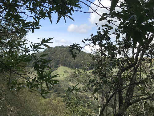
Fairmont Ridge / Sugarloaf Hill

DATE: March 22, 2021
DISTANCE: 1.82km / 1.13 miles
ELEVATION GAIN: 90m / 295'
TIME TAKEN: 0:43
SUMMIT: Sugarloaf Hill: 358m / 1175'
LEONA CANYON REGIONAL OPEN SPACE
ALAMEDA COUNTY, CA
STOLEN OHLONE LAND
SOUNDTRACK: Thin Lizzy: Sugar Blues

PHOTO ALBUM
MAP 1
MAP 2


Full hike report coming soon!


Saturday, January 9, 2021

Barberry Peak / Eureka Peak

DATE: Saturday, January 9, 2021
DISTANCE: 14.81 km / 9.2 miles
ELEVATION GAIN: 796m / 2611’
TIME TAKEN: 5:08
EBMUD EAST BAY WATERSHED
CLAREMONT CANYON REGIONAL PRESERVE
CONTRA COSTA COUNTY, CA
ALAMEDA COUNTY, CA
SOUNDTRACK: Electric Wizard: Barbarian


SUMMITS:
• Barberry Peak: 2709m / 1683’
• Eureka Peak: 2639m / 1640’

PHOTO ALBUM
MAP


Barberry and Eurkea are two little summits in the East Bay hills. Eureka is barely on private property, and I have never attempted to reach it, even though I have hiked close by several times over the past few years. Barberry Peak, a feature which I didn’t even know had a name until last year, is a publicly accessible ridgepoint overlooking the east side of the Caldecott Tunnel entrance. They were both on my “East Bay Hills Obscure Peaks To-Do List,” and both would be visited today.

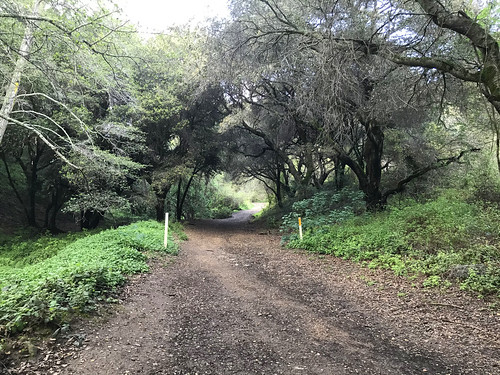
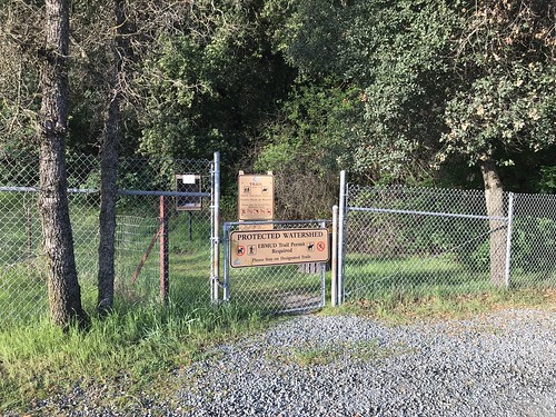
The weekend was here, which means nothing to me, of course, unemployed for almost a year now, but my brother Alex still has a job, and he has weekends off. So as usual, I hit him up to see if he wanted to hike. He also gets the choice of where we go, because his time is much more precious than mine. He had the idea that we would do a warmup hike for our trip to Death Valley, coming the following weekend, so at Big Al’s suggestion, we were at the De La Veaga trailhead in Orinda, to do a repeat, or at least some approximation, of my old “Orinda To Oakland” hike: not carless this time, no use of dirty dog BART. Fearing I would be late for the meetup time, and fighting a hangover from drinking alone at home last night (where else?) I jumped in the van and rocketed myself through the Caldecott Tunnel, to the trailhead. I actually got there first, but Alex was only seconds behind me, and he had to come all the way from San Francisco. We tried to approximate the weight of the backpacking load we would be carrying in Death Valley, Alex with his large pack at 25 pounds, and me with my daypack, stuffed with as much extra weight as I could find, including junk from the back of my van, which got it up to 22 pounds. I followed proper protocol, and singed in at the trailhead with my EBMUD permit number, and we were off, on what has become one of my most familiar trails.

We were soon lost in conversation, and before I knew it, there was a fire road off to the right, and I said “how would you feel about a mild trespass to an obscure East Bay peak?” He was game, and we veered off, contouring along the hillside cow trails, to be away from the view of the house that was right there by the peak, even though we weren’t even trespassing yet. Around this time, we saw three coyotes in the valley below. Cool! We came around the west side of the hill to remain out of sight, and then went straight up.  Then, at the top of the climb, where there was a fence delineating the private property of Eureka Peak, there was one more coyote! Less than 15 feet past the barbed wire fence, and we were on Eureka. A good view of Mount Diablo and Vollmer Peak nearby. Then we went straight down through the fields to rejoin the De La Veaga Trail below, which carried us up the west side of Siesta Valley, into Oakland, and back to civilization, as we heard the roar of cars on Grizzly Peak Boulevard.

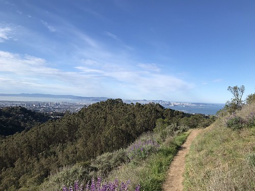
Erupting now into daylight now, out of the tranquil Eucalyptus and Bay Laurel groves, we crossed GPB, dodging both motorists and cyclists, and went into the muddy trails of Claremont Canyon Regional Preserve. Not too long after this is my favorite part of the Orinda To Oakland hike, where you come around the bend and the whole of Oakland, San Francisco and The Bay is revealed before you! Magical every time. At this point, there were now quite a bit of people about, coming up from Berkeley, from the west, to enjoy the weekend afternoon. We didn’t feel the need to go all the way down to the bottom of the Berkeley side, because we were not planning on using BART. So we turned around, and headed back the way we came. Back across GPB, and then at the four-way trail intersection, I said to Alex, “how about we go check out Barberry Peak?” And that was it, off to the next quest.

A short jaunt down the Bay Ridge Trail, and we got to the unofficial track that leads up to Barberry. There was a picnic table there, so we sat down and had a quick snack. Then up the hill. The use trail continued all the way to the top, with classy switchbacks and everything.  The peak had some rocky bits, and an open view of the surrounding area, especially down to the 24 freeway cut. Urban hiking at it’s finest. We decided to make things interesting, yet again, by not returning the way we came, but by looking for a way down the ridgeline towards the California Shakespeare Theater. The idea seemed bunk at first, a potential total bushwhack, but then just like magic, a faint trail appeared that carried us almost all the way down to the bottom of the ridge, where it magically disappeared again with no evident destination, and we had to slide down a steep, slippery hillside, plough through a tangle of brush, and we were finally delivered down at the Cal Shakes Theater.

The facility was officially closed due to Covid (obviously), but the theater was still physically open (no doors), so we went inside and had a look. From there, we decided to take the most direct way possible back to the trailhead, traveling N/NE over two fences, through the EBMUD watershed and cow fields, where we soon found another old trail that led us through a gap in the ridge, back to the more robust system of cow and farm roads on the other side, which funneled us finally back into the De La Veaga Trail. From that point, we were down to the cars on the Orinda side in a matter of minutes. It ended up being a wild variation on the Orinda To Oakland Hike, but highly successful in researching the obscure peaks of the East Bay hills.

FURTHER READING
Oakland Geology:
Some science on Barberry Peak and surroundings
Bob Burd: Bob handles Eureka Peak and many others


Saturday, March 28, 2020

Redwood Peak

DATE: Saturday, March 28, 2020
DISTANCE: 9.22 miles
ELEVATION GAIN: 1,667 ft.
TIME TAKEN: 3:28
SUMMIT: Redwood Peak 1,619
DIMOND CANYON PARK
JOAQUIN MILLER PARK
REDWOOD REGIONAL PARK
ALAMDEA COUNTY, CA
CONTRA COSTA COUNTY, CA


PHOTO ALBUM
MAP


Redwood Peak is the high point of Redwood Regional Park in the Easy Bay Hills, as well as the high point of a long NW-SE running ridge, which is kind of a northwestern extension of the San Leandro Hills trajectory, the western frontline of hills running from East Oakland to Castro Valley. I had been curious for years what was the highpoint of that ridge up there, because I can almost see it from my front door. A blackish green tree studded prominence in distance, at times sun crowned, at times fog shrouded.

As the world and the Bay Area was reeling with Coronavirus lockdown, I was trying to use my now abundant free time to get some hiking in, to visit some places I’d been meaning to visit over the years.  With Saturday projected as a rainy day, I though it would be a good time to finally pay a visit to Redwood Peak. I knew that the summit is tree covered, so I wouldn’t be missing out on any views due to the clouds, and the waterway of Dimond Canyon, through which I planned to ascend, should be gushing with spring runoff, for a lush riparian hiking experience. The third bonus for which I hoped, was that the rain would keep other people indoors, and I could hike in isolation.

Graffiti gate

Well, it didn’t rain very hard at any point during the day, and even though the parking lot at the Dimond Recreation Center, where I began, was completely empty, I encountered quite a few people out on the trails that day. Various configurations of runners, hikers and dog walkers. Few of them hiking alone. I cursed them all for being out, and then cursed myself for being part of the problem. I began the hike by following the course of Sausal Creek up through Dimond Canyon, a path I have followed three of four times before. This is one of my favorite hikes in Oakland, probably one of the best urban hikes you can do in any city. I did things a little differently this time by remaining in the creek bed the whole way up. There’s an intermittent trail, but mostly a bunch of rock skipping and puddle jumping. The artificial waterfalls created by public works projects past are minor obstacles. Beyond the Leimert Bridge and some hydrological infrastructure, the main trail was rejoined, which carried me out of the canyon, past the desolate Montclair Golf Club, and a temporary return to civilization at Monterey Boulevard.

Canyons of Oakland
The conveniently placed pedestrian tunnel carried me beneath the Warren Freeway, and I reconnected with the park system at Palos Colorados Trail, which took me into one of Joaquin Miller Park’s finest redwood canyons. Up to this point, this was almost a duplicate of a hike I had done with my brother Alex back in January, 2018. Where I diverged from that was when I took a left and headed up the Cinderella Creek watershed, following the trails in a northeasterly direction, gaining altitude and curving around the north of the park, and eventually leaving it as I crossed Skyline Boulevard. Like I said, there were still a lot of people around, but all the facilities, like the PAL camp, and the Chabot Observatory, were closed, leaving a somewhat ghostly shoulder season vibe. Throughout the course of the day, and especially up past the border with Redwood Regional Park, I made a series of wrong turns and meandering loops, which I blame upon the overabundance of trails and roads in this highly civilized park. Not that I was in a big hurry or anything, but I did not take the most direct course! My peregrination led me through gnarled oaks, a magic faery circle, and even a banana slug encounter. Eventually, I found my way up the the top, Redwood Peak. Even though it was completely forested, there was still a noticeable summit (more than I was expecting), a rock outcropping, and a U.S. Coast and Geodetic Survey benchmark. It was a nice spot, which I would have remained at longer if not for the imminent arrival of a party of five adventurous youths. So off I went, back down the mountain.

Magic circle

I took the West Ridge Trail past the observatories, went back across Skyline Boulevard, through a parking lot, and then down the Scout Trail to the Castle Park Trail. This was the only section of the day that had a view out to of the trees. My intention was to cut back down to the Palos Colorados Trail, but I somehow went the wrong way on the Sunset Trail and ended up getting dumped in a neighborhood. Rather than retrace my steps back into the park I decided to walk through the residential area, down Castle Drive to Ascot Drive, past Joaquin Miller Elementary School. For a road hike, it wasn’t too bad. Ascot Drive even has a trail along part of it. I re-crossed the Warren Freeway, and then returned the way I came, back down through Diamond Canyon, back down to the rec center parking lot, which had a few cars in it by now, and couple of people ill-advisedly smoking weed together. Now, when I leave my front steps and look left down the street, which points at a distant redwood covered hill, I know what I'm looking at, and another piece of the grand puzzle is filled in.

FURTHER READING
•Bob Burd: A quick jaunt to Redwood Peak
•East Bay Trails: Another approach to Redwood Peak
•Redwood Hikes: Good photographs and description of Redwood Regional Park
•Oakland Trails: Information on the mosaic trail markers


Map by Alltrails

Tuesday, March 17, 2020

Huckleberry Regional Botanical Preserve

DATE: Tuesday, March 17, 2020
DISTANCE: 3.13 miles
ELEVATION GAIN: 850 ft.
TIME TAKEN: 1:07
HUCKLEBERRY BOTANICAL PRESERVE

CONTRA COSTA COUNTY, CA

PHOTO ALBUM
MAP


Huckleberry Botanical Regional Preserve is a 240 acre urban treasure. According to the brochure, "the native plant community found here is seen nowhere else in the East Bay, and represents a relic plant association found only in certain areas of California where ideal soil and climate conditions exist." There is a self guided interpretive loop trail, which has little signs telling you what all the plants are. I felt a a jerk not studying the botanical specimens like I was supposed to, but I was in a strange mood, and half wondering if the rangers were gonna come throw me out of the park. So I hiked quickly, not lingering in any one place too long. You see…

First sighting of Round Top

The Bay Area, along with most of the world at this point, was in the grip of panic and confusion related to the Coronavirus pandemic. The industry in which I am employed having virtually evaporated overnight, I thought I could at least take the opportunity to do a lot of hiking, even if nothing else good came from the situation. But today, when I arrived at the Huckleberry Staging Area, I saw the parking lot closed with caution tape, and signs saying the the East Bay Regional Parks were closed by order of the Department Of Health! Lame. I didn't think it was right for them to close the parks, so I drove around until I found a place where I could park by the side of the road, and jumped in at the Upper Pinehurst Trailhead. "I'll have the damn place to myself," I thought, and hopefully not get caught and fined. The next day it was announced that closing the parks had been a mistake, and they were all re-opened. This was before EVERYONE lost their jobs and started flocking to open spaces, and they had to start closing them again (more on that soon!)

The main reason I wanted to go to Huckleberry was because I had never been to it before. It was on the "to do" list, and I didn't quite know what to expect. It is a true "forest bath" experience. No open peaks or hilltops, no waterfalls, just going DEEP into the plants. Ferns, manzanita, bay laurel and oaks surrounded me completely. When you could occasionally see out from the herbaceous wonderland, there was a great view of Round Top, as well as Mount Diablo and points east. I achieved my goal of squeezing in a quick hike for the day, but I don't feel like I did the park "right." I fully intend to return and follow along with the brochure to study the variety of plants. California plant identification is one of my weak spots, and it would make me a more credible outdoors writer if I could expand my knowledge. 
It was a nice little hike. I did not, in fact, have the place to myself, as I saw several other parties within. I was the only one doing the responsible thing and hiking by myself. I got in, did the loop, and got back out without incident, wondering on my way home if all my hikes for the foreseeable future would be done against the law.

FURTHER READING:

Monday, March 16, 2020

Leona Canyon

DATE: Monday, March 16, 2020
DISTANCE: 3.75 miles
ELEVATION GAIN: 684 ft
TIME TAKEN: 1:17
LEONA CANYON OPEN SPACE
ALAMEDA COUNTY, CA


PHOTO ALBUM
MAP


Intending this to be the week that I hike every single day, having nothing else to do, my job and most of my social activities eliminated by the Covid-19 Quarantine order, I decided to grab a quick one today on the way home from San Jose. I had never been to Leona Canyon before, but as one of the green blobs on the map of the East Bay, it was bound to get visited someday. And that day is today.

Tree tunnel

At first, I tried to enter from the north end, at Merritt College, but access to the trailhead is cut off there now, because the college is shut, due to Coronavirus, so I drove down to the south end, at the Canyon Oaks Apartments, and entered that way. It was party cloudy, cool, and 4:30 PM, good conditions, and just enough time for a jaunt before I lost the light. At the south end of the park, there is an earthen dam which must exist to control the flow of Rifle Range Branch (the creek that runs through the canyon), and forms a small pond there. Leona Trail is the main track which follows the floor of the canyon from one end to the other, and off I went, through a tree tunnel of oaks, next to the trickling Rifle Range Branch. Moss and ferns painted the canyon floor green on black.

Old chimney

My ulterior motive for being here was try to find a path up Sugarloaf Hill, a prominent East Oakland high point that I'd seen many times before, driving south on 580. I now knew where it was, lodged in the northwest corner of this park, but I didn't know how to get to it. I followed the Leona Trail all the way to Merritt College, past it's abandoned athletic field and solar farm, looking for an unofficial trail to the top, which I guessed would probably be on the north end. I didn't really see anything promising, just what looked like deer trails on the other side of thick tangles of weeds, and I just didn't have the appetite at the moment to plunge into the bushes. I returned the way I came, keeping a sharp eye out to my left for trails that would go up to Sugarloaf Hill, and I followed a few false leads. (I was later able to glean from the internet that the trail goes up behind the storage sheds in the parking lot, looks like I have unfinished business in Leona) The one bonus I got for looking out was seeing the remaining chimney of an old homestead, slowly disappearing under a blanket of damp moss. Then I walked back down the road to the parking lot.

FURTHER READING
• Oakland Geology Blog: Leona Canyon
• "Step back in time in Leona Canyon," SFGate

Map by East Bay Regional Parks District

Tuesday, March 10, 2020

Orinda To Rockridge 2020

DATE: Tuesday, March 10, 2020
DISTANCE: 7.03 miles
ELEVATION GAIN: 1381 ft.

ELEVATION LOSS: 1684 ft.
TIME TAKEN: 2:06 hours
SUMMIT: Skyline Ridge AKA Sprial Knob: 1400'
SIESTA VALLEY RECREATION AREA

CLAREMONT CANYON REGIONAL PRESERVE
CONTRA COSTA COUNTY, CA

ALAMEDA COUNTY, CA

PHOTO ALBUM
MAP 

https://hikingmetalmaniac.blogspot.com/p/carless-hikes.html


I returned from my lovely weekend in Big Sur to find that the Novel Coronavirus (Covid 19) has basically evaporated the industry in which I am employed, almost overnight, so I'm going to try to make the best of it by hiking as much as possible! Today, I decided to keep things in my neighborhood and re-visit the original carless hike, from Orinda BART to Rockridge BART in Oakland. I didn't get out there as early as I would have liked (sunrise) but it was still morning at least. As before, I make this a carless hike by entering the BART system at MacArthur, and going two stops east to Orinda, which puts me on the other side of the hills. Then I hike back over the hills to Oakland, re-enter the BART system at Rockridge, and take the train one stop to home base, MacArthur.

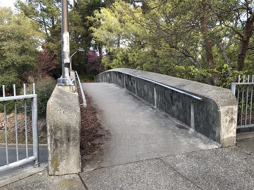
First pedestrian bridge

The first time I did this maneuver, I said the most difficult part was getting out of the BART station and across the busy road to the trailhead. Two and a half years later, the intersection of Camino Pablo and Santa Maria Way in Orinda remains a realm of the utmost hostility to pedestrians, but I was able to rely on my memories from the last venture, and streamline the crossing somewhat. Exiting the fare gates Orinda BART at 8:40, I turned right, and then made an immediate left on a pedestrian bridge that crosses a small access road. This path then dipped down and took me northwest, beneath two overpasses. Arriving then at a freeway onramp with no crosswalk, I was asked to turn right, and the path continued to another pedestrian bridge that took me above the freeway ramps and deposited me at the cul-de-sac of Orinda Way. Orinda Way to a left turn at Santa Maria. Santa Maria to Camino Pablo. This time, instead of walking along the north side of Camino Pablo, and running across the freeway-like road opposite the trailhead, I crossed at the traffic light. Even though there's no crosswalk, I walked with the green light and made it across in one piece. And that is the last street crossing for awhile, even though the next one is no less harrowing!

Trailhead

I arrived at the De La Veaga trailhead at 8:48, a gate off of a small gravel turnout, diligently signing the log book with my EBMUD trail permit number, rejecting the scofflaw ways of my past. (HERE'S WHERE YOU GET AN EBMUD TRAIL PERMIT) The De La Veaga Trail is only what I would call a trail for the first half mile or so, and then it intersects and becomes one with a fire road, which seemed to be recently re-graded and widened. The fire road winds it's way lazily up grassy oak studded hillsides and beneath massive high voltage power lines. Views begin to open up back to the east, and soon majestic Diablo comes into view. Eventually the road gains a ridge, and I crossed through another cattle gate (but no cows around today at all). To the south, I looked down into the lush spring green Siesta Valley, with Las Trampas in the distance. To the west, the familiar ridgeline of the Oakland and Berkeley hills played out in front of me. At this point I encountered the only other humans on the DLV trail, three hikers headed in the opposite direction.

Poppies

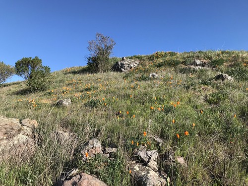
The fire road dipped down into the northwestern end of Siesta Valley, past some poppy speckled hillsides, and then climbed back up the more heavily wooded other side to leave the EBMUD protected watershed and meet the East Bay Skyline trail. This took me on the final stretch, to the crest of Frowning Ridge, where I emerged into sunlight, and made an unprotected mad dash across Grizzly Peak Boulevard. Entering the system of trails that leads down Skyline Ridge and Claremont canyon, there is a change of atmosphere. In a zone that is touched by coastal fog, the vegetation becomes more lush, and non-native eucalyptus trees are a strong presence. Now comes my favorite part, as I descend the ridge, and around a bend comes a fine view of bonny old Oakland! And then San Francisco too!

Oakland and San Francisco

As I made my way west, down the trail, I decided to stop and verify just what was the geographical feature named Skyline Ridge, even though I've been there before. It is the eastern, and higher of the two mini hills (that have side trails leading to them) on top of the main ridge. This particular one has two spirals made of rocks at the top. Hence it's other name, Spiral Knob. Alternately hiking and jogging down towards Berkley now, I officially entered Claremont Canyon Regional Preserve. The farther down I got, the more hikers and joggers I saw, of course. Getting close to civilization. Down the Stonewall Panoramic trail. Bloody steep in places, and lots of loose pebbles! I had to be careful not to end up sliding down it on my ass. Popped out of the bottom of the park at Stonewall Road, took it South to Claremont Avenue, and then College Avenue to Rockridge, where I re-entered the BART system after just over two hours of hiking. I still believe this is probably one of the finest urban hikes you can do in the Bay Area, and one of the few in the world where you can ride the subway to the trailhead! Please leave a comment if you know of any other ones!

Map by Google

Thursday, June 6, 2019

Grizzly Peak / Chaparral Peak / Vollmer Peak

Grizzly Peak from Vollmer Peak
DATE: Thursday, June 6, 2019
DISTANCE: 8.5 miles (?)
ELEVATION GAIN: (?)
TIME TAKEN: 4 hours
TILDEN PARK
CLAREMONT CANYON RPD
PHOTO GALLEY

SUMMITS
GRIZZLY PEAK: 1758 ft. 
CHAPARRAL PEAK: 1770 ft. 
VOLLMER PEAK: 1905 ft. 


One major component of my Bay Area "Carless" hikes concept, still in development, is to be the Bear Transit Hill Line, a bus that travels from Downtown Berkeley BART, up through the campus, to it's highest stop, the Space Sciences Lab, which is close to Grizzly Peak Boulevard and the crest of the Berkeley hills. Be forewarned, it costs one dollar for non students / non faculty, it doesn't take Clipper cards, and it only originates/terminates at the BART station on the first (7:35AM) and last two (6:40PM and 7:30PM) trips of the day. All other circuits during the day originate and terminate at Evans Hall on the UC Berkeley campus, which is not a far walk from the BART station. REMEMBER! It costs one dollar in CASH to ride the bus, and that's a one way ticket. Bring two dollars in cash with you if you want to ride the shuttle back down.

Hill Line map. Click to enlarge.
Anyway, if you have no car, you can take BART from anywhere in the system to Downtown Berkeley, and for $1, get a ride to the top of the Berkeley Hills ridgeline, where you have access to over 150 miles of trails through Tilden Park, Wildcat Canyon, and if you keep going, Sibley, Redwood Regional, and beyond. Right now, the Berkeley stop of this bus is on the South side of Addison Street between Shattuck and Oxford, but I think it's going to move back to Shattuck when the construction is complete. So it was here on a Thursday morning at 7:35 AM that I boarded the Bear Transit Hill Line bus, diligently plunging into my research for the carless hikes program. The other goal of the day was to summit some of the most significant elevations in the East Bay hills, some for the first time. Sadly, I have been bitten by the "peak bagging" (a term I hate, sounds a bit too much like tea bagging...) bug, so I can add that to my list of time consuming and pointless hobbies. Peak bagging, or summiting, as I shall call it from now on, makes a natural fit in my life, considering my strong interests in hiking, collecting, AND lists! I have no idea why I didn't become obsessed with it much earlier in life.

Hill Line schedule. Click to enlarge.
I almost immediately made a stupid mistake (a theme which will be repeated often in Constant Ascension) by bringing only one dollar in cash with me, for the ride up, not thinking about how I was going to get down. You'll see how this affected my trip later! The lightly used bus travels up through the educated environs of UC Berkeley, and past various other attractions. Using this bus to get to the Botanical Garden would be another fun excursion! I eavesdropped on the scientists riding the bus as they spoke in hushed tones about the universe. In about 15 minutes, I got to the terminal bus stop, which is in the parking lot if the Space Sciences Laboratory.  I leapt out and hit the trail immediately, with the enthusiasm of an early riser excited for hours of hiking to come. Northeast, past the building I went over a small berm to Grizzly Peak Boulevard (which will from now on be called GPB), where a use trail leads along the road to the intersection with Golf Course Drive. Turn right, and there is the trailhead of Grizzly Peak Trail. I was off into the woods.

Grizzly Peak Trail
This trail mostly hugs the ridge line just below the boulevard, and I headed Southeast. Dense trees and plants, charming views of the surrounding hills and ridges to North and East. Mount Saint Helena visible to the North. The trail winds it's way around the North side of it's same named peak, and this landscape was all familiar to me, as I had been on the trails of Tilden Park before, in my many years living in Oakland, but until recently, never paid much attention to where I was going, how many miles I was walking, or what geographical features I was looking at or standing on. Soon, I was standing on Grizzly Peak, for probably the first time. Though the major road of the area is named after it, and it has somewhat iconic status in Berkeley culture, it was honestly pretty difficult to tell what Grizzly Peak actually was all for these years. It's just another eucalyptus encrusted, radio tower crowned, high point on the ridge that is apparently called Frowning Ridge. But today I made a point to get to the top and check it out. A short, beer can littered trail goes up from the road, and soon your are at the summit! As you can see from the photo, the peak is private property, managed by a telecommunications concern. Luckily for me, some intrepid soul in the past has already cut a hole in the fence, and I was able to slip right inside past the chain link and razor wire, and get as close as possible to the true summit of Grizzly Peak (1758 ft.). Mount Tamalpais was eminently visible to the West.

The beautiful summit of Grizzly Peak
Back down, a mad dash across GPB, to one of the finest vista points along the road, a much better view than on the peak it's self. A popular car turnout, no doubt, for teenagers and young adults alike to park,  drink, do drugs and make out, with a fine view of The Bay spreading out below. And I do not absolve myself of any of those transgressions! A short walk along the pedestrian hostility of the road got me to the fire trail that leads to Chaparral Peak. I had most certainly been to Chaparral Peak (1770 ft.) before in my walks, but was barely even able to recognize it as a mountain, much less the highest point in the city of Oakland! When you're there, it pretty much looks like a meadow with some scrub trees in it, but now that I know what it is, I have a new appreciation. It is at this point that views open up to Mount Diablo in the East.  Now, I must take a moment to give some credit to this post on Oakland Geology website, for actually inspiring today's hike! Check it out.

Without much to do on Chaparral, except eat my only cliff bar, I quickly moved on to my next goal, an apparently unnamed mound that looms over GPB to the South. I had noticed this prominence many times before, as there is a cool view of it from GPB as you drive South. In the ignorance and confusion of my past, I had though that maybe THIS was Grizzly Peak, but now I know better. Crossed GPB again, and got to the place where the De La Veaga trail, The Skyline trail and the trail down to Cal Shakes meet the road. This area is labeled "Scotts Peak Trailhead" on Google Maps, but I can't figure out which one is Scotts Peak Trail, or what Scotts Peak is! I will update when I figure it out. Also at this intersection is a short paved road that leads to the top of the mound which I will call "Frequency Peak," due it's radio antennae.

"Frequency Peak"
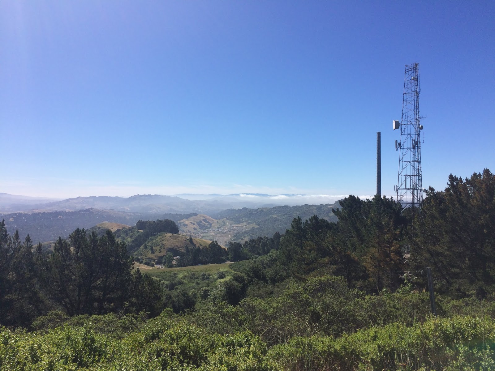
It's basically just another high point on the ridge, occupied by private telecommunications gear, and fenced off. I estimate it to be close to 1700 feet. I circled the perimeter of the fence, to see if there was a way in (there wasn't) but I saw that someone had got inside at some point to do some painting. Off the Northeast side was another unobstructed view of Diablo, and some large animals that I could not identify. To get to my next goal, I took my life in my hands, and walked back North on shoulderless GPB towards Tilden. I realize now that I could could have simply taken the Bay Area Ridge Trail, which parallels it, and avoided the speeding vehicles attempting to snatch my life. Back into Tilden at the Seaview Trail, past the steam trains up towards Vollmer Peak. There was a team of geriatrics with their trekking poles preparing for an expedition when I passed through. I circled around the East side of Vollmer Peak on the Seaview trail, which I find to be a curious name, because the only part of the actual SEA you would ever be able to view from it would be the small gap through the Golden Gate. Hit Vollmer Peak Road, an easy paved grade that makes the summit in minutes. Vollmer, another hill that has been flattened on top and graced with the presence of telecommunications towers. This one however has the distinction of being the highest point in the East Bay Hills (1905 ft.). This was the only summit of the day where I wasn't alone, I shared it with a few casual hikers and dog walkers. I had a view back to my previous ascent, Grizzly Peak, West to foggy San Francisco and the Golden Gate, and Southeast to Las Trampas ridge.

Looking towards Las Trampas from Vollmer Peak
Back down on Vollmer Peak Road, to Vollmer Peak Trail, which zig zags down the West side of the hill, back into Tilden Park, and around the back side of the park's fire station and corporation yard, where I heard the firefighters doing some kind of military bootcamp style call and response chant. Serene Tilden with it's picnic areas beckoned, and I took a whimsical detour through what might be an upper section of Wildcat Creek. Popping out on Gillespie Trail, wondering why I chose to walk through a poison oak infested gulch wearing shorts. Out of the park and another crossing of GPB, up over the fire road, and into an area I've been to many times before, which I call Woodchip Meadow (you will know what I'm talking about if you've ever been there). Up to a lovely spot I know well, a prominent and oft visited location which I will call "Chill Hill" until I can figure out if it has a real name. It is serene hilltop with with a circle of trees, about 1,700 feet. It is one of the nicest places in the East Bay Hills as far as I'm concerned.

"Chill Hill"
The reason I came back this way was with the intention of descending back into civilization down the Skyline Ridge trail, because I had forgotten to bring an extra dollar to pay for the Hill Line Bus to get back to Berkeley, I had no idea if they would let me slide, or if there was an ATM at the Space Sciences Lab, or a cafeteria or anything to break a $20 dollar bill. And I didn't want to walk all the way back there to find out. So I started walking down the ridge, which is a trail I've done many times before, and then curiosity got the best of me, and I decided to turn off on Telegraph Canyon, a trail I had never done. I had always wanted to check it out, because there's out turnout for it I'd seen from Claremont Avenue, and I can't get enough of tree filled canyons! If I had known what was in store, I would have saved this excursion for a different time.

Telegraph Canyon is a very nice descent through the trees to Claremont Avenue, but that's where the enjoyment ends. I guess the only point of this trail is to park at the bottom and walk up towards the top, because if you come down, and want to continue going down on foot, like I did (towards Rockridge BART) you're faced with no choice but to walk along the road. Being the stubborn bastard that I am, I chose this option as opposed to retracing my steps and continuing in the trail system. Take it from from me, walking along this part of Claremont FUCKING SUCKS and is extremely dangerous. It was scarier than all the combined loose rock, poison oak, and rattlesnakes I have ever encountered. There is absolutely no sidewalk or path along the road in this area, and cars rush by at ridiculous speeds around blind hairpin turns. I had to frequently crisscross the road to get to the other side that had slightly more shoulder to protect me. Never walk down here if you can possibly avoid it, it was not made for pedestrians. Dealing with this stretch of road came close to ruining my whole day, and what's worse is the thought that I could have taken the easy alternative of beautiful trails leading down the ridge. Lesson learned! Soon enough, the nightmare was over and I got to the sidewalks of the Claremont District. I stopped in Star Market to peruse the vast beer selection, and then ended my journey at Rockridge BART, re-entering the public transit system at the end of this carless hike.

Detail of the Tilden Section
Map of the complete hike


Tuesday, April 23, 2019

Round Top (1,763)

DATE: Tuesday, April 23, 2019
DISTANCE: 4.75 MILES
ELEVATION GAIN: 800 feet
TIME TAKEN: 1.5 Hours
SUMMIT: 1,763 feet
SIBLEY VOLCANIC RP
ALAMEDA COUNTY, CA


I had a free morning, and the van needed to be moved by 9am because of street sweeping, so I drove up to Sibley Volcanic Regional Park to walk around. Pathetically, in all of my years living in Oakland, I had never been inside Sibley, or up to the top of Round Top. Driven past them, but never got out. Today was the remedy. Cruised up 24 with rush hour traffic still pouring out of the tunnel from the other direction. Just on the other side of the ridge, I exited the freeway at Fish Ranch, took a sharp right to Old Tunnel Road, and eased into the West parking lot for Sibley. I took my time walking around, checking out the informative signs regarding the area's volcanic history. My goal of Round Top came into view almost immediately. Followed by a peek over Highway 24 to the  Berkeley Hills. Traveling clockwise through the park, I came to a washed out road that had not survived the unusually wet winter.

Around the North edge of the park, there are many crisscrossing trails that go up, down and around the folds of Gudde Ridge, and into some volcanic recesses and small canyons. These I pursued at my own leisurely pace. Atop the ridge line, mighty Diablo came into view in the East. To west, I could see San Francisco and out through the Golden Gate. I continued my meander through the volcanic wilds and soon came upon a sight familiar to me from photographs, a stone labyrinth constructed on the floor of an old quarry. Not wanting to waste my time with such childish pursuits, I took a picture from above and moved on. My life is enough of a maze already.

I was getting close to the main goal of the morning, getting to the top of Round Top, a gently curved prominence that crowns to ridge of the Oakland Hills. The trail, now plunged into a heavily wooded area, and curved around back of the mountain. When I reached the south side, I crossed onto a paved service road that snaked to the top. Another East Bay hill, another complex of radio antennae awaits, right? And no view out, due to the crown of eucalyptus the encircles the place. Just about what I was expecting. Back down into the park, on my way out. Hit the Skyline Trail, which is not very skyline-ey at this point as it plunges down into the forested valley of Round Top Creek. It was shady, lush, and at times a bit muddy. A contrast to the exposed rocky hilltops of the volcanic ridge. Soon enough, I popped out of the woods, got in the van, and hit Trader Joe's in Rockridge for salad and sandwich supplies. Two band practices and late night shift at work would later complete my day.


CLICK "READ MORE" TO SEE ADDITIONAL PHOTOGRAPHY

Wednesday, January 10, 2018

Dimond Canyon / Joaquin Miller Park

DATE: Wednesday, January 10, 2018
DISTANCE: 7 miles (estimate)
ELEVATION GAIN: 1,000 ft. (estimate)
TIME TAKEN: 3 hrs. (estimate)
ALAMDEA COUNTY, CA


PHOTO ALBUM HERE
Dimond Canyon / Joaquin Miller: January 10, 2018


Here is an old hike for which I finally uploaded the photos, and wrote the description! Me and my brother Alex were looking for something to do, it was the beginning of the new year, and I didn’t have a new year’s resolution to hike more, I had a LIFE resolution to hike more. So we down to Dimond Park, to just start walking up the canyon, and go as far as we felt like. This was my second or third time going up this way, and I had never made it past the Montclair Golf Club. We ended up going way past there, under the freeway, up Palo Seco Creek into Joaquin Miller Park, and all the way back down. Neither of us had been to that part of Joaquin Miller before, so we took the time to check out the features, natural and manmade. To complete the loop, we ended up doing part of the hike back on the road, but that’s just an aspect of the grand urban excursion! And we’re fortunate that such expeditions are possible within the fine city of Oakland. 

Gateway to the underworld


FURTHER READING
•Redwood Hikes: Excellent photographs and another good loop in Joaquin Miller
•BA Hiker: An excellent description of Joaquin Miller Park
•Hiking Project: Info on Dimond Canyon

Map background by Friends Of Sausal Creek


Dimond Canyon / Joaquin Miller: January 10, 2018