Showing posts with label East Bay Hills. Show all posts

Monday, March 22, 2021

Fairmont Ridge / Sugarloaf Hill

DATE: March 22, 2021
DISTANCE: 1.82km / 1.13 miles
ELEVATION GAIN: 90m / 295'
TIME TAKEN: 0:43
SUMMIT: Sugarloaf Hill: 358m / 1175'
LEONA CANYON REGIONAL OPEN SPACE
ALAMEDA COUNTY, CA
STOLEN OHLONE LAND
SOUNDTRACK: Thin Lizzy: Sugar Blues

PHOTO ALBUM
MAP 1
MAP 2


Full hike report coming soon!


Thursday, March 18, 2021

Berekeley Highpoint

DATE: Thursday, March 18, 2021
DISTANCE: 10.54km / 6.55 miles
ELEVATION GAIN: 371m  1217'
TIME TAKEN: 2:35
SUMMIT: Berkeley City High Point: 404m / 1325'
TILDEN REGIONAL PARK
ALAMEDA COUNTY, CA
SOUNDTRACK: Blatz: Berkeley Is My Baby

PHOTO ALBUM
MAP


Full hike report coming soon!


Monday, March 8, 2021

Lafayette Reservoir

DATE: Monday, March 8
DISTANCE: 8.2km / 5.1 miles
ELEVATION GAIN: 284m / 933'
TIME TAKEN: 1:36
SUMMIT: Peak 1038' (316m)
PARK NAME: LAFAYETTE RESERVOIR RECREATION AREA
COUNTY: CONTRA COSTA COUNTY, CA
STOLEN BAY MIWOK LAND
SOUNDTRACK:
Stone Titan: Sunny Side Up

PHOTO ALBUM
MAP


FULL HIKE DESCRIPTION COMING SOON!


Wednesday, February 3, 2021

Murrieta Falls

DATE: Wednesday, February 3, 2021
DISTANCE: 12.37km / 13.28 miles
ELEVATION GAIN: 1277m / 4191’
TIME TAKEN: 8 hr
DEL VALLE REGIONAL PARK
OHLONE REGIONAL WILDERNESS
ALAMEDA COUNTY, CA
SOUNDTRACK: Tyrranicide: Facing Reality

SUMMITS:

• Rocky Ridge: 739m / 2426’
• Schlieper Rock: 939m / 3080’

PHOTO ALBUM
MAP


FULL HIKE DESCRIPTION COMING SOON!


Friday, January 29, 2021

Castle Rock (Mount Diablo)

DATE: Friday, January 29, 2021
DISTANCE: 7.84km / 4.87 miles
ELEVATION GAIN: 267m / 877’
TIME TAKEN: 2:50
SUMMIT: Castle Rock: 296m / 972’
DIABLO FOOTHILLS REGIONAL PARK
MOUNT DIABLO STATE PARK
CONTRA COSTA COUNTY, CA
SOUNDTRACK: Helstar: Dracula’s Castle

PHOTO ALBUM
MAP


FULL HIKE DESCRIPTION COMING SOON!


Saturday, January 9, 2021

Barberry Peak / Eureka Peak

DATE: Saturday, January 9, 2021
DISTANCE: 14.81 km / 9.2 miles
ELEVATION GAIN: 796m / 2611’
TIME TAKEN: 5:08
EBMUD EAST BAY WATERSHED
CLAREMONT CANYON REGIONAL PRESERVE
CONTRA COSTA COUNTY, CA
ALAMEDA COUNTY, CA
SOUNDTRACK: Electric Wizard: Barbarian


SUMMITS:
• Barberry Peak: 2709m / 1683’
• Eureka Peak: 2639m / 1640’

PHOTO ALBUM
MAP


Barberry and Eurkea are two little summits in the East Bay hills. Eureka is barely on private property, and I have never attempted to reach it, even though I have hiked close by several times over the past few years. Barberry Peak, a feature which I didn’t even know had a name until last year, is a publicly accessible ridgepoint overlooking the east side of the Caldecott Tunnel entrance. They were both on my “East Bay Hills Obscure Peaks To-Do List,” and both would be visited today.

The weekend was here, which means nothing to me, of course, unemployed for almost a year now, but my brother Alex still has a job, and he has weekends off. So as usual, I hit him up to see if he wanted to hike. He also gets the choice of where we go, because his time is much more precious than mine. He had the idea that we would do a warmup hike for our trip to Death Valley, coming the following weekend, so at Big Al’s suggestion, we were at the De La Veaga trailhead in Orinda, to do a repeat, or at least some approximation, of my old “Orinda To Oakland” hike: not carless this time, no use of dirty dog BART. Fearing I would be late for the meetup time, and fighting a hangover from drinking alone at home last night (where else?) I jumped in the van and rocketed myself through the Caldecott Tunnel, to the trailhead. I actually got there first, but Alex was only seconds behind me, and he had to come all the way from San Francisco. We tried to approximate the weight of the backpacking load we would be carrying in Death Valley, Alex with his large pack at 25 pounds, and me with my daypack, stuffed with as much extra weight as I could find, including junk from the back of my van, which got it up to 22 pounds. I followed proper protocol, and singed in at the trailhead with my EBMUD permit number, and we were off, on what has become one of my most familiar trails.

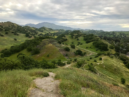
We were soon lost in conversation, and before I knew it, there was a fire road off to the right, and I said “how would you feel about a mild trespass to an obscure East Bay peak?” He was game, and we veered off, contouring along the hillside cow trails, to be away from the view of the house that was right there by the peak, even though we weren’t even trespassing yet. Around this time, we saw three coyotes in the valley below. Cool! We came around the west side of the hill to remain out of sight, and then went straight up.  Then, at the top of the climb, where there was a fence delineating the private property of Eureka Peak, there was one more coyote! Less than 15 feet past the barbed wire fence, and we were on Eureka. A good view of Mount Diablo and Vollmer Peak nearby. Then we went straight down through the fields to rejoin the De La Veaga Trail below, which carried us up the west side of Siesta Valley, into Oakland, and back to civilization, as we heard the roar of cars on Grizzly Peak Boulevard.

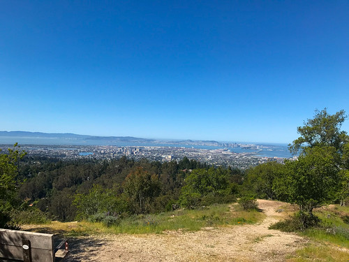
Erupting now into daylight now, out of the tranquil Eucalyptus and Bay Laurel groves, we crossed GPB, dodging both motorists and cyclists, and went into the muddy trails of Claremont Canyon Regional Preserve. Not too long after this is my favorite part of the Orinda To Oakland hike, where you come around the bend and the whole of Oakland, San Francisco and The Bay is revealed before you! Magical every time. At this point, there were now quite a bit of people about, coming up from Berkeley, from the west, to enjoy the weekend afternoon. We didn’t feel the need to go all the way down to the bottom of the Berkeley side, because we were not planning on using BART. So we turned around, and headed back the way we came. Back across GPB, and then at the four-way trail intersection, I said to Alex, “how about we go check out Barberry Peak?” And that was it, off to the next quest.

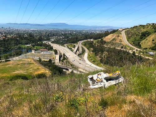
A short jaunt down the Bay Ridge Trail, and we got to the unofficial track that leads up to Barberry. There was a picnic table there, so we sat down and had a quick snack. Then up the hill. The use trail continued all the way to the top, with classy switchbacks and everything.  The peak had some rocky bits, and an open view of the surrounding area, especially down to the 24 freeway cut. Urban hiking at it’s finest. We decided to make things interesting, yet again, by not returning the way we came, but by looking for a way down the ridgeline towards the California Shakespeare Theater. The idea seemed bunk at first, a potential total bushwhack, but then just like magic, a faint trail appeared that carried us almost all the way down to the bottom of the ridge, where it magically disappeared again with no evident destination, and we had to slide down a steep, slippery hillside, plough through a tangle of brush, and we were finally delivered down at the Cal Shakes Theater.

The facility was officially closed due to Covid (obviously), but the theater was still physically open (no doors), so we went inside and had a look. From there, we decided to take the most direct way possible back to the trailhead, traveling N/NE over two fences, through the EBMUD watershed and cow fields, where we soon found another old trail that led us through a gap in the ridge, back to the more robust system of cow and farm roads on the other side, which funneled us finally back into the De La Veaga Trail. From that point, we were down to the cars on the Orinda side in a matter of minutes. It ended up being a wild variation on the Orinda To Oakland Hike, but highly successful in researching the obscure peaks of the East Bay hills.

FURTHER READING
Oakland Geology:
Some science on Barberry Peak and surroundings
Bob Burd: Bob handles Eureka Peak and many others


Saturday, December 12, 2020

Eagle Peak

DATE: Saturday, December 12, 2020
DISTANCE: 7.26km / 4.51 miles
ELEVATION GAIN: 498m / 1635’
TIME TAKEN: 1:51
SUMMIT: Eagle Peak: 524m / 1720’
LAS TRAMPAS REGIONAL PRESERVE
CONTRA COSTA COUNTY, CA
SOUNDTRACK: Jerusalem: Hooded Eagle

PHOTO ALBUM
MAP


FULL HIKE DESCRIPTION COMING SOON!


Friday, November 13, 2020

Black Point / Lime Ridge

DATE: November 13, 2020
DISTANCE: 19.11km / 11.88 miles
ELEVATION GAIN: 971m / 3186’
TIME TAKEN: 4:38
LIME RIDGE OPEN SPACE
MOUNT DIABO STATE PARK
CONTRA COSTA COUNTY, CA
SOUNDTRACK: Chainsaw Orchestra: Black Point


SUMMITS:
• Lime Ridge High Point: 305m / 1,001’
• Black Point: 546m / 1,791’

PHOTO ALBUM
MAP


"THE SEVEN GATES OF DIABLO" #7


To be honest, even though I was keen to visit Lime Ridge Open Space and Black Point someday, based on their own merits, the true reason for my visit on November Thirteenth was to establish the “seventh gate” to Mount Diablo State Park, the last piece in my project, the Seven Gates Of Diablo: Seven ways to walk into the park from the outside (the park was closed to cars due to the pandemic). Why seven? It just sounded more badass than six. Of all the “seven gates,” this one was the most questionable: Hopping fences and crossing through borderline “private” property, dodging herds of cows, and entering MDSP through a non entrance that is not known to the public whatsoever! If you’re interested in such an adventure, please continue!

I arrived at the Lime Ridge parking lot at Ygnacio Valley Boulevard and Cowell Road, in Concord, at about 7:30AM. The weather was cool, and the sky was grey, but the landscape was just about as dry as could be, having not seen rain since May. I began trekking down the dusty dirt roads that led me into the park. I soon broke off onto dusty trails that wound up into the dusty oaks and parched grass environment that made up Lime Ridge Open Space, and I could see, at first from the tracks, and soon after from the participants, that this was a mountain bike place. And before I knew it, I was dodging them. Everything looked brown and tired and dead, and then Diablo came into view, as it always does. Elevation was gained, and views opened up of the surrounding countryside. There were darker clouds in the distance, suggesting that the long dry season might be about to come to an end.

Within a half hour, I had arrived at my first destination, the Lime Ridge Highpoint, which was crowned by a bench. I wasn’t tired yet, so I didn’t sit, but instead spilled off the south side of the hill to continue towards the park border, following at first, a rustic track through the brush, then the more typical ranch road. Less than an hour in, I was through Lime Ridge Park, and at a private property gate, which I jumped over and continued on my way. I don’t think it was actually private property, just some kind of land reserve that hadn’t been opened to the public yet, or that’s what I told myself to justify it. Now I was in a no-man’s-land of straw colored ranch, nibbled to the stub fearless cows, and toxic green ponds. Some of the cows were blocking the roads I wanted to use, and didn’t seem like they wanted me around, so I actually did some detours into the fields just to avoid them. In less than an hour, it was 9:17 by now, I was through the questionable land tract, and at Mount Diablo State Park’s unceremonious secret back entrance.

I came in on a utility road, which momentarily intersected with Red Road, and less than ten minutes after that, reached the Black Point Trail, which would lead me to my next summit goal. It was here on this winding trail that I saw the only other person of the day in MDSP, a female jogging down the hill. I continued on, until then I had considered it more likely that I would meet a mountain lion than a human, so I guess it was a nice surprise! The trail carried me along and up over the west shoulder of Black Point. With a view out now, I thought I saw some smoke rising from a fire somewhere on the other side of the Oakland Hills… will it ever end? Just before 10AM, I reached Black Point summit, which was marked with a post, and was pretty brushy and unremarkable. But it had a decent view of it’s surroundings: I was able to catch views out to the south, of Olofson Peak, and to Eagle Peak in front of Mount Diablo. In another half hour, I was at the bottom of the trail again, at Red Road, and exited the park the way I had come in. Somehow, on my way back through the cow fields, I took a detour through a woodsy ravine, which would have been rather pleasant in wetter weather. I also captured, photographically, the effect of a hillside divided by a fence, one side cow clipped, one side not.

I had a glance back at Black Point behind me, and then got back into Lime Ridge, on the Paraiso Trail. I took a different way back through Lime Ridge, trying to see the scenery, which consisted of mountain bike chewed trails, blasted hilltops, and weird concrete structures whose presence could not be explained. There was a strange feeling all day, like a tension as the world waited for the first rain of the season finally to come, and it did, not long after. It wasn't much, but it was the beginning. Me, I felt I had gotten away with something, entering Mount Diablo through an obscure entrance that few have ever used, and why would you want to? But that was it: the seventh gate had been passed.

FURTHER READING

Bay Area Hiker: Presents a handy guide to Lime Ridge
Bob Burd: Takes the kids to Black Point
• Lime Ridge on PEAKBAGGER
• Black Point on PEAKBAGGER


Wednesday, September 23, 2020

Gossip Rock

DATE: September 23, 2020
DISTANCE: 8.47km / 5.26 miles
ELEVATION GAIN: 351m / 1150’
TIME TAKEN: 2 Hr.
SUMMIT: Gossip Rock 329m / 1080’
DRY CREEK PIONER REGIONAL PARK
ALAMEDA COUNTY, CA
STOLEN OHLONE LAND
SOUNDTRACK:
Toy Dolls: Idle Gossip

PHOTO ALBUM
MAP


It had been over twenty days since my last hike, California had mostly been a smoky hell, and I was dealing with a not too horrible, but very persistent foot injury that might have stemmed all the way back to  my excessive rock hopping on the Fourth of July. Smokewise, the was was fairly clear, I needed to get outside and do something, anything, and I had some screenprinting supplies to hand off to Amber, so we met about halfway between San Jose and Oakland, and went out for a little hike.

The trail was selected more for it’s central location than any other reason, and it had a named “summit” for a destination, satisfying my requirements. It was a warm day, which we were acutely aware of, not starting until after 10AM. Climbing the fire roads, first through the lower vegetated stream bed, then up into the oak grove savannah, everything dry as a bone. Gossip Rock was not the high point of the area, or even the park, but it was within reach for our quick jaunt, a classic oak shaded rock outcrop in the Bay Area hills. One of the flat rocks appears to be an Ohlone Native American grinding stone. We went back down to the parking lot (mostly) the way we came up, and then went out separate ways!

FURTHER READING
• Quincy Koetz: A nice summary
• East Bay Hill People: Another brief description
• Gossip Rock on PEAKBAGGER


Saturday, May 23, 2020

Pleasanton Ridge

DATE: Saturday, May 23, 2020
DISTANCE: 16.35km /  10.16 miles
ELEVATION GAIN: 579m / 1898 ft.
TIME TAKEN: 4:18
SUMMIT: Pleasanton Ridge High Point: 1,629 ft.
PLEASANTON RIDGE REGIONAL PARK
ALAMEDA COUNTY, CA

SOUNDTRACK: Ramones: Pleasant Dreams


PHOTO ALBUM
MAP


A few days prior to this, I had considered my 16 mile outing in the hinterlands of Mount Diablo to be my last hike of the season in the East Bay Hills, which were increasingly getting warmer and drier. It was time to focus some attention on the Sierra Nevada now!  But out of the blue, an old friend hit me up to go on a hike in Sunol Regional Wilderness. In spite of the fact that it was a pretty hot day, we weren’t getting an early start, and  it was also a Saturday (I usually avoid going out on the weekends at any cost, since I can pretty much hike any day I choose, unemployment has it’s benefits!), I readily agreed to meet up with Bryce so I could catch up with the old buddy and talk music, life, etc.

I tried to meet Bryce at the Sunol parking lot, at the appointed time, but even before I got there, I knew this would be a no go. Even Welsh Creek Road, on the approach, was jammed with cars, trying to turn around and get out, not one parking space in sight. When I got to the gate of Sunol, there was a prominent sign reading “Parking Lot Full,” and I believed it. Just then, I saw Bryce driving out, and he kind of shrugged. We pulled over at a turnout together, back down the road, to consult,  and I suggested Pleasanton Ridge instead. I had never been there before, but it was on my local hit list. This turned out to be a good choice, as we pulled into the Foothill Staging Area, we saw the parking lot was not even half full. Not bad for a beautiful Saturday in late May.

We took off uphill, on a meandering course that began with the Woodland Trail. No particular goal in mind, but I was angling to get to the high point of the ridge if possible. It was typical California rolling hill country, turning from green to brown at this time of year, cowshit country, the beasts were about. But there was a nice breeze and some especially majestic oaks. It wasn’t long before a view opened up to south to Maguire Peaks and Mission Peak. We turned north, and cruised the ridgetop. To our left, the higher, but privately owned,  Sunol Ridge beckoned for some future trespassing. Most of the park seems to be double trails, a ranch/fire road and a complimentary single track trail (or trails) that go alongside it, or weave around near it. We used both of these options alternately as they suited us.

Continuing north on the Thermalito Trail eventually joined us up with the Ridgeline Trail, on which also continued north, through the area which temporarily becomes Augustine Bernal City Of Pleasanton Park. Once through the enclave, you are back in PRRP. Much to my delight, the high point of the the Pleasanton Ridge formation was found, almost by accident. But then verified by smartphone of course. There was a bench, a water tank, and a ton of ducks for some reason. Also, what are these strange little monuments? We took a different was back to the parking lot, creating a sort of grand loop out of the  Ridgeline, Meadow and Sycamore Grove trails. A nice afternoon outside. And bear in mind, friends out there, if you ask me to go for a hike with you, I probably won’t say no. Unless I am already on a hike.

FURTHER READING
BA Hiker: Some general info in PRRP
Redwood Hikes: Big pictures and a little info
Bob Burd: Bob visit the Pleasanton Ridge highpoint


Wednesday, April 29, 2020

Morgan Territory

Morgan Territory
DATE: Wednesday, April 29, 2020
DISTANCE: 15.46 km / 9.61 miles
ELEVATION GAIN: 510m / 1672 ft.
TIME: 3:44
MORGAN TERRITORY REGIONAL PRESERVE
CONTRA COSTA COUNTY, CA

SOUNDTRACK: Sepultura: Territory


SUMMITS:
Bob Walker Ridge: 603m / 1977 ft.
Marsh Benchmark 787m / 2581 ft.


PHOTO ALBUM
MAP 1

MAP 2


Morgan Territory Regional Presereve is an East Bay open space, not quite attached to the south-east corner of Mount Diablo State Park, named for the wayward Alabama colonizer and grizzly bear killer named Jeremiah Morgan. The park was first established in 1976, and encompasses 5,000 acres of rolling hills.

I was back in Oakland. It was day 39 of of Covid-19 lockdown, by my personal count. I wanted to hike, and got up early for that reason, but I could not leave the house. There are strange psychological factors at play in a pandemic. I procrastinated, fiddled around, probably did the dishes or something, and eventually dragged myself out and headed to Morgan Territory for my late start. Not too many cars in the parking lot of the main staging area. I got out an immediately headed north-east on the Volvon Trail. Most of the people I saw that day were near the beginning, and I lost them soon after. It was partly cloudy, breezy, and I was clipping along at a fine hiking pace, once I finally got out there, through the oak studded hills. I wish I'd had a reason to go down Whipsnake Trail, the next intersection, because that's a good name for a trail, but I was headed for Bob Walker Ridge, the only named high point in the whole park, so I turned north on the Blue Oak Trail. Here, I gained a little elevation, and was able to see out east into the central valley. Blue Oak was a winding old farm road, progressing through scattered groves and undulating green hillocks, and it was only a matter of time until El Diablo reared it's massive head above the next ridge. I must say, it was quite pleasantly verdant out there, the grass was tall, and I took note of how it was stirred in the breeze.

Diablo framed by oaks

When I got to the Volvon Loop Trail, I veered to right, so I could go along the east side of Bob Walker Ridge. I didn't stay on the trail  too long before I cut off into the grass to get to the high point of the ridge. There was actually a faint trail leading up to the top, where like so many other East Bay hill summits, an oak thicket and some small rock outrcroppings were present. After this, I went back down (east) to rejoin the Volvon Loop Trail. I went around the north end of Bob Walker Ridge on the trail, and then curved back around the other side, south. Lots of cows on this side. Oh did I mention this is a big cow farm park? When I got down to the big intersection of Volvon Loop, Eagle Trail and Stone Corral Trail, I ran into a group of athletic looking young people, not a mask in sight. I was hoping to keep my distance, and breeze right pass them without a word, but they stopped me to ask a question, something like: "We saw you start at the same time as us, from the parking lot, how long do you think to complete the Volvon Loop?" I replied, maybe two more miles, and they balked. I was surprised, athletic young people should be kicking my ass on this shit1 Look at them, getting out-hiked by a beer swilling, drug taking anarchist! One I was away from the kids, I finally sat down on a boulder and took a break, checking my ankles for ticks. Then it was down the Coyote Trail, out of the meadows and into the trees, following the creek.

High point of Bob Walker Ridge

The Coyote Trail was a good change from the previous landscape, and a fun walk, shaded under a consistent oak foliage now, and climbing up and down the little rocky steps on the hillside along the mostly dry ravine bed. There was only one problem, and this wa something I'd never seen before, until the pandemic struck, maybe I was just lucky in the past, or maybe this is a new thing, but: people sitting down, taking a break RIGHT IN THE MIDDLE OF THE TRAIL! A SINGLE TRACK WITH ROCKS AND TREES ON BOTH SIDES AND NO ROOM TO GO AROUND THEM! WHAT THE FUCK?! And they act surprised when someone needs to get past?!?!  Anyway... I didn't let it ruin my day. I moved on from it ya know? Like ya should, and soon I was back at the parking lot, having completed my loop, and I was faced with a choice: go home now, or add to the hike some more? I had plenty of day left at this point, so I kept going across Morgan Territory Road and up the Clyma Trail now... on my way to Marsh Benchmark. I took Clyma Trail, an old ranch road, seemingly, to the logical conclusion of it's usefulness to me, and bend in the road at it's southwest extremity that was closest to Marsh BM. From there, faint trails in the grass came and went. I followed as best I could, without crossing the fence into private property. Someone's ranch house was eminently visible at the park boundary. If they had been looking off their back porch, they would have seen me. Anyway, I continued up, the way that I found, and soon intersected the service road that leads up to the top. Marsh Benchmark: This is the radio tower crowned hill that lords over the Livermore Valley area on the north side. I had noted this mountain before, driving through the area on interstate 580, and it was satisfying to now be on top.


The trail came and went

I was glad I had made the effort to extend the day's hike, now I felt like i had accomplished something, as well as satisfying my mountain hunger. Unlike Bob Walker Ridge, Marsh was a substantial peak with 360 degree views. There was an especially good angle on Mount Diablo and Oyster Point. East, into the Central Valley. South, down to Loma Prieta even. I found the actual benchmark, too. I sat down on the concrete foot of a radio tower and had a snack. From the top of the hill, I saw a much better trail going down the north side, much better than the way I had come up, so If you're keen to go up Marsh Benchmark, look at my map, and go up the north-west way. the way I came down. That is, if you care about being on a trail. Back then, I had an irrational fear of getting ticks, so I was always looking for a way to not go through the tall grass. I wrapped things up at the summit, headed down, and took some pictures of the awesome clouds, and a sturdy footbridge, I got back to the van in the parking lot, and as I drove home to Oakland, contemplated how 2020 would be a lost year for rock and roll.
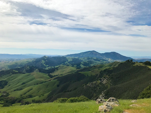
L-R Oyster Point, Mount Diablo

ON PEAK NAMES
Bob Walker Ridge: Named for nature photographer, environmental activist, San Francisco Sierra Club president, and one of the founders of Sierra Club's Gay and Lesbian Activities Section (GLS), the first such group. Bob's photography brought much attention to the Morgan Territory and East Bay Hills area, and his activism ensured that they would be preserved as parkland. Of all the hills and mountains in California named after dead white guys, I find this to be one of the most unobjectionable!
Marsh Benchmark: If if didn't have the USGS benchmark on top, what would this place be called? Just Marsh? Marsh Mountain? Why does "benchmark" become part of the name, when it has a benchmark on it?

FURTHER READING
•Bay Area Hiker: The usual good descriptions and big photographs
•The Outbound: This describes a similar loop to what I did
•Redwood Hikes: Big photos and hiking recommendations
•Bob Burd: Bob pays a visit to Marsh Benchmark on the way to Oyster Point

map 1

Friday, April 24, 2020

Radio Tower Hill

DATE: Friday, April 24, 2020
DISTANCE: 15.32km / 9.52 miles
ELEVATION GAIN: 426m / 1400 ft.
TIME: 4 hours
SIBLEY VOLCANIC REGIONAL PRESERVE
ALAMEDA COUNTY, CA
CONTRA COSTA COUNTY, CA
SOUNDTRACK:
Black Sabbath: Am I Going Insane


PEAKS
“Grizz-Line Hill” 458m / 1504 ft.
“Radio Tower Hill” 457m / 1500 ft.


PHOTO ALBUM
MAP


I was up in the Montclair District of Oakland this Friday morning to have some body work done on my van (it got a kiss from a telephone pole). When I dropped it off, the guy said it would take about three hours, so I decided to go for a hike, of course. It seemed like the perfect time to check out a few more obscure features in the Oakland hills that I had not been to before, or not in a long time. I started out with getting some snacks, and most importantly, water (it seemed like it was going to be a a warm one), from the 7-11. Then I hoofed it up Thornhill Avenue, which began gently, then grew increasingly steep as I approached the top of the ridge. I enjoyed the shade of the abundant landscaping, and the meticulous angles of the midcentury architecture. It wasn’t a bad walk at all, even though there was no sidewalk, the cars were few and not passing too close. 

Thornhill to Sobrante Road, to Thorndale Drive, to Elverton Drive and finally, as the landscaping and houses began to thin out, I reached Skyline Boulevard. From Skyline, I scurried up a casual trail on the embankment on the side of the road, which brought me to my first destination, Peak 1504’, which I will heretofore call “Grizz-Line Hill,” because it is sandwiched between Grizzly Peak Boulevard and Skyline Boulevard. There is a possibility that I may have been here in the past, but it was long before I kept track so meticulously of my comings and goings. There were fine, open views to the west, of San Francisco and the Golden Gate, and east to Gudde Ridge running through Sibley. “Grizz-Line Hill” would be a fine place to spend some hours, enjoying the view, reading a book, drinking a beer… there’s even a bench placed there which would abet such activities.

West from "Grizz-Line Hill."

I descended another use trail, on the north side of the hill, to get down to Grizzly Peak Boulevard (which will from now on be referred to as GPB), and walked west, and then north-west, along it. My next destination would be the summit colloquially known as “Radio Tower Hill,” which I had certainly not been to before. GPB, in this section, was blessed with an unofficial sidewalk in the grassy area off to the side, so I had some protection from the traffic as a traipsed along. The mouth of the Caldecott Tunnel spilled out to the west, below, and precarious hillside homes lined the sides of the road. At one point, I came across a massive herd of goats “clearing the weeds” (They were mostly just sitting there! Busted! Get to work!) from a vacant piece of land. I knew that goats were employed for this purpose, but I always imagined a team of three or four goats, diligently scouring the property, not forty goats, mostly just lying around, chomping the occasional weed when they felt like it. Perhaps I caught them on their coffee break. 

At a bend in GPB, there is a distinctive outcropping of sedimentary rock, and this was my signal to leave the road and take a use trail up to “Radio Tower Hill.” It was a few minutes up through grass and wildflowers, and then, there I was, at the KPFA transmitter tower, which is a landmark that should be known to anyone who has driven east through the Caldecott Tunnel and looked up. “Radio Tower Hill” indeed! I couldn’t argue. From the top, I had a good look at Barberry Peak, another obscure East Bay hill which I intended to visit soon. Now that I was secure knowing there were no guards on this “private property,” I took the obvious driveway back down to GPB. To continue my journey now, I needed to get back to Skyline Boulevard, which was parallel to GPB, just below, but in order to avoid crawling through people’s backyards, as well as steep hillsides and brush, I backtracked all the way to “Grizz-Line.” It was a nice day out, and I wasn’t in a hurry, so I took my time. 

Rock ourcropping on GPB just below Radio Tower

Back down on Skyline, which also has a pretty good sidewalk/trail along it, I hiked west until I hit Broadway Terrace, went downhill just a wee bit, then went over the guardrail and down a use trail on the grassy hillside. The last piece in the puzzle of my loop, I intended to follow the big power lines down to the bottom of the ridge. It turned out that there was a clear path all the way. The use trail led down until I got to a big water tank on my left. There, it met up with s PGE& access road. There were some workers around there doing some tree maintenance, but if I was trespassing, they didn’t care. At some point I came to a gate in this road, which would have blocked cars, but was easily walked around by a pedestrian. I continued to follow the service road. The PG&E property is kind of a no man’s land in the Oakland Hills, no houses or structures beneath the power lines, no trees either. No inhabitants, but also not a park. Private property, but obviously, regularly trespassed upon by walkers. 

Before too long, I came to another gate, this one wide open. They’re obviously not trying too hard to keep people out of here. The PG&E road came to an end again, or turned off to the south, and I continued on my planned trajectory, following a use trail that led downhill, across a grassy hillside, still beneath the power lines. On this hillside, I found an abandoned, destroyed couch. In the middle of nowhere, and I wondered who put it there, and why? It wasn’t a dumping ground, there was no other trash. Perhaps someone's onetime hangout spot, but a hell of a long way to carry a couch. I was now reaching the bottom of the hill, approaching the terminus of the power lines at the sub-station by Lake Temescal, and it was time to get out of powerline land. There was an access gate to the south, which I went around, and I was on Pali Court, back in the suburban neighborhood of “Glen Highlands,” just north-west of Montclair. I felt like I had unlocked a key to this previously mysterious section of the East Bay hills. By now, I had gotten the call that my van was done, so I walked back through the quaint, hilly neighborhoods to my starting point.

How did THIS get up here?

ON PEAK NAMES
“Grizz-Line Hill”: As far as I know, this bump doesn’t have a name, which is surprising, (to me anyway, I’m always surprised at how many peaks don’t have names) because it’s got a nice bit of prominence and a killer view. “Grizz-Line” is a portmanteau I created of Grizzly Peak Boulevard and Skyline Boulevard, and it is technically within Sibley Regional Park.  If anyone knows a better name for it, please tell me!
“Radio Tower Hill”: I’ve read about it being called this, maybe only on Oakland Geology (see below) so I’m just gonna stick with it for now.

FURTHER READING
•Oakland Geology: A little blurb about “Radio Tower Hill” 


Monday, April 20, 2020

China Wall

DATE: Monday, April 20, 2020
DISTANCE: 28.92km / 17.97 miles
ELEVATION GAIN: 1,045m / 3430 ft.
TIME TAKEN: 7:52

HOWE HOMESTEAD PARK
SHELL RIDGE OPEN SPACE
DIABLO FOOTHILLS REGIONAL PARK
CASTLE ROCK RECREATIONAL AREA
MOUNT DIABLO STATE PARK
CONTRA COSTA COUNTY, CA

SOUNDTRACK: Ramones: Chinese Rock

SUMMITS:
•Quarry Hill: 152m / 500'
•Fossil Hill: 128m / 420’
•Shell Ridge: 270m / 885’
•“Stonegate Hill” 238m+ / 780’+
•China Wall High Point 325m / 1066’

PHOTO ALBUM
MAP

"THE SEVEN GATES OF DIABLO" #4


4:20. The high holiday of the stoner realm. I, as usual, would not smoke any pot this day. Oh, to be contrarian. I guess I felt kind of bad for all those poor stoners who would have to smoke all alone today, quarantined, instead of in a merry circle, together outdoors in the park, like they usually do. My only contribution to the cannabis culture continuum was to accidentally walk up a hill that was 420 feet above sea level. I didn't accidentally walk up it, but is was accidentally 420 feet.

I began my rambling journey, which would cover almost eighteen miles and eight hours, shortly after 7AM. I had just hit the Danville Smart & Final, and had the back of the van loaded with toilet paper, paper towels and a giant jar of pickles, which in Coronavirus times, felt like winning the  lottery. Pandemic capitalism produces some strange winners, doesn’t it? Oh, to spend my meager cash, whenever I want, on whatever I want, and call it FREEDOM! 

Howe Homestead Park
As I set out on the trail, I actually wasn’t feeling that great, (little sleep, slight hangover) as I had gotten quite drunk “with” my girlfriend on FaceTime last night. I groggily set out from the parking lot of Howe Homestead Park in Walnut Creek, the westernmost extremity of the the blob of conjoined parkland that stretches east, seventeen miles to Mount Diablo, Morgan Territory and eventually Round Valley. If they could somehow connect this superpark to Black Diamond Mines Regional Presrve, through additional property acquisition, it would really be something! Bigger than some European countries! I’d had my eyes on Howe Homestead Park for awhile already, as a potential starting point for a carless hike. It is merely a 1.5 mile walk or bike from Walnut Creek BART station, and then you’re at the doorstep of a whole world of regional parks and preserves. BART was not on the table during this time, but luckily, I have a vehicle, and Howe Homestead has a free parking lot, open from sunrise to sunset every day. 

Looking down from Summit Ridge

Anyway, I was off, into the first of five different park jurisdictions I would pass through that day. I intended to explore the area, which I'd never visited before, and go up some of the various hills and rock features, and ultimately make it out to Castle Rock, a massive and mysterious protrusion at the western edge of Mount Diablo State Park. The Kovar Trail led up and out of what looked like a community garden, up into the oak studded grassy hills that would define the landscape for most of the day's rambling. It was cloudy and cool, perfect hiking weather, and it wasn't much climbing before I could see out above the suburban homes for views of Shell Ridge and Mount Diablo.  

Shell Ridge high point (center right)
The first elevation destination was Fossil Hill, which doesn't really have a trail up to it, but still an easy walkup. Crowned with small rock outcroppings and some bushes, it provided a vantage point of the immediate area, mostly other low hills. Back down into the valley, there were lots of flowers out, especially these yellow ones. Luckily I'm not allergic to them, because they're everywhere! I followed the Indian Creek Trail through most of the long valley between Shell Ridge and Joaquin Ridge, and it's a nice backstreet alternative to the Briones-Diablo Regional Trail, which is like the hiking freeway through the region. I moved east and then north to check out a feature called Haystack Hill, but the perimeter of it was surrounded by an "electric" fence! It didn't look electrified at all, it looked like it was made out of string. I grew up in the country, and I know what electric fences look like! But maybe they've found a way to make them out of string now. I didn't try my luck invading the boundary of Haystack Hill, and immediately progressed south to the Ridge Top Trail, and took it up to the high point of Shell Ridge, the dominant feature of that area. The summit was mostly grassy, and slightly rocky, with an empty Gatorade bottle thrown in for good measure. The high point of Shell Ridge is at the southeast end of it. The entire Ridgeline can be traversed via the Ridge Top Trail, I should do that sometime.

China Wall formation
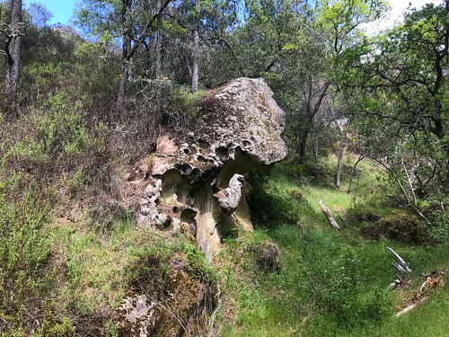
I veered south from that point, through an area of stagnant cattle ponds, and walked around a lightly forested protrusion called Old Man's Hill. I didn't see anything close to a trail going up it on from any side, and in my tired, hungover, paranoid state at the time, I thought the tall grass would be full of ticks, so I didn't go up. But while in the area, I saw a really cool looking pointy hill, which turned out to be accessible from the Stonegate Trail. For the purposes of my writing, I shall call it "Stonegate Hill."  (Or "Stoned-Gate", for 4:20?) At the top of this pointy hill, I took my first snack and water break of the day, and diligently checked my socks and lower legs for vampire spiders. From here, I continued southeast, through more open oak meadows, through Castle Rock Regional Recreation Area (which Castle Rock is not even in) to the border of Mount Diablo State Park. At the fence here, I took a hard right and went up along it to the high point of the China Wall area. On the way up, I passed by some fascinating geological features, and a herd of cows that ran away when I got close (Don't worry cows! I don't like beef!) The hilltop was nice, and it turned out to be my major summit achievement of the day, but the real feature of China Wall, from which it gets it name, is just to the east, where a spine of bizarre rock formations undulates linearly up and down the hillsides and through the valley.

Rock formations along Sunset Trail

Over the wall, my journey now took me on an inefficient S-curve, from Briones-Diablo Road, to the Little Yosemite Trail. One last nasty aside here, this Little Yosemite is the second place in the Bay Area that I've been to that looks NOTHING like Yosemite. Not even a little. So maybe be a bit more careful before you throw that name around? Lil' Yos' took me to Stage Road and a picnic area, where I turned east, along the healthy flowing, and lushly vegetated Pine Creek. An uphill move on the Sunset Trail led up a steep gulch, past some torturous rock formations, signs of things to come at Castle Rock! Excitement was building. But when I topped out at Falcon Road, I was smacked in the face with a sign saying that Castle Rock is closed from February through July each year for the Peregrine Falcon nesting sites! Strangely  enough, this was not the first time I had been denied access to a place called Castle Rock due to Peregrine Falcon nesting! So what we learned today is that Peregrine Falcons LOVE castle rocks.

With no reasonable way to proceed, unable to form a loop through Castle Rock as I intended, I was forced to retrace my steps back down the Sunset Trail to Stage Road, where I had a sad snack lunch in the picnic area. I saw that I had approached Castle Rock in the EXACTLY WRONG way so as to miss ALL the signs saying it was closed.  At this point, I had already walked thirteen miles from the van, and was hoping I could take a more direct way back! Boosted by a caffeine and sugar laden tea drink, I then hightailed up the Buckeye Ravine Trail, stopping only for a glance back at my failed objective, the majestic Castle Rock formation. After this, I mostly stuck to the Briones-Diablo Freeway, which got me back to the van in just under five miles, much more direct than the circuitous ramblings of the morning. I didn't make it to my main objective for the day, but I saw some other cool stuff, and explored a vast swath of territory I'd never seen before. Not making it to Castle Rock just gives me a reason to return, and it's great to have a reason to come back here.

ON PEAK NAMES
"Stonegate Hill" I picked this nickname for it because it doesn't have a name on the map, and it's by the Stonegate Trail. To me, it's a hill worthy of a name
China Wall Is this racist by today's standards? Is China Hill cancelled?

FURTHER READING
•East Bay Trails: Information, photos and video of Shell Ridge
•SF Gate: Shell Ridge
•BA Hiker: China Wall and Diablo Foothills Regional Park
•East Bay Hill People: China Wall