|
| Grizzly Peak from Vollmer Peak |
DATE: Thursday, June 6, 2019
DISTANCE: 8.5 miles (?)
ELEVATION GAIN: (?)
TIME TAKEN: 4 hours
TILDEN PARK
CLAREMONT CANYON RPD
PHOTO GALLEY
SUMMITS
GRIZZLY PEAK: 1758 ft.
CHAPARRAL PEAK: 1770 ft.
VOLLMER PEAK: 1905 ft.

One major component of my Bay Area
"Carless" hikes concept, still in development, is to be the
Bear Transit Hill Line, a bus that travels from Downtown Berkeley BART, up through the campus, to it's highest stop, the Space Sciences Lab, which is close to Grizzly Peak Boulevard and the crest of the Berkeley hills. Be forewarned, it costs one dollar for non students / non faculty, it doesn't take Clipper cards, and it only originates/terminates at the BART station on the first (7:35AM) and last two (6:40PM and 7:30PM) trips of the day. All other circuits during the day originate and terminate at Evans Hall on the UC Berkeley campus, which is not a far walk from the BART station. REMEMBER! It costs one dollar in CASH to ride the bus, and that's a one way ticket. Bring two dollars in cash with you if you want to ride the shuttle back down.
 |
| Hill Line map. Click to enlarge. |
Anyway, if you have no car, you can take BART from anywhere in the system to Downtown Berkeley, and for $1, get a ride to the top of the Berkeley Hills ridgeline, where you have access to over 150 miles of trails through Tilden Park, Wildcat Canyon, and if you keep going, Sibley, Redwood Regional, and beyond. Right now, the Berkeley stop of this bus is on the South side of Addison Street between Shattuck and Oxford, but I think it's going to move back to Shattuck when the construction is complete. So it was here on a Thursday morning at 7:35 AM that I boarded the Bear Transit Hill Line bus, diligently plunging into my research for the carless hikes program. The other goal of the day was to summit some of the most significant elevations in the East Bay hills, some for the first time. Sadly, I have been bitten by the "peak bagging" (a term I hate, sounds a bit too much like tea bagging...) bug, so I can add that to my list of time consuming and pointless hobbies. Peak bagging, or summiting, as I shall call it from now on, makes a natural fit in my life, considering my strong interests in hiking, collecting, AND lists! I have no idea why I didn't become obsessed with it much earlier in life.
 |
| Hill Line schedule. Click to enlarge. |
I almost immediately made a stupid mistake (a theme which will be repeated often in Constant Ascension) by bringing only one dollar in cash with me, for the ride up, not thinking about how I was going to get down. You'll see how this affected my trip later! The lightly used bus travels up through the educated environs of UC Berkeley, and past various other attractions. Using this bus to get to the Botanical Garden would be another fun excursion! I eavesdropped on the scientists riding the bus as they spoke in hushed tones about the universe. In about 15 minutes, I got to the terminal bus stop, which is in the parking lot if the Space Sciences Laboratory. I leapt out and hit the trail immediately, with the enthusiasm of an early riser excited for hours of hiking to come. Northeast, past the building I went over a small berm to Grizzly Peak Boulevard (which will from now on be called GPB), where a use trail leads along the road to the intersection with Golf Course Drive. Turn right, and there is the trailhead of Grizzly Peak Trail. I was off into the woods.
 |
| Grizzly Peak Trail |
This trail mostly hugs the ridge line just below the boulevard, and I headed Southeast. Dense
trees and
plants, charming views of the surrounding hills and ridges to
North and
East.
Mount Saint Helena visible to the North. The trail winds it's way around the North side of it's same named peak, and this landscape was all familiar to me, as I had been on the trails of Tilden Park before, in my many years living in Oakland, but until recently, never paid much attention to where I was going, how many miles I was walking, or what geographical features I was looking at or standing on. Soon, I was standing on Grizzly Peak, for probably the first time. Though the major road of the area is named after it, and it has somewhat iconic status in Berkeley culture, it was honestly pretty difficult to tell what Grizzly Peak actually was all for these years. It's just another eucalyptus encrusted, radio tower crowned, high point on the ridge that is apparently called Frowning Ridge. But today I made a point to get to the top and check it out.
A short, beer can littered trail goes up from the road, and soon your are at the summit! As you can see from the photo, the peak is private property, managed by a telecommunications concern. Luckily for me, some intrepid soul in the past has already cut a hole in the fence, and I was able to slip right inside past the chain link and razor wire, and get
as close as possible to the true summit of Grizzly Peak (1758 ft.).
Mount Tamalpais was eminently visible to the West.
 |
| The beautiful summit of Grizzly Peak |
Back down, a mad dash across GPB, to one of the finest vista points along the road, a much better view than on the peak it's self. A popular car turnout, no doubt, for teenagers and young adults alike to park, drink, do drugs and make out, with a fine view of The Bay spreading out below. And I do not absolve myself of any of those transgressions! A short walk along the pedestrian hostility of the road got me to the fire trail that leads to Chaparral Peak. I had most certainly been to Chaparral Peak (1770 ft.) before in my walks, but was barely even able to recognize it as a mountain, much less the highest point in the city of Oakland! When you're there, it pretty much looks like a
meadow with some scrub trees in it, but now that I know what it is, I have a new appreciation. It is at this point that views open up to
Mount Diablo in the East. Now, I must take a moment to give some credit to
this post on
Oakland Geology website, for actually inspiring today's hike! Check it out.
Without much to do on Chaparral, except eat my only cliff bar, I quickly moved on to my next goal, an apparently unnamed mound that looms over GPB to the South. I had noticed this prominence many times before, as there is a cool view of it from GPB as you drive South. In the ignorance and confusion of my past, I had though that maybe THIS was Grizzly Peak, but now I know better. Crossed GPB again, and got to the place where the De La Veaga trail, The Skyline trail and the trail down to Cal Shakes meet the road. This area is labeled "Scotts Peak Trailhead" on Google Maps, but I can't figure out which one is Scotts Peak Trail, or what Scotts Peak is! I will update when I figure it out. Also at this intersection is a
short paved road that leads to the top of the mound which I will call "Frequency Peak," due it's radio antennae.
 |
| "Frequency Peak" |
It's basically just another high point on the ridge, occupied by private telecommunications gear, and fenced off. I estimate it to be close to 1700 feet. I circled the perimeter of the fence, to see if there was a way in (there wasn't) but I saw that someone had got inside at some point to do some
painting. Off the Northeast side was another unobstructed view of
Diablo, and some large
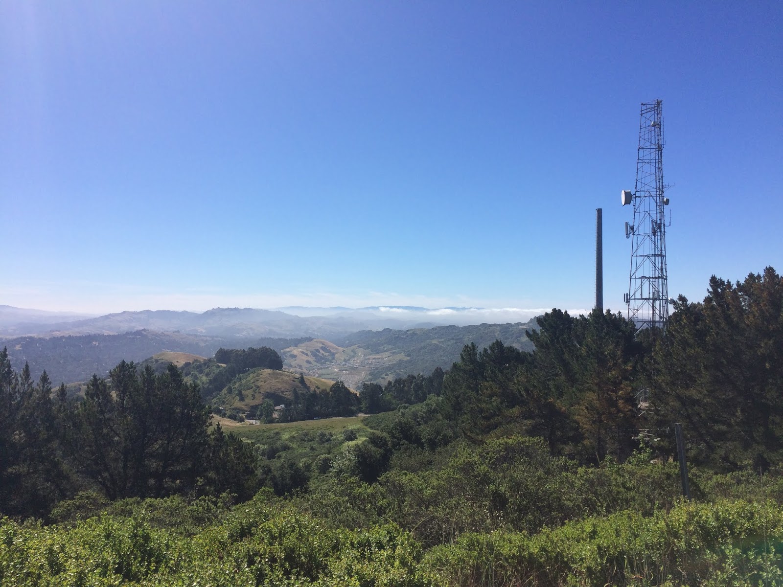
animals that I could not identify. To get to my next goal, I took my life in my hands, and walked back North on shoulderless GPB towards Tilden. I realize now that I could could have simply taken the Bay Area Ridge Trail, which parallels it, and avoided the speeding vehicles attempting to snatch my life. Back into Tilden at the Seaview Trail, past the steam trains up towards Vollmer Peak. There was a team of geriatrics with their trekking poles preparing for an expedition when I passed through. I circled around the East side of Vollmer Peak on the Seaview trail, which I find to be a curious name, because the only part of the actual SEA you would ever be able to view from it would be the small gap through the Golden Gate. Hit Vollmer Peak Road, an easy paved grade that makes the summit in minutes. Vollmer, another hill that has been flattened on top and graced with the presence of telecommunications towers. This one however has the distinction of being the highest point in the East Bay Hills (1905 ft.). This was the only summit of the day where I wasn't alone, I shared it with a few casual hikers and dog walkers. I had a view back to my previous ascent,
Grizzly Peak, West to
foggy San Francisco and the
Golden Gate, and Southeast to
Las Trampas ridge.
 |
| Looking towards Las Trampas from Vollmer Peak |
Back down on Vollmer Peak Road, to Vollmer Peak Trail, which zig zags down the West side of the hill, back into Tilden Park, and around the back side of the park's fire station and corporation yard, where I heard the firefighters doing some kind of military bootcamp style call and response chant. Serene Tilden with it's picnic areas beckoned, and I took a whimsical detour through what might be an upper section of
Wildcat Creek. Popping out on Gillespie Trail, wondering why I chose to walk through a poison oak infested gulch wearing shorts. Out of the park and another crossing of GPB, up over the fire road, and into an area I've been to many times before, which I call Woodchip Meadow (you will know what I'm talking about if you've ever been there). Up to a lovely spot I know well, a prominent and oft visited location which I will call
"Chill Hill" until I can figure out if it has a real name. It is serene hilltop with with a circle of trees, about 1,700 feet. It is one of the nicest places in the East Bay Hills as far as I'm concerned.
 |
| "Chill Hill" |
The reason I came back this way was with the intention of descending back into civilization down the Skyline Ridge trail, because I had forgotten to bring an extra dollar to pay for the Hill Line Bus to get back to Berkeley, I had no idea if they would let me slide, or if there was an ATM at the Space Sciences Lab, or a cafeteria or anything to break a $20 dollar bill. And I didn't want to walk all the way back there to find out. So I started walking down the ridge, which is a trail I've done many times before, and then curiosity got the best of me, and I decided to turn off on Telegraph Canyon, a trail I had never done. I had always wanted to check it out, because there's out turnout for it I'd seen from Claremont Avenue, and I can't get enough of tree filled canyons! If I had known what was in store, I would have saved this excursion for a different time.
Telegraph Canyon is a very nice descent through the trees to Claremont Avenue, but that's where the enjoyment ends. I guess the only point of this trail is to park at the bottom and walk up towards the top, because if you come down, and want to continue going down on foot, like I did (towards Rockridge BART) you're faced with no choice but to walk along the road. Being the stubborn bastard that I am, I chose this option as opposed to retracing my steps and continuing in the trail system. Take it from from me, walking along this part of Claremont FUCKING SUCKS and is extremely dangerous. It was scarier than all the combined loose rock, poison oak, and rattlesnakes I have ever encountered. There is absolutely no sidewalk or path along the road in this area, and cars rush by at ridiculous speeds around blind hairpin turns. I had to frequently crisscross the road to get to the other side that had slightly more shoulder to protect me. Never walk down here if you can possibly avoid it, it was not made for pedestrians. Dealing with this stretch of road came close to ruining my whole day, and what's worse is the thought that I could have taken the easy alternative of beautiful trails leading down the ridge. Lesson learned! Soon enough, the nightmare was over and I got to the sidewalks of the Claremont District. I stopped in Star Market to peruse the vast beer selection, and then ended my journey at Rockridge BART, re-entering the public transit system at the end of this
carless hike.
 |
| Detail of the Tilden Section |
 |
| Map of the complete hike |