Showing posts with label Snow. Show all posts

Sunday, October 10, 2021

Mount Conness

DATE: Sunday, October 10. 2021
DISTANCE: 15.14km / 9.41 miles
ELEVATION GAIN: 948m / 3111'
TIME TAKEN: 9:45
INYO NATIONAL FOREST
HOOVER WILDERNESS
YOSEMITE NATIONAL PARK
MONO COUNTY, CA
TUOLUMNE COUNTY, CA
NORTHERN PAIUTE, WESTERN MONO AND CENTRAL SIERRA MIWOK STOLEN LAND
SOUNDTRACK: Uzala: Ice Castle


SUMMITS:
• Mount Conness: 3837m / 12,590'
• Puppy Dome: 2670m / 8760'

PHOTO ALBUM
MAP


...continued.

Mount Conness is a striking mountain on Yosemite’s eastern border, the highest peak in the Sierra Nevada north of Tioga Pass. Though the mountain has massive cliffs on two sides, there are also class 2 and class 3 options for reaching the top. Conness had been in my crosshairs for some time now, as I quixotically pursued my quest to climb my first 12er only after I had climbed my first 11er, and so on. Conness was to be the first 12er, due to its relatively short approach, not too difficult climb, and epic scenic beauty. Due to my retreat from my intended overnight trip to Black Hawk Mountain and Granite Dome the previous day, it opened the gate for me to do a day hike today, and Mount Conness it was to be.

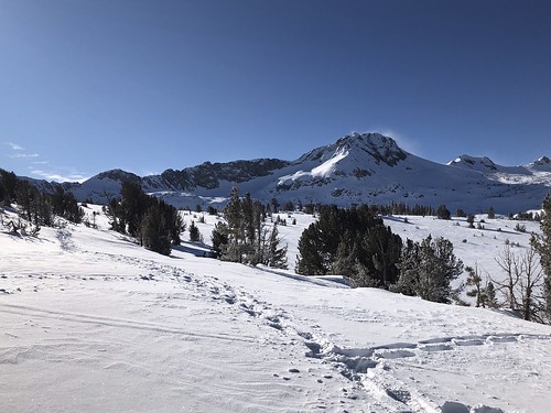
I awoke in my van at the parking lot for the seasonally closed Sawmill Campground, which was to be my trailhead for today's raid on Mount Conness. The peaks of the Conness Crest gleamed in the dawn light, heavenly granite frosted with October snow. It was 8:30AM, and I started off, through the ghostly silent campsites in the snow, there was a decent path to follow at first. It was cold, but Lee Vining Creek was flowing, and I used a casual log bridge to cross it. Just past 9AM, I came up to a curious dilapidated structure that looked like it had been saved from falling over only by the tree next to it. The trail kind of drifted off after this point, and it was cross country through (usually) light and (sometimes) deeper snow. I angled myself uphill to gain elevation to Alpine Lake, per the GPS track I was following, but I didn't angle up fast enough, and I ended up below some big cliffs with impressive boulder rockfall and even some icicles too. Light scrambling now, cross country uphill to Alpine Lake. I was there at 10:30AM. The going past that was slow. A thin covering of snow on the talus field, so I had to be careful not to step through an invisible hole in the rocks and snap my ankle. It wasn't enough snow to just walk over the top of everything, each step had to be considered.

I blame the elevation, somewhat (Alpine Lake is already over 11,000 feet), but more so my general out of shapeness, and possibly the residual effects of yesterday's illness, for my slow going that day. I was now frequently out of breath, and having dizzy spells. So, it took me like, two hours to make it from Alpine Lake, up the east ridge of Conness, and over the lip of the plateau. The snowy rocks added to my difficulty, because I had to find a route up, clearing snow, route finding, climbing, etc. so it was after 1pm, I finally got on the plateau and had some easy going, walking across the comparatively flat expanse in mostly shallow snow. Straight shot to the summit column now, it was right in front of me, like a twisted granite barrel, over 12,500' in elevation. It had been 1300' of elevation gain from Alpine Lake to the summit plateau, BTW. In merely 15 minutes, I had walked across the plateau, to Conness' shoulder, where there was some kind of stone monument / structure, or possibly the remains of a bench?

Now connecting onto the S-curve "staircase in the sky"  southeast approach to the Conness summit, I was privy to dizzying views of the big wall cliffs on the SW and north sides of the mountain, they fell away to either side of the narrow ridge I was upon. I'm sure the "staricase" is a class 2 walkup in normal weather, with maybe some low class 3, but covered in snow, the steps weren't obvious, and I had to pick my way slowly and carefully up, due to the exposure on both sides. I must have taken a long break somewhere in there, don't recall exactly, because I did not reach the summit until 2:30PM. Baby's first 12er! I savored the views all around, I was higher than anything else close by, dilligently dug the summit register ammo box out of the snow and signed it. I wasn't gonna let this one go.

I came down the staircase, just as I had come up, following my footprints in search of solid rock. I followed close to my same route getting down the east ridge, not that it mattered, one path was as good as another, as long as I avoided cliffs. I did not descend elegantly or efficiently, it was a combo of kicking steps, nasty postholing, sliding on my ass, and scrambling down the rocks that were exposed. I changed course when I saw another human being down there, so I decided to say "hullo." It was a man with a dog that would not stop barking at me. I guess the guy was heading up Conness, also, but on a pretty late schedule, seemed like he would be returning in the dark. He said something about drinking a lot of tequila last night in Sonora, and that the dog didn't like my orange hat. So I bid him "bon chance," and continued down, sticking higher (farther north) on the ridgeline than on the ascent, and ultimately meeting my old path down at Alpine Lake.

I don't know what took me so long to get back, analyzing the timeline of my photographs now, months later, it doesn't make sense. I guess I was pretty beat from my useless 17 miles hike the day before, and now my climb of Conness in the snow. Maybe I'm too hard on myself. Back to the van. Down to Tuolumne Meadows to see if anything was still open (fuck no). I decided to climb up Puppy Dome in the twilight for an easy bonus peak. Then, parked by the shores of inky black Tenaya Lake, I cooked myself an excellent dinner of ramen, salami and cheese sandwiches, and dark chocolate for desert. Then I went to sleep at a reasonable hour in the van, parked in a dark trailhead parking lot on Tioga Road.

To be continued...

FURTHER READING
• Mount Conness on SUMMITPOST and PEAKBAGGER
• Puppy Dome on SUMMITPOST and PEAKBAGGER
• Iron Hiker also does the east side approach


Friday, December 27, 2019

Round Top (10,381)

DATE: Friday, December 27, 2019
DISTANCE: 7.36 miles
ELEVATION GAIN: 2074 ft.
TIME TAKEN: 6:12
SUMMIT: 10,381 ft. SPS OGUL
MOKELUMNE WILDERNESS

ALPINE COUNTY, CA


PHOTO ALBUM HERE
Round Top: December 27, 2019


Round Top. This is a mountain that I go way back with. The first Sierra Peak I ever climbed, my first time over 10,000 feet, my first "real" mountain, with exposure, scrambling and a rocky crown. But I realized not too long ago, during this personal surgence in "summit oriented hiking," that I had never made it to the true summit. Two or three visits had been made during childhood, coming up Highway 88 out of Jackson for Sierra Nevada day hike family excursions. It didn't cross my mind until recently whether or not I had made it to the "actual" top or not, but a conversation with my father confirmed that we had never crossed the gap between the false (western) summit and the true eastern crag. I know I would have returned to Roundtop sooner or later, for nostalgia purposes, but the quest to reach the "top" of Round Top added fuel to the fire and some sense of urgency.

Looking east at the summit
Round Top. It's not really that round, is it? Maybe only in the sense that it's not exceptionally pointy. But it turns out it was probably named for The Battle of Little Roundtop, by confederate sympathizer gold miners in the area, as were nearby Little Roundtop and Jeff Davis Peak. Why confederate sympathizers would want to name a mountain after a battle that the confederacy lost is beyond me, but the south had a lot of other backwards ideas too. Yes, Round Top is only rounded in the vaguest sense, like if you squint your eyes and blur it all together into one shape. But if you open your eyes fully, you will see that the top is quite jagged, four district lobes of varying prominence. Lacerated, crumbling basalt, looking somewhat like one of my poorly maintained toenails (eww!). Turns out at one point there was a different name the mountain, Silver Era Peak, which I find to be much more elegant and distinctive. If the Native American name is not known, let's have Silver Era at least!

Two Sentinels over Kirkwood
Visiting our parents in Jackson, lingering temporarily after the Christmas holidays, my brother Alex and I found ourselves alone at the house, with our parents back to work, and younger brother Axell also back to The Bay. A conversation began something like this:

"Let's go up to the mountains tomorrow!"

"Let's go up to Carson Pass and look at the snow!"

"Let's see if Kirkwood rents snow shoes!"

"Maybe we can hike out in it a little bit!"

Friday morning, we were up pretty early, stopping only for snacks and then continuing rapidly uphill towards our destination. I hadn't been up Highway 88 past Pine Grove in years. In general it looked the same, but small things were different. Too many things to remember accurately, or categorize. Soon enough, the snow took hold, and we were in the alpine wonderland of the Sierra Nevada. Like I said, it had been years. Too many years. Everything looked familiar, having seen it before, but it all looked different too, seeing it with adult eyes, these worn down, jaded eyes. It didn't look any less beautiful. The brutal majesty of Carson Spur, cold, black volcanic rock. Not the welcoming granite of Lake Tahoe or Yosemite. It still felt like the gateway to another world.

First sight
Yes, Kirkwood does rent snowshoes, at their cross country ski shop, and we got some and headed to the Carson Pass Sno-Park, the site of many Sno-Man building activities in our childhood. We strapped on the shoes, neither of us having ever used them before… and off we went. Snow shoes are pretty self explanatory, "just don't try to walk backwards," they said at the shop. Though the amount of snow cover thoroughly suggested WINTER, the sun was out, there sky was crystal clear, and our blood was warmed almost immediately as we stomped the powder on the course of the Pacific Crest Trail, southbound. No specific goal in mind, just an outing in the snow. And it wasn't long before that old buddy, Round Top poked it's head above the trees. While I would have been perfectly content to make the summit of, perhaps, Elephant's Back, (reasonable, yes) Round Top came into focus, and Alex uttered the magic words: "it doesn't really look that far." The unfinished business with Roundtop had been brewing inside him from childhood as well. We were in the same sled, having both been up before, but never to the true summit. As soon as he invoked the spell, there was no turning back. The objective was clear.

The climb begins
There were snow shoe and cross country ski tracks all the way to Winnecmucca Lake, or the place where Winnemucca Lake would have been, had it not been replaced by a crystalline white velvet blanket, and we met one fellow traveller, on his way back from the Roundtop / Sisters saddle. We pressed on. Having no experience with the snow shoes, it didn't seem like the conditions were that great (we were still sinking into the snow fairly deep), and aside from the shoes themselves, we weren't REALLY properly geared up for this expedition, having minimal jackets, and only just raided our parents' coat closet for mittens and hats. Once in the shadow of the mountain, it got cold. And when we gained elevation towards the saddle, the wind picked up, and it got colder, but views were opening up all around of the Sierra landscape. The fine peaks of the Carson Pass area were on display, as well as a plethora of others, in the distance. The route to Round Top was vaguely familiar to us, having been here before, but it seemed almost another life ago. And we'd never been here in the snow, of course.  Reaching the saddle on the west side of the peak, we were back in the sun, and feeling enthusiastic about making the summit. The snow thinned out over the chunky apron of basalt, and we soon jettisoned the snow shoes. Even though Mount Lassen in July had been quite still rather snow covered, this was my first winter ascent of a big mountain, and my gut was filled with an elixir of excitement, tinged with a droplet of dread.

Almost there
The dread comes when you start climbing the steep parts, when you have volcanic rock that's already unstable, even under the best conditions, then you cover it with snow, so you can't even really see what you're working with as far as footholds and handholds. Getting to the first summit was no big deal, but we were now confronted with the notch between us and the true, higher summit, which we handled by cutting down to the south, around the bottom of it, and slowly making our way up the class three climb to the peak. Alex did a fine job picking the route. We took our time, carefully brushing away snow from the rock to find purchase for our cold stiffened claws. There was no thought of recklessness, as It was an almost 3,000 foot drop to the floor of Summit City Canyon at our backs, a constant reminder of where negligent behavior would send us. The care and persistence we took in making a path to the top paid off, and we were soon enough in a place neither of us had been before, the true summit of Round Top.

In the shadow
Having over 2500 feet of prominence, Round Top affords a 360 degree view of the entire area. With a naked eye, we could see past Lake Tahoe to the north, down the Dardanelles in the south, and even Mount Diablo was visible as small gray lump in the west. We didn't bother looking for the summit register in the snow, but spent a few minutes taking pictures in all directions (N-NW-W-SW-S-SE). After this, we had no other objective but to return the snow shoes to Kirkwood by the time they closed at 4PM, and we were gonna be cutting it close. Coming down, it was even colder now in the wind chill and shadow of the mountain, almost brutally so. But we pushed on, not always following our own tracks back, but following somebody's. When we got close to the parking lot, this proved to be a problem, because there were quite a few trails in the snow down there, causing us to follow the wrong ones and fumble around looking for the PCT again. We were rather frosted and fried, back in the pine trees, and everything was starting to look the same. Luckily the shoes were returned just in the nick of time, and we were then free to reflect on the day's accomplishment over heartwarming beverages in the Kirkwood Saloon.

FURTHER READING
•Round Top on Summitpost
•A winter ascent by Bob Burd
•Norcal Hiker 
•Alltrails

Map by National Geographic

Round Top: December 27, 2019


Tuesday, February 5, 2019

Mount Diablo 2019

DATE: Tuesday, February 5, 2019
DISTANCE: 11.9 miles
ELEVATION GAIN: 3500 ft.(+-)
TIME TAKEN: 7 HOURS
MOUNT DIABLO STATE PARK
CONTRA COSTA COUNTY, CA 
SOUNDTRACK: ZZ Top: El Diablo

SUMMITS
MOUNT DIABLO NORTH PEAK: 3849 ft.
BALD KNOB: 2645 ft.
EAGLE PEAK: 2369 ft.
TWIN PEAKS: 1733 ft. 
MITCHELL ROCK:  1080 ft.

MOUNT DIABLO CLIMBED AGAIN 1/1/2020


I hadn't been to the top of Mount Diablo since the 80s, when I was a wee lad, and my parents had driven us to the top. I do not remember this. I take their word for it, and ever since moving to California in 1990, the specter of the shadowy mountain has lurked at the edge of my consciousness, the edge of my imagination. It was visible right out the front door, 70 miles away, from where I grew up in Jackson, CA. The fiery California sun would set the horizon ablaze most evenings, Diablo a silent, waiting tombstone for the Helios grave. When I moved to Oakland in 2000, the El Diably was much closer, but much less visible, barely thought of. Only on stoner trips to the highest ridges, and journeys out of town, past the forbidden zone beyond the Caldecott Tunnel, did it rear it massive head. Centrally prominent in the middle of the East Bay population center, yet mysterious to most. A thieves thicket of winding paths, dead end canyons, dark peaks and tortured rock formations. Why did I wait so long to return to Mount Diablo? Well, why did I wait so long to do A LOT of things? Answer me that. I won't like the answer. A whimsical drinking picnic to Rock City in late 2017 was not even an appetizer, it was a midday snack. But it was sometime in 2018 when I made it my goal to hike every major peak in the Bay Area from base to summit, the hardest way possible. I wanted to FEEL the size of each mountain. And Mount Diablo is one of the major-ist of the major peaks around, so it had to be done.  

Then the right time came. Tuesday, February 5, 2019.  I had the whole day off of work and it was one of those magical rare times when Mount Diablo gets a powdering of snow, so I set out from home as early as I could manage to make my pilgrimage the (temporarily) silver mountain! Popping out of Caldecott Tunnel and pushing East, I could see that the upper slopes of Diablo were graced with snow! But the summit it's self was shrouded in clouds. I hoped they would blow away before I reached the top! But there were many hours for that to happen. Cruised out through the suburban environs of Walnut Creek and up Ygnacio Valley road. Hit a CVS or something for water and snacks. 

With the added enticement of heavenly dandruff upon the shoulders of the giant, I began my journey from the Mitchell Canyon parking lot. To me this seemed like a suitable jumping off point that I could call "the bottom" of the mountain. Wanting to make up for my years overdue absence from the sleeping behemoth in the Bay Area's backyard, I planned an ASS KICKING agenda for the day, one that would take me all the way to the summit, as well as to several sub peaks and minor attractions. The muddy roads and dog walk domain of the lower regions gave way quickly as I hit the Mitchell Rock trail and began climbing. Sweet ascent. It wan't too long before I had sweeping views to the North, of the canyon I had come up out of, and the ziggurat hillside of the nearby quarry. I could now see clearly how much snow had fallen on the upper heights, and it wasn't too long before I came across my first light patch of the white fluffy stuff, so rare to see in the Bay Area! Mitchell rock was an elementary scramble up to a raptor's perch, with a straight shot looking North down the valley. To the south, I caught a view of the various heights that awaited.


The trail continued upward steadily from there, through manzanita and scrub oak. I could imagine how hot and baked this terrain was in the summer, but now it it was mystically frosted with new snow. Views to the North expanded, and I could now see into the Sacramento River Delta. Up, with more brush snowy brush tangles.  The next summit to attain was Eagle Peak. This is one of the many Eagle Peaks in California, but today, THIS ONE was mine, and mine alone. No other humans had been sighted since I left Oak Road. Atop Eagle Peak, there was a crumbling vulcan turret and few other signs of life. Ominous snowy peaks towered around and above me. Dustings of snow and light manzanita were the main landscape. I became temporally lost at the five point intersection at Murchio Gap, and I accidentally walked South on Meridian Ridge Road for awhile, before realizing that "this must be wrong," and going to back to find the Bald Ridge trailhead, which was a little bit obscured at the entrance. And it was a far cry from the muddy jeep of track of Meridian, no doubt. Bald Ridge Trail was, for the most part, a snowy underbrush tunnel, and I stripped down to a t-shirt, in spite of the weather, as I barged ahead through what felt like serious elevation gain. Panting and sweating, I burst from the underbrush at the next junction, Prospector's Gap, a mud puddle crossroad in the pass between the North and South summits of El Diablo.

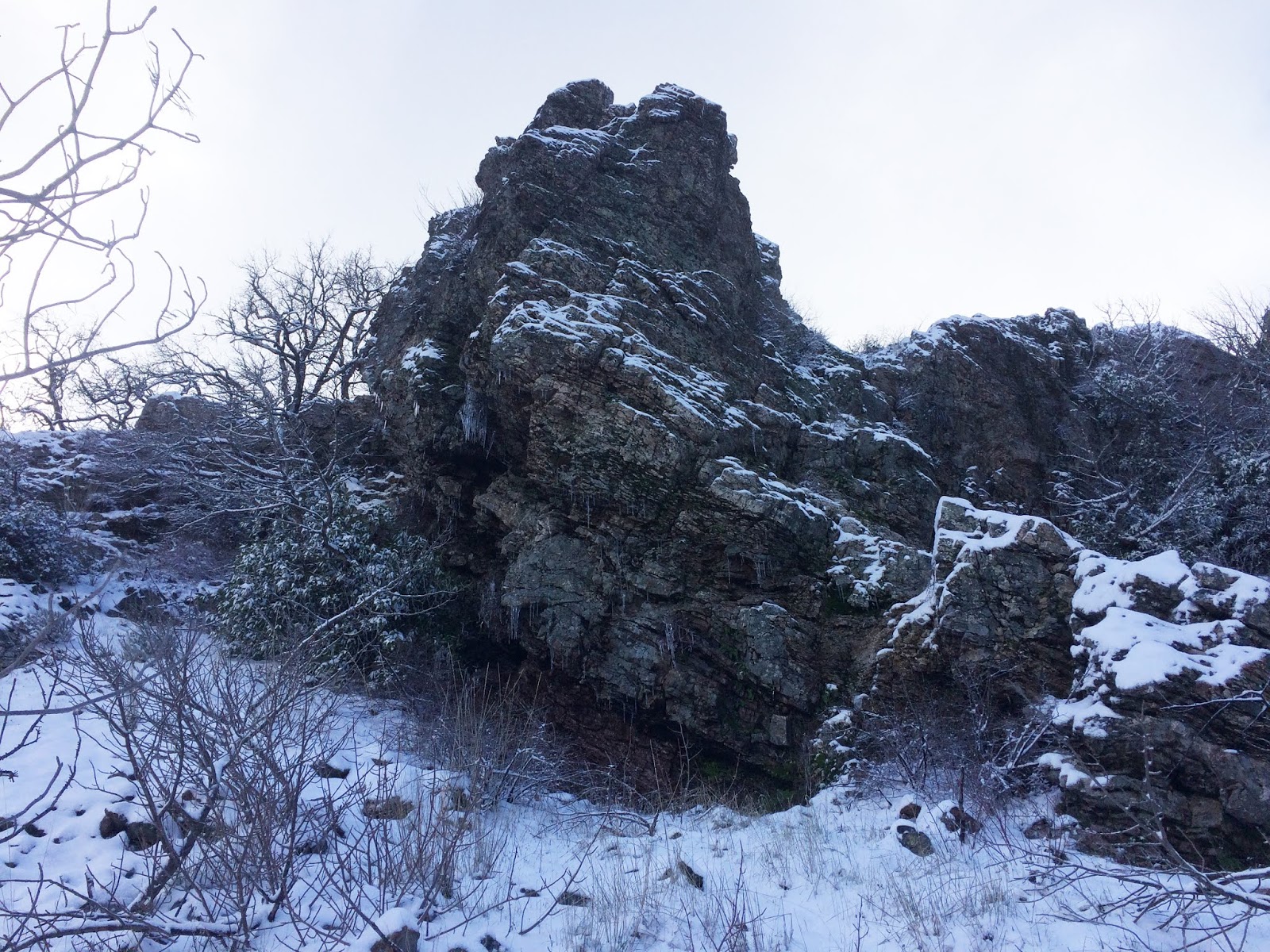
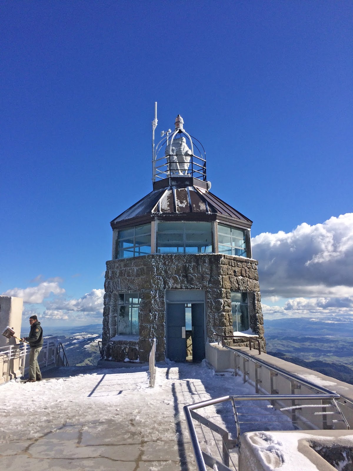
Here, I turned South on the North Peak trail (huh?), which would wind me around to the South (main) peak of Mount Diablo. There was an excellent view of the North Peak, a snowy clattering brook pouring down the hillside, and an ominous dark boulder which had genuine motherfucking ICICLES on it! The thrill of seeing snow and ice in this part of California was almost beyond description. Also, to my bewilderment, I saw some strange tracks in the snow. Mountain Bike! What the fuck. Fucking maniacs. I curved around the bottom of the main summit and got a view to the South, where most of the high points for miles had been crowned with snow, as far as I could see. The main destination was in sight at this point. So, while no humans (besides the phantom mountain biker) had been present on my insane miles of uphill rambling, it was not to last. Finally, I reached the summit area, the civilized part of Mount Diablo, the part that you can drive up to, even with Grandma, and your two year old larvae. I heard the screams of adolescents flinging bits of frozen debris, the stern chiding of their guardians; I had returned to society. Paved roads. Buildings. Up to the watchtower I went. The observation deck. I could now look down upon the North Peak, and out across the Bay Area through the Golden Gate. The view from the top is probably one of the best in California, and I took time to soak it in.  There was a ranger bitterly shoveling snow and de-icing the stairs. Inside the gift shop museum in the basement of the tower was a very fine relief map of the whole area, some exhibits about the old Mountain. It was nice to be indoors and warm, temporarily. I sat and ate a banana and some trail mix. Up on the deck next to the tower, I got out my binoculars and looked around. Ideally, I was hoping to see Jackson Butte in the East, my ancestral (well, since 1990) home, which has such a clear view of Diab. But the Sierras and their subsidiary hench-hills were ensorceled with heavy clouds, no doubt the storm that had marauded the Bay Area last night was now casting literal feet of snow upon the grand Sierras. All was not lost. I COULD clearly see as far North as the Sutter Buttes, and spy upon downtown Sacramento and Stockton with my super goggles. To the South, Mission Peak was easily identified, and Mount Umunhum crowned the Southern horizon. I had finally made my heroic return.

Now for the fun part. I had spent too long at the top. I had chosen a steep and circuitous route to get there. I was tired. As I dragged my ass back down the North Peak trail to Prospector's Gap, I decided to forgo my original master plan of also conquering the North Summit. That would wait for another day. As would the waterfalls. I decided to take the most direct path back to my point of origin. Even without the additional summit second entree, and waterfall side dish, I still had a five and a half mile downhill hike to complete my grand loop dinner, pay for the meal, and hopefully have enough left over for a tip. Stumbling on the steep ramp of Prospector's Gap Road, a fire trail for rugged vehicles. It's hard on the feet walking down a road like that. Middle Trail cut through the bush again to re-emerge at a different part of Meridian Ridge Road, my old nemesis. Nothing but wide and bloody muddy fire roads at this point, I pressed on North through Donner Canyon, the road which mostly parallels a sloshing friendly creek of the same name, and some old time settlement ruins that I didn't have the energy to inspect. Cut West across Murchio Road towards where the van was parked, there's and old water tower out there, and the landscape is back to the rolling, oak studded savanna that probably defines the majority of Northern California. Back in the Mitchell Canyon parking lot, I sighed, scraped some mud from my boots, and fired up the 5.9 litre V8 of my 2000 Dodge Ram Van 3500. It is incredibly wasteful of gas to drive this beast solo out to trail heads. It's meant for hauling the entire band and gear. Oh well. Back to Oakland. Park the damn thing. BART to San Francisco. Hazzard's Cure practice. Late night super veggie burrito from Taqueria San Jose. Just remember: you don't have tot eat the whole thing… burritos are easy to save half for later… you don't have to eat the whole thing… burritos are…


CLICK "READ MORE" TO SEE ADDITIONAL PHOTOGRAPHY