Saturday, April 24, 2021
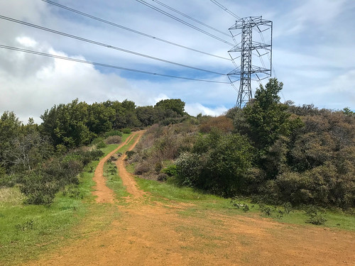
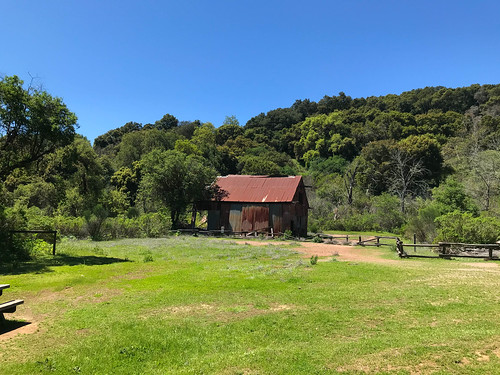
Bald Peaks (Calero)
DISTANCE: 22.74km / 14.13 miles
ELEVATION GAIN: 840m / 2757'
TIME TAKEN: 4:57
CALERO COUNTY PARK
SANTA CLARA COUNTY, CA
STOLEN TAMIEN, AMAH MUTSUN, OHLONE, MUWEKMA AND AWASWAS LAND
SOUNDTRACK: Deafest: Bald Hill
SUMMITS:
• Bald Peak: 560m / 1838'
• Bald Peak Middle Summit: 494m / 1621'
• Bald Peak East Summit: 467m / 1531'
• Fern Peak: 521m / 1710'
PHOTO ALBUM
MAP
Friday, March 12, 2021
Loma Prieta
DISTANCE: 24.94km / 15.5 miles
ELEVATION GAIN: 1,299m / 4262'
TIME TAKEN: 5:54
UVAS CANYON COUNTY PARK
SANTA CLARA COUNTY, CA
STOLEN TAMIEN, AMAH MUTSUN, OHLONE, MUWEKMA AND AWASWAS LAND
SOUNDTRACK: Possessor: Dark Mountain
SUMMITS:
• Loma Prieta: 1154m / 3786'
• Nibbs Knobb: 821m / 2694'
PHOTO ALBUM
MAP
Full hike report coming soon!
Thursday, March 11, 2021
Castle Rock State Park
DISTANCE: 11.57km / 7.19 mile
ELEVATION GAIN: 507m / 1662'
TIME TAKEN: 4:01
CASTLE ROCK STATE PARK
SANBORN COUNTY PARK
SANTA CRUZ COUNTY, CA
SANTA CLARA COUNTY, CA
STOLEN TAMIEN, RAMAYTUSH, OHLONE AND MUWEKMA LAND
SOUNDTRACK: Ancient Gate: Castle Behind Mist
SUMMITS:
• Varian Peak: 873m / 2865'
• Goat Rock: 890m+ / 2920'+
• Castle Rock (Attempt): 980m / 3214'
• Indian Rock (Attempt): 893m / 2931'
PHOTO ALBUM
MAP
FULL HIKE REPORT COMING SOON
Saturday, January 23, 2021
Purisima Creek Redwoods Preserve
DISTANCE: 4.36km / 2.71 miles
ELEVATION GAIN: 266m / 872 ‘
TIME TAKEN: 2 hr
PURISIMA CREEK REDWOODS PRESERVE
SAN MATEO COUNTY CA
SOUNDTRACK: Deep Purple: Maybe I’m A Leo
PHOTO ALBUM
MAP
FULL HIKE DESCRIPTION COMING SOON!
Friday, January 1, 2021
San Vicente Hill
DISTANCE: 11.33km / 7.04 miles
ELEVATION GAIN: 298m / 978’
TIME TAKEN: 3:17
SUMMIT: Peak 1058’ “Calero Point”
CALERO COUNTY PARK
SANTA CLARA COUNTY, CA
SOUNDTRACK: Exhumed: Zip-Loc Body Bag
PHOTO ALBUM
MAP
FULL HIKE DESCRIPTION COMING SOON!
Monday, May 18, 2020
Windy Hill
DISTANCE: 17.28km / 10.74 miles
ELEVATION GAIN: 559m / 1834 ft.
TIME: 4:00
SUMMIT: Windy Hill: 588m / 1930 ft.
WINDY HILL REGIONAL PRESERVE
SAN MATEO COUNTY, CA
SOUNDTRACK: R.I.P.: In The Wind Pt. I
Windy Hill stands out along the ridgeline of the coastal hills of the San Francisco peninsula as one of the few unforested spots. It’s pretty much directly southwest of the Stanford University campus. Easily ascended via Skyline Boulevard (Highway 35), or you can hike up from the bottom via Portola Road in Portola Valley.
It was my turn to visit San Jose (it usually is), so the ball was in Amber’s court to pick out a hiking activity. We had noticed Windy Hill a few weeks earlier, driving past it, so it came to pass that we returned to give it a go. Amber brought her friend Korrine, we parked in the main parking lot, masked up, took some shots of whiskey, and powered up Windy Hill, which lived up to it’s name. The day was cool, especially on the exposed windy hilltop, and the sky was partially filled with billowing clouds. From the top of the hill, there was a panoramic view across the South Bay, and even over to Mount Diablo. With the ladies, i completed the quick loop around Windy Hill, and back to the parking lot. Amber took Korrine home, and left me to my own devices for about three hours.
From the parking lot, I began my next adventure by heading south on the Lost Trail, which went immediately through a gate, and into some rather thick vegetation on both sides of the trail. A sudden contrast to the windswept grasses I’d just left behind. Lost Trail curved along the hillside, roughly parallel to, but out of sight of Highway 35. I was quite impressed by the variety and thickness of plants, and the moss that decorated the trees. A lot of moisture from the Pacific Ocean must pour over the hill in this particular area. There was by now a good view back up at Windy Hill from along the trail, Before too long, I reached the intersection with the Hamm’s Gulch Trail. I regret to inform you there was no Hamm’s Beer available. At this point, the route began winding and switchbacking it’s way downhill, and the trees grew thicker and mossier. Quite spectacular, actually. Into the gulch!
I was mostly in the woods, but there were a few glimpses out, even another sighting of Mount Diablo. At the bottom of the hill, I came to a crossroad, but I remained on Hamm’s Gulch Trail, and soon crossed a shady creek. Reaching now the eastern extremity of my journey, I joined the Meadow Trail and turned north, then east, suddenly the landscape changed again, to rolling oak studded fields. Meadow Trail soon put me onto Spring Ridge Trail, and from there it was gentle but steady uphill on a fire road, back up to the ridge and Windy. I was able to have a look back over at the forested area from whence I had just descended. Spring Ridge Trail mostly keeps to the open, but ducks into the occasional oak grove now and then. Majestic clouds blew in from the coast, trying to penetrate the interior of the land. Before I knew it, I was back up by Windy Hill. I didn’t return to the top, but circled around the west side next to the road. I had overestimated the time it would take me to do the loop hike, the internet had provided inaccurate mileage or something. I still had about an hour until I was due to be picked up, so I started hiking down the Lost Trail again.
This time, I kept going past the Hamm’s Gulch turnoff, and continued through the splendid vegetated forest. I was hoping to find a shortcut to get up to the highway, and make another loop out of that, but I couldn’t, and I had to turn around, going almost all the way back to Hamm’s Trail again, but turning southwest on a fire road that took me up to the highway, but in a very roundabout manner. I walked north along Highway 35, just to see something different, but of course, it sucked. Either having to walk in the tall grass, or right by the side of the road, getting buzzed by Teslas. All of my blundering about in the final hour explains my path, if you are trying to interpret my course on the map. All this fuckery also made me late for my pickup rendezvous time, and I was scolded sternly, being sent to bed without any beer that night.
FURTHER READING
•BA Hiker: Good descriptions and photos
•Alltrails: This is pretty much what I did, except I started at the top
•Long Green Tunnel: Another one from the bottom
Monday, April 27, 2020
Sanborn County Park
DISTANCE: 7.24 km / 4.5 miles
ELEVATION GAIN: 391m / 1,283 ft.
TIME TAKEN: 2:00
SANBORN COUNTY PARK
SANTA CLARA COUNTY, CA
SOUNDTRACK: Wizzerd: Forest
PHOTO ALBUM
MAP
On another one of my visits to San Jose, this was a hike in Sanborn County Park, just outside of Saratoga. Amber and I made a good 4.5 mile loop out of the main parking lot, using mostly the Sanborn Trail and the San Andreas Trail. No summits, no waterfalls, just a nice walk in the woods. This would be a decent one any time, even on a hot day, due to plenty of tree coverage. There were so many fantastic trees, in fact, that I decided to climb one! We had a look at the camp sites, for future reference. At one point we did gain enough elevation to see out across the Santa Clara Valley, through the trees. Two hours round trip, then it was time for dinner and a movie back at the old homestead.

FURTHER READING
•Bay Area Hiker: Large photos and a good description of the park
•AllTrails: Here, someone else did the exact same hike as us
•Outbound Collective
Friday, April 17, 2020
El Sombroso
Distance: 19.5 km / 12.1 miles
Elevation Gain: 843m / 2,766 ft.
Time: 3:47
Summit: El Sombroso 914 m / 2,999 ft.
Sierra Azul Open Space Preserve
Santa Clara County, CA
Soundtrack: T.S.O.L.: Beneath The Shadows
PHOTO ALBUM
MAP


FURTHER READING
•Alltrails: This is same as the hike I did
•Bob Burd: Bob incidentally hits Sombroso on the way to Umunhum
ON PEAK NAMES
El Sombroso: "The Shadowy"
Wednesday, April 15, 2020
Mine Hill
DISTANCE: 8.53km / 5.3 miles
ELEVATION GAIN: 412m / 1,352 ft.
TIME TAKEN: 2:41
SUMMIT: Mine Hill: 527m / 1728'
ALMADEN QUICKSILVER COUNTY PARK
SANTA CLARA COUNTY, CA
SOUNDTRACK: Quicksilver Messenger Service
PHOTO ALBUM
MAP
After over three weeks of socially isolating, me and my girlfriend decided to see each other, neither of us had been sick, and we had barely interacted with any other people, besides our household members. So I went down to San Jose to pay her a visit, and ended up spending three days, during which time I got in three short hikes hikes in the hills of south San Jose. The first, on Wednesday, April 15 began with my first visit to Almaden Quicksilver County Park, which had not been closed by Coronavirus regulations. Amber and I took a walk which carried us through some of the historic mining infrastructure, and up to the high point of the park, the strip mined remains of a feature called Mine Hill. It was 72 degrees, clear and very springlike, with abundant wildflowers.

During the hike, I got to thinking that over the course of it's lifetime, the New Almaden Quicksilver Mine must have been extremely profitable. But because the area was left polluted by mining activities, not much could be done to it in modern times besides turn it into a park. How much more money would the land have been worth had it left to be developed into suburban homes? As part of the new California gold rush: REAL ESTATE? But we were saved from even more stucco McMansions by the mining pollutions from the days of yore, and now have this urban escape to enjoy.
FURTHER READING
•Bob Burd: Bob tackles Mine Hill (and several others)
•BA Hiker: Lots of good information and history on Almaden Quicksilver Park
•Redwood Hikes: Great Photographs and detailed map, as usual


