DATE: Thursday, March 11, 2021
DISTANCE: 11.57km / 7.19 mile
ELEVATION GAIN: 507m / 1662'
TIME TAKEN: 4:01
CASTLE ROCK STATE PARK
SANBORN COUNTY PARK
SANTA CRUZ COUNTY, CA
SANTA CLARA COUNTY, CA
STOLEN TAMIEN, RAMAYTUSH, OHLONE AND MUWEKMA LAND
SOUNDTRACK: Ancient Gate: Castle Behind Mist
SUMMITS:
• Varian Peak: 873m / 2865'
• Goat Rock: 890m+ / 2920'+
• Castle Rock (Attempt): 980m / 3214'
• Indian Rock (Attempt): 893m / 2931'
PHOTO ALBUM
MAP
FULL HIKE REPORT COMING SOON
Showing posts with label Santa Cruz County. Show all posts
Thursday, March 11, 2021
Friday, February 7, 2020
Maple Falls
DATE: Friday, February 7
DISTANCE: 6.5 miles
ELEVATION GAIN: 823 ft.
TIME TAKEN: 3.5 hours
FOREST OF NISENE MARKS
SANTA CRUZ COUNTY, CA
PHOTO ALBUM
MAP
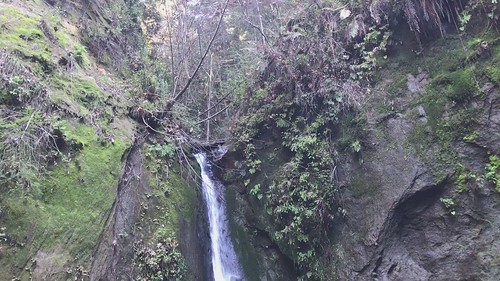
Eventually, we veered right onto the Bridge Creek Trail, the most direct path to Maple Falls. Here the trail follows the creek, and as you go deeper, the canyon narrows, eventually coming to a wild section where you have hop across the water a few times, climb over some logs and rocks, and do some light scrambling to continue. Through all this, it is quiet obvious where the trail is. There is a small appetizer falls on Bridge Creek in this section, as well as another one pouring down the hill from the east side. The scramble continues, and not far from this is the true cascade of Maple Falls, a majestic silver ribbon slicing down the middle of a woodland notch, pouring over a mossy rock headwall, and splashing into a serene shallow pool. At the edge, there was a rocky, small "beach" and some logs upon which we sat and ate some of our takeaway food. To the upper right of the main fall, we observed the mystifying effect of small rivulets pouring down through the moss from above, creating the impression of a sparkling, twinkling, living wall!
DISTANCE: 6.5 miles
ELEVATION GAIN: 823 ft.
TIME TAKEN: 3.5 hours
FOREST OF NISENE MARKS
SANTA CRUZ COUNTY, CA
PHOTO ALBUM
MAP
The Forest Of Nisene Marks is a nearly 10,000 acre state park near Santa Cruz, CA. It's serene redwood canyons belie it's turbulent history: 140 million board feet of redwood trees were removed from the area beginning in 1883, a wholesale massacre that continued until 1924. The present day trees, still impressive, are all second and third growth. The epicenter of the disastrous 1989 Loma Prieta earthquake also sits solidly within the parks boundaries!
Maple Falls is set deep within Forest Of Nisene Marks, where Bridge Creek plunges majestically 40 feet over a rock wall at the end of a lush canyon, far enough out and up a rugged enough trail that a good portion of potential visitors are discouraged!
Killing some time before Deathgrave practice in a San Jose bookstore (okay, not just any bookstore, but the FANTASTIC Recycle Books) I happened upon an exhaustive compendium called California Waterfalls (Ann Marie Brown, Foghorn Outdoors, second edition May 2000) which I bought up right away and began studying. It turned out that Amber and I would both have a free day to hike the next day, so I consulted the book, and chose Maple Falls as the destination. This was skillfully picked so that it could also be done in conjunction with a brunch at one of our favorite restaurants, Gayle's Bakery in Capitola. While at Gayle's, waiting for our number to be called, and perusing the displays of quiche, polenta, and myriad other delights, I ran into my boss from my first job, Melissa, and her husband Tom, from back in Jackson, California, who are friends of my parents and I had not seen in years. It was a really strange coincidence! But I digress.
Maple Falls is set deep within Forest Of Nisene Marks, where Bridge Creek plunges majestically 40 feet over a rock wall at the end of a lush canyon, far enough out and up a rugged enough trail that a good portion of potential visitors are discouraged!
Killing some time before Deathgrave practice in a San Jose bookstore (okay, not just any bookstore, but the FANTASTIC Recycle Books) I happened upon an exhaustive compendium called California Waterfalls (Ann Marie Brown, Foghorn Outdoors, second edition May 2000) which I bought up right away and began studying. It turned out that Amber and I would both have a free day to hike the next day, so I consulted the book, and chose Maple Falls as the destination. This was skillfully picked so that it could also be done in conjunction with a brunch at one of our favorite restaurants, Gayle's Bakery in Capitola. While at Gayle's, waiting for our number to be called, and perusing the displays of quiche, polenta, and myriad other delights, I ran into my boss from my first job, Melissa, and her husband Tom, from back in Jackson, California, who are friends of my parents and I had not seen in years. It was a really strange coincidence! But I digress.
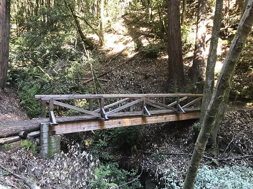
Brunch in Capitola put us near the gate of The Forest of Nisene Marks state park, a threshold neither of us had crossed before. We paid the fee, got the map, and drove up into the lush redwood filled park. The "Winter Gate," which I assumed would be closed, because it's winter, was open, which allowed us to drive an extra mile closer to the trailhead and shorten the trip. There were maybe two or three cars in the parking lot at 11:30am when we embarked from Porter Family Picnic Area. North out of the parking lot, past the gate and down the road, forking left onto Loma Prieta Grade. There were some nice ups and downs, a few footbridges (which I ALWAYS take pictures of), some finely constructed cliffside trail work, and even a brief plank walk, which you don't really see too much of. Here and there were seen the remains of old structures left behind from the logging days, which were slowly returning to the earth.
We remained secluded in the blind canyon for about a half an hour, and began to return the way we came. We had only seen two hikers coming down from the falls on our way up, and ran into four more as we were leaving. They looked like they were about to turn back, so we informed them that they were only at the first (mini) waterfall, and to keep going! I took us on a small detour on the return, a section of Loma Prieta Grade that runs to the west of, but basically parallel to Bridge Creek Trail. Just so we could see something different. It was nice because we got up on the hillside a little bit, out of the dark canyon, and got some sunshine. It was actually SUCH a beautiful day out, for February, that I almost regretted spending it in a shady, dank forest. ALMOST. We did not see another soul on Loma Prieta Grade as we meandered south along the folded, steep earth, and soon reunited with the intersection of Bridge Creek Trail, continuing south, back to the car. It was an excellent dayhike, one of my favorite of the local redwood excursions that I have done so far, owing mainly to the payoff of the elusive Maple Falls!
FURTHER READING
• Open Space Trust: Trail information
• The Outbound: More trail information
• California Waterfalls: Ann Marie Brown: Foghorn Outdoors, May 2000: pp 324-326
FURTHER READING
• Open Space Trust: Trail information
• The Outbound: More trail information
• California Waterfalls: Ann Marie Brown: Foghorn Outdoors, May 2000: pp 324-326
Tuesday, June 4, 2019
Henry Cowell Redwoods
DATE: Tuesday, June 4, 2019
DISTANCE: 3 MILES ?
HENRY COWELL REDWOODS STATE PARK
SANTA CRUZ COUNTY, CA
A quick late morning / early afternoon getaway to the Redwoods. The day was beautiful, and so was my hiking partner, so there were no complaints! This was my third time to Henry Cowell, and each time I go a little deeper. This time, the goal was the Cathedral Redwoods grove, which is a cool spot with some ancient, and gigantic trees, as can be expected. Still, I have only scratched the surface of this large state park, and as of yet I have not even set foot in the Fall Creek Unit, a separate area near to the North. Indeed, I think hiking a ten mile loop in the Fall Creek Unit will be next on the agenda for the inevitable return to Henry Cowell! Hopefully a report on that soon.

DISTANCE: 3 MILES ?
HENRY COWELL REDWOODS STATE PARK
SANTA CRUZ COUNTY, CA
A quick late morning / early afternoon getaway to the Redwoods. The day was beautiful, and so was my hiking partner, so there were no complaints! This was my third time to Henry Cowell, and each time I go a little deeper. This time, the goal was the Cathedral Redwoods grove, which is a cool spot with some ancient, and gigantic trees, as can be expected. Still, I have only scratched the surface of this large state park, and as of yet I have not even set foot in the Fall Creek Unit, a separate area near to the North. Indeed, I think hiking a ten mile loop in the Fall Creek Unit will be next on the agenda for the inevitable return to Henry Cowell! Hopefully a report on that soon.
Monday, April 15, 2019
Sempervirens Falls
DATE: Monday, April 15, 2019
DISTANCE: 6.9km / 4.3 miles
ELEVATION GAIN: 184m / 603 feet
TIME TAKEN: 3 hours
BIG BASIN REDWOODS SP
SANTA CRUZ COUNTY, CA
SOUNDTRACK: Thergothon: Everlasting
Sempervirens is an easy destination hike in Big Basin, too easy for me actually, so we turned it into a larger loop. This was only my second visit to Big Basin, the first one being a rather disorganized, poorly documented late start hike with the Owl brothers.
This hike began at the visitor center, and looped counterclockwise through the park, through the spectacular old growth redwoods of the Sequoia Trail, and on to Sempervirens Falls, which is not the largest waterfall in the park, but still well worth a visit! Then it was north-west, over slippery rock, to the Skyline-To-Sea Trail, and back down south along Opal Creek for most of the wat back to the visitor center. A very satisfying little hike through California’s first state park.
DISTANCE: 6.9km / 4.3 miles
ELEVATION GAIN: 184m / 603 feet
TIME TAKEN: 3 hours
BIG BASIN REDWOODS SP
SANTA CRUZ COUNTY, CA
SOUNDTRACK: Thergothon: Everlasting
Sempervirens is an easy destination hike in Big Basin, too easy for me actually, so we turned it into a larger loop. This was only my second visit to Big Basin, the first one being a rather disorganized, poorly documented late start hike with the Owl brothers.
This hike began at the visitor center, and looped counterclockwise through the park, through the spectacular old growth redwoods of the Sequoia Trail, and on to Sempervirens Falls, which is not the largest waterfall in the park, but still well worth a visit! Then it was north-west, over slippery rock, to the Skyline-To-Sea Trail, and back down south along Opal Creek for most of the wat back to the visitor center. A very satisfying little hike through California’s first state park.
Friday, January 4, 2019
West Wadell Creek State Wilderness
DISTANCE: 4.7 miles
ELEVATION GAIN: 800 feet
TIME TAKEN: 3.5 hours
BIG BASIN REDWOODS SP
SANTA CRUZ COUNTY, CA
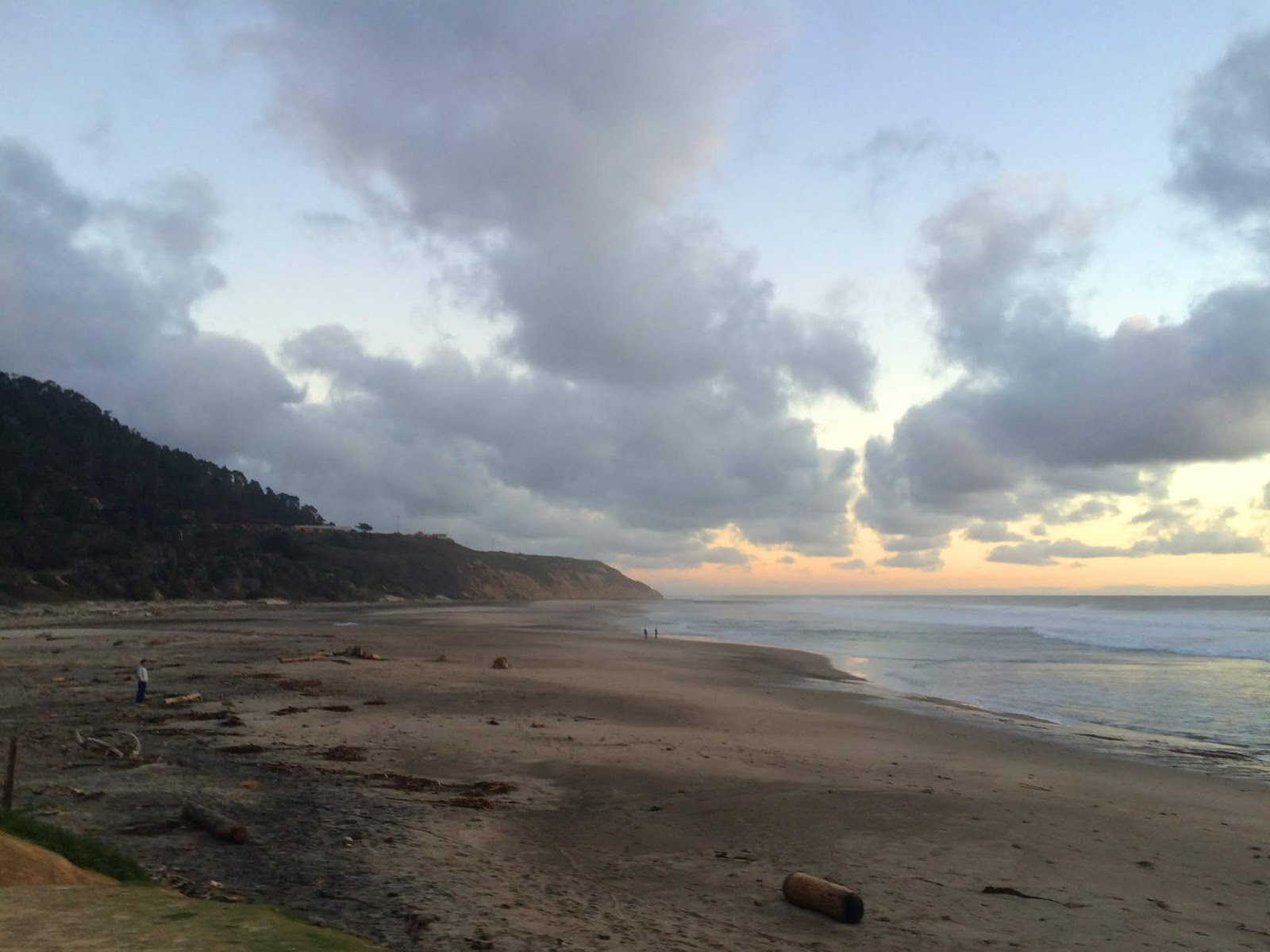
I took Amber out to breakfast in San Jose that morning, and when she went to the bathroom, I furtively picked up my phone and began looking up trails we could do that would be not too long, but scenic and rewarding, and I somehow stumbled upon the idea of checking out West Waddell Creek State Wilderness, which is where the famous "Skyline To Sea" trail dumps you at the sea. So we would do some little hike around there and there would be some beach, and some nice trees, and maybe if I was lucky I would get up Chalk Mountain. You can't really go wrong with any coastline North of Santa Cruz. Amber still didn't have a decent pair of hiking boots yet, so we didn't make it very far up the Westridge Trail. Not even close to Chalk Mountain. But we we drank a nice bottle of wine, and watched the clouds go by, and saw the golden sunset hour upon the hills, and saw some really cool trees and rocks, and even a jackrabbit. And then the sunset at the beach. I have to always remember to appreciate living in a place where I can have an experience like this, in JANUARY.
Sunday, October 28, 2018
Laguna Creek Beach
DATE: Sunday, October 28, 2018
COAST DAIRIES STATE PARK
SANTA CRUZ COUNTY, CA
A nice late afternoon, hiking along Laguna Creek Beach, a ridiculously photogenic place. It was Halloween time, so I was thrilled that a pumpkin patch was found along the way. The crashing waves and literal clouds of birds added to the epic nature. The California coast cannot be beat!
CLICK "READ MORE" TO SEE ADDITIONAL PHOTOGRAPHY
COAST DAIRIES STATE PARK
SANTA CRUZ COUNTY, CA
A nice late afternoon, hiking along Laguna Creek Beach, a ridiculously photogenic place. It was Halloween time, so I was thrilled that a pumpkin patch was found along the way. The crashing waves and literal clouds of birds added to the epic nature. The California coast cannot be beat!
CLICK "READ MORE" TO SEE ADDITIONAL PHOTOGRAPHY
Subscribe to:
Posts (Atom)