Showing posts with label Eldorado County. Show all posts

Thursday, May 27, 2021

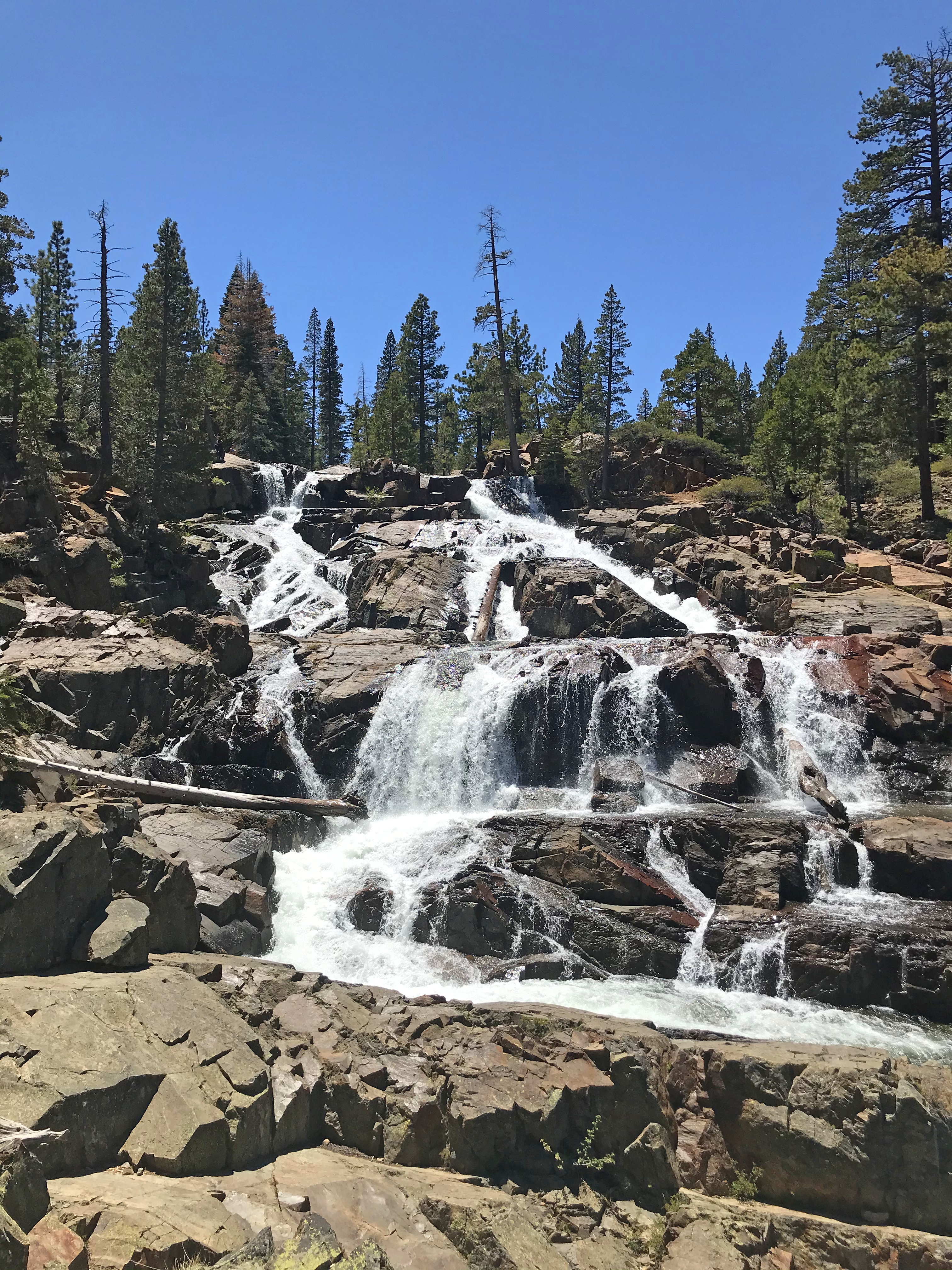
Glen Alpine Falls / Eagle Point

DATE: Thursday, May 27, 2023
DISTANCE: 3.97km / 2.47 miles
ELEVATION GAIN: 98m / 323’
TIME TAKEN: 1:21
ELDORADO NATIONAL FOREST
EL DORADO COUNTY, CA
STOLEN WASHOE LAND
SOUNDTRACK:
Taste: Over The Glen

PHOTO ALBUM
MAP 1 - Glen Alpine Falls
MAP 2 - Eagle Point


TRIP REPORT COMING SOON!


Wednesday, May 26, 2021

Eagle / Cascade Falls

DATE: Wednesday, May 26, 2021

EAGLE FALLS
DISTANCE: 1.9km / 1.19 miles
ELEVATION GAIN: 76m / 250'
TIME TAKEN: 1:09
EMERALD BAY STATE PARK

CASCADE FALLS
DISTANCE: 3.51km / 2.18 MILES
ELEVATION GAIN: 128m / 421'
TIME TAKEN: 1:28

ELDORADO NATIONAL FOREST
EL DORADO COUNTY, CA
STOLEN WASHOE LAND
SOUNDTRACK: Hüsker Dü: Everything Falls Apart

PHOTO ALBUM
MAP


TRIP REPORT COMING...?


Sunday, October 11, 2020

Echo Peak

DATE: Sunday, October 11, 2020
DISTANCE: 7.98km / 4.96 miles
ELEVATION GAIN: 918m / 3013’
TIME TAKEN: 5:20
ELDORADO NATIONAL FOREST
DESOLATION WILDERNESS
ELDORADO COUNTY, CA
STOLEN WASHOE LAND

SOUNDTRACK: Pink Floyd: Echoes

SUMMITS:
• Peak 7758 (“Dumbo”) /  2365m
• Flagpole Peak: 2549m / 8363’
• Echo Peak: 2711m / 8895’
• Peak 8760’ / 2670m
• Indian Rock 2621m / 8600’
• Angora Peak (2X): 2617m / 8586’


PHOTO ALBUM
MAP

 Angora Peak previously climbed September 29, 2020


CONTINUED: Previous day’s hike: Freel Peak

This day’s hike describes a point to point traverse of the ridge north of Echo Lakes, with six summits attained along the way. This is almost completely off trail, but can be done over pretty easy terrain if you so choose, with a few exceptions. A brief class 3 scramble is inevitable to get to the very top of Flagpole Peak, and the crux of the trip is a stiff class 3 (some say class 4) down and up climb through a rocky notch between Peak 8760 and Indian Rock. Almost unlimited bonus scrambling on high quality granite can be had in this area if you’re into that sort of thing!

Awaking again at Fallen Leaf Campground, Alex and I decided to use our bikes that we had both brought and check out the path out to Baldwin Beach, which was pleasing to the senses of course. We had a clear sunny day on our hands now, just the type that was meant to be spent hiking at Lake Tahoe. We returned to camp and packed up. Then, since we had bikes AND two cars, we used all of the vehicles in our next maneuver. We put both bikes on Alex’s bike rack, and dropped his car up at the Angora Lakes parking lot. Then biked back down, past the Angora Lookout (nice views of Fallen Leaf Lake and Tallac), back to the campground, where we threw the bikes into my van, and drove up to the Echo Lake parking lot, starting the hike from there. With all of the morning’s beach going and driving and biking around we didn’t start hiking until 12:30PM, but it wasn’t a big deal since we only anticipated about five miles.

We crossed the bridge at the east end of Echo Lake and followed the trail west for a few minutes, before heading uphill, over the granite towards what we presumed was Flagpole Peak, the first stop on our agenda.Instead, we arrived at another, lower summit, Peak 7758, which someone later called “Dumbo.” The day was cloudless, Echo Lake sparkling, and we already had views of the Crystal Range coming into sight. From the top of Dumbo, we now had a clear view of Flagpole Peak and our path to get to it. We descended down into a sandy saddle, and then got right to the excellent granite that awaited. There’s probably an easier way up, but we found extremely fun class three most of the way: ramps, slabs, cracks, you name it, it was a granite paradise! It was about 1:45PM when we made it to the top of Flagpole Peak (yes, there is a flagpole), there were two fellas up there already who told us of their ascent route, and of the colloquial name (“Dumbo”) for Peak 7758. After admiring the view (almost straight down on the lake!) we wished them well, and carried on.

The next goal, Echo Peak, the day’s highest point, could have been reached more easily and faster if we had stuck to the south side of the ridge, but we chose to stick right along the top, where we took every opportunity to get into class three scrambles on the excellent rock. At that pace, we didn’t reach the summit of Echo Peak until after 3PM. Echo Peak is more of a ridge highpoint, and not a very interesting peak, but the view was sublime, with Angora Lakes, Fallen Leaf and Tahoe spilling out in front of us like a sapphire necklace. We enjoyed the peak and a snack, and had a nice chat with a nerdy couple from Davis that had hiked up there. Next came an easy section, north on the sandy ridgeline, where we passed over Peak 8760, a bump so insignificant that we didn’t even notice it. Just after that, the soft ridge came to an abrupt end, and we approached the fractured granite notch that separated us from Indian rock. This required a downclimb on the granite jumble with a steep slope on one side, and VERY steep cliffs on the other side. Alex led the way down, gracefully, and then chose a successful route up the other side. The rock was of good quality, and we had no issues. Some have denoted this section as class 4. I’ll let you judge it for yourself!

Next up was the summit of Indian Rock, which was less a peak, and more like the high point at the edge of a huge cliff. Indeed, it towers over 2,000 feet above the Glen Alpine Creek area to the north, and is quite an impressive sight from that direction! Now it was time for the sixth, and final summit of the day, Angora Peak, which I had visited just twelve days earlier, from the other side, unfortunately in a smoky haze. I was happy to have a clear day for the return visit. It was now about 4:30, and we took almost an hour to pick our way over to Angora Peak, slowing our pace now, coming to the end of a busy two days. Once more, we met another pair of hikers at the top of the peak, this time a local couple. They complained about the amount of outsiders (sorry!) flooding the region during the pandemic and confirmed our suspicion that it was still unusually busy, for October. The Angora Peak summit register that I had signed less than two weeks ago was gone, so we made our final descent now, twilight crawling in, down the slopes to Alex’s car in the Angora Lakes parking lot. He gave me a ride to my van back at Echo Lake, we sorted out our bikes in the now darkness, and went our own ways back to the Bay Area, through the snaking highways of the California night.

FURTHER READING
• Bob Burd: Does a similar traverse
• The Outbound: Flagpole Peak from Echo Summit
• Greg Lamy: Echo Peak from Echo Lake
• Trails Guide: Angora Peak from the east
• Peak 7758 (“Dumbo”) on PEAKBAGGER
• Flagpole Peak on SUMMITPOST and PEAKBAGGER
• Echo Peak on SUMMITPOST and PEAKBAGGER
• Peak 8760 on PEAKBAGGER
• Indian Rock on PEAKBAGGER
• Angora Peak on PEAKBAGGER


Saturday, October 10, 2020

Freel Peak

DATE: Saturday, October 10, 2020
DISTANCE: 22km / 13.66 miles
ELEVATION GAIN: 1327m / 4354’
TIME TAKEN: 7:06
ELDORADO NATIONAL FOREST
EL DORADO COUNTY, CA
STOLEN WASHOE LAND

SOUNDTRACK: Deodato feat. Camille: Are You For Real?

SUMMITS:
•Trimmer Peak: 3022m / 9915
• Freel Peak: 3316m / 10,881’

PHOTO ALBUM

MAP


...continued: Previous Day's Hike: Tahoe Mountain

Freel Peak is the highest point in the Lake Tahoe Basin rim, clocking in at nearly 11,000 feet above sea level. This alone should be enough reason enough to pay it a visit. But there's more! The height and prominence of this peak provides the most complete and sweeping view of the spectacular Lake Tahoe area that you will see anywhere! And while the top of the peak is pretty much just a pile of talus, the approach hike is a treat in it's self, bringing you through locations of scenic granite majesty. This can be done as a class one hike all the way to the top if you stay on the trail. 

I was up with my alarm at 7am, Alex had slept on the open ground as he is wont to do, and he was also waking up. We were in pretty good shape, because it had been too cold outside the night before to stay up late and drink too much beer! It was our second annual October trip to stay at Fallen Leaf Lake and do some mountain climbing (last year: Mount Tallac). Our original plan today had been to approach Freel from the south, via Willow Creek Road. I’d read that some people needed 4WD to get up that grade; my van is 2WD, but high clearance at least, so I though it was worth a shot. We got to the turnoff, and then only a few hundred feet up the dirt road before I found my wheels spinning uselessly in the dust. Now, we could have just parked at the bottom of the road and walked up, this might have been more economical for time in the big picture, but instead, we decided to drive around, back to Meyers, and use the other trailhead at the end of Fountain Place Road, which probably burned an hour.

It was almost quarter past nine by the time our boots hit the dirt at Fountain Place. There are two ways to go up to Freel from there, the proper Armstrong Connector Trail to Armstrong Pass, or a gated private dirt road that leads through an inholding in the woods. The private road was more direct, supposedly steeper, and word on the street was that no one had been hassled for trespassing. We decided to take the proper trail on the way up, and maybe use the private road on the way back. The Armstrong Connector Trail was dusty and well worn by foot and mountain bike, a forest freeway. It wasn’t very direct (towards Freel Peak), but it was a nice walk, with the open granite shoulder of the mountain soon coming into view, followed by our arrival at Armstrong Pass one hour and twenty four minutes after we started out. Three different trails converge at Armstrong Pass, and we took a short break to much on a breakfast of trail mix, while two other parties came and went. From here, we now had a view to the South, and could see Hawkins Peak, among many others. From the pass, we turned north on the Tahoe Rim Trail towards Star Lake. The path starting gaining elevation in earnest now, creeping up the rocky western side of the Freel Massif. Tallac and the Crystal Range came into view. I had heard Freel Peak was a basically a pile of sand at the top (not wrong), but I had no idea about the granite wonderland that was to be passed through on the approach. We came through right below the massive rock known as “Fountain Face," Peak 9841 and it’s jagged eastern ridge appeared soon after.

It was just past noon when we got to the turnoff trail for Freel Peak (I’ll call it Freel Pass), but having admired the jumbled Granite of Trimmer Peak from down in village on last month’s visit, I was keen to give it a go. I asked Alex if he wanted to do Trimmer before or after Freel, and the results came in for Trimmer. So off we went, out to the west. We followed the rocky ridge, right over point 9885, down through a sandy saddle, and then up to the granite stronghold of Trimmer Peak. This was our first unabated view of south Lake Tahoe, which never disappoints. We could also see that a lot of clouds were blowing through, though luckily they weren’t bringing rain or snow. It took us about an hour to get to the summit of Trimmer, longer than I was expecting, but it provided much beloved extracurricular granite scrambling, and we found the summit register as well.

I thought I saw a quicker way to get back to Freel Pass, and I led us back, this time cutting to the south of Point 9885. This proved to be a terrible idea, with much sidehilling on loose scree, steep plunging cliffs, and a struggle to not lose and regain elevation. It was very tedious, and it burned more precious October daylight than necessary, taking another full hour to get back on track for our Freel ascent. Now 2:30PM, it was getting cloudier and colder, but we pushed on, and made it to the final 1,200 feet to the top in less than an hour. It was very brisk and windy, but Alex had thoughtfully brought a flask filled with Scotch whiskey, so that helped. The previous party had already gone down, so we didn’t have to share it either! Now at almost 11,000 feet, at the highest point on the Tahoe Rim, we had a 360 degree view of the surroundings, snowless mountains, the lake, now slate grey beneath the clouds, the drier expanse of Nevada to the east. We spent about 20 minutes up there, and decided to forgo any more bonus peaks (Jobs, etc.) due to the waning daylight (almost 4PM now), and the cold winds. I had hoped to also include Jobs Peak and Job’s Sister in the day’s hike, but apparently I had traded them for Trimmer.

Now that it was time to go back down, the more direct trail through Trout Creek Canyon seemed worth a shot. Down we went, the trail plunging down a steep sandy hill, which was fun to descend, and would have been a pain to come up. So we accidentally made the right choice in trails. There was one final view of the fabulous cliffs of Peak 9841, and then we were down into the aspens on the canyon floor. The trail almost disappeared, at times, in the thicket, but this was easily forgiven with the beautiful fall colors surrounding. Soon, we came to an old fenceline, saw "No Trespassing" signs, and we were in the old Fountain Place property inholding. The trail became a dirt road, and like an omen, we saw a shotgun shell lying in our path. The omen turned out to be meaningless, though. We saw a few a dilapidated structures in the distance, one car parked, but no people. And then, just like that, we were through the gate, back at the trailhead parking lot, no trouble! Just over seven hours out. We went back to Fallen Leaf Campground to stay another night.

To be continued: Sunday, October 11, Echo Peak!


FURTHER READING
• Ted’s Outdoor World: A very similar route to ours (minus Trimmer)
• The Outbound: Another description
• Trimmer Peak on PEAKBAGGER
• Freel Peak on SUMMITPOST and PEAKBAGGER


Friday, October 9, 2020

Tahoe Mountain

DATE: Friday, October 9, 2020
DISTANCE: 3km / 1.87 miles
ELEVATION GAIN: 160m / 526’
TIME TAKEN: 46 min.
ELDORADO NATIONAL FOREST
ELDORADO COUNTY, CA
SOUNDTRACK: Cathedral: Copper Sunset

SUMMITS:
Tahoe Mountain SE Summit: 2172m / 7127’
Tahoe Mountain: 2210m / 7249’

PHOTO ALBUM
MAP


I had established camp at Fallen Leaf, and it would be a few hours still until my brother Alex arrived, so I decided to enjoy the afternoon and go for a bike ride up to the Devron Connector trailhead, which connects into a neighborhood on the west side of Fallen Leaf Lake. It was quarter past five, but I had still enough light remaining for a short hike, so I locked the bike to a tree and went for it. After I gained some elevation, I could see out to the south, and saw some smoke haze lingering in the atmosphere, but it was much better than my visit in September. In about five minutes, I was at the Valley View Trail, which switchbacked me up to the top of the NW-SE trending ridge. I now had a good view out at Freel Peak, tomorrow's destination, and the red and white striped tower on Tahoe Mountains SE summit.

The top of the ridge was very flat and civilized, with dirt road access for the radio towers. I had a partial view of Lake Tahoe, to the north, through the trees. Fifteen minutes later, I was at the proper, taller NW summit of Tahoe Mountain. This one had a small shack structure on top, more trees, less views. But I could see the almost set sun going down behind Mount Tallac and Fallen Leaf Lake, and it was nature's glory indeed. I wasn't in a big hurry, because I had only a short way to go, and still enough light, but I decided to cut downhill through the woods from there, taking a shortcut back to my bike, and I rode my bike back down the road to the campground uneventfully. Alex showed up sometime after dark, and we dined on takeout pizza and decent beer, ah the joys of camping in Lake Tahoe!

CONTINUED: Saturday, October 10: Freel Peak

FURTHER READING
• The Long Green Tunnel: Description of this short hike
• PEAKBAGGER: Tahoe Mountain NW Summit and SE Summit


Tuesday, September 29, 2020

Angora Peak

DATE: Tuesday, September 29, 2020
DISTANCE: 6km / 3.76 miles
ELEVATION GAIN: 514m / 1687’
TIME TAKEN: 2:55
SUMMIT: Angora Peak: 2617m / 8586’
ELDORADO NATIONAL FOREST
ELDORADO COUNTY, CA
STOLEN WASHOE LAND

SOUNDTRACK:
Smoke Mountain


PHOTO ALBUM
MAP


...CONTINUED:
Yesterday's Hike: D.L. Bliss State Park


I was awake in the Angora Lakes parking lot at 7:30AM, shortly after sunrise, Amber still asleep in the van. In order to satisfy my lust for elevation gain, I set out solo to ascend Angora Peak. I quickly saw, to my dismay, that the wildfire smoke had returned to the Tahoe Basin during the night. I walked part of the way up the dirt road towards Angora Lake, then turned due north, following what looked like a use trail going up to the peak. The trail came and went, and ultimately trying to follow it didn’t really matter. I tried to follow the shoulder of the ridge, it was steep, more rocky than brushy. As I gained elevation I could see how much smoke had poured in, obscuring the views. I burned my knees on the steep scree, and was happy to get to the giant granite boulders close to the summit. I had a look down at Angora Lakes, which appeared equal in size, like two eyes in the trees.

After that, pushed up the boulders to reach a false summit, but I could see the real one now, a few hundred feet away. More scrambling. I tried to focus on the joy of the granite instead of the disappointment of the hazy air. The top of Angora Peak was pretty much a big pile of rocks, and hidden amongst them was an ammo box summit register / geo cache. The smoke seemed to be getting worse as I surveyed the area from the top. I originally had planned to do a loop including Indian Rock and Echo Peak, but the smoke was a buzzkill, and I decided to return to the parking lot. I took a slightly different route on the descent, just to the north, not quite as steep, again finding patches of a use trail that came and went. I was back at the van by 9:30AM, and Amber was just waking up. We went on to spend the rest of the day lounging by Upper Angora Lake, enjoying our holiday. Later on, we observed some extreme cliff jumping occurring across the water!

FURTHER READING
• Lake Tahoe Getaways: Angora Lakes
• Angora Peak on PEAKBAGGER


Monday, September 28, 2020

D.L. Bliss State Park

DATE: Monday, September 28, 2020
DISTANCE: 9.5km / 5.91 miles
ELEVATION GAIN: 270m / 886’
TIME TAKEN: 3:13
D.L. BLISS STATE PARK
ELDORADO COUNTY, CA
STOLEN WASHOE LAND

SOUNDTRACK: Excruciating Terror: Ignorance Is Bliss

PHOTO ALBUM
MAP


…CONTINUED
: Yesterday's Hike: Maggies Peaks

After spending the night in the van at Lake Tahoe, Amber and I started off in the morning to hike on the famous Rubicon Trail in D.L. Bliss State Park, on the western shore of Lake Tahoe. The smoke was still gone, and the sky and especially the especially the lake were an unreal perfect blue. there was no better place to enjoy it than the Rubicon Trail, as far as I could tell. No peaks, scrambling or strenuous distances today, just a hell of a nice walk along the lake.

About 10:15AM, we started south from the parking lot, and almost immediately were immersed in the spectacular scenery. It was fairly busy, as to be expected, but not annoyingly so. The trail is very well constructed, with bridges, boardwalks and chain ropes at all necessary locations. We took just over two hours to get to our turnaround spot, almost all the way down to Emerald Point (the peninsula, not the mountain). On the way back up, we did a slight variation on the trail, which got us to the adorable little Rubicon Point Lighthouse, which could have been pretty easily mistaken for an outhouse in my opinion. We were back at the van by about 2PM. But the excitement wasn’t quite over, as we saw a bear by the roadside on the way out!

To be continued... TOMORROW'S HIKE: Angora Peak

FURTHER READING
• 101 Hikes In Northern California: Matt Heid: Wilderness Press, 2000: pp 202-204: Description of the full hike
• California Through My Lens Description with photos
• Rubicon Point on PEAKBAGGER


Sunday, September 27, 2020

Maggies Peaks

DATE: September 27, 2020
DISTANCE: 12km / 7.45 miles
ELEVATION GAIN: 782m / 2566’
TIME TAKEN: 6:30
ELDORADO NATIONAL FOREST
DESOLATION WILDERNESS
ELDORADO COUNTY, CA
SOUNDTRACK: The Exploited: Maggie
STOLEN WASHOE LAND


SUMMITS:
• Maggie’s Peak South: 2651m / 8699’
• Maggie’s Peak North: 2590m / 8499’


PHOTO ALBUM
MAP


Maggies Peaks are a nearly symmetrical double mountain formation in south Lake Tahoe, near Emerald Bay and Cascade Lake. Supposedly they were named after a busty barmaid who worked at the Tahoe Tavern in the 1800’s! I had been interested in Maggie’s Peaks for quite awhile, and not for some kind of juvenile breast fascination. I thought it would be a really cool hike to make a loop through the beautiful alpine environment including Eagle Falls, Eagle Lake and Granite Lake. Today, that’s what I did. Maggie’s Peak South is the taller one, and has a strong use trail to the top, class one all the way, very popular with the dayhikers. Maggie’s Peak North is less tall but more challenging at class two, with plenty of optional class 3 for fun.

After some kind of family and friends gathering at my parents’ house in Jackson, Amber and I were set to have a short getaway to Lake Tahoe. My brother Alex, and my other brother’s girlfriend, Silver, were also free, and decided to join us in Tahoe for the day. Amber and I drove up in her van, and Alex drove himself and Silver in in his Toyota, so they could return to The Bay at the end of the day. We had to park up the road from our intended trailhead at Eagle Falls, it was a beautiful Sunday (the smoke had miraculously cleared) and the area was slammed. We started hiking from the cars at 11:30AM, enjoying views of the stunning Emerald Bay as we went down the road. In 20 minutes, we were at the Eagle Falls trailhead, and the area was quite full of people, even though the waterfall was barely in existence at this point. I didn’t care, I was too busy admiring the granite crags of Emerald Point high above to the north.

We arrived at Eagle Lake by 12:30, and in an effort to please everyone in the party, we spent about an hour swimming and picnicking at Eagle Lake. After that, I pushed my agenda on everyone to to my intended ascent of Maggie’s Peaks, Alex onboard of course, the girls… skeptical? We took the Eagle Falls Trail up to it’s junction with the Bayview Trail, through increasingly sublime alpine scenery. I was salivating over the excellent granite of Eagle Lake Buttress and it’s surroundings, which I hoped to climb soon. The melange of the pines and the granite dust, the warm sunshine and the cool breeze, it was intoxicating to me. But by now, Amber was hangry, was convinced I mislead her about the mileage of the hike, and Silver was functioning, somehow, hiking in cowboy boots, couldn’t have been happy. So we split off into natural pairs in between Maggie’s Peaks: the girls went straight down, back to the road, and Alex and I naturally took off up the use trail to Maggie’s Peak South. That had been my angle all along, of course, to have two teams to split into. The south peak had a good crowd of casual day-hikers at the main viewpoint, which dramatically overlooked the lake, so we enjoyed it briefly, then paid a visit to what we presumed was the high point, a more prominent rock just to the south.

Next it was off to the less popular Maggie’s Peak North, we found our own way there, over some open granite, admiring some spectacular Sierra Juniper trees along the way. We used a fun class 3 chute to ascend the peak (there was probably an easier way), and admired the views all around from Fallen Leaf Lake to Mount Tallac to Emerald Point. Not wanting to leave the ladies waiting too long, we then plunged almost straight down from the peak to Granite Lake, where Alex, always gung ho for a swim, sampled the waters of the lake. Then it was back on the trail, heading for Bayview Campground and the road, but we took another time saving shortcut, going north cross country and plunging down the steep hillside back to highway 89 where the cars were parked. We found the girls smoking weed in the van has we dumped the rocks out of our boots, and then made our way to Sonney’s Barbeque, where hunger was vanquished and thirst was relieved. Alex and Silver then returned to the Bay Area, while Amber and I remained to spend a few more days at the lake.

FURTHER READING
• Bob Burd: Knocks out both peaks in the snow
• Hiking Project:
South Peak only
• Outdoor Project: South Peak only
• Maggies Peaks on SUMMITPOST
• Maggies Peak South on PEAKBAGGER
• Maggies Peak North on PEAKBAGGER


Monday, July 27, 2020

Red Lake Peak

DATE: Monday, July 27, 2020
DISTANCE: 25.1km / 15.6 miles
ELEVATION GAIN: 1,245m / 4,085’
TIME TAKEN: 9 hours
ELDORADO NATIONAL FOREST
HUMBOLDT TOIYABE NATIONAL FOREST
ALPINE COUNTY, CA
ELDORADO COUNTY, CA
SOUNDTRACK:
Shrine Of The Serpent: King In Red

SUMMITS:
• Red Lake Peak: 3067m / 10,063’
• Crater Lake Peak: 2972m / 9,750’
• Stevens Peak: 3066m / 10,059’
• Peak 9,442’ / 2878m
• Peak 9,211’ / 2808m
• Peak 8665’ / 2641m


PHOTO ALBUM
MAP


…continued.

I had been out trying to hit the summits and trails in the Sierras for five days, and on the sixth day, I finally got the early start I’d hoped for every time. Up at 5:30, barely anything to clean up at camp, up the road to the Meiss / Pacific Crest Trailhead at Carson Pass, a quick brekky out the back of the van, and I was off at 6:30AM. There’s an unofficial trail that goes up to Red Lake Peak, from the parking lot, which I didn’t find at first, because I walked the wrong way out of the parking lot. I circled back a little, over the rocks and found the trail, which I was able to follow all the rest of the way to the top, through the alpine brush and volcanic outcroppings. The sun had now just come up, and Red Lake, below, was shining like a mirror. To the south, majestic morning light illuminated the massif from Elephants Back to Round Top to The Sisters, and on to Caples Lake. For an unofficial trail, this one was very strong, and I was making good progress. It wasn’t long before i gained enough elevation to see my first view of Lake Tahoe.

When I got up to the top, my first stop was the southern “prow” that looked out over Carson Pass. But this was not the summit. To the north was was an ominous series of of igneous extrusive columns. According to GPS, the south one was the high point, so I climbed it, fun class 3, this volcanic rock ain’t so bad as long as it’s not falling apart! In fact, it can be really good, with the chunky formations in the conglomerate rock forming handholds. From the top of the “summit,” the next formation looked taller, so I climbed that one too, just to be sure. I had a good view of my adventures from a few days back: Raymond Peak and Silver Peak in the distance beyond. I had felt very tired when I first started out, and I thought maybe I would do RLP only, but by now I was feeling invigorated, and decided to continue along the ridge, following my original master plan. Though it is not on any map, there is a solid trail from RLP all the way to the base of Peak 9211, and beyond. The trail would come on really strong sometimes, and then suddenly disappear. Then, as I continued cross country, I would meet the trail again, as it came in from another direction, and I would be like “where the fuck have you been?”

I crossed Crater Lake Peak, and hopefully it’s summit, it’s a pretty flat mound, and from there I took a look down at the whimsically named lake from which the “peak” takes it’s name. Moving on from there, I was on top of Stevens Peak by 9:20AM. More distinctive than Crater Lake Peak, it had class 2 sharp rock piles on top, and a great view of the organ pipe volcanic cliffs / columns that fell below Peak 9442’. Back on the main ridge, after Stevens Peak, I shed some of the extra layers of clothing, because it was warming up, approaching 10AM. Continuing north, I must have crossed Peak 9442’, because I was sticking to the ridgeline, but I barely noticed it. By 10:40AM, I broke off my relationship with the fickle use trail, and headed up to Peak 9211, going north-west now to do my big loop.  The trail seemed to continue it’s own way, to the north-east, probably to Waterhouse Peak.

There was a standard rocky outcrop to crown Peak 9211, but a surprise when an adorable fawn erupted from the bushes and bounded away, followed moments later by a second one. then I glanced downhill saw a Marmot! This must be the wildlife section of the hike. Down the hill I went, headed for cross country uncharted territory. West off of Peak 9211’ was brushy, so I headed for the pines, and followed them down to a bubbly little creek. Up the other side of the ravine, I was aiming for Peak 8665, but my aim was off, and I went too much due west, I should have cut north-west to the saddle, I could have saved myself some elevation gain and loss. During this time, I crossed a mysterious old trail, but didn't follow it. Before I got to my summit destination, I reached the top of the rocky cliffs that rise above Round Lake. Following the cliff edge north, there was an excellent view down at the lake. The top of Peak 8665 had a cairn with a stick poking out like a flagpole, the only marker of any kind that I saw on any of the peaks that day. North-northwest down the ridge now, through light forest. I reached the Meiss / Tahoe Rim Trail in a half hour, the first official trail I’d been on all day, followed immediately by the first other hikers I’d seen all day. Around the next bend, to my surprise, I came upon a gentleman playing flamenco guitar. He was good! I felt like I was in Disneyland now, entertainment provided.

Just after 12:30PM, I was at the shore of Round Lake. There were a few scattered camps of people around. I decided to circle the lake around the west side, so I could take in the view of the towering cliffs above. There is a pretty strong use trail around (most of) the west side, but I made it more difficult for myself by intentionally avoiding all the camps of people. I stopped briefly to dunk my feet and take a break at one isolated spot I found. The use trail dissipated by the time I reached the southwest corner of the lake, and there was some pretty bad swamp / bushes / alpine jungle. I had to backtrack a little, and try a few different options before I got through, but I did it without too much real bushwhacking. Shortly after that, I rejoined the main trail near the southeast corner of the lake. Now, with no more peaks to climb, and no more lakes to circumambulate, I picked up the pace. Through the woods, then across pastoral Meiss Meadow to hit the PCT in less than an hour. I had a good view to the east of Carson Ridge, the four peaks I had climbed across in the morning. there were a few hikers around, and an especially big group crossing a creek near the trail junction. They paused to let me pass by. Back in Oakland I don’t look like a very threatening person, but on the trails, i must look some kind of savage barbarian bandit, because the yuppies, Girl Scouts, and retirees give me a lot of space. More easy undulating terrain, one more hour on the PCT, and I was back at the van at 3:42PM. I drank my last beer, and drove back to my parents’ house down in Jackson.

FURTHER READING
• Tahoe Trail Guide: A different approach to  RLP
• Outdoor Project: A little history on RLP
• Bob Burd: Bob on Red Lake Peak
• Red Lake Peak on SUMMITPOST and PEAKBAGGER
• Crater Lake Peak on PEAKBAGGER
• Stevens Peak on SUMMITPOST and PEAKBAGGER
• Peak 9,442 on PEAKBAGGER
• Peak 9,211 on PEAKBAGGER
• Peak 8665 on PEAKBAGGER


Saturday, July 25, 2020

Eagle Rock

DATE: July 25, 2020
DISTANCE: 9.78km / 6.08 miles
ELEVATION GAIN: 600m / 1966’
TIME TAKEN: 3:30
ELDORADO NATIONAL FOREST
ELDORADO COUNTY, CA
SOUNDTRACK:
Misfits: Where Eagles Dare

SUMMITS:

• Eagle Rock: 1911m / 6270’
• Peak 6452’: 1967m / 6452’


PHOTO ALBUM
MAP


...continued

Eagle Rock is a granite gendarme that can be seen towering over the south side of Highway 50, between Kyburz and Strawberry, if you know when to look (eyes on the road!). I had compiled a mental list of things to do in this area while camping in Kyburz over the fourth of July weekend, and Eagle Rock had been identified as a close and moderate destination.

Inevitably woke up late after the inevitable night of partying. I was also loathe to leave Amber’s van bed; it was extremely comfortable, and the site of the best sleep I’d gotten in the past four nights. After slowly gaining my footing, and eating breakfast, I hopped in my van and drove up Silver Fork Road to look for the dirt forest service roads that snaked up towards Eagle Rock on the map. I decided the best place to start would be across from China Flat Campground, and I parked next to an old abandoned cabin. I started walking at 11:45AM, up the remains of an old dirt road. It had a log fallen across it within the first ten feet, so obviously it’s not something I could have driven up, even with 4WD. The old dirt road snaked up the hill, and soon intersected with what appeared to be fresh logging roads. There wasn’t much shade, the road was an inch deep in that powdery kind of dust, and the day was warm already. I though to myself, this area would be good for early or late season hiking, with it’s low elevation. I had saved a GPS track in my phone from Marcus Sierra, his path up the logging roads to Peak 6452. I decided to follow his path up the gently winding way, visit peak 6452, and then hit Eagle Rock on the way back.

There was no active logging going on (weekend?), but there was one large piece of equipment on the road, and several giant piles of cut down trees. It wasn’t total clearcutting, thankfully, more of a thinning, selective logging apparently. Now I knew where all the logging trucks, rumbling down Silver Fork Road, past our camp in Kyburz, had been coming from. When I got close to the summit of Peak 6452, I tried to go cross country to save time, and was confronted with a head high wall of impenetrable manzanita. So my advice is, don’t look for shortcuts around here. I continued following the Marcus Sierra track, going around the east side, and there found a decent trail which took me almost all the way to the top. Here, Peak 6452 opens up with granite and scrub pines. I stood atop the granite boulder high point for a minute or two, then sat down to quench my thirst. It was hot! Thunder Mountain, the Amador County high point, and the Silver Fork American River watershed were visible to the south, the north face looked down upon highway 50. Eagle Rock, my next goal was also in sight. Going down the west side of the peak, I struck off for it.

The trail that had brought me to Peak 6452 seemed to continue, but it looked like it was going downhill, away from the rock, south-west, so I broke off to go cross country, there were patches of irritating brush to push through, on and off, across the saddle. It took about a half hour to reach the large granite boulders at the base of Eagle Rock. I was happy to be past the brush, and scrambling on beautiful granite now. The way up was a fun climb across giant rock chunks, starting on the east side, then turning north. It was easy class 3, and there are probably multiple class 3 options to reach the top, as well as more difficult ones if you choose. At the top of my climb was a rock “doorway” which led to a north facing ledge. Going left from here led me to the very top of the rock. It was now about 2:30, and I had views down upon Highway 50, north to the Crystal Range, and south to Thunder Mountain again, which was now living up to it’s name, dark clouds massing in its vicinity. And then right on cue came the first thundrclap from the distance. Still traumatized (not actually) from my experience on Silver Peak, I was happy to have plenty of time to get off of the rock before the thunderstorm got to me (I could tell it was headed my way!)

I climbed back down the rock the way I had come, and then headed cross country, moderately steep downhill, through the pines and slippery forest floor carpet, I was trying to make a shortcut by going straight down to where the van was parked. I could hear the thunder getting closer. Soon I crossed a dirt road that was going east-west. No idea where it went, it wasn’t on my map. I continued past there, down through the pines, as fast as I could without slipping. Keeping a mostly straight path, except when zig-zagging around the patches of nastier brush. I eventually crossed a dry creek, and got to a nasty wall of brush that didn’t have a clear path around it. I was so close to the van that I just decided to push through, getting scratched on the legs and smacked in the face, it’s OK, my looks weren’t much to write home about anyway. I was back at the van at 3:15, for a 3.5 hour round trip hike. Then I headed back to Kyburz Camp to jump in the river and wash off the dirt and sweat! No sunset hike with the gang tonight, we had an earlier dinner, and I started drinking earlier, ended up passed out in a camping chair. Eventually, Amber woke me up and sent me to her van.

FURTHER READING
Marcus Sierra: Report from visit to Peak 6452
• Eagle Rock on PEAKBAGGER
• Peak 6452 on PEAKBAGGER


Friday, July 24, 2020

Horsetail Falls

DATE: Friday, July 24, 2020
DISTANCE: 4.62 km / 2.87 miles
ELEVATION GAIN: 206m / 675’
TIME TAKEN: 2:24
ELDORADO NATIONAL FOREST
DESOLATION WILDERNESS
EL DORADO COUNTY, CA
SOUNDTRACK:
Hysteria: Night Closing In

PHOTO ALBUM
MAP


...continued.

…and woke up at 1:30AM! My body hates me! It will not allow me to go to bed early, so I can wake up early. I just lay there, until at least 4:30, tossing and turning on the van seat, pausing occasionally to stare at the stars. Can’t get up and watch a movie or something when you have insomnia in the woods. Finally got back to sleep, and because of the interruption, slept in until about 9AM, again crushing my plans to rise and hike before or at sunrise. Ugh, I’m bad at this. I decided to head to Kyburz, where I was to meet up with Amber, and maybe find a short hike to do along the way. I took Highway 4 to 89. Stopped in Meyers, south of Lake Tahoe, for supplies. People were streaming into the lake area, and almost every trailhead I had passed looked slammed. Friday in July! During a pandemic! What a curious world. Luckily I as headed to a private campsite, and could be away from the crowds. 


In Kyburz, Amber was already established in the camp, with guests Melanie and James. I almost instantly had a shot of rum in my hand, fun times ahead, but bad news for hiking motivation! After hanging out, swimming and eating dinner, I motivated the gang of city slickers to do a shirt hike. Amber chose Horsetail Falls as the destination, and Melanie and James came with. It was a sunset hike, starting at about 7:15PM. Pyramid Creek and Horsetail Falls seemed to be much more raging than my previous visit on July 4. From summer thunderstorm rain? The granite canyon was lit pink from the sunset light, and magic filled the air. We hiked up to the base of the main falls, and it’s plunge pool. It was cool to re-visit a favored area so soon again. We returned to the trailhead by flashlight with minimal difficulty. Back at Kyburz Camp, it was to be a night of high revelry and merrymaking on the South Fork American River.

...to be continued.

FURTHER READING
•Alltrails: This is basically it
•Tahoe South: And again
•Roots Rated: And again


Sunday, July 5, 2020

Lovers Leap / Hogsback / Sugarloaf

DATE: Sunday, July 5, 2020

LOVER'S LEAP / HOGSBACK
DISTANCE:
10.14 km / 6.3 miles
ELEVATION GAIN: 479m / 1571’
TIME TAKEN: 3 hours
EL DORADO NATIONAL FOREST
ELDORADO COUNTY, CA

SOUNDTRACK: Black Oak Arkansas: High On The Hog


SUMMITS:
•Lover’s Leap: 2,117m / 6944’
•Hogsback: 1,926m / 6320’


PHOTO ALBUM
MAP


...continued.
 

I was a little tired out from yesterday’s epic trip to Pyramid Peak, and it had been party time in Kyburz Camp last night, with my brother Axell and his girlfriend showing up to hang out. So I really didn’t get an early start this day. No one wanted to go with me, so I took one of the two available vehicles to the Lover’s Leap Trailhead, determined to keep exploring the features around the area while I had the convenient home base of Kyburz. Lovers Leap is best known as a rugged cliff, training ground for technical rock climbers, handily located as a nice day trip from Sacramento. Lacking the kinds of skills needed to climb up the famous front, I was going, naturally, the easy way. From Kyburz it was Highway 50 East to the 42 Mile Stone Road near Strawberry, through the summer cabins, along the dusty dirt Strawberry Creek Road to the trailhead, where I arrived just before 1PM. The trail was signed, obvious and well trodden, also, dusty and hot on this July afternoon. Up through the pines I went, planning on making a tidy loop of the whole thing. I reached the top of the Lovers Leap cliff in about 35 minutes, and took in the expected sweeping views of Highway 50 below, Pyramid Peak, etc. There were a moderate amount of hikers about, but not as bad as I was expecting for a holiday weekend. I went off the top of the cliff area, continuing on the trail first east, then north, back down into the pine forest, and got down to the bottom, at the Pony Express Trail, just after two PM. Now west on the Pony Express Trail, but not for too long, because I soon broke off to go up and over the Hogsback formation, a picturesque granite ridge that sits in the shadow of Lover’s Leap, to the north.

It was nice to finally get up close and personal with these big rocks that I had seen so many times, driving by on Highway 50. Even if the traverse of Hogsback from the NE to the SW isn’t anything super special, just class 2 on nice rock, don’t forget you also get the best possible view of Lover’s Leap. Coming off the SW end of Hogsback, I came to the crux of the day, with a surprise class 3 downclimb, then it was through some mild brush, and back to the Pony Express Trail. I made a quick stop at Strawberry Lodge along the way to see if the bar would sell me a bottle of bourbon to go (no dice). So, it was back on the the trail, er, road actually, a thing called Strawberry Lane that took me along the quaint vacation homes by the river, to the end of civilization, where a fortunate connector trail took me through the woods and back to the dirt road where I has parked. Now back to Kyburz. Once back at camp, I can only imagine I treated myself to some kind of late lunch, but I don't remember.

SUGARLOAF
DISTANCE:
2.33km / 1.45
ELEVATION GAIN: 402m / 1319 ft.
TIME TAKEN: 1:24
SUMMIT: 1533m / 5030’ (reached?)
EL DORADO NATIONAL FOREST
ELDORADO COUNTY, CA

SOUNDTRACK: Def Leppard: Pour Some Sugar On Me

MAP
PHOTO ALBUM


Eventually cut through the laze and haze of a summer late afternoon, and set out for an early evening hike down the road, my brother Axell joining me this time, now to have a look at the local formation known as Sugarloaf. Now, there are many rock formations and hills in the world known as Sugarloaf, and some of them look like sugarloafs, but this one most certainly does not. Like Lover’s Leap, here we have another rock climber’s mecca, which, as usual, shall be attempted to be climbed by me the easy way. We waked down the highway from Kyburz to Sugarloaf at about 7PM, still plenty light out, found the unmarked trail by the roadside and went up. Very soon entered an area strewn with large boulders, climber’s trails crisscrossing every which way among them. Not a climber to be seen, however. 

We stuck generally to the west / left and easily made our way to the base of the big rock. Then north, around the back of the granite sentinel, where there’s said to be the easiest ascent of the thing. Scrambling on the rocks, which got into class 3 territory, we got within about 15 feet of the top, then ran out of skills. But a nice hike and granite scramble, cool views of the sunset light on the hills, Now 8PM, we descended, this time along the east side of Sugarloaf, where there is actually a better trail to get down. Back into the jumble of big boulders and climber’s trails. Back through the woods in the deepening twilight, to relax, dine and drink one last night of the 4th of July holiday at the Kyrburz camp. 

FURTHER READING
•Alltrails: Lovers Loop, like what I did, but without Hogsback
•Hiking Project: Another Lovers Leap hike
•Lover's Leap on SUMMITPOST and PEAKBAGGER
•Hogsback on PEAKBAGGER
•Sugarloaf on PEAKBAGGER