Showing posts with label Mount Diablo. Show all posts

Friday, January 29, 2021

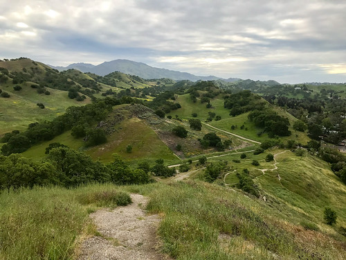
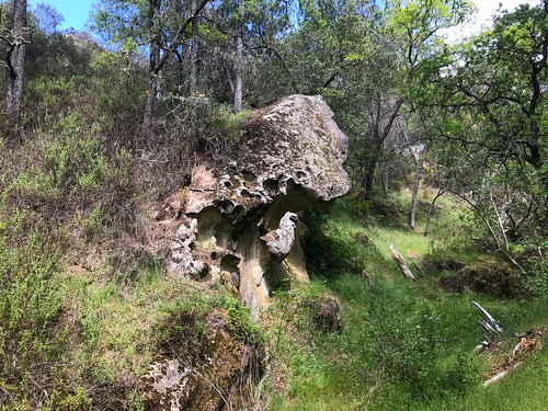
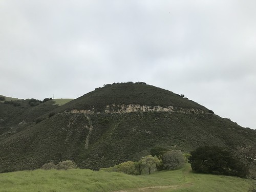
Castle Rock (Mount Diablo)

DATE: Friday, January 29, 2021
DISTANCE: 7.84km / 4.87 miles
ELEVATION GAIN: 267m / 877’
TIME TAKEN: 2:50
SUMMIT: Castle Rock: 296m / 972’
DIABLO FOOTHILLS REGIONAL PARK
MOUNT DIABLO STATE PARK
CONTRA COSTA COUNTY, CA
SOUNDTRACK: Helstar: Dracula’s Castle

PHOTO ALBUM
MAP


FULL HIKE DESCRIPTION COMING SOON!


Saturday, November 14, 2020

The Seven Gates Of Diablo

I wrote most of this, but never finished it, during the pandemic shutdown of 2020. It took me a long time to find the "Seventh Gate" to Diablo (through Lime Ridge), and even longer to write the Lime Ridge trip report that was the final piece of the puzzle. By the time I actually finished the "Seven Gates" article, Mount Diablo State Park had long ago re-opened to cars, and my information was basically useless. But here's the entire guide as it was originally meant to appear. And it's still fun to walk into MDSP from any of these access points! -HMM 5/21/2022

Mount Diablo State Park remains closed to vehicular access, but that doesn't mean you can't get in... you'll just have to walk a little bit. During the Covid-19 lockdown, I've spent a good amount of time exploring the ways to enter Mount Diablo State Park on foot. Just in time for it to get REALLY HOT out there, here is a list of the points I have used to gain access. Once inside the park, you have the ideal situation for social distancing, because barely anyone is there! I would almost say these "seven gates" lead to seven different worlds, because Mount Diablo has so many mirco-climates and micro-regions! Try a few different ones! There are other ways to enter Mount Diablo on foot, but many are within the private gated communities which surround the park on most of the West and South sides. These are the seven entrances that I have personally used.


1. SHARKEY ROAD: NORTHEAST SIDE ACCESS
On New Years Day, before the dreaded plague of Covid-19 was known, I used this entrance because it was closest way to get to Mount Olympia, a sub peak on the north side of the park. There is a small turnout on the south side of Marsh Creek Road, with with room for a few cars. It is about 2.3 miles from the intersection with Clayton Road if you're heading east, and before the Three Springs Staging Area. From this turnout you go through a gate and enter the park on Sharkey Road. From here you can reach many destinations on the north side of the park, or go all the way up to the top if you're feeling so inclined. I reached Mount Olympia that day, and continued on to the North and South summits later, which you can read about in the trip report HERE.
•SHARKEY ROAD LOCATION


2. REGENCY DRIVE OR RIALTO GATE: NORTH SIDE ACCESS
The Regency and Rialto Gates to Mount Diablo have been known since antiquity to cheapskates who want to avoid paying the entrance fee at the Mitchell Canyon entrance. The residents of the neighborhood, naturally got fed up with this, so beware, there is a two hour parking restriction for non residents on weekends. If you park here, respect the neighbors, don't litter, don't be an asshole.  From this entrance, you have easy access to such locations on the north side as Donner Creek, Wild Oat Canyon and Eagle Peak. After the pandemic had begun, I used the Rialto Drive gate as entry point to go see the waterfalls of Wild Oat Canyon, which you can read about HERE.
•REGENCY GATE LOCATION
•RIALTO GATE LOCATION 


3. BLACKHAWK SOCCER FIELD: SOUTH SIDE ACCESS
This one was one of the most inventive and challenging approaches to the park. For those looking for a bit of effort and adventure. You begin at the Blackhawk Soccer Field, on Blackhawk Road. It has a parking lot, but it's gated and closed (due to Covid-19 or always, I don't know). The roads along these exclusive country club communities in that area are uniformly "NO PARKING ANY TIME," and you can't park in the neighborhoods, because they're gated and private. So what to do? Park at Blackhawk Plaza shopping center, and from there, walk or bike (or take an Uber! Whatever!) two miles gently uphill to the soccer field. From there, an old ranch track called Black Sage Road winds it's way up the hill behind the field. This takes you north to the Mount Diablo State Park boundary, goes over a hill, and dumps you at a dirt cul-de-sac at the base of Fossil Ridge. From there, you must scramble up a very brushy hillside which has kind of a trail in it, if you can find it. In a few minutes, you burst from the shrubbery onto South Gate Road, right by the South Gate Main Entrance to the park. From here, you are free to explore one of the most interesting areas of Mount Diablo. Read how I used this entrance to reach Rock City HERE.
•SOCCER FIELD LOCATION

•BLACKHAWK PLAZA LOCATION


4. HOWE HOMESTEAD: ACCESS FROM WALNUT CREEK
This is by far the most preposterous of all my methods of walking into mount Diablo, with about a 4.5 mile walk from Howe Homestead Park in Walnut Creek to the Mount Diablo State Park boundary. It's a quality walk, let me assure you. You are entirely in parkland the whole way, and pass through four other parks before Diablo. The reason that Howe Homestead Park was even on my radar as an approach to Mount Diablo is because it is 1.5 miles from Walnut Creek BART station. I was formulating a carless hike in which I would take BART to Walnut Creek, bike to Howe Homestead, and walk into Diablo from there. You could still use BART for this hike if you want. But there is a free parking lot at Howe which is open from sunrise to sunset. Read about how I used this trailhead to do an epic hike that took me almost 18 miles through the parklands HERE.
•HOWE HOMESTEAD PARK  LOCATION


5. GREEN VALLEY TRAIL: SOUTHWEST ACCESS
During normal times, access to Rock City via Wall Point Road, on Mount Diablo State Park's southwestern edge is easily achieved through the Macedo Ranch Staging Area. But because all vehicular access to Mount Diablo is closed during the Covid-19 pandemic, this is not an option. An alternative? Enter through the Green Valley Trail, an inconceivable right of way that was somehow carved out of the exclusive residential neighborhoods that surround it. As far as I can tell, outsiders are not permitted to park in the upscale enclave near the trailhead. The closest unregulated parking that I could find is on Stone Valley Road, by Monte Vista High School. You then have about a half mile to the trailhead, which you can walk or bike (or take a Lyft! Whatever!). Check out this report about a loop I made from Green Valley, up to Rock City, and back out of the park via Wall Point Road and Emmons Canyon HERE.
•TRAILHEAD LOCATION
•PARKING LOCATION


6. FINLEY ROAD: SOUTHEAST ACCESS

Finley Road, at the north end of Tassajara, can be used as a back door to Mount Diablo State Park or Morgan Territory Regional Preserve. Finley Road ends at a gate, at a private property line, so you have to park about a half mile down the road on a dirt shoulder and walk back to it. Once beyond the gate you can continue on "Old" Finley Road towards Morgan Territory, or hang a left on the Oyster Point Trail, which will lead you into the Black Hills region of Mount Diablo SP. While far from the summit, this secluded corner of the park has charms of it's own: myriad rock outcroppings, oak shaded ravines, and even an inexplicable pine forest! Read the report HERE.  
•TRAILHEAD LOCATION


7. LIME RIDGE: NORTHWEST ACCESS

Lime Ridge Regional Open Space occupies the northwestern corner of Walnut Creek, at the border with Concord. While Lime Ridge is open to the public, of course, the continuation of the journey through to Mount Diablo SP is not, which makes this hike the most questionable of the "Seven Gates Of Diablo." I saw on my Mount Diablo map that dirt roads connected the short distance that separates Lime Ridge Open Space and Mount Diablo State Park. I was not confronted by any human beings getting across the interstitial private land, just tons of cows! Once I made it into MDSP, I used official trails to gain the summit of Black Point. Read the trip report HERE.

Friday, November 13, 2020

Black Point / Lime Ridge

DATE: November 13, 2020
DISTANCE: 19.11km / 11.88 miles
ELEVATION GAIN: 971m / 3186’
TIME TAKEN: 4:38
LIME RIDGE OPEN SPACE
MOUNT DIABO STATE PARK
CONTRA COSTA COUNTY, CA
SOUNDTRACK: Chainsaw Orchestra: Black Point


SUMMITS:
• Lime Ridge High Point: 305m / 1,001’
• Black Point: 546m / 1,791’

PHOTO ALBUM
MAP


"THE SEVEN GATES OF DIABLO" #7


To be honest, even though I was keen to visit Lime Ridge Open Space and Black Point someday, based on their own merits, the true reason for my visit on November Thirteenth was to establish the “seventh gate” to Mount Diablo State Park, the last piece in my project, the Seven Gates Of Diablo: Seven ways to walk into the park from the outside (the park was closed to cars due to the pandemic). Why seven? It just sounded more badass than six. Of all the “seven gates,” this one was the most questionable: Hopping fences and crossing through borderline “private” property, dodging herds of cows, and entering MDSP through a non entrance that is not known to the public whatsoever! If you’re interested in such an adventure, please continue!

I arrived at the Lime Ridge parking lot at Ygnacio Valley Boulevard and Cowell Road, in Concord, at about 7:30AM. The weather was cool, and the sky was grey, but the landscape was just about as dry as could be, having not seen rain since May. I began trekking down the dusty dirt roads that led me into the park. I soon broke off onto dusty trails that wound up into the dusty oaks and parched grass environment that made up Lime Ridge Open Space, and I could see, at first from the tracks, and soon after from the participants, that this was a mountain bike place. And before I knew it, I was dodging them. Everything looked brown and tired and dead, and then Diablo came into view, as it always does. Elevation was gained, and views opened up of the surrounding countryside. There were darker clouds in the distance, suggesting that the long dry season might be about to come to an end.

Within a half hour, I had arrived at my first destination, the Lime Ridge Highpoint, which was crowned by a bench. I wasn’t tired yet, so I didn’t sit, but instead spilled off the south side of the hill to continue towards the park border, following at first, a rustic track through the brush, then the more typical ranch road. Less than an hour in, I was through Lime Ridge Park, and at a private property gate, which I jumped over and continued on my way. I don’t think it was actually private property, just some kind of land reserve that hadn’t been opened to the public yet, or that’s what I told myself to justify it. Now I was in a no-man’s-land of straw colored ranch, nibbled to the stub fearless cows, and toxic green ponds. Some of the cows were blocking the roads I wanted to use, and didn’t seem like they wanted me around, so I actually did some detours into the fields just to avoid them. In less than an hour, it was 9:17 by now, I was through the questionable land tract, and at Mount Diablo State Park’s unceremonious secret back entrance.

I came in on a utility road, which momentarily intersected with Red Road, and less than ten minutes after that, reached the Black Point Trail, which would lead me to my next summit goal. It was here on this winding trail that I saw the only other person of the day in MDSP, a female jogging down the hill. I continued on, until then I had considered it more likely that I would meet a mountain lion than a human, so I guess it was a nice surprise! The trail carried me along and up over the west shoulder of Black Point. With a view out now, I thought I saw some smoke rising from a fire somewhere on the other side of the Oakland Hills… will it ever end? Just before 10AM, I reached Black Point summit, which was marked with a post, and was pretty brushy and unremarkable. But it had a decent view of it’s surroundings: I was able to catch views out to the south, of Olofson Peak, and to Eagle Peak in front of Mount Diablo. In another half hour, I was at the bottom of the trail again, at Red Road, and exited the park the way I had come in. Somehow, on my way back through the cow fields, I took a detour through a woodsy ravine, which would have been rather pleasant in wetter weather. I also captured, photographically, the effect of a hillside divided by a fence, one side cow clipped, one side not.

I had a glance back at Black Point behind me, and then got back into Lime Ridge, on the Paraiso Trail. I took a different way back through Lime Ridge, trying to see the scenery, which consisted of mountain bike chewed trails, blasted hilltops, and weird concrete structures whose presence could not be explained. There was a strange feeling all day, like a tension as the world waited for the first rain of the season finally to come, and it did, not long after. It wasn't much, but it was the beginning. Me, I felt I had gotten away with something, entering Mount Diablo through an obscure entrance that few have ever used, and why would you want to? But that was it: the seventh gate had been passed.

FURTHER READING

Bay Area Hiker: Presents a handy guide to Lime Ridge
Bob Burd: Takes the kids to Black Point
• Lime Ridge on PEAKBAGGER
• Black Point on PEAKBAGGER


Wednesday, May 20, 2020

Windy Point

DATE: Wednesday, May 20, 2020
DISTANCE: 26.54 km / 16.49 miles
ELEVATION GAIN: 910m / 2986 ft.
TIME TAKEN: 7:15
MORGAN TERRITORY REGIONAL PRESERVE
MOUNT DIABLO STATE PARK
CONTRA COSTA COUNTY, CA
SOUNDTRACK: Scorpions: Wind Of Change

SUMMITS:
•Windy Point: 644m / 2112 ft.
•Black Hawk Ridge: 622m / 2040 ft.
•Oyster Point: 642m / 2106 ft.


PHOTO ALBUM
MAP

"SEVEN GATES OF DIABLO" #6


Finley road, at the north end of Tassajara, outside of Livermore, can be used as a back door to Mount Diablo State Park or Morgan Territory Regional Preserve. Finley Road ends at a gate, at a private property line, with no parking right at it. So you have to park about a half mile down the road on a dirt shoulder and walk back to gain entry. Once beyond the gate you can continue on "Old" Finley Road towards Morgan Territory, or hang a left on the Oyster Point Trail, which will lead you into the Black Hills region of Mount Diablo SP. While far from the Diablo summit, this secluded corner of the park has charms of it's own: myriad rock outcroppings, oak shaded ravines, and even an inexplicable forest of Knob-cone Pine!

I figured this would be the last Mount Diablo hike of the season, until the cooling rains of winter arrived. It was about to get 'ot! Bloody 'ot! And while I don't mind hiking in the heat (a good way to sweat out the toxins!), getting up really early to avoid the worst sun of the day can be fun, I have personal transportation and fat government checks rolling in to subsidize my whimsical outdoor lifestyle, so for me, the coming heat of the Bay Area inland valleys signaled a time to focus my attention on the Sierras, and other cooler, breezier places. But before we go up there, let's have the last Diablo hike of spring 2020! This was a continuation of my Mount Diablo State Park exploration which had been ongoing during the Covid-19 pandemic. I was looking for all the ways to walk into the park from the outside, the entrances were all closed to motor vehicles. This was entry point number six.  Finley Road entrance doesn't start you off in MDSP, or even the adjacent Morgan Territory, but it gives you access to both, an isolated backdoor. In fact, it's one of the most obscure of all entrances to Mount Diablo, being over five miles as the crow flies from the summit.

My hike began about 10AM, walking up the pastoral country road from the turnout down Finley. It was less than ten minutes to walk to the gate, ten more minutes on the road through private estates, and I was at the boundary of Morgan Territory. Two notable features after this were a washed out section of road, and a dilapidated old house. I can just read the real estate listing now! Scenic location! Filled with air and light! Bring your contractor and make your dream a reality! Turned left on Oyster Point Trail, which brought me to the MDSP boundary in six more minutes. Oyster Point Trail follows along a forested hillside of the ridge that contains Oyster Point, it felt a little bit wild, rustic, no people around at all. As I gained some elevation, I could see out at Marsh Benchmark to the east (previous hike), and north to the extensive rock formations that characterize this remote corner of the park. As always, I took note of El Diablo's first appearance. By 11:32 AM, Oyster Point Trail dumped me out of the woods, and into an open meadow, where an easy to miss signpost was not missed, and it directed me up to the summit of Oyster Point. The trail is faint and lightly used, but I was able to find my way up to what I determined was the actual high point, and also the placemark stick by 11:48AM. Back down, back along the trail. I was headed for Black Hawk Ridge now.

Oyster Point Trail continued west from the meadow, down and up and down through two creekbeds and through another semi-wild, woodsy area, where I encountered a lone mountain biker. I was dismayed to see some unsightly high tension power lines cutting directly through one of the most elegant rocky sections. Like an almost national park level of geological splendor, and THIS is how they choose to embellish it? "Where should we put these fucking power lines? How about right here, directly through these rocks? OK! Looks good to me!" I consoled myself thinking that someday, the power lines would be gone, and the rocks would still be there for millions more years. After this, I reached a five way intersection crossroads, and turned south. Up to the Blackhawk Ridge, which is rather open, and gave me a good view back to Oyster Point. Following the top of the ridge, I found the exact high point of Blackhawk, which is a small rock monolith. Continuing along the ridgetop,  I caught a gimpse of my future destination, Windy Point. I chose to walk down the trail to the far west end of Blackhawk Ridge, and then loop back on a lower trail, so I could see a bit more of the park. The lower trail brought me east, back to the five way intersection. I now turned north, and soon split off of the fire / service road (that leads to access the power lines), on a single track trail that leads into an area colloquially known as "José's World." This is the heart of the rock formations of the Black Hills area. I sat down upon one of them, and finally ate lunch. Then half-heartedly looked for a path through the brush and boulders that would bring me to the area high point known as "Knob Point." But I soon decided to save it for another day. I still had a long path ahead of me.

José's World Trail cut through from one fire road to another, and I popped out on the next east/west trajectory, first turning west (left) to have a look at Balancing Rock. It was now 2PM. Then I went back east on the fire road, past José's World, continuing to a private property gate. I took the ranch/fire road through the mostly open fields to the base of Windy Point. It was only just before I reach W.P. that I officially re-entered MDSP again. Windy Point was reached by cutting uphill from the road, through the grass, to yet another oak and rock crowned East Bay hilltop. But it wasn't just any East Bay Hill. Rush fans take note, the summit of the hill has an elevation of 2112'! Maybe now you know the real reason I wanted to climb it! Windy Point lorded over the area, and gave me another view out to Marsh Benchmark, and beyond.  It was now 3:09PM, and I had completed my agenda of features to visit for the day, so it was down, down, down the ranch roads, down the Tasajara Creek watershed. I took a break at a cow pond, which, unusually, had a name: Bob's Pond. Tassajara Creek Trail was a nice woodsy path that was in the oaken shade of the canyon. By 4:50PM, I had rejoined Finley Road, and was headed back through that corner of Morgan Territory, back past the abandoned homestead, back through the gate, back to the van. It had ended up being a long day, about 7.5 hours going 16.5 miles. I stopped at the grocery store on the way home and bought ingredients for the lasagna.

FURTHER READING
•Hiking Project:
Some info on Oyster Point Trail

•Bob Burd:
Bob handles Windy Point and Blackhawk Ridge in an efficient manner


Thursday, May 14, 2020

Wall Point

DATE: Thursday, May 14, 2020
DISTANCE: 13.98km / 8.69 miles
ELEVATION GAIN: 532m / 1746 feet
TIME TAKEN: 7:01 hours
SUMMIT: Wall Point 488+ m / 1600+ ft
MOUNT DIABLO STATE PARK
CONTRA COSTA COUNTY CA


Mount Diablo State Park is still closed to vehicle access, so here is another one for my "Seven Gates Of Diablo" project. Trying out many different ways to park outside somwhere and walk in. My research led me to this hike, another good option for approaching the Rock City area.

Unusually, Amber came to visit me in Oakland, instead of me going to San Jose to visit her, so I took her on a hike in my neck of the woods. Mount Diablo! Am I getting sick of it yet? No! Honestly going to different parts of Mount Diablo is going to different landscapes, different microclimates, almost like going to different worlds. With the Macedo Rancho Staging Area parking lot closed, I would have to implement one of my park and hike and bike schemes to gain this entrance to the park. We drove out to the affluent suburb of Alamo, and first, scouted out the Green Valley Trailhead by car, which is in a semi "private" residential enclave, parking along the roadside limited and restricted, and I don't know how  seriously they take that. Not wanting to risk a ticket or tow, I proceeded with the original park and bike and hike plan. I dropped Amber off at the trailhead, and drove back to park on Stone Valley Road by Monte Vista High School, the closest unregulated parking that I had found in my research. I pulled my bicycle from the cargo hold, sped down the road, and was back at the trailhead in about five minutes. I locked the bike to something, and we proceeded east along the Green Valley Trail, an improbably slice of public access through a very private area. I wondered aloud how it even came to exist.

The trail wasted no time in crossing two excellent footbridges, which I duly documented. Past the final suburban cul-de-sac, we burst out into the fields and oak meadows, the green grass of spring beginning to crisp golden by this time of year. The trail was never far from the colony of luxury homes at the edge of Alamo, and it brought us within sight of one of the most preposterous Xanadu mansion I have ever seen. I actually recalled reading about this notorious house the news. After this, there was another strange moment when the trail went right through the garden of another wealthy estate. They could have easily made the trail go around it, but they for some reason directed through the garden, with two gates, and improbably tolerate hikers crossing the property. It wasn't too long after this that we Mount Diablo State Park boundary, and turned up the Summit Trail, up Dan Cook Canyon. Here, the luxury estates were finally left behind, replaced by increasingly large rock outcrops. The Summit Trail (a fire road, actually) was a steadily incline that eventually fed us right into Live Oak Campground, where we admired some of the campsites. Then I gave Amber a tour of Rock City, which was still fairly fresh in my mind from last time. We walked around through the various rock features, which as a fan of Pinnacles National Park, I though she would enjoy. (Mini-ccles?)

It was pretty quiet out there, people-wise, but not abandoned, and we claimed out own rock to have a little picnic on top of. The rain teased a bit, but did not follow through. After lunch, we went up to Sentinel Rock, which was her favorite. We didn't have all day, so then we headed out, down Wall Point Road, which was new to me, and provided a different view of Sentinel Rock. Wall Point is a fire road that slopes gently downhill, and carried us west, back to the edge of the park. I made sure to stop off and tag the summit feature, yet another oak and rock studded East Bay hilltop, Wall Point. The rocky outcrop features typical of the area continued as we descended, giving us something to look at. We took a left turn at Emmons Canyon Road, which led south to the Mount Diablo State Park boundary, back into the "private" neighborhoods. The rest was just a street walk, through a neighborhood, back to Green Valley Trail, bike back to the van, van back to the trailhead, pick up Amber, van back to Oakland, Amber back to San Jose, and a good day to you all.

FURTHER READING
•Alltrails: This is almost exactly what we did
•Redwood Hikes: Another account of basically the same loop. Great big photos. 


Monday, April 20, 2020

China Wall

DATE: Monday, April 20, 2020
DISTANCE: 28.92km / 17.97 miles
ELEVATION GAIN: 1,045m / 3430 ft.
TIME TAKEN: 7:52

HOWE HOMESTEAD PARK
SHELL RIDGE OPEN SPACE
DIABLO FOOTHILLS REGIONAL PARK
CASTLE ROCK RECREATIONAL AREA
MOUNT DIABLO STATE PARK
CONTRA COSTA COUNTY, CA

SOUNDTRACK: Ramones: Chinese Rock

SUMMITS:
•Quarry Hill: 152m / 500'
•Fossil Hill: 128m / 420’
•Shell Ridge: 270m / 885’
•“Stonegate Hill” 238m+ / 780’+
•China Wall High Point 325m / 1066’

PHOTO ALBUM
MAP

"THE SEVEN GATES OF DIABLO" #4


4:20. The high holiday of the stoner realm. I, as usual, would not smoke any pot this day. Oh, to be contrarian. I guess I felt kind of bad for all those poor stoners who would have to smoke all alone today, quarantined, instead of in a merry circle, together outdoors in the park, like they usually do. My only contribution to the cannabis culture continuum was to accidentally walk up a hill that was 420 feet above sea level. I didn't accidentally walk up it, but is was accidentally 420 feet.

I began my rambling journey, which would cover almost eighteen miles and eight hours, shortly after 7AM. I had just hit the Danville Smart & Final, and had the back of the van loaded with toilet paper, paper towels and a giant jar of pickles, which in Coronavirus times, felt like winning the  lottery. Pandemic capitalism produces some strange winners, doesn’t it? Oh, to spend my meager cash, whenever I want, on whatever I want, and call it FREEDOM! 

Howe Homestead Park
As I set out on the trail, I actually wasn’t feeling that great, (little sleep, slight hangover) as I had gotten quite drunk “with” my girlfriend on FaceTime last night. I groggily set out from the parking lot of Howe Homestead Park in Walnut Creek, the westernmost extremity of the the blob of conjoined parkland that stretches east, seventeen miles to Mount Diablo, Morgan Territory and eventually Round Valley. If they could somehow connect this superpark to Black Diamond Mines Regional Presrve, through additional property acquisition, it would really be something! Bigger than some European countries! I’d had my eyes on Howe Homestead Park for awhile already, as a potential starting point for a carless hike. It is merely a 1.5 mile walk or bike from Walnut Creek BART station, and then you’re at the doorstep of a whole world of regional parks and preserves. BART was not on the table during this time, but luckily, I have a vehicle, and Howe Homestead has a free parking lot, open from sunrise to sunset every day. 


Looking down from Summit Ridge

Anyway, I was off, into the first of five different park jurisdictions I would pass through that day. I intended to explore the area, which I'd never visited before, and go up some of the various hills and rock features, and ultimately make it out to Castle Rock, a massive and mysterious protrusion at the western edge of Mount Diablo State Park. The Kovar Trail led up and out of what looked like a community garden, up into the oak studded grassy hills that would define the landscape for most of the day's rambling. It was cloudy and cool, perfect hiking weather, and it wasn't much climbing before I could see out above the suburban homes for views of Shell Ridge and Mount Diablo.  

Shell Ridge high point (center right)
The first elevation destination was Fossil Hill, which doesn't really have a trail up to it, but still an easy walkup. Crowned with small rock outcroppings and some bushes, it provided a vantage point of the immediate area, mostly other low hills. Back down into the valley, there were lots of flowers out, especially these yellow ones. Luckily I'm not allergic to them, because they're everywhere! I followed the Indian Creek Trail through most of the long valley between Shell Ridge and Joaquin Ridge, and it's a nice backstreet alternative to the Briones-Diablo Regional Trail, which is like the hiking freeway through the region. I moved east and then north to check out a feature called Haystack Hill, but the perimeter of it was surrounded by an "electric" fence! It didn't look electrified at all, it looked like it was made out of string. I grew up in the country, and I know what electric fences look like! But maybe they've found a way to make them out of string now. I didn't try my luck invading the boundary of Haystack Hill, and immediately progressed south to the Ridge Top Trail, and took it up to the high point of Shell Ridge, the dominant feature of that area. The summit was mostly grassy, and slightly rocky, with an empty Gatorade bottle thrown in for good measure. The high point of Shell Ridge is at the southeast end of it. The entire Ridgeline can be traversed via the Ridge Top Trail, I should do that sometime.

China Wall formation
I veered south from that point, through an area of stagnant cattle ponds, and walked around a lightly forested protrusion called Old Man's Hill. I didn't see anything close to a trail going up it on from any side, and in my tired, hungover, paranoid state at the time, I thought the tall grass would be full of ticks, so I didn't go up. But while in the area, I saw a really cool looking pointy hill, which turned out to be accessible from the Stonegate Trail. For the purposes of my writing, I shall call it "Stonegate Hill."  (Or "Stoned-Gate", for 4:20?) At the top of this pointy hill, I took my first snack and water break of the day, and diligently checked my socks and lower legs for vampire spiders. From here, I continued southeast, through more open oak meadows, through Castle Rock Regional Recreation Area (which Castle Rock is not even in) to the border of Mount Diablo State Park. At the fence here, I took a hard right and went up along it to the high point of the China Wall area. On the way up, I passed by some fascinating geological features, and a herd of cows that ran away when I got close (Don't worry cows! I don't like beef!) The hilltop was nice, and it turned out to be my major summit achievement of the day, but the real feature of China Wall, from which it gets it name, is just to the east, where a spine of bizarre rock formations undulates linearly up and down the hillsides and through the valley.

Rock formations along Sunset Trail

Over the wall, my journey now took me on an inefficient S-curve, from Briones-Diablo Road, to the Little Yosemite Trail. One last nasty aside here, this Little Yosemite is the second place in the Bay Area that I've been to that looks NOTHING like Yosemite. Not even a little. So maybe be a bit more careful before you throw that name around? Lil' Yos' took me to Stage Road and a picnic area, where I turned east, along the healthy flowing, and lushly vegetated Pine Creek. An uphill move on the Sunset Trail led up a steep gulch, past some torturous rock formations, signs of things to come at Castle Rock! Excitement was building. But when I topped out at Falcon Road, I was smacked in the face with a sign saying that Castle Rock is closed from February through July each year for the Peregrine Falcon nesting sites! Strangely  enough, this was not the first time I had been denied access to a place called Castle Rock due to Peregrine Falcon nesting! So what we learned today is that Peregrine Falcons LOVE castle rocks.

With no reasonable way to proceed, unable to form a loop through Castle Rock as I intended, I was forced to retrace my steps back down the Sunset Trail to Stage Road, where I had a sad snack lunch in the picnic area. I saw that I had approached Castle Rock in the EXACTLY WRONG way so as to miss ALL the signs saying it was closed.  At this point, I had already walked thirteen miles from the van, and was hoping I could take a more direct way back! Boosted by a caffeine and sugar laden tea drink, I then hightailed up the Buckeye Ravine Trail, stopping only for a glance back at my failed objective, the majestic Castle Rock formation. After this, I mostly stuck to the Briones-Diablo Freeway, which got me back to the van in just under five miles, much more direct than the circuitous ramblings of the morning. I didn't make it to my main objective for the day, but I saw some other cool stuff, and explored a vast swath of territory I'd never seen before. Not making it to Castle Rock just gives me a reason to return, and it's great to have a reason to come back here.

ON PEAK NAMES
"Stonegate Hill" I picked this nickname for it because it doesn't have a name on the map, and it's by the Stonegate Trail. To me, it's a hill worthy of a name
China Wall Is this racist by today's standards? Is China Hill cancelled?

FURTHER READING
•East Bay Trails: Information, photos and video of Shell Ridge
•SF Gate: Shell Ridge
•BA Hiker: China Wall and Diablo Foothills Regional Park
•East Bay Hill People: China Wall


Sunday, April 12, 2020

Rock City

SUNDAY, APRIL 12, 2020 (Easter Sunday)
HIKE: 13.5km / 8.4 miles
BIKE: 6.44km / 4 miles
ELEVATION GAIN: 496m / 1626 ft.
TIME TAKEN: 6:47
SUMMIT: Fossil Ridge 549m / 1800ft.
MOUNT DIABLO STATE PARK
CONTRA COSTA COUNTY, CA
SOUNDTRACK: RIOT: ROCK CITY

PHOTO ALBUM
MAP

"THE SEVEN GATES OF DIABLO" #3


Yes, another Covid quarantine hike! What better place to quarantine than the outdoors? Does that even make any sense? Alex hit me to go for a hike over the weekend, which I’ve been trying to avoid, because there are still a lot more people out over the weekends. But I can’t say no to the lad! He also invited our other brother Axell, who also brought his dog, so now we were REALLY breaking the law! But no ill came of it. Mount Diablo was still closed to vehicular access, due to the coronavirus pandemic. I was formulating a new approach to the park from the south side, based on maps and satellite imagery that I had been studying in my voluminous free time. I wanted to visit the south side of the park, because I had only been visiting the north for there past few years, my only south side venture having been to Rock City, in February of 2017, and that’s where we would return today.

The point of entry was Black Sage Road, which leads north from behind Blackhawk Soccer Field, on Blackhawk Road. Maybe sometimes this parking lot is open, and can be used to access the trailhead, but the soccer field and it’s parking lot were closed, as I had anticipated. We did a drive by to confirm this, then went through with the plan: dropped Axell and the dog off at the parking lot gate, Alex and I continued down the road to Blackhawk Plaza shopping center, where we ditched the van. There is absolutely no street parking on Blackhawk Road, or any of the adjacent neighborhoods, which are ultra exclusive gated country club communities. We extracted our bikes from the back of the van, and rode the two miles, gentle uphill, back to the soccer field and the waiting boy and his dog. Locked the bikes there and started on the trail.

The brushy hillside to climb up to South Gate Road

Black Sage Road looks to never be driven (I don’t even know why it exists, it doesn’t really go anywhere) and not hiked recently. That last idea could be an illusion, maybe it was hiked yesterday, but the spring grass is growing fast and tall this time of year. But this is far from a well worn trail. At this point, the sky was uniformly gray, the air still cool. We took the grassy path across the rolling hills, crossed the border into Mount Diablo State Park, up and over hill 1461’. From here, there were views of Black Hawk Ridge, Devil’s Slide, and Fossil Ridge ahead.  Zuma the dog was having a blast, finally liberated from the prison of San Francisco. Black Sage Road culminated in a dirt cul-de-sac at the base of a brush covered hillside. My plan was to hope for a trail, or something close to one, going up this hillside, connecting with South Gate Road, one of Mount Diablo’s main entrances. At first we didn’t find one, and I thought we were in for a nasty bushwhack, but it got better, a semi-trail emerged through the brittle, pungent bushes, and we soon crawled out onto the road.

Yes, the park is closed to vehicular access right now, but still open to pedestrians and cyclists, and two cyclists passed by on the road within 30 seconds. It must be nice for them to have a car free park! But I am so conditioned to trying to stay off the roads, away from cars, that I almost immediately had the team storming, off trail, up a grassy hillside to the crest of Fossil Ridge. The bros rolled their eyes as I searched for the exact high point of the hill. Zuma chased after a flock of wild turkeys. After this, it was into Rock City, which my hiking companions had never been to before. There were a handful of mountain bikers around, and a few hikers who had walked all in the way in from outside somewhere, like we had.

Checking out the sandstone caves

By now, the clouds were parting, and the Mount Diablo had come out. In the warm afternoon sun, we enjoyed some drinks and snacks on a big rock, then explored around, scrambling on the open stone, like the days of our childhood back in the Sierras. Up Sentinel Rock, into some of the little caves, looped  around on the Summit Trail, through Live Oak Campground, out to the Artist Point area, made a choice to form a big loop out of the whole thing by leaving the park via Madrone Canyon Trail and Sycamore Creek.

The Madrone Canyon Trail took us into a shady, wooded area, and soon there was another large rock outcropping on our right: even though we were trying to leave, we couldn't resist another scramble. It turned out to be even cooler than anything in Rock City. I looked at the map and saw it was called Boyscout Rocks. Ugh. We unanimously agreed that we would call it the “Temples Of Syrinx” from now on. After scrambling on these rocks for a half hour, we finally got ready to leave the park, again. Down Madrone Canyon, onto Sycamore Creek Road, through the rocky gateway between Black Hawk and Fossil Ridges, Devil's Slide, which we had observed from above earlier in the day. When we got to the state park border, there was a private property / no trespassing sign. We would have to walk back through a private gated county club estate to get back to the main road! And we did, and no one fucked with us. But I cannot recommend walking through this neighborhood as part of your hike. In order to get out of the estate, and back to our point of origin at the soccer field much more quickly, we went down a street that dead ended at a locked gate and a garden wall. We climbed over the wall and handed the dog over the top too, feeling again like the mischievous youth that we once were.


FURTHER READING
(I wish I had more for you here, but most internet articles pertaining to this area are oriented towards families, roped climbers and mountain bikers)  
•Mount Diablo Interpretive Association: Guide To Mount Diablo Geology
•Bhilburn: Summit Trail To Rock City
•The Outbound: Rock City


Tuesday, April 7, 2020

Donner Falls

DATE: Tuesday, April 7, 2020
DISTANCE: 6.39 miles
ELEVATION GAIN: 1500 ft.
TIME TAKEN: 4:09
MOUNT DIABLO STATE PARK
CONTRA COSTA COUNTY, CA
SOUNDTRACK: C.O.C.: Canyon Man

Donner Falls Previously Visited
• February 17, 2019
• January 1, 2020 

PHOTO ALBUM
MAP

"THE SEVEN GATES OF DIABLO" #2


It’s hard to keep a regular schedule under Coronavirus lockdown (not that I really had one before). No work, no band practice, no good reason to ever stay up late or get up early, no schedule… but today was ridiculous! I went to bed at midnight, and woke up at 2AM, unable to get back to sleep. I lay there, staring into the void until six, then decided I might as well get up and go for a hike. I had been itching to get out to Murrieta Falls in the Ohlone Regional Wilderness, because the last few days of rain had been decent, and they might be the last of the season for all I know. But what I had working against me was that Lake Del Valle near the trailhead was closed to the public, which would add something like an extra eight miles to the hike, and I didn’t even have a wilderness permit. So I decided to give up on that (maybe next year?) and take another stab at finding my way into the upper part of Wild Oat Canyon / Donner Falls on Mount Diablo.

 Donner Canyon Road, very muddy


I jumped in the van, drove out there, and was parked by the Rialto Drive gate before 7:30 AM. Because Mount Diablo State park is closed to vehicular access, due to the Coronavirus Pandemic, parking outside the neighborhood outside was a must, and conveniently, the Rialto Gate is closest to the waterfalls. TAKE NOTE: There is a two hour restriction on parking in this residential neighborhood on weekends. Through the entrance, and into the green spring grass I went, at 7:31 AM, and by 7:38 I was making my first crossing of Donner Creek. The park was lush, green, quiet, and devoid of human animals. It was a spectacular California spring morning. The weekend of rain had muddied up the roads quite nicely. Soon enough I was off the fire road, and onto Middle Trail, which was less muddy, but a more primitive environment. Wild turkeys and jackrabbits were about. Next it was onto the Falls Trail, and I could hear a dull roar in the distance of cascading water. There was a nice view out to some protruding volcanic rock across the canyon that I had never really noticed before, framed in by cascades of vegetation. The sun had yet to fully clear the rim of the canyon, so I was half in shadow as I made my way in. Going counterclockwise on the Waterfall Loop, I came to the first two minor waterfalls on my left. Light began shining in past the unnamed western shoulder of Mount Olympia above,  (I mistakenly thought this WAS Mount Olympia at first.) and by now I had gained enough elevation at the head of the canyon to have a look back to Clayton Valley and the hills beyond, illuminated in their vernal splendor.

The first major waterfall was soon sighted, as it pours out through a dramatic cleft in the volcanic rock. I came around the bend, and was soon behind this falls, and here is a picture of where the creek pours through that rock cleft and over the edge. A few more minutes and I came to a hairpin turn in the trail, which marked the arrival at the main fork of Donner Creek, and my signal to turn right on a steep, muddy hillside that barely looked like a trail. I had never successfully identified this turn until today, after two previous attempts in the past. Once up past the steep dirt slide, it looks like a trail again, albeit an unofficial one, and It brought me up right alongside upper Donner Creek Falls, which is barely visible from the main trail. Climbing a bit more, I was able to see that there is a single higher waterfall, which pours down into a double, lower one. Next to the big upper one is a sculpted, shallow rock cave. This was as far as the trail took me, but I had been itching for some rock scrambling, and I wanted to check out the volcanic crags that marched up the canyon.

Looking down the canyon again, higher up, Eagle peak in the distance

I walked across the top of the lower falls, past the grotto, and climbed up unadvisable steep hillside that was composed of loose, damp, volcanic rock. I had to pull myself up by a tree root; to my left, I noted a much easier looking way that I could use to come back down. Now I was up in the rocky dreamscape of the canyon. There were faint use trails here and there, from humans or animals, and I wandered around, trying to see if there was yet an even higher waterfall above. I didn’t find one, but I had a good time looking around. I came back down the same way, only to find that my escape route was actually too steep for me to descend safely. Whoops. I had to wander around for another half hour looking for an easier way down. Finally free from the treacherous maze of rocks above, and back on the main trail, I took a moment to eat breakfast.

Clayton Oaks Road

Continuing the loop of the Falls Trail, there were swell views back back at the cascades where I’d been. On the way back out, I took some pictures of the blooming wildflowers, with the intention of expanding my botanical knowledge by identifying them at home. I took a few trails I’d never been to before to get back to the gate: Wasserman Trail to Bruce Lee Spring Trail to Canyon Oaks Road. And that was it! I did not cross paths with a single other person on the trail that day, a successful social isolation hike. I saw two people in the distance on another trail, and I heard voices, but I never saw the source from whence they came. A fine day indeed, I felt a little crazy, but it was probably from the only two hours of sleep I got.

FURTHER READING
Gambolin’ Man: He did just about the same thing I did, but describes it like a true poet. ALSO! I was under the impression that the Native name for Mount Diablo had been lost to time, because the natives were killed off before their name could be learned. But Gambolin has the answer! (Called “Tuyshtak” long ago by Ohlone people, meaning “at the day”)
Bay Area Hiker: Description of the Waterfall Loop hike. Good info.
•Nor Cal Hiker: Another take on the Waterfall Loop hike.