Showing posts with label EBRPD. Show all posts

Saturday, May 23, 2020

Pleasanton Ridge

DATE: Saturday, May 23, 2020
DISTANCE: 16.35km /  10.16 miles
ELEVATION GAIN: 579m / 1898 ft.
TIME TAKEN: 4:18
SUMMIT: Pleasanton Ridge High Point: 1,629 ft.
PLEASANTON RIDGE REGIONAL PARK
ALAMEDA COUNTY, CA

SOUNDTRACK: Ramones: Pleasant Dreams


PHOTO ALBUM
MAP


A few days prior to this, I had considered my 16 mile outing in the hinterlands of Mount Diablo to be my last hike of the season in the East Bay Hills, which were increasingly getting warmer and drier. It was time to focus some attention on the Sierra Nevada now!  But out of the blue, an old friend hit me up to go on a hike in Sunol Regional Wilderness. In spite of the fact that it was a pretty hot day, we weren’t getting an early start, and  it was also a Saturday (I usually avoid going out on the weekends at any cost, since I can pretty much hike any day I choose, unemployment has it’s benefits!), I readily agreed to meet up with Bryce so I could catch up with the old buddy and talk music, life, etc.

I tried to meet Bryce at the Sunol parking lot, at the appointed time, but even before I got there, I knew this would be a no go. Even Welsh Creek Road, on the approach, was jammed with cars, trying to turn around and get out, not one parking space in sight. When I got to the gate of Sunol, there was a prominent sign reading “Parking Lot Full,” and I believed it. Just then, I saw Bryce driving out, and he kind of shrugged. We pulled over at a turnout together, back down the road, to consult,  and I suggested Pleasanton Ridge instead. I had never been there before, but it was on my local hit list. This turned out to be a good choice, as we pulled into the Foothill Staging Area, we saw the parking lot was not even half full. Not bad for a beautiful Saturday in late May.

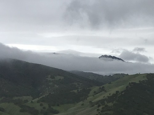
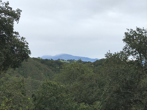
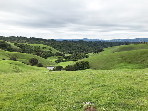
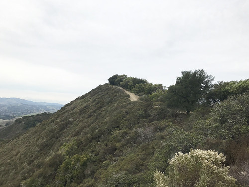
We took off uphill, on a meandering course that began with the Woodland Trail. No particular goal in mind, but I was angling to get to the high point of the ridge if possible. It was typical California rolling hill country, turning from green to brown at this time of year, cowshit country, the beasts were about. But there was a nice breeze and some especially majestic oaks. It wasn’t long before a view opened up to south to Maguire Peaks and Mission Peak. We turned north, and cruised the ridgetop. To our left, the higher, but privately owned,  Sunol Ridge beckoned for some future trespassing. Most of the park seems to be double trails, a ranch/fire road and a complimentary single track trail (or trails) that go alongside it, or weave around near it. We used both of these options alternately as they suited us.

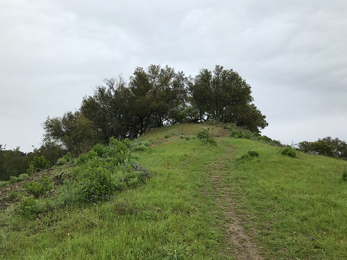
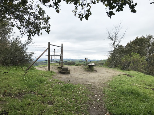
Continuing north on the Thermalito Trail eventually joined us up with the Ridgeline Trail, on which also continued north, through the area which temporarily becomes Augustine Bernal City Of Pleasanton Park. Once through the enclave, you are back in PRRP. Much to my delight, the high point of the the Pleasanton Ridge formation was found, almost by accident. But then verified by smartphone of course. There was a bench, a water tank, and a ton of ducks for some reason. Also, what are these strange little monuments? We took a different was back to the parking lot, creating a sort of grand loop out of the  Ridgeline, Meadow and Sycamore Grove trails. A nice afternoon outside. And bear in mind, friends out there, if you ask me to go for a hike with you, I probably won’t say no. Unless I am already on a hike.

FURTHER READING
BA Hiker: Some general info in PRRP
Redwood Hikes: Big pictures and a little info
Bob Burd: Bob visit the Pleasanton Ridge highpoint


Saturday, April 4, 2020

Round Valley Hill

DATE: Saturday, April 4, 2020
DISTANCE: 5.35 miles
ELEVATION GAIN: 1118 ft.
TIME TAKEN: 1:46
SUMMIT: Round Valley Hill (1,200 ft.)
ROUND VALLEY REGIONAL PRESERVE
CONTRA COSTA COUNTY, CA

SOUNDTRACK: Ratt: Round And Round

PHOTO ALBUM 
MAP


Up at 5:30AM, with two goals in mind: explore one of the East Bay Regional Parks on the far periphery, and in the process, get much needed provisions from a suburban grocery store, which might not be as "crazy" as the ones in Oakland are right now. The grocery thing worked out, rolling into a suburban strip mall supermarket in Brentwood at 7:15 AM was a pretty relaxed environment, compared the Covid Chaos back in Oakland.

Into the cow clipped hills

I was hoping that Round Valley Regional Preserve might be well abandoned when I got there at 8:15 AM, with a forecast of rain, but that was not to be. I don't know if it matters anymore that it's a Saturday. Nothing makes sense anymore! But there I was at the trailhead, and I chose to be part of the problem, not part of the solution. At least I was hiking alone, unlike some people.  I crossed the bridge and started the main loop, going clockwise on the Hardy Canyon Trail. I guess EVERYONE must do that loop COUNTER clockwise, because I had at least ten fucking trail runners rushing at my face within the first ten minutes. But Round Valley has one advantage for the age of social distance hiking, most trails are doubled or even tripled, a ranch road and one or sometimes even two singe track footpaths / cowpaths all going the same way. So if someone is coming near, you can usually take a different, parallel trail. And go hang out with the cows, because there are lots and lots of cows.  The runners tapered off a bit, and a cold wind picked up, as the trail climbed out of Hardy Canyon and up to the saddle next to Round Valley Hill. I cut north on an unofficial trail that led to the top. It was studded with some graceful oak trees and a few rock outcroppings, one of which was the highpoint. Rain had threatened since I started hiking, but never got beyond some scattered sprinkles. From the top of the hill, there was a pretty good view of the surroundings. Clouds shrouded Mount Diablo and Morgan Territory, and distant, ethereal sunlight illuminated the San Joaquin Valley. Socially distanced at last.

Mount Diablo makes a brief appearance

Down off the hilltop, there were more hikers and runners about, and Mount Diablo made a brief appearance. I took a side trail to some mini cave rocks.  Then kept going, down to the head of Round Valley proper. I had considered making a loop through the valley out there, just to check it out, but I wasn't feeling it. I chose to be part of the solution instead of the problem, and leave. So I continued on the Miwok Trail, along Round Valley Creek for most of it, and this dumped me back at my point of origin, which is a large parking lot, almost half full. Fat raindrops began to splatter on the windsheild as I started the van, so I guess I made the right choice! Back home to be completely socially isolated! I should return to Round Valley sometime when I have more patience, and less paranoia.

FURTHER READING
• Redwood Hikes (they say YES, most people do the loop counterclockwise)
• BA Hiker (another take on the same trail)

Map background by EBRPD

Wednesday, March 18, 2020

Briones Peaks Loop

https://hikingmetalmaniac.blogspot.com/p/carless-hikes.htmlDATE: Wednesday, March 18, 2020
DISTANCE ON FOOT: 11.34 miles
DISTANCE ON BIKE: 3.26 miles
ELEVATION GAIN: 2544
TIME TAKEN ON LOOP HIKE: 4:19 hours
BRIONES REGIONAL PARK
CONTRA COSTA COUNTY, CA


SUMMITS
Briones Peak: 1,483 ft.
Table Top: 1,433 ft.
Mott Peak: 1,424
Russell Peak: 1,357


PHOTO ALBUM
MAP 1
MAP 2


In my perpetual analysis of the green blobs which stud the hinterlands on maps of the Bay Area, Briones Regional Park was a standout. Almost as large as Mount Diablo State Park, apparently, but mysterious. Sprawling. Impenetrable? The darkwild heart of the north-central East Bay. What was in that blob? Cursory research revealed disappointing details: A barren landscape of sunbaked hills, slathered in cow shit and infested with mountain bikers. It did not go to the top of my list. Years passed, and over time, my curiosity grew. Better reports came in of the astounding natural beauty, wild isolation, and if nothing else, fantastic views of Mount Diablo!  Of course I would have to visit Briones someday.  

Briones Regional Park was once part of Rancho Boca de la Canada de Pinole. In the 1850s and 1860s, the area was developed into rich orchards and vineyards, and cattle ranching was, and still remains, an industry. In 1957 Contra Costa County and the East Bay Municipal Utility District agreed to a land conveyance that established a large open space park in the Bear Creek watershed to be called Briones. In 1964, when portions of Contra Costa County were annexed to the East Bay Regional Park District, the County and the Park District agreed to a transfer of county land to the Park District, with the District to carry out additional land acquisition. Since 1966, watershed lands and other acquisitions have combined to form today’s parkland.

First sighting of Diablo

Preferring to always plunge right into the deep end instead of daintily testing the waters, I planned out an almost eleven mile loop excursion through Briones, which would take me to the four named summits within, as well as the only waterfall. To inject additional spice, I decided to make it a carless hike, utilizing BART and bike to get from my doorstep to the trailhead. Here's what I did:

1. Took BART from my home base of MacArthur Station in Oakland to Lafayette Station, three stops to the east. This takes 13 minutes and costs $3.10

2. Rode my bicycle from Lafayette Station up Happy Valley Road to it's intersection with Panorama Drive. 1.36 miles with 174 feet elevation gain.

3. I had to walk my rickety single speed punk bike up the hill of Panorama Drive. If you have a decent road or mountain bike with GEARS, you could probably ride up. It gains 438 feet of elevation in .54 miles. When I got to the park boundary, I locked my bike to a tree, and continued on foot.

4. THE HIKE: 10.8 mile loop through Briones Regional Park.

5. Biking back down Panorama Drive was quite fun, as it's all steep downhill. Functioning brakes recommended. Continuing on Happy Valley back to the BART station is not bad, though the road has no shoulder in some places, forcing you to share the right of way with a steady stream of white BMW SUVs.


Russel Peak

THE HIKE: I locked up my bike and got on with the real hiking part just before 10AM. I intended to start earlier, but I had spent the early morning wrestling with California's unemployment insurance website. But now for the freedom of the trail! The air was cool and the sky was overcast for the entire day, threatening rain, but barely ever following through. I started off on the Mariposa Trail, which is the spur that connects with Lafayette's road system. Mount Diablo immediately peaked out to the east, and the to the south, as I gained elevation, Las Trampas and Rocky Ridge dominated the horizon. Overnight rain and a moist environment had brought the newts out, and I made my first turn, right on to Russell Peak Trail, which led in short order to it's namesake grassy mound. Lafayette Ridge, undulating down to the east, was a striking sight with it's winding trail and emerald green hillsides. To the west, Briones Reservoir shone under the gray skies like a dirty mirror carelessly flung upon a green quilt. Not long after continuing from Russell Peak, I came across a heard of cows blocking the trail. I couldn't believe my eyes, because leading the pack was quite literally the cow from hell. The bovine beasties weren't scared of me, and didn't want to move, and I kind cut around them on the hillside.

Bear Creek Trail

The next trail move was to make an left/east turn on the Seaborg Trail, which had the feel of an old ranch road, and it skirted along a forested tributary of Bear Creek. The best wildlife experience of the day occurred when a screeching hawk flew by. After this I took a left on Bear Creek trail, which crossed the stream, passed by Homestead Valley Campground, and plunged into wildest, or at least wildest seeming area of the park that I saw that day. Bear Creek Trail was the only single track, winding, deeply vegetated trail of the day, and it made me feel like I was in the wilderness, and not on a cow ranch. It led through the woods, to a crossing of Bear Creek, and up some stairs on the embankment of the opposite shore. Down to the right of the steps was a mysterious looking grotto. My illusion of wildness was shattered as I climbed the embankment and emerged into the Oak Grove picnic area, where scattered families walked with their children, and canine companions cavorted without a care. 

West from Mott Peak

I crossed through the parking lots of the picnic area and entered the gate for the Abrigo Valley Trail, which was to lead me towards my only non summit destination of the day, Abrigo Falls. Abrigo, apparently is one of those California waterfalls that only exists under the best conditions, and today, even with a few days of rain earlier in the week, and some overnight showers, those conditions were not met. The waterfall I spied through the trees had all the force of a leaky faucet, so I didn't bother scrambling down to have a better look. From here I climbed a rather steep, and extremely muddy trail to the junction with Briones Crest Trail, which was the beginning of a stretch that kept me on top of open, windy, grassy, highlands for for the next hour or so. At this point I got my one and only view out to the northeast, towards Suisun Bay and The Delta. One good thing that can be said for hiking in a cattle ranch is that it's not difficult to travel off the official trails. There are faded farm roads and cow paths going along most of the fences, and even when there's no trail at all, the grass is kept clipped like a lawn by the munching hoards. No bushwhacking required. I was able to use these methods, combined with one barbed wire fence crossing, to easily access Mott Peak, the second summit of the day. King Diablo was eminently visible to the east, and the hills of Oakland and Berkeley crowned the horizon to the west. I cut along fence line cow trails and rejoined Briones Crest Trail at it's junction with Old Briones Road. 

Briones Peak

Continuing southeast on Briones Crest Trail, I soon came to an offshoot track that led up to the third (and highest) summit of the day, Briones Peak. It was crowned by both a benchmark, and a bench, and bisected with barbed wire. Just after coming down from the penultimate mound of Briones Regional Preserve, I took the Tabletop Trail branching off slightly to the southeast. Along the way there was a bench, with a plaque dedicated to two brother and sister musician / hikers, who both lived to ripe old ages. That's a good sign for me, if being a musician hiker is good for longevity! Tabeltop, the fourth and final summit of the day, was found soon after, the only one with a building on top. It apparently served some function relating to the minor communications tower there. It's hard to see from this picture, but to the east, there is a very steep hillside, almost approaching cliff status, some of the most extreme topography I saw in Briones.

Completing the loop
I continued on down the road with the end of my loop in sight, emerald rolling hills to the west. Briones does have it charms, no doubt, as long as you look up and out, not down at the endless varieties of cow pies that litter the thoroughfare. From this section of trail, there was visible an excellent play of light on Diablo's north peak, while the higher south summit remained in the clouds all day. Glad I wasn't up there. I rejoined the Briones Crest Trail temporarily as I got close to my point of origin, and paid some attention to the California Sky Lupines that sprouted alongside. I closed the loop as I returned to the Russel Peak Trail, and then Mariposa Trail, where the same stubborn herd of cattle attempted to block my progress. The final guardians, I had to walk right through them. They backed off a little, and weren't hostile, thankfully. Because if they wanted to, they could have FUCKED ME UP; giant, dumb animals…
Retracing my steps along Mariposa, I found my bike still locked to the tree, and plunged down Panorama Drive in matter of minutes. A few more minutes after that on Happy Valley put me back at the BART station, back in the public transportation system, and at the finale of an extremely epic carless Bay Area hike.


FURTHER READING
•An Ode To Briones by Gambolin Man
•Redwood Hikes (some great photography)
•Norcal Hiker


Saturday, December 21, 2019

Las Trampas Regional Wilderness

DATE: Saturday, December 21, 2019
DISTANCE: 12.49 miles
ELEVATION GAIN: 3172 ft.
TIME TAKEN: 5:07
LAS TRAMPAS REGIONAL WILDERNESS
ALAMEDA COUNTY, CA

CONTRA COSTA COUNTY, CA

SUMMITS
LAS TRAMPAS PEAK: 1827 ft.
VAIL PEAK: 1787 ft.
ROCKY RIDGE HIGH POINT: 2024 ft. 

PHOTO ALBUM HERE
Las Trampas: December 21, 2019


Las Trampas Regional Preserve is 5,778 acres of wilderness near the East Bay towns of Dublin, San Ramon and Moraga. It's main topographical feature is two parallel ridges, trending northwest-southeast: Las Trampas Ridge and Rocky Ridge, separated by Bollinger Canyon. Rocky Ridge, with a high point of 2024 feet, has the distinction of being the highest point in the North-East Bay outside of the Mount Diablo massif. I had seen it over the years, poking out above the crest of the Oakland Hills, and wondered what it was. Las Trampas is Spanish for "The Traps" or "The Snares." According to Erwin G. Gudde's California Place Names, traps were once set in the chaparral of the hills to catch elk. I had never been to Las Trampas before, and I was intrigued by it's  wild and rocky appearance, compared to the cow field walks of most other parks in the area. A large network of trails snaked for miles throughout, and I planned my visit with a loop that would take me to all the highest points.

It was the winter solstice, and I had planned to go on a hike with my brother Alex, but based on a text I had received from him at about 4am, I assumed he would probably be in no condition to meet me, so I decided to continue on my own. I don't think I even got started until 10AM or later... it was not early. I drove the van from Oakland to the main staging area in the middle of the park, which was central to everything I wanted to do. It was  a Saturday, so it was far from abandoned, but I didn't have to go far from the trailheads to escape the masses of humanity.

Las Trampas Ridge
I began my twelve and a half mile walk throughout the park on the south side of the Bollinger Creekworld of oak (regular and poison), Bay Laurel, and the riparian habitat of the streambed. It wasn't too long before I gained some elevation, got out of the trees, and was able able to have a look back south, down Bollinger Canyon. One I got up to the Las Trampas Ridge Trail, I followed it northwest, where it basically clung to the top of the undulating crest. Landscape changed to scrub chaparral, and the fire road / trail roller-coastered along the top of the ridge to the eventual high point, Las Trampas Peak, at the north-west corner of the park. Mount Diablo was now clearly visible to the east, and a murky haze filled the valley below, out to Concord and beyond. The top of Las Trampas Peak was a patch of dirt next to an oak tree, a nice place for a picnic perhaps, under different circumstances. The view southeast along the the ridge top looked too wild to be anywhere close to the middle of the East Bay suburbs, and the other rugged high points of the ridge were in plain sight. Rocky Ridge, my goal for the second half of the hike, was openly visible to the west.
Loop, which got me immediately into the damp, earthy

Bridge on Mahogany Trail
I frolicked back down the Las Trampas Ridge Trail, towards the pointy looking peaks that had captured my attention. Vail Peak and Eagle Peak. The woody trail dove down into the vegetation, through mature oak and madrone,  and Vail Peak was a short side trip up a slippery, brushy hillside. By the time I realized that I should have taken a left on the Corduroy Hills Trail to reach Eagle Peak, I was already so far past that I didn't feel like doubling back. I guess I'll save that one for another day. I charged south-east on the Chamise Trail, which led down a ravine past some gnarly rock protrusions, and then back into the woods on the Mahogany Trail, which fell quickly under the spell of arched oaks along the streamed, and carried me over a most picturesque stream bed. Soon after this, I made a brief return to civilization, such that it is, and temporarily joined Bollinger Canyon Road, a real car road, to continue my large loop. This led near the horse stables and equestrian staging area, aromatic with a tang of dung and straw.


Attaining Rocky Ridge
I left  the road at my earliest opportunity, plunging back into the bush on the Elderberry Trail, which ledRocky Ridge, parallel to but, much different in landscape than it's sister ridge, Las Trampas. Rocky Ridge lived up to it's name, and it had enough prominence that I could now see San Francisco Bay to the west, illuminated by the sleepy winter solstice sun. Coming from this direction, I first reached the southern highpoint of Rocky Ridge, which is 1,877 feet elevation, and has an EBMUD benchmark. There's also a park bench up there, upon which I took short break, indulging in water and trail mix. At this point, I could have had a hell of an easier day if I had just remained on Rocky Ridge Trail, and followed the crest north-west. But, like a cat that's easily distracted by a shiny thing, I saw a sign for Devil's Hole Trail (Cool!), and just couldn't resist. So down I went, losing all that hard earned elevation, through a landscape of mostly grassy, somewhat rocky hillsides. It was not blatantly apparent what Devil's Hole was, but maybe it was THIS formation. It was a a scenic detour to be sure, and there were more of the Las Trampas Ridge style brushy, pointy hills to be admired. I took a wrong turn at the bottom, and ended up at the south west corner of the park, at a boundary gate. It was pretty deeply vegetated down there, and dark, and then I startled a herd of what was probably wild pigs… the animals ran off quickly through the bush I couldn't get a good look at them.
first gently, and soon steeply, up to the long crest of

West to a solstice sunset
Back out and up. Time to pay for my visit to Devil's Hole (no one goes for free) with some punishing elevation gain to regain Rocky Ridge, up the Sycamore Trail. To the west, I was able to identify Ramage Peak. And beyond, the undulating series of ridges that stack up behind San Leandro, The Bay glimmering in the distance. Maybe the Sycamore Trail is punishingly steep, maybe I was running out of steam at the end of the day, maybe both. But the landscape is worth it, I would consider this the "dark" side of Rocky Ridge. Rocky, pointy little peaks, no other humans in sight. A good push got me back up on top of the ridge, and I continued to the high point, labeled as "Rock 2" on the map, at 2024 feet. Good views of The Bay at this point. Personal energy and sunlight were low by now, so I hightailed down the hill back to the parking lot, on a semi paved road. And now, I'm low on words to say, so if you want more, try these!

FURTHER READING•
•BA Hiker "Las Trampas Regional Wilderness is the tough guy of the East Bay Regional Park District."
•Redwood Hikes (nice, big photographs)
•KQED (good notes on geology)


Las Trampas: December 21, 2019

Thursday, August 17, 2017

Black Diamond Mines

DATE: Monday, August 17, 2017
BLACK DIAMOND MINES
CONTRA COSTA COUNTY, CA


On August 21, 2017, parts of North America were treated to a total solar eclipse. Though not in the path of totality, the Bay Area was still within range to have a pretty good spectacle. Amber and I woke up early that day to attempt the viewing. We did not have eclipse glasses, which although they had been given away for free at places like the Berkeley Public Library,  were in high demand and therefore in shorter supply than Coca Cola in Soviet Russia. The most immediate obstacle that confronted us, however was that the morning sky was filled with the characteristic East Bay summer cloud cover, which would not permit any eclipse viewing whatsoever.

So we jumped in the car and drove. East. Away from the coast, and away from the fog. Gradually, with the miles, the clouds began to dissipate, and blue skies and the soon to be 70% obscured sun came into view. We were out by Pittsburgh at this point, so I decided to head us up into the Black Diamond Mines, a division of the East Bay Regional Parks district that I had never been to before. Along the short road, and into the main parking lot, there was a decent crowd gathered to watch the solar phenomenon. Folks even generously shared their eclipse glasses with us so we could stare at the rare sight in sky.

After seeing the sun almost completely eclipsed by the moon, we took a brief walk into the parched, golden brown hills of the park. No pictures of the eclipse, I didn't have the proper equipment for that, and didn't want to risk burning a circle in my eye. But the hike was short and nice, and here are my quick impressions of Black Diamond Mine.