

HIKE: 13.5km / 8.4 miles
BIKE: 6.44km / 4 miles
ELEVATION GAIN: 496m / 1626 ft.
TIME TAKEN: 6:47
SUMMIT: Fossil Ridge 549m / 1800ft.
MOUNT DIABLO STATE PARK
CONTRA COSTA COUNTY, CA
SOUNDTRACK: RIOT: ROCK CITY
PHOTO ALBUM
MAP
"THE SEVEN GATES OF DIABLO" #3
Yes, another Covid quarantine hike! What better place to quarantine than the outdoors? Does that even make any sense? Alex hit me to go for a hike over the weekend, which I’ve been trying to avoid, because there are still a lot more people out over the weekends. But I can’t say no to the lad! He also invited our other brother Axell, who also brought his dog, so now we were REALLY breaking the law! But no ill came of it. Mount Diablo was still closed to vehicular access, due to the coronavirus pandemic. I was formulating a new approach to the park from the south side, based on maps and satellite imagery that I had been studying in my voluminous free time. I wanted to visit the south side of the park, because I had only been visiting the north for there past few years, my only south side venture having been to Rock City, in February of 2017, and that’s where we would return today.
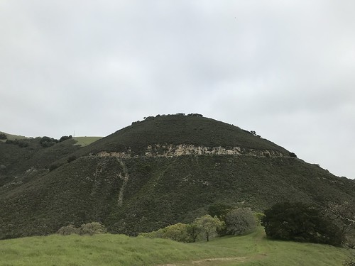
Black Sage Road looks to never be driven (I don’t even know why it exists, it doesn’t really go anywhere) and not hiked recently. That last idea could be an illusion, maybe it was hiked yesterday, but the spring grass is growing fast and tall this time of year. But this is far from a well worn trail. At this point, the sky was uniformly gray, the air still cool. We took the grassy path across the rolling hills, crossed the border into Mount Diablo State Park, up and over hill 1461’. From here, there were views of Black Hawk Ridge, Devil’s Slide, and Fossil Ridge ahead. Zuma the dog was having a blast, finally liberated from the prison of San Francisco. Black Sage Road culminated in a dirt cul-de-sac at the base of a brush covered hillside. My plan was to hope for a trail, or something close to one, going up this hillside, connecting with South Gate Road, one of Mount Diablo’s main entrances. At first we didn’t find one, and I thought we were in for a nasty bushwhack, but it got better, a semi-trail emerged through the brittle, pungent bushes, and we soon crawled out onto the road.

By now, the clouds were parting, and the Mount Diablo had come out. In the warm afternoon sun, we enjoyed some drinks and snacks on a big rock, then explored around, scrambling on the open stone, like the days of our childhood back in the Sierras. Up Sentinel Rock, into some of the little caves, looped around on the Summit Trail, through Live Oak Campground, out to the Artist Point area, made a choice to form a big loop out of the whole thing by leaving the park via Madrone Canyon Trail and Sycamore Creek.
 The Madrone Canyon Trail took us into a shady, wooded area, and soon there was another large rock outcropping on our right: even though we were trying to leave, we couldn't resist another scramble. It turned out to be even cooler than anything in Rock City. I looked at the map and saw it was called Boyscout Rocks. Ugh. We unanimously agreed that we would call it the “Temples Of Syrinx” from now on. After scrambling on these rocks for a half hour, we finally got ready to leave the park, again. Down Madrone Canyon, onto Sycamore Creek Road, through the rocky gateway between Black Hawk and Fossil Ridges, Devil's Slide, which we had observed from above earlier in the day. When we got to the state park border, there was a private property / no trespassing sign. We would have to walk back through a private gated county club estate to get back to the main road! And we did, and no one fucked with us. But I cannot recommend walking through this neighborhood as part of your hike. In order to get out of the estate, and back to our point of origin at the soccer field much more quickly, we went down a street that dead ended at a locked gate and a garden wall. We climbed over the wall and handed the dog over the top too, feeling again like the mischievous youth that we once were.
FURTHER READING
(I wish I had more for you here, but most internet articles pertaining to this area are oriented towards families, roped climbers and mountain bikers)
•Mount Diablo Interpretive Association: Guide To Mount Diablo Geology
•Bhilburn: Summit Trail To Rock City
•The Outbound: Rock City

No comments:
Post a Comment