DISTANCE: 15km / 9.32 miles
ELEVATION GAIN: 742m / 2433'
TIME TAKEN: 6:10
ROBERT LOUIS STEVENSON STATE PARK
NAPA COUNTY, CA
STOLEN WAPPO LAND
SOUNDTRACK: Archon: Helena
SUMMITS:
• Mount Saint Helena: 1324m / 4343'
• Mount Saint Helena South Peak: 1280m / 4200'
• Hole In The Rock: ?
PHOTO ALBUM
MAP
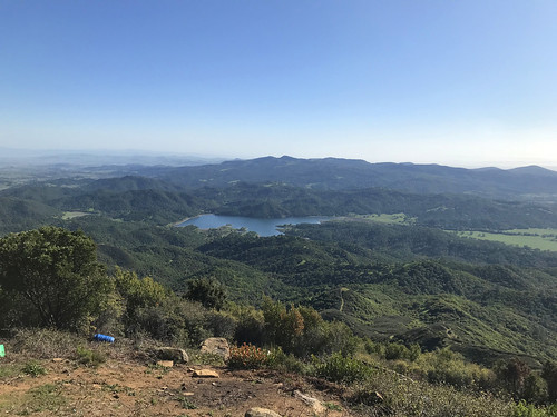
Mount Saint Helena had been on the hit list for a very long time now, it being the crown peak of the North Bay, and the second highest peak of the Bay Area (not to mention the Napa County high point). It required a visit. It was also high time for a hike with my brother, Alex, and since he was a weekend warrior, we set off that Saturday morning, the first of May, I picked him up from his apartment in San Francisco's Western Addition, and we were off, cruising the highways major and minor, arriving at the Stevenson Memorial Trailhead at 9:25AM, We didn't waste any time getting onto the well constructed trail, which had been engineered with well crafted steps and switchbacks, rising through a forested belt of oaken woodland that had been spared from the recent fires. Within 25 minutes, we were getting up out of the trees, and now had views to the east of the table rocks, and Calistoga Valley from the south to the north. In less than a mile, the single track trail ended, and the journey continued on a dusty fire road. At the western point of sharp switchback, we came to a big rock, and decided to do some gratuitous scrambling. This was fun, but also very lucky, because it gave us a view of a feature called Hole In The Rock, which we probably wouldn't have seen otherwise. The landscape in this area had been burned over, and there were faint climber's trails through the brush, so we decided to visit the enticing rock feature in the distance. We plied the rocky tracks and added more class 3 along the way, maybe unnecessary, but there was a fixed rope at one point, which means we weren't the first to go that way by any means. By about 10:30AM, we were at Hole In The Rock, which certainly lived up to it's name. We climbed around, through, and even managed to get on top of the thing. We also climbed, or tried climbing some of the adjacent big rocks. Exhausting the possibilities of the area, for the most part, and feeling the need to move on, we decided to shortcut uphill to rejoin the road, rather than backtrack, and although there was a trail at first, we either lost it, or it just dissolved, and we were dumped into the day's only bushwhack, which wasn't actually too bad, because like I said, the area had burned last summer, or maybe the summer before.
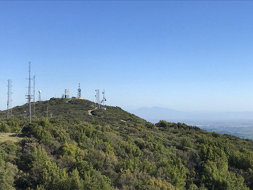
We rejoined the trail / road at about 11:30AM, Hole In The Rock ended up being the coolest part of the day, and was now behind us. The road took us into the upper reaches of some unburned pines, which offered welcome shade in the warm, sunny day. We diligently followed the road now, and saw many other hikers out on the fine Saturday afternoon. One of them complimented us on our facial hair! As if we coordinated it or something? We reached the top of Mount Saint Helena at 12:15PM, and tried to enjoy the surroundings and the views. There were some people doing an annoying thing, sitting, hanging out RIGHT on the actual highpoint of the mountain. I wandered around for a few minutes, pretending not care, and right before I said to them "excuse, I'm going to have to touch the high point of this mountain," they finally moved. Not as bad a move as people sitting down in the middle of the trail, but come on! Confrontation avoided. This time. Now that we had reached the main summit, I informed Alex that Mount Saint Helena had three sub-peaks, and he said
"I'm not going to all of them," and I said
"OK, let's just go to the East Peak?"
partly because that one is also on the California Coastal Peaks list, but more importantly, I wanted to get a good photograph of the main peak. East Peak was a class one walk up on gravelly rock, to more communications towers. We didn't hit any other peaks after that, but we did take a little jaunt north to a rocky, piney point. This proved very worthwhile, as it actually gave the perfect photograph angle of the main peak that I'd been wanting. By now, it was almost 1pm, and time to head down, so it was back upon the dusty road, amongst hikers of all stripes, many in large groups, perhaps school chums they were. There wasn't much to stand in our way on descent, and we were back at the van at 2:30PM. But the "bros day out" wasn't over yet. We went into Santa Rosa to get some Vietnamese food, then hit one of my all time favorite breweries, Moonlight, and then another brewery! Henhouse! Oh boy. It was hot outside, and the biergarten was crowded, and we were then a little tipsy as we pulled down 101, back into San Francisco, and finally to Owl band practice with our third, youngest brother.
FURTHER READING
• Mount Saint Helena on SUMMITPOST and PEAKBAGGER
• Mount Saint Helena East Peak on PEAKBAGGER
• MODERN HIKER