Showing posts with label Cowshit Country. Show all posts

Saturday, May 23, 2020

Pleasanton Ridge

DATE: Saturday, May 23, 2020
DISTANCE: 16.35km /  10.16 miles
ELEVATION GAIN: 579m / 1898 ft.
TIME TAKEN: 4:18
SUMMIT: Pleasanton Ridge High Point: 1,629 ft.
PLEASANTON RIDGE REGIONAL PARK
ALAMEDA COUNTY, CA

SOUNDTRACK: Ramones: Pleasant Dreams


PHOTO ALBUM
MAP


A few days prior to this, I had considered my 16 mile outing in the hinterlands of Mount Diablo to be my last hike of the season in the East Bay Hills, which were increasingly getting warmer and drier. It was time to focus some attention on the Sierra Nevada now!  But out of the blue, an old friend hit me up to go on a hike in Sunol Regional Wilderness. In spite of the fact that it was a pretty hot day, we weren’t getting an early start, and  it was also a Saturday (I usually avoid going out on the weekends at any cost, since I can pretty much hike any day I choose, unemployment has it’s benefits!), I readily agreed to meet up with Bryce so I could catch up with the old buddy and talk music, life, etc.

I tried to meet Bryce at the Sunol parking lot, at the appointed time, but even before I got there, I knew this would be a no go. Even Welsh Creek Road, on the approach, was jammed with cars, trying to turn around and get out, not one parking space in sight. When I got to the gate of Sunol, there was a prominent sign reading “Parking Lot Full,” and I believed it. Just then, I saw Bryce driving out, and he kind of shrugged. We pulled over at a turnout together, back down the road, to consult,  and I suggested Pleasanton Ridge instead. I had never been there before, but it was on my local hit list. This turned out to be a good choice, as we pulled into the Foothill Staging Area, we saw the parking lot was not even half full. Not bad for a beautiful Saturday in late May.

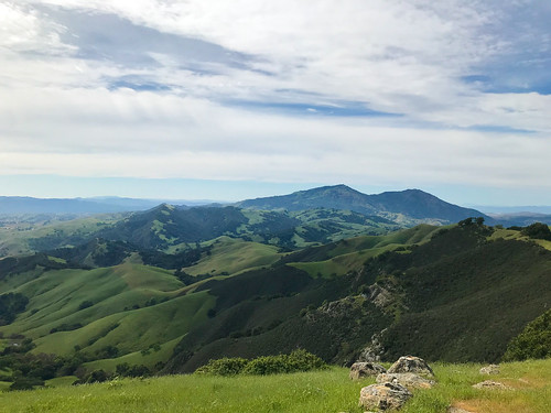
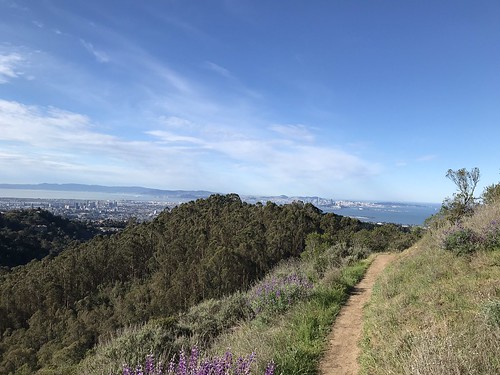
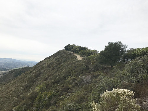
We took off uphill, on a meandering course that began with the Woodland Trail. No particular goal in mind, but I was angling to get to the high point of the ridge if possible. It was typical California rolling hill country, turning from green to brown at this time of year, cowshit country, the beasts were about. But there was a nice breeze and some especially majestic oaks. It wasn’t long before a view opened up to south to Maguire Peaks and Mission Peak. We turned north, and cruised the ridgetop. To our left, the higher, but privately owned,  Sunol Ridge beckoned for some future trespassing. Most of the park seems to be double trails, a ranch/fire road and a complimentary single track trail (or trails) that go alongside it, or weave around near it. We used both of these options alternately as they suited us.

Continuing north on the Thermalito Trail eventually joined us up with the Ridgeline Trail, on which also continued north, through the area which temporarily becomes Augustine Bernal City Of Pleasanton Park. Once through the enclave, you are back in PRRP. Much to my delight, the high point of the the Pleasanton Ridge formation was found, almost by accident. But then verified by smartphone of course. There was a bench, a water tank, and a ton of ducks for some reason. Also, what are these strange little monuments? We took a different was back to the parking lot, creating a sort of grand loop out of the  Ridgeline, Meadow and Sycamore Grove trails. A nice afternoon outside. And bear in mind, friends out there, if you ask me to go for a hike with you, I probably won’t say no. Unless I am already on a hike.

FURTHER READING
BA Hiker: Some general info in PRRP
Redwood Hikes: Big pictures and a little info
Bob Burd: Bob visit the Pleasanton Ridge highpoint


Wednesday, May 20, 2020

Windy Point

DATE: Wednesday, May 20, 2020
DISTANCE: 26.54 km / 16.49 miles
ELEVATION GAIN: 910m / 2986 ft.
TIME TAKEN: 7:15
MORGAN TERRITORY REGIONAL PRESERVE
MOUNT DIABLO STATE PARK
CONTRA COSTA COUNTY, CA
SOUNDTRACK: Scorpions: Wind Of Change

SUMMITS:
•Windy Point: 644m / 2112 ft.
•Black Hawk Ridge: 622m / 2040 ft.
•Oyster Point: 642m / 2106 ft.


PHOTO ALBUM
MAP

"SEVEN GATES OF DIABLO" #6


Finley road, at the north end of Tassajara, outside of Livermore, can be used as a back door to Mount Diablo State Park or Morgan Territory Regional Preserve. Finley Road ends at a gate, at a private property line, with no parking right at it. So you have to park about a half mile down the road on a dirt shoulder and walk back to gain entry. Once beyond the gate you can continue on "Old" Finley Road towards Morgan Territory, or hang a left on the Oyster Point Trail, which will lead you into the Black Hills region of Mount Diablo SP. While far from the Diablo summit, this secluded corner of the park has charms of it's own: myriad rock outcroppings, oak shaded ravines, and even an inexplicable forest of Knob-cone Pine!

I figured this would be the last Mount Diablo hike of the season, until the cooling rains of winter arrived. It was about to get 'ot! Bloody 'ot! And while I don't mind hiking in the heat (a good way to sweat out the toxins!), getting up really early to avoid the worst sun of the day can be fun, I have personal transportation and fat government checks rolling in to subsidize my whimsical outdoor lifestyle, so for me, the coming heat of the Bay Area inland valleys signaled a time to focus my attention on the Sierras, and other cooler, breezier places. But before we go up there, let's have the last Diablo hike of spring 2020! This was a continuation of my Mount Diablo State Park exploration which had been ongoing during the Covid-19 pandemic. I was looking for all the ways to walk into the park from the outside, the entrances were all closed to motor vehicles. This was entry point number six.  Finley Road entrance doesn't start you off in MDSP, or even the adjacent Morgan Territory, but it gives you access to both, an isolated backdoor. In fact, it's one of the most obscure of all entrances to Mount Diablo, being over five miles as the crow flies from the summit.

My hike began about 10AM, walking up the pastoral country road from the turnout down Finley. It was less than ten minutes to walk to the gate, ten more minutes on the road through private estates, and I was at the boundary of Morgan Territory. Two notable features after this were a washed out section of road, and a dilapidated old house. I can just read the real estate listing now! Scenic location! Filled with air and light! Bring your contractor and make your dream a reality! Turned left on Oyster Point Trail, which brought me to the MDSP boundary in six more minutes. Oyster Point Trail follows along a forested hillside of the ridge that contains Oyster Point, it felt a little bit wild, rustic, no people around at all. As I gained some elevation, I could see out at Marsh Benchmark to the east (previous hike), and north to the extensive rock formations that characterize this remote corner of the park. As always, I took note of El Diablo's first appearance. By 11:32 AM, Oyster Point Trail dumped me out of the woods, and into an open meadow, where an easy to miss signpost was not missed, and it directed me up to the summit of Oyster Point. The trail is faint and lightly used, but I was able to find my way up to what I determined was the actual high point, and also the placemark stick by 11:48AM. Back down, back along the trail. I was headed for Black Hawk Ridge now.

Oyster Point Trail continued west from the meadow, down and up and down through two creekbeds and through another semi-wild, woodsy area, where I encountered a lone mountain biker. I was dismayed to see some unsightly high tension power lines cutting directly through one of the most elegant rocky sections. Like an almost national park level of geological splendor, and THIS is how they choose to embellish it? "Where should we put these fucking power lines? How about right here, directly through these rocks? OK! Looks good to me!" I consoled myself thinking that someday, the power lines would be gone, and the rocks would still be there for millions more years. After this, I reached a five way intersection crossroads, and turned south. Up to the Blackhawk Ridge, which is rather open, and gave me a good view back to Oyster Point. Following the top of the ridge, I found the exact high point of Blackhawk, which is a small rock monolith. Continuing along the ridgetop,  I caught a gimpse of my future destination, Windy Point. I chose to walk down the trail to the far west end of Blackhawk Ridge, and then loop back on a lower trail, so I could see a bit more of the park. The lower trail brought me east, back to the five way intersection. I now turned north, and soon split off of the fire / service road (that leads to access the power lines), on a single track trail that leads into an area colloquially known as "José's World." This is the heart of the rock formations of the Black Hills area. I sat down upon one of them, and finally ate lunch. Then half-heartedly looked for a path through the brush and boulders that would bring me to the area high point known as "Knob Point." But I soon decided to save it for another day. I still had a long path ahead of me.

José's World Trail cut through from one fire road to another, and I popped out on the next east/west trajectory, first turning west (left) to have a look at Balancing Rock. It was now 2PM. Then I went back east on the fire road, past José's World, continuing to a private property gate. I took the ranch/fire road through the mostly open fields to the base of Windy Point. It was only just before I reach W.P. that I officially re-entered MDSP again. Windy Point was reached by cutting uphill from the road, through the grass, to yet another oak and rock crowned East Bay hilltop. But it wasn't just any East Bay Hill. Rush fans take note, the summit of the hill has an elevation of 2112'! Maybe now you know the real reason I wanted to climb it! Windy Point lorded over the area, and gave me another view out to Marsh Benchmark, and beyond.  It was now 3:09PM, and I had completed my agenda of features to visit for the day, so it was down, down, down the ranch roads, down the Tasajara Creek watershed. I took a break at a cow pond, which, unusually, had a name: Bob's Pond. Tassajara Creek Trail was a nice woodsy path that was in the oaken shade of the canyon. By 4:50PM, I had rejoined Finley Road, and was headed back through that corner of Morgan Territory, back past the abandoned homestead, back through the gate, back to the van. It had ended up being a long day, about 7.5 hours going 16.5 miles. I stopped at the grocery store on the way home and bought ingredients for the lasagna.

FURTHER READING
•Hiking Project:
Some info on Oyster Point Trail

•Bob Burd:
Bob handles Windy Point and Blackhawk Ridge in an efficient manner


Tuesday, May 12, 2020

Yerba Benchmark / Grant Ranch

DATE: Tuesday, May 12, 2020
DISTANCE: 12.95km / 8.05 miles
ELEVATION GAIN: 429m / 1409 ft.
TIME: 3:35
JOSEPH D. GRANT COUNTY PARK
SANTA CLARA COUNTY, CA

SUMMIT: Yerba Benchmark: 749m / 2457 ft.
SOUNDTRACK: Sleep: Some Grass

PHOTO ALBUM
MAP


This was the second time I'd been to Grant Ranch Park, the first time being only to drive through it on the way to Mount Hamilton a few months earlier. Joseph D. Grant County Park, as it's officially known, is the largest of the Santa Clara County Parks, situated between East San Jose and Mount Hamilton. I had been going on quite the tour of San Jose Parks this spring, so it was inevitable that I would end up here at some point. Specifically, to reach one of the high hills.

Amber and I arrived on a cool, mostly cloudy morning, and parked at an old barn near the beginning of the San Felipe trail. Now, they call these trails, but what they really are is old ranch roads. I steered us south, secretly hoping to mount the provocatively name Panochita Hill. On the way, we passed the decrepit Snell Barn, had views of the higher mountains to the east, and plenty of rolling oak meadows, still green at this time of year. The sight of Snell Campground jogged Amber's memory of an epic night of camping many years ago. Eagle Trail to Brush Trail. The sun never fully emerged, but nor did it ever rain. At the southern border of the park, the Dutch Flat Trail took a sharp turn to the west, and I did not see a clear path (or any path at all) up to Panochita Hill, so I silently abandoned that project. Now came the best part of the hike, as we climbed up to the ridge that forms the west side of the park. Over the crest of the hill, the Valley came into view, sprawling out beyond. The high point of the ridge "Yerba Benchmark," was found along the way, as we moved north along the ridgetop. Though I didn't find the USGS benchmark plaque, there was a sitting bench, and I had climbed at least one hill for the day's outing. At this point, we had almost returned to our starting point, and we closed the loop, descending east now onto Dutch Flat Trail, leaving the ridge, and arriving back at the car in short order.

FURTHER READING
•Bob Burd: Bob visits YB and many others
•Alltrails: Here is a loop very similar to the one we did


Wednesday, April 29, 2020

Morgan Territory

Morgan Territory
DATE: Wednesday, April 29, 2020
DISTANCE: 15.46 km / 9.61 miles
ELEVATION GAIN: 510m / 1672 ft.
TIME: 3:44
MORGAN TERRITORY REGIONAL PRESERVE
CONTRA COSTA COUNTY, CA

SOUNDTRACK: Sepultura: Territory


SUMMITS:
Bob Walker Ridge: 603m / 1977 ft.
Marsh Benchmark 787m / 2581 ft.


PHOTO ALBUM
MAP 1

MAP 2


Morgan Territory Regional Presereve is an East Bay open space, not quite attached to the south-east corner of Mount Diablo State Park, named for the wayward Alabama colonizer and grizzly bear killer named Jeremiah Morgan. The park was first established in 1976, and encompasses 5,000 acres of rolling hills.

I was back in Oakland. It was day 39 of of Covid-19 lockdown, by my personal count. I wanted to hike, and got up early for that reason, but I could not leave the house. There are strange psychological factors at play in a pandemic. I procrastinated, fiddled around, probably did the dishes or something, and eventually dragged myself out and headed to Morgan Territory for my late start. Not too many cars in the parking lot of the main staging area. I got out an immediately headed north-east on the Volvon Trail. Most of the people I saw that day were near the beginning, and I lost them soon after. It was partly cloudy, breezy, and I was clipping along at a fine hiking pace, once I finally got out there, through the oak studded hills. I wish I'd had a reason to go down Whipsnake Trail, the next intersection, because that's a good name for a trail, but I was headed for Bob Walker Ridge, the only named high point in the whole park, so I turned north on the Blue Oak Trail. Here, I gained a little elevation, and was able to see out east into the central valley. Blue Oak was a winding old farm road, progressing through scattered groves and undulating green hillocks, and it was only a matter of time until El Diablo reared it's massive head above the next ridge. I must say, it was quite pleasantly verdant out there, the grass was tall, and I took note of how it was stirred in the breeze.

Diablo framed by oaks

When I got to the Volvon Loop Trail, I veered to right, so I could go along the east side of Bob Walker Ridge. I didn't stay on the trail  too long before I cut off into the grass to get to the high point of the ridge. There was actually a faint trail leading up to the top, where like so many other East Bay hill summits, an oak thicket and some small rock outrcroppings were present. After this, I went back down (east) to rejoin the Volvon Loop Trail. I went around the north end of Bob Walker Ridge on the trail, and then curved back around the other side, south. Lots of cows on this side. Oh did I mention this is a big cow farm park? When I got down to the big intersection of Volvon Loop, Eagle Trail and Stone Corral Trail, I ran into a group of athletic looking young people, not a mask in sight. I was hoping to keep my distance, and breeze right pass them without a word, but they stopped me to ask a question, something like: "We saw you start at the same time as us, from the parking lot, how long do you think to complete the Volvon Loop?" I replied, maybe two more miles, and they balked. I was surprised, athletic young people should be kicking my ass on this shit1 Look at them, getting out-hiked by a beer swilling, drug taking anarchist! One I was away from the kids, I finally sat down on a boulder and took a break, checking my ankles for ticks. Then it was down the Coyote Trail, out of the meadows and into the trees, following the creek.

High point of Bob Walker Ridge

The Coyote Trail was a good change from the previous landscape, and a fun walk, shaded under a consistent oak foliage now, and climbing up and down the little rocky steps on the hillside along the mostly dry ravine bed. There was only one problem, and this wa something I'd never seen before, until the pandemic struck, maybe I was just lucky in the past, or maybe this is a new thing, but: people sitting down, taking a break RIGHT IN THE MIDDLE OF THE TRAIL! A SINGLE TRACK WITH ROCKS AND TREES ON BOTH SIDES AND NO ROOM TO GO AROUND THEM! WHAT THE FUCK?! And they act surprised when someone needs to get past?!?!  Anyway... I didn't let it ruin my day. I moved on from it ya know? Like ya should, and soon I was back at the parking lot, having completed my loop, and I was faced with a choice: go home now, or add to the hike some more? I had plenty of day left at this point, so I kept going across Morgan Territory Road and up the Clyma Trail now... on my way to Marsh Benchmark. I took Clyma Trail, an old ranch road, seemingly, to the logical conclusion of it's usefulness to me, and bend in the road at it's southwest extremity that was closest to Marsh BM. From there, faint trails in the grass came and went. I followed as best I could, without crossing the fence into private property. Someone's ranch house was eminently visible at the park boundary. If they had been looking off their back porch, they would have seen me. Anyway, I continued up, the way that I found, and soon intersected the service road that leads up to the top. Marsh Benchmark: This is the radio tower crowned hill that lords over the Livermore Valley area on the north side. I had noted this mountain before, driving through the area on interstate 580, and it was satisfying to now be on top.


The trail came and went

I was glad I had made the effort to extend the day's hike, now I felt like i had accomplished something, as well as satisfying my mountain hunger. Unlike Bob Walker Ridge, Marsh was a substantial peak with 360 degree views. There was an especially good angle on Mount Diablo and Oyster Point. East, into the Central Valley. South, down to Loma Prieta even. I found the actual benchmark, too. I sat down on the concrete foot of a radio tower and had a snack. From the top of the hill, I saw a much better trail going down the north side, much better than the way I had come up, so If you're keen to go up Marsh Benchmark, look at my map, and go up the north-west way. the way I came down. That is, if you care about being on a trail. Back then, I had an irrational fear of getting ticks, so I was always looking for a way to not go through the tall grass. I wrapped things up at the summit, headed down, and took some pictures of the awesome clouds, and a sturdy footbridge, I got back to the van in the parking lot, and as I drove home to Oakland, contemplated how 2020 would be a lost year for rock and roll.

L-R Oyster Point, Mount Diablo

ON PEAK NAMES
Bob Walker Ridge: Named for nature photographer, environmental activist, San Francisco Sierra Club president, and one of the founders of Sierra Club's Gay and Lesbian Activities Section (GLS), the first such group. Bob's photography brought much attention to the Morgan Territory and East Bay Hills area, and his activism ensured that they would be preserved as parkland. Of all the hills and mountains in California named after dead white guys, I find this to be one of the most unobjectionable!
Marsh Benchmark: If if didn't have the USGS benchmark on top, what would this place be called? Just Marsh? Marsh Mountain? Why does "benchmark" become part of the name, when it has a benchmark on it?

FURTHER READING
•Bay Area Hiker: The usual good descriptions and big photographs
•The Outbound: This describes a similar loop to what I did
•Redwood Hikes: Big photos and hiking recommendations
•Bob Burd: Bob pays a visit to Marsh Benchmark on the way to Oyster Point

map 1

Tuesday, March 10, 2020

Orinda To Rockridge 2020

DATE: Tuesday, March 10, 2020
DISTANCE: 7.03 miles
ELEVATION GAIN: 1381 ft.

ELEVATION LOSS: 1684 ft.
TIME TAKEN: 2:06 hours
SUMMIT: Skyline Ridge AKA Sprial Knob: 1400'
SIESTA VALLEY RECREATION AREA

CLAREMONT CANYON REGIONAL PRESERVE
CONTRA COSTA COUNTY, CA

ALAMEDA COUNTY, CA

PHOTO ALBUM
MAP 

https://hikingmetalmaniac.blogspot.com/p/carless-hikes.html


I returned from my lovely weekend in Big Sur to find that the Novel Coronavirus (Covid 19) has basically evaporated the industry in which I am employed, almost overnight, so I'm going to try to make the best of it by hiking as much as possible! Today, I decided to keep things in my neighborhood and re-visit the original carless hike, from Orinda BART to Rockridge BART in Oakland. I didn't get out there as early as I would have liked (sunrise) but it was still morning at least. As before, I make this a carless hike by entering the BART system at MacArthur, and going two stops east to Orinda, which puts me on the other side of the hills. Then I hike back over the hills to Oakland, re-enter the BART system at Rockridge, and take the train one stop to home base, MacArthur.

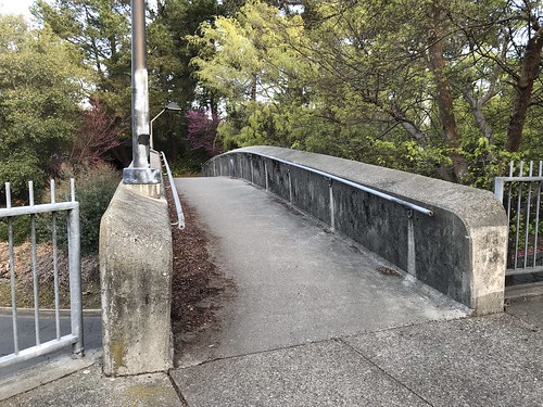
First pedestrian bridge

The first time I did this maneuver, I said the most difficult part was getting out of the BART station and across the busy road to the trailhead. Two and a half years later, the intersection of Camino Pablo and Santa Maria Way in Orinda remains a realm of the utmost hostility to pedestrians, but I was able to rely on my memories from the last venture, and streamline the crossing somewhat. Exiting the fare gates Orinda BART at 8:40, I turned right, and then made an immediate left on a pedestrian bridge that crosses a small access road. This path then dipped down and took me northwest, beneath two overpasses. Arriving then at a freeway onramp with no crosswalk, I was asked to turn right, and the path continued to another pedestrian bridge that took me above the freeway ramps and deposited me at the cul-de-sac of Orinda Way. Orinda Way to a left turn at Santa Maria. Santa Maria to Camino Pablo. This time, instead of walking along the north side of Camino Pablo, and running across the freeway-like road opposite the trailhead, I crossed at the traffic light. Even though there's no crosswalk, I walked with the green light and made it across in one piece. And that is the last street crossing for awhile, even though the next one is no less harrowing!

Trailhead

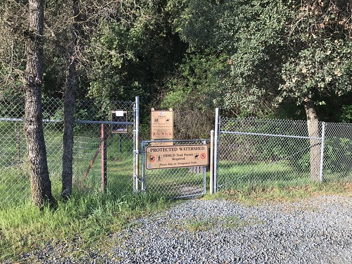
I arrived at the De La Veaga trailhead at 8:48, a gate off of a small gravel turnout, diligently signing the log book with my EBMUD trail permit number, rejecting the scofflaw ways of my past. (HERE'S WHERE YOU GET AN EBMUD TRAIL PERMIT) The De La Veaga Trail is only what I would call a trail for the first half mile or so, and then it intersects and becomes one with a fire road, which seemed to be recently re-graded and widened. The fire road winds it's way lazily up grassy oak studded hillsides and beneath massive high voltage power lines. Views begin to open up back to the east, and soon majestic Diablo comes into view. Eventually the road gains a ridge, and I crossed through another cattle gate (but no cows around today at all). To the south, I looked down into the lush spring green Siesta Valley, with Las Trampas in the distance. To the west, the familiar ridgeline of the Oakland and Berkeley hills played out in front of me. At this point I encountered the only other humans on the DLV trail, three hikers headed in the opposite direction.

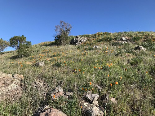
Poppies

The fire road dipped down into the northwestern end of Siesta Valley, past some poppy speckled hillsides, and then climbed back up the more heavily wooded other side to leave the EBMUD protected watershed and meet the East Bay Skyline trail. This took me on the final stretch, to the crest of Frowning Ridge, where I emerged into sunlight, and made an unprotected mad dash across Grizzly Peak Boulevard. Entering the system of trails that leads down Skyline Ridge and Claremont canyon, there is a change of atmosphere. In a zone that is touched by coastal fog, the vegetation becomes more lush, and non-native eucalyptus trees are a strong presence. Now comes my favorite part, as I descend the ridge, and around a bend comes a fine view of bonny old Oakland! And then San Francisco too!

Oakland and San Francisco

As I made my way west, down the trail, I decided to stop and verify just what was the geographical feature named Skyline Ridge, even though I've been there before. It is the eastern, and higher of the two mini hills (that have side trails leading to them) on top of the main ridge. This particular one has two spirals made of rocks at the top. Hence it's other name, Spiral Knob. Alternately hiking and jogging down towards Berkley now, I officially entered Claremont Canyon Regional Preserve. The farther down I got, the more hikers and joggers I saw, of course. Getting close to civilization. Down the Stonewall Panoramic trail. Bloody steep in places, and lots of loose pebbles! I had to be careful not to end up sliding down it on my ass. Popped out of the bottom of the park at Stonewall Road, took it South to Claremont Avenue, and then College Avenue to Rockridge, where I re-entered the BART system after just over two hours of hiking. I still believe this is probably one of the finest urban hikes you can do in the Bay Area, and one of the few in the world where you can ride the subway to the trailhead! Please leave a comment if you know of any other ones!

Map by Google

Saturday, December 21, 2019

Las Trampas Regional Wilderness

DATE: Saturday, December 21, 2019
DISTANCE: 12.49 miles
ELEVATION GAIN: 3172 ft.
TIME TAKEN: 5:07
LAS TRAMPAS REGIONAL WILDERNESS
ALAMEDA COUNTY, CA

CONTRA COSTA COUNTY, CA

SUMMITS
LAS TRAMPAS PEAK: 1827 ft.
VAIL PEAK: 1787 ft.
ROCKY RIDGE HIGH POINT: 2024 ft. 

PHOTO ALBUM HERE
Las Trampas: December 21, 2019


Las Trampas Regional Preserve is 5,778 acres of wilderness near the East Bay towns of Dublin, San Ramon and Moraga. It's main topographical feature is two parallel ridges, trending northwest-southeast: Las Trampas Ridge and Rocky Ridge, separated by Bollinger Canyon. Rocky Ridge, with a high point of 2024 feet, has the distinction of being the highest point in the North-East Bay outside of the Mount Diablo massif. I had seen it over the years, poking out above the crest of the Oakland Hills, and wondered what it was. Las Trampas is Spanish for "The Traps" or "The Snares." According to Erwin G. Gudde's California Place Names, traps were once set in the chaparral of the hills to catch elk. I had never been to Las Trampas before, and I was intrigued by it's  wild and rocky appearance, compared to the cow field walks of most other parks in the area. A large network of trails snaked for miles throughout, and I planned my visit with a loop that would take me to all the highest points.

It was the winter solstice, and I had planned to go on a hike with my brother Alex, but based on a text I had received from him at about 4am, I assumed he would probably be in no condition to meet me, so I decided to continue on my own. I don't think I even got started until 10AM or later... it was not early. I drove the van from Oakland to the main staging area in the middle of the park, which was central to everything I wanted to do. It was  a Saturday, so it was far from abandoned, but I didn't have to go far from the trailheads to escape the masses of humanity.

Las Trampas Ridge
I began my twelve and a half mile walk throughout the park on the south side of the Bollinger Creekworld of oak (regular and poison), Bay Laurel, and the riparian habitat of the streambed. It wasn't too long before I gained some elevation, got out of the trees, and was able able to have a look back south, down Bollinger Canyon. One I got up to the Las Trampas Ridge Trail, I followed it northwest, where it basically clung to the top of the undulating crest. Landscape changed to scrub chaparral, and the fire road / trail roller-coastered along the top of the ridge to the eventual high point, Las Trampas Peak, at the north-west corner of the park. Mount Diablo was now clearly visible to the east, and a murky haze filled the valley below, out to Concord and beyond. The top of Las Trampas Peak was a patch of dirt next to an oak tree, a nice place for a picnic perhaps, under different circumstances. The view southeast along the the ridge top looked too wild to be anywhere close to the middle of the East Bay suburbs, and the other rugged high points of the ridge were in plain sight. Rocky Ridge, my goal for the second half of the hike, was openly visible to the west.
Loop, which got me immediately into the damp, earthy

Bridge on Mahogany Trail
I frolicked back down the Las Trampas Ridge Trail, towards the pointy looking peaks that had captured my attention. Vail Peak and Eagle Peak. The woody trail dove down into the vegetation, through mature oak and madrone,  and Vail Peak was a short side trip up a slippery, brushy hillside. By the time I realized that I should have taken a left on the Corduroy Hills Trail to reach Eagle Peak, I was already so far past that I didn't feel like doubling back. I guess I'll save that one for another day. I charged south-east on the Chamise Trail, which led down a ravine past some gnarly rock protrusions, and then back into the woods on the Mahogany Trail, which fell quickly under the spell of arched oaks along the streamed, and carried me over a most picturesque stream bed. Soon after this, I made a brief return to civilization, such that it is, and temporarily joined Bollinger Canyon Road, a real car road, to continue my large loop. This led near the horse stables and equestrian staging area, aromatic with a tang of dung and straw.


Attaining Rocky Ridge
I left  the road at my earliest opportunity, plunging back into the bush on the Elderberry Trail, which ledRocky Ridge, parallel to but, much different in landscape than it's sister ridge, Las Trampas. Rocky Ridge lived up to it's name, and it had enough prominence that I could now see San Francisco Bay to the west, illuminated by the sleepy winter solstice sun. Coming from this direction, I first reached the southern highpoint of Rocky Ridge, which is 1,877 feet elevation, and has an EBMUD benchmark. There's also a park bench up there, upon which I took short break, indulging in water and trail mix. At this point, I could have had a hell of an easier day if I had just remained on Rocky Ridge Trail, and followed the crest north-west. But, like a cat that's easily distracted by a shiny thing, I saw a sign for Devil's Hole Trail (Cool!), and just couldn't resist. So down I went, losing all that hard earned elevation, through a landscape of mostly grassy, somewhat rocky hillsides. It was not blatantly apparent what Devil's Hole was, but maybe it was THIS formation. It was a a scenic detour to be sure, and there were more of the Las Trampas Ridge style brushy, pointy hills to be admired. I took a wrong turn at the bottom, and ended up at the south west corner of the park, at a boundary gate. It was pretty deeply vegetated down there, and dark, and then I startled a herd of what was probably wild pigs… the animals ran off quickly through the bush I couldn't get a good look at them.
first gently, and soon steeply, up to the long crest of

West to a solstice sunset
Back out and up. Time to pay for my visit to Devil's Hole (no one goes for free) with some punishing elevation gain to regain Rocky Ridge, up the Sycamore Trail. To the west, I was able to identify Ramage Peak. And beyond, the undulating series of ridges that stack up behind San Leandro, The Bay glimmering in the distance. Maybe the Sycamore Trail is punishingly steep, maybe I was running out of steam at the end of the day, maybe both. But the landscape is worth it, I would consider this the "dark" side of Rocky Ridge. Rocky, pointy little peaks, no other humans in sight. A good push got me back up on top of the ridge, and I continued to the high point, labeled as "Rock 2" on the map, at 2024 feet. Good views of The Bay at this point. Personal energy and sunlight were low by now, so I hightailed down the hill back to the parking lot, on a semi paved road. And now, I'm low on words to say, so if you want more, try these!

FURTHER READING
•BA Hiker "Las Trampas Regional Wilderness is the tough guy of the East Bay Regional Park District."
•Redwood Hikes (nice, big photographs)
•KQED (good notes on geology)


Las Trampas: December 21, 2019

Wednesday, July 12, 2017

Orinda To Rockridge

DATE: Wednesday, July 12, 2017
DISTANCE: 8.5 miles
ELEVATION GAIN: 1,853 ft
TIME TAKEN: 3 hours
SUMMIT: Hump 1551'
SIESTA VALLEY RECREATION AREA
CLAREMONT CANYON REGIONAL PRESERVE
CONTRA COSTA COUNTY, CA
ALAMEDA COUNTY, CA 

This hike repeated on March 10, 2020


ORIGINAL DESCRIPTION FROM THE "HEAVY METAL HIKES" FACEBOOK GROUP: The other day, I was looking for some kind of decently long hike I could do without driving anywhere (because Jean Claude Van Ram is not in the best shape these days), and I noticed that there is a trail head right by Orinda BART. So I took the train out there, and walked over the hill back to Rockridge BART, and took the train home again. About 8.5 miles in three hours.

The original carless hike. I was looking for something to do that I didn't have to drive to, and I noticed from looking at maps that there is a trail that originates right by Orinda BART station, just on the other side of the hills. So all I had to do to construct this carless hike was get on BART at MacArthur, right by my apartment, and travel two stops east, through the tunnel beneath the hills. When I popped out in Orinda, it was a few degrees hotter, and a bit sunnier. Those of you who are familiar with the suburbs will not be surprised to hear that the most difficult part of the hike came at the beginning: trying to find my way out of the BART station complex in a way that would put me on the South side of Camino Pablo near the trailhead. After walking around for awhile, and following some false leads, I deemed this to be pretty impossible, and followed a path that led out to the dead end cul-de-sac of Orinda Way, which I followed out between the Shell and Chevron stations. At Camino Pablo, I RAN unprotected across the road, which was very busy at that time of day. It seemed like the cars were going at almost freeway speeds, and there's no crosswalk of any kind. But then the worst was behind me, and I was at the De La Veaga trailhead.

I was now on EBMUD Watershed protected land, and a sign informed me that I needed a permit hike in the area. Not even considering the idea of turning back after all the effort I had already put in, I decided to break the rules and continue. I'll get a permit if I ever do this again. HERE'S HOW YOU CAN GET AN EBMUD PERMIT

I hiked uphill on the De La Veaga Trail, enjoying pleasant views of the town of Orinda and Mount Diablo beyond. A side trail trail led along a fence to a point known as Hump 1551'. This was a typical Bay Area cowshit country hike, and the bovine beasts were plentiful, especially around the Siesta Valley area. Good thing they're peaceful animals, because they're HUGE, and if they had a mind to trample me, it would be short work. I am not a large human being. Climbed up the other side of Siesta Valley and popped out at Grizzly Peak Boulevard, back into familiar territory. Down the other side of the hills. The refreshment of the cool air on the Bay side, after the heat of Orinda made for easy going, and the view that opens up of Oakland and San Francisco is always a stunner. I can't imagine it ever getting old.  Came down Skyline Ridge, hit Claremont Avenue, and then took College to Rockridge, past the yuppies and the strollers, re-entering the BART system there. Carless hike successful!