Showing posts with label Redwoods. Show all posts

Saturday, January 23, 2021

Sunday, December 13, 2020

Portola Redwoods

DATE: Sunday, December 13, 2020
DISTANCE: 18.97km / 11.79 miles
ELEVATION GAIN: 819m / 2686’
TIME TAKEN: 5:30
PORTOLA REDWOODS STATE PARK
SAN MATEO COUNTY, CA
SOUNDTRACK:
Lesbian: Forestelevision

PHOTO ALBUM
MAP


FULL HIKE REPORT COMING SOON!


Tuesday, August 11, 2020

Butano State Park

DATE: Tuesday, August 11, 2020
DISTANCE: 10 miles, total?
BUTANO STATE PARK
SAN MATEO COUNTY, CA

SOUNDTRACK: Gates Of Slumber: To Walk The Night

PHOTO ALBUM


I was too depressed to write this report for many months. Shortly after my first visit to Butano State Park, it burned down in the 2020 CZU Lightning Complex Fire, along with Big Basin. It is not known what condition it’s in at this point.

Butano State Park encompasses a secluded redwood canyon on Little Butano Creek in the Pescadero Watershed. Amber and I showed up early, before Fern and Greg, at the campsite, so we got settled in and then went on a little walk around the area to become oriented. When Fern and Greg showed up, we went on another hike together, this time down towards the park entrance area. Then it was time for dinner, drinks and drugs, the hallmarks of a Fern and Greg camping trip! Oh, how I love them. That night, we went out again, basically repeating the first hike of the day, going out to find an open area to try to see the meteor showers. It wasn’t exactly cloudy, but there was a fine. marine haze that impaired stargazing significantly. Amber and I left the next morning, and five days later began an early, long and intense California fire season, in which Butano would be one of the first sites to succumb. 

FURTHER READING
• Redwood Hikes: The usual big photographs and quality description

• Bay Area Hiker: A dissenting opinion on Butano!

Monday, May 18, 2020

Windy Hill

DATE: Monday, May 18, 2020
DISTANCE: 17.28km / 10.74 miles
ELEVATION GAIN: 559m / 1834 ft.
TIME: 4:00
SUMMIT: Windy Hill: 588m / 1930 ft.
WINDY HILL REGIONAL PRESERVE
SAN MATEO COUNTY, CA
SOUNDTRACK: R.I.P.: In The Wind Pt. I


PHOTO ALBUM
MAP


Windy Hill stands out along the ridgeline of the coastal hills of the San Francisco peninsula as one of the few unforested spots. It’s pretty much directly southwest of the Stanford University campus. Easily ascended via Skyline Boulevard (Highway 35), or you can hike up from the bottom via Portola Road in Portola Valley.

It was my turn to visit San Jose (it usually is), so the ball was in Amber’s court to pick out a hiking activity. We had noticed Windy Hill a few weeks earlier, driving past it, so it came to pass that we returned to give it a go. Amber brought her friend Korrine, we parked in the main parking lot, masked up, took some shots of whiskey, and powered up Windy Hill, which lived up to it’s name. The day was cool, especially on the exposed windy hilltop, and the sky was partially filled with billowing clouds. From the top of the hill, there was a panoramic view across the South Bay, and even over to Mount Diablo. With the ladies, i completed the quick loop around Windy Hill, and back to the parking lot. Amber took Korrine home, and left me to my own devices for about three hours.

From the parking lot, I began my next adventure by heading south on the Lost Trail, which went immediately through a gate, and into some rather thick vegetation on both sides of the trail. A sudden contrast to the windswept grasses I’d just left behind. Lost Trail curved along the hillside, roughly parallel to, but out of sight of Highway 35. I was quite impressed by the variety and thickness of plants, and the moss that decorated the trees. A lot of moisture from the Pacific Ocean must pour over the hill in this particular area. There was by now a good view back up at Windy Hill from along the trail, Before too long, I reached the intersection with the Hamm’s Gulch Trail. I regret to inform you there was no Hamm’s Beer available. At this point, the route began winding and switchbacking it’s way downhill, and the trees grew thicker and mossier. Quite spectacular, actually. Into the gulch!

I was mostly in the woods, but there were a few glimpses out, even another sighting of Mount Diablo. At the bottom of the hill, I came to a crossroad, but I remained on Hamm’s Gulch Trail, and soon crossed a shady creek. Reaching now the eastern extremity of my journey, I joined the Meadow Trail and turned north, then east, suddenly the landscape changed again, to rolling oak studded fields. Meadow Trail soon put me onto Spring Ridge Trail, and from there it was gentle but steady uphill on a fire road, back up to the ridge and Windy. I was able to have a look back over at the forested area from whence I had just descended. Spring Ridge Trail mostly keeps to the open, but ducks into the occasional oak grove now and then. Majestic clouds blew in from the coast, trying to penetrate the interior of the land. Before I knew it, I was back up by Windy Hill. I didn’t return to the top, but circled around the west side next to the road. I had overestimated the time it would take me to do the loop hike, the internet had provided inaccurate mileage or something. I still had about an hour until I was due to be picked up, so I started hiking down the Lost Trail again.

This time, I kept going past the Hamm’s Gulch turnoff, and continued through the splendid vegetated forest. I was hoping to find a shortcut to get up to the highway, and make another loop out of that, but I couldn’t, and I had to turn around, going almost all the way back to Hamm’s Trail again, but turning southwest on a fire road that took me up to the highway, but in a very roundabout manner. I walked north along Highway 35, just to see something different, but of course, it sucked. Either having to walk in the tall grass, or right by the side of the road, getting buzzed by Teslas. All of my blundering about in the final hour explains my path, if you are trying to interpret my course on the map. All this fuckery also made me late for my pickup rendezvous time, and I was scolded sternly, being sent to bed without any beer that night.

FURTHER READING
•BA Hiker: Good descriptions and photos
•Alltrails: This is pretty much what I did, except I started at the top
•Long Green Tunnel: Another one from the bottom


Monday, April 27, 2020

Sanborn County Park

DATE: Monday, April 27, 2020
DISTANCE: 7.24 km / 4.5 miles
ELEVATION GAIN: 391m / 1,283 ft.
TIME TAKEN: 2:00
SANBORN COUNTY PARK
SANTA CLARA COUNTY, CA
SOUNDTRACK: Wizzerd: Forest


PHOTO ALBUM
MAP


On another one of my visits to San Jose, this was a hike in Sanborn County Park, just outside of Saratoga. Amber and I made a good 4.5 mile loop out of the main parking lot, using mostly the Sanborn Trail and the San Andreas Trail. No summits, no waterfalls, just a nice walk in the woods. This would be a decent one any time, even on a hot day, due to plenty of tree coverage. There were so many fantastic trees, in fact, that I decided to climb one! We had a look at the camp sites, for future reference. At one point we did gain enough elevation to see out across the Santa Clara Valley, through the trees. Two hours round trip, then it was time for dinner and a movie back at the old homestead.

View out over Santa Clara Valley from Sanborn Trail

FURTHER READING
•Bay Area Hiker: Large photos and a good description of the park
•AllTrails: Here, someone else did the exact same hike as us
•Outbound Collective


Saturday, March 28, 2020

Redwood Peak

DATE: Saturday, March 28, 2020
DISTANCE: 9.22 miles
ELEVATION GAIN: 1,667 ft.
TIME TAKEN: 3:28
SUMMIT: Redwood Peak 1,619
DIMOND CANYON PARK
JOAQUIN MILLER PARK
REDWOOD REGIONAL PARK
ALAMDEA COUNTY, CA
CONTRA COSTA COUNTY, CA


PHOTO ALBUM
MAP


Redwood Peak is the high point of Redwood Regional Park in the Easy Bay Hills, as well as the high point of a long NW-SE running ridge, which is kind of a northwestern extension of the San Leandro Hills trajectory, the western frontline of hills running from East Oakland to Castro Valley. I had been curious for years what was the highpoint of that ridge up there, because I can almost see it from my front door. A blackish green tree studded prominence in distance, at times sun crowned, at times fog shrouded.

As the world and the Bay Area was reeling with Coronavirus lockdown, I was trying to use my now abundant free time to get some hiking in, to visit some places I’d been meaning to visit over the years.  With Saturday projected as a rainy day, I though it would be a good time to finally pay a visit to Redwood Peak. I knew that the summit is tree covered, so I wouldn’t be missing out on any views due to the clouds, and the waterway of Dimond Canyon, through which I planned to ascend, should be gushing with spring runoff, for a lush riparian hiking experience. The third bonus for which I hoped, was that the rain would keep other people indoors, and I could hike in isolation.

Graffiti gate

Well, it didn’t rain very hard at any point during the day, and even though the parking lot at the Dimond Recreation Center, where I began, was completely empty, I encountered quite a few people out on the trails that day. Various configurations of runners, hikers and dog walkers. Few of them hiking alone. I cursed them all for being out, and then cursed myself for being part of the problem. I began the hike by following the course of Sausal Creek up through Dimond Canyon, a path I have followed three of four times before. This is one of my favorite hikes in Oakland, probably one of the best urban hikes you can do in any city. I did things a little differently this time by remaining in the creek bed the whole way up. There’s an intermittent trail, but mostly a bunch of rock skipping and puddle jumping. The artificial waterfalls created by public works projects past are minor obstacles. Beyond the Leimert Bridge and some hydrological infrastructure, the main trail was rejoined, which carried me out of the canyon, past the desolate Montclair Golf Club, and a temporary return to civilization at Monterey Boulevard.

Canyons of Oakland
The conveniently placed pedestrian tunnel carried me beneath the Warren Freeway, and I reconnected with the park system at Palos Colorados Trail, which took me into one of Joaquin Miller Park’s finest redwood canyons. Up to this point, this was almost a duplicate of a hike I had done with my brother Alex back in January, 2018. Where I diverged from that was when I took a left and headed up the Cinderella Creek watershed, following the trails in a northeasterly direction, gaining altitude and curving around the north of the park, and eventually leaving it as I crossed Skyline Boulevard. Like I said, there were still a lot of people around, but all the facilities, like the PAL camp, and the Chabot Observatory, were closed, leaving a somewhat ghostly shoulder season vibe. Throughout the course of the day, and especially up past the border with Redwood Regional Park, I made a series of wrong turns and meandering loops, which I blame upon the overabundance of trails and roads in this highly civilized park. Not that I was in a big hurry or anything, but I did not take the most direct course! My peregrination led me through gnarled oaks, a magic faery circle, and even a banana slug encounter. Eventually, I found my way up the the top, Redwood Peak. Even though it was completely forested, there was still a noticeable summit (more than I was expecting), a rock outcropping, and a U.S. Coast and Geodetic Survey benchmark. It was a nice spot, which I would have remained at longer if not for the imminent arrival of a party of five adventurous youths. So off I went, back down the mountain.

Magic circle

I took the West Ridge Trail past the observatories, went back across Skyline Boulevard, through a parking lot, and then down the Scout Trail to the Castle Park Trail. This was the only section of the day that had a view out to of the trees. My intention was to cut back down to the Palos Colorados Trail, but I somehow went the wrong way on the Sunset Trail and ended up getting dumped in a neighborhood. Rather than retrace my steps back into the park I decided to walk through the residential area, down Castle Drive to Ascot Drive, past Joaquin Miller Elementary School. For a road hike, it wasn’t too bad. Ascot Drive even has a trail along part of it. I re-crossed the Warren Freeway, and then returned the way I came, back down through Diamond Canyon, back down to the rec center parking lot, which had a few cars in it by now, and couple of people ill-advisedly smoking weed together. Now, when I leave my front steps and look left down the street, which points at a distant redwood covered hill, I know what I'm looking at, and another piece of the grand puzzle is filled in.

FURTHER READING
•Bob Burd: A quick jaunt to Redwood Peak
•East Bay Trails: Another approach to Redwood Peak
•Redwood Hikes: Good photographs and description of Redwood Regional Park
•Oakland Trails: Information on the mosaic trail markers


Map by Alltrails

Friday, February 7, 2020

Maple Falls

DATE: Friday, February 7
DISTANCE: 6.5 miles
ELEVATION GAIN: 823 ft.
TIME TAKEN: 3.5 hours
FOREST OF NISENE MARKS
SANTA CRUZ COUNTY, CA

PHOTO ALBUM
MAP 


The Forest Of Nisene Marks is a nearly 10,000 acre state park near Santa Cruz, CA. It's serene redwood canyons belie it's turbulent history: 140 million board feet of redwood trees were removed from the area beginning in 1883, a wholesale massacre that continued until 1924. The present day trees, still impressive, are all second and third growth. The epicenter of the disastrous 1989 Loma Prieta earthquake also sits solidly within the parks boundaries!

Maple Falls is set deep within Forest Of Nisene Marks, where Bridge Creek plunges majestically 40 feet over a rock wall at the end of a lush canyon, far enough out and up a rugged enough trail that a good portion of potential visitors are discouraged!

Killing some time before Deathgrave practice in a San Jose bookstore (okay, not just any bookstore, but the FANTASTIC Recycle Books) I happened upon an exhaustive compendium called California Waterfalls (Ann Marie Brown, Foghorn Outdoors, second edition May 2000) which I bought up right away and began studying. It turned out that Amber and I would both have a free day to hike the next day, so I consulted the book, and chose Maple Falls as the destination. This was skillfully picked so that it could also be done in conjunction with a brunch at one of our favorite restaurants, Gayle's Bakery in Capitola. While at Gayle's, waiting for our number to be called, and perusing the displays of quiche, polenta, and myriad other delights, I ran into my boss from my first job, Melissa, and her husband Tom, from back in Jackson, California, who are friends of my parents and I had not seen in years. It was a really strange coincidence! But I digress.


First bridge

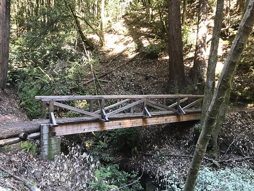
Brunch in Capitola put us near the gate of The Forest of Nisene Marks state park, a threshold neither of us had crossed before. We paid the fee, got the map, and drove up into the lush redwood filled park. The "Winter Gate," which I assumed would be closed, because it's winter, was open, which allowed us to drive an extra mile closer to the trailhead and shorten the trip. There were maybe two or three cars in the parking lot at 11:30am when we embarked from Porter Family Picnic Area. North out of the parking lot, past the gate and down the road, forking left onto Loma Prieta Grade. There were some nice ups and downs, a few footbridges (which I ALWAYS take pictures of), some finely constructed cliffside trail work, and even a brief plank walk, which you don't really see too much of. Here and there were seen the remains of old structures left behind from the logging days, which were slowly returning to the earth. 

Eventually, we veered right onto the Bridge Creek Trail, the most direct path to Maple Falls. Here the trail follows the creek, and as you go deeper, the canyon narrows, eventually coming to a wild section where you have hop across the water a few times, climb over some logs and rocks, and do some light scrambling to continue. Through all this, it is quiet obvious where the trail is. There is a small appetizer falls on Bridge Creek in this section, as well as another one pouring down the hill from the east side. The scramble continues, and not far from this is the true cascade of Maple Falls, a majestic silver ribbon slicing down the middle of a woodland notch, pouring over a mossy rock headwall, and splashing into a serene shallow pool. At the edge, there was a rocky, small "beach" and some logs upon which we sat and ate some of our takeaway food. To the upper right of the main fall, we observed the mystifying effect of small rivulets pouring down through the moss from above, creating the impression of a sparkling, twinkling, living wall!
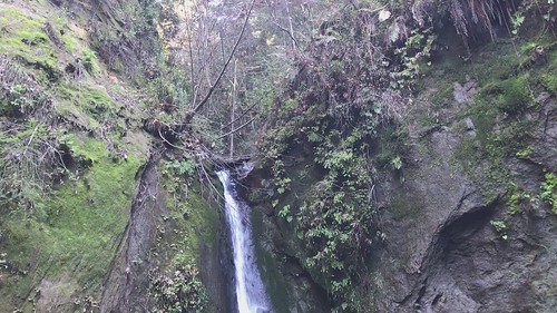
Maple Falls
 
We remained secluded in the blind canyon for about a half an hour, and began to return the way we came. We had only seen two hikers coming down from the falls on our way up, and ran into four more as we were leaving. They looked like they were about to turn back, so we informed them that they were only at the first (mini) waterfall, and to keep going! I took us on a small detour on the return, a section of Loma Prieta Grade that runs to the west of, but basically parallel to Bridge Creek Trail. Just so we could see something different. It was nice because we got up on the hillside a little bit, out of the dark canyon, and got some sunshine. It was actually SUCH a beautiful day out, for February, that I almost regretted spending it in a shady, dank forest. ALMOST. We did not see another soul on Loma Prieta Grade as we meandered south along the folded, steep earth, and soon reunited with the intersection of Bridge Creek Trail, continuing south, back to the car. It was an excellent dayhike, one of my favorite of the local redwood excursions that I have done so far, owing mainly to the payoff of the elusive Maple Falls!

FURTHER READING
• Open Space Trust: Trail information
• The Outbound: More trail information 
• California Waterfalls: Ann Marie Brown: Foghorn Outdoors, May 2000: pp 324-326

Tuesday, July 23, 2019

Founder's Grove

DATE: Tuesday, July 23
DISTANCE: .4 MILES
ELEVATION GAIN: Undetectable
TIME TAKEN: .5 HOURS
HUMBOLDT REDWOODS STATE PARK
HUMBOLDT COUNTY, CA


As some of us know, it can be almost impossible to take any time on a rock and roll tour for excursions into nature. Owl has had some limited success in the past, so I know it can be done, but when I visited the Northwest, playing drums for the hard partying Deathgrave, hiking time was almost non existent. Luckily there was one leisurely day between Eureka and Fort Bragg where we were able to cruise the Avenue Of The Giants and stop briefly at majestic Founder's Grove.


Tuesday, June 11, 2019

Bear Creek Redwoods

DATE: Tuesday, June 11, 2019
DISTANCE: 3.4 MILES
ELEVATION GAIN: Minor
TIME TAKEN: 1.5 hours
BEAR CREEK REDWOODS PRESERVE
SANTA CLARA COUNTY, CA


This was a super quickie to go check out the newest Mid Peninsula Open Space Preserve, Bear Creek Redwoods, which just opened this year. Time constraints allowed only a jaunt to the old growth redwoods, consumption of a breakfast burrito in their shadows, and a hasty return to the grind of civilization. 


Tuesday, June 4, 2019

Henry Cowell Redwoods

DATE: Tuesday, June 4, 2019 
DISTANCE: 3 MILES ?
HENRY COWELL REDWOODS STATE PARK
SANTA CRUZ COUNTY, CA

A quick late morning / early afternoon getaway to the Redwoods. The day was beautiful, and so was my hiking partner, so there were no complaints! This was my third time to Henry Cowell, and each time I go a little deeper.  This time, the goal was the Cathedral Redwoods grove, which is a cool spot with some ancient, and gigantic trees, as can be expected. Still, I have only scratched the surface of this large state park, and as of yet I have not even set foot in the Fall Creek Unit, a separate area near to the North. Indeed, I think hiking a ten mile loop in the Fall Creek Unit will be next on the agenda for the inevitable return to Henry Cowell! Hopefully a report on that soon.


Monday, April 15, 2019

Sempervirens Falls

DATE: Monday, April 15, 2019
DISTANCE: 6.9km / 4.3 miles
ELEVATION GAIN: 184m / 603 feet
TIME TAKEN: 3 hours
BIG BASIN REDWOODS  SP
SANTA CRUZ COUNTY, CA
SOUNDTRACK: Thergothon: Everlasting


Sempervirens is an easy destination hike in Big Basin, too easy for me actually, so we turned it into a larger loop. This was only my second visit to Big Basin, the first one being a rather disorganized, poorly documented late start hike with the Owl brothers.

This hike began at the visitor center, and looped counterclockwise through the park, through the spectacular old growth redwoods of the Sequoia Trail, and on to Sempervirens Falls, which is not the largest waterfall in the park, but still well worth a visit! Then it was north-west, over slippery rock, to the Skyline-To-Sea Trail, and back down south along Opal Creek for most of the wat back to the visitor center. A very satisfying little hike through California’s first state park.


Sunday, March 10, 2019

Rocky Ridge / Soberanes Canyon

DATE: Sunday, March 10, 2019
DISTANCE: 5.5 miles
ELEVATION GAIN: 1,788 ft. 
TIME TAKEN: 3.5 hours 
SUMMIT: ROCKY RIDGE:  1,435 ft.
GARRAPATA STATE PARK
BIG SUR
MONTEREY COUNTY, CA
SOUNDTRACK: Thin Lizzy: Rocky
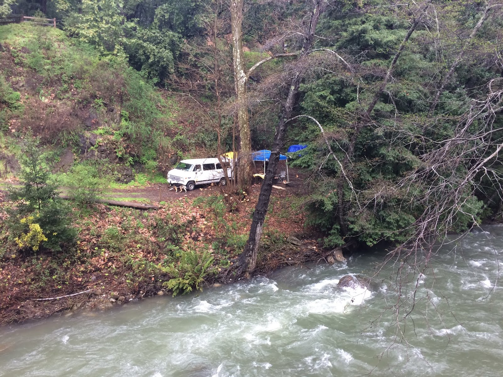
When it was announced that Kikagaku Moyo was playing a show at the intimate Fernwood Tavern in Big Sur, Amber immediately snatched up tickets, along with campsite double aught (the finest one in the adjacent campground) for two nights. Amber's cousin Allen and his big German Shepherd awaited us when we got there. We had to set up some canopies over the fire and the picnic table, because it was raining intermittently the whole afternoon, and throughout the night, which we had mostly expected. The Big Sur River was surging QUITE impressively, and we were happy to have a campsite well above the banks. Other campsites within view were not so protected, and we silently wished them the best, should Rio El Sur Grande burst it's banks (it didn't).

 
The sun set pretty early, and we had been drinking and carrying on on for quite awhile by the time it got dark. But the gig wasn't scheduled to begin until 10pm, so we drafted and quickly executed a plan for a night hike! Headlamps and flashlights ablaze, we went Southeast down the trail that leads out of Fernwood campground, no particular destination in mind. We stumbled through mud, and over many rocks and roots in the semi darkness. And for his reputation as a mighty Native American pathfinder, Allen was the one who injured himself in the dark, though it may have because he was also the most drunk! This would also explain why he doesn't remember seeing Kikagaku Moyo that night.  Poor fella. The show was great, and the intimate, sold out, wood paneled room sounded perfect. I'm sure I passed out like a stone in Amber's comfortable camper van, oblivious of the rainy, cold night outside.


I felt pretty good the next morning, for some reason, even after all the beer, whiskey and whatever else I could get my paws on. I had two potential hikes in mind, and my Big Sur guide said one allowed dogs, and one didn't. So we took ourselves and the big pup to the supposed "dog friendly" trail, only to immediately find a "no dogs" sign at the trailhead. This is one reason I do not have any pets, and therefore do not have to go on trails for the purpose of exercising them. But Allen took responsibility for the shep, broke the rules, and we continued without incident! The Soberanes Canyon / Rocky Ridge loop in Garrapata State park was magnificent. We saw nary a drop of yesterday's rain, and completed a route that had almost everything one could wish for in a Big Sur hike: Gushing creek, redwood groves, rocky inclines, rolling verdant hillsides, ocean views and even a goddamn rainbow to top it off! 

Amber was not as thrilled as I was, even in her new hiking boots, because the hangover that somehow eluded me had sunk it's claws deeply elsewhere. After what I considered a perfect Big Sur hike, with an encore at the beach, we returned to the campground to find Bryce and Crystal waiting for us. The party began… or continued? We were able to find someone selling an extra ticket to that nights (added later) sold out show, so that Allen could go in and remember seeing the band this time. Amber and I were able to watch the band from outside, at the side door, and witness a totally different, heavier set list than the night before. No complaints whatsoever. Except for MY hangover the NEXT day.