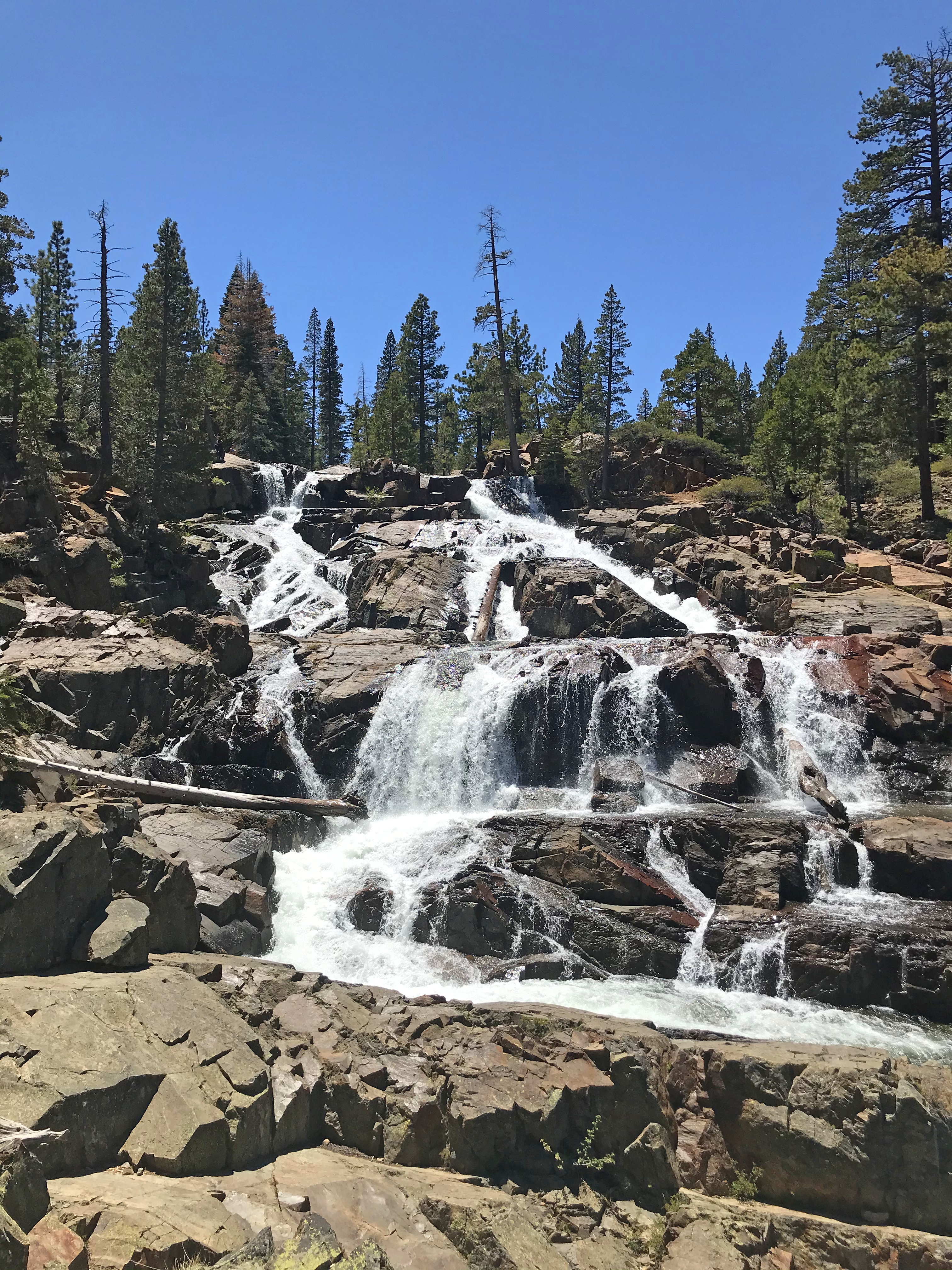
Tuesday, August 3, 2021
Granite Chief
DISTANCE: 14.63km / 9.09 miles
ELEVATION GAIN: 1202m / 3944'
TIME TAKEN: 6:36
PALISADES AT TAHOE RESORT
TAHOE NATIONAL FOREST
GRANITE CHIEF WILDERNESS
PLACER COUNTY, CA
NISENAN AND WASHOE STOLEN LAND
SOUNDTRACK: Three Inches Of Blood: Chief And The Blade
SUMMITS:
• Granite Chief: 2745m / 9006'
• Needle Peak: 2734m / 8971'
PHOTO ALBUM
MAP
Since I didn't roll into Tahoe the night before until about 1:30AM, and didn't close my eyes until about two, the mandatory minimum amount of sleep for basic human functionality, for me anyway, five hours, required me to sleep until 7AM, which was not the ideal early start that I'd hoped for. Luckily, I was tired enough to pass right out on the bench seat of the van. Awaking at 7AM, I got right out of the Eagle Point Campground, and drove up to my first Tahoe hiking expedition of the week. I was pretty unfamiliar with the area, so I accidentally drove into Alpine Meadows first, instead of my intended destination, Squaw Valley, which by the time you read this will have been renamed "Palisades Tahoe." The driving around cost me some time. After that, I drove the proper way, into Squaw Valley. Parking was not allowed at the trailhead, so I had to park in the giant lot by the "village," which is like an open air mall, so that's my first Sierra Nevada hike ever that's begun in a mall parking lot. By then it was about 8:20AM, and it was already hot. I realized I had forgotten to bring sunglasses, so then I had to go into the mall, and buy some expensively priced cheap sunglasses!
So now, it was almost 9AM by the time I started hiking. The first stretch of the Shirley Canyon Trail is a well maintained track through the woods and increasingly steep boulder landscape, up to Shirley Lake. There were multiple parties ascending, and I passed them all in due time. There were dry waterfalls on dry Shirley Creek, and with the elevation gain, views opened up of the multitudes of surrounding peaks. And out of the trees, and onto the granite, the heat amplified. Seems like most of the other hikers were going up to the lake, I took a glance at it, and then continued. My plan had been to continue south from the lake on the Solitude Trail for a hot minute, then cut cross country, directly up towards Granite Chief, possibly following the course of Squaw Creek. But I was not paying attention, and I continued on Solitude Trail for too long. I realized my error when I took my first break of the day, and determined to have a cross country section, off trail, (for some reason, it was really a slow down waste of time that probably cost me Lyon Peak), I cut back into the bush. I love how my navigational errors become the fuel for extra adventure! Up ahead, the Squaw Creek drainage looked too brushy to ascend, so I stuck to the left of the canyon. The front country nature of this hike really hit home now, as I found voluminous amounts of garbage littered about. Everything from bottle caps, to beer cans, to shoes and orphaned single ski poles. No where near the trail or even the ski lifts. Is this stuff left out here by cross country skiers in winter?
I came up a trail that wasn't on any maps, that took me to the maintenance road for the Shirley Lake Express ski lift. I then veered back into my precious "wilderness," back into the bush, determined to make a hard time of it, apparently. And now it actually got interesting, keeping left (south) in the canyon, I came to some steep hiking, pine tree shade, and even a bit of light class 3 as I climbed a chute up to the dirt road at the top. Now that I had forced a backcountry experience in the front country, I could move on. At the top of the Squaw Creek watershed, it was 11:30AM, but I was very close to Granite Chief, and I followed the trail up, never losing sight of the omnipresent ski lifts. I got to the top of Granite Chief at noon exactly, and signed the register. The day was a little hazy, but not smoky. I took in the views from all directions, and I could see the smoke from Dixie Fire in the north. I spent less than ten minutes on Granite Chief, and headed off to the next peak, Needle.
There was a faint use trail for some parts along the ridge, but mostly it was rocky, and more tedious than I was expecting. I have no Idea why I was expecting something easier. Going along the ridge, I had a bird's eye view of Needle Lake below, and other points north. By a quarter to one, I had reached the cliff band below Needle Peak: Suddenly, red volcanic rock. I veered to the north side of the ridge to get around the cliffs, and I found a chute on the north side of it with a brief class three scramble to the top, where there was an old summit register in a rusty tin can. By now, it was 1pm. I had already bought a ticket for, and was planning to use the aerial tram from High Camp, to descend to the parking lot, which would save me three miles on the back end. The last actual tram went down at 4:30PM. I was pretty sure I could make it to the day's third peak, Lyon, and back to High Camp in time for the last tram. But I decided I didn't really want to be out all day, it was hot and dry, and I was out of shape for hiking, and feeling it. My friends would start arriving at Eagle Point Campground around 4PM, and I wanted to hang out. So I abandoned Lyon Peak, a decision which irks me to this day, because it makes so much logical sense to do it line with Granite Chief and Needle, and now I have to go back and do it by it's self some day. Dumb. Should have gotten an earlier start. Should have brought sunglasses. Should have stuck to the trails: D.U.M.B.
So now, trying to get back efficiently, decided to, rather than pick my way back along the ridge, I would plunge down the hillside and hit the Tevis Cup Trail, taking that back to civilization. It was some elevation loss and regain, but I'm sure it was still ultimately faster. I reached the Tevis Cup Trail by 2PM, a dusty, well established track through the pines. By 3PM, I was at High Camp, the place where the aerial tram descends. I noticed that there was a bar there, and my ears perked up, but then I saw a tram was about to leave, so I was like "fuck it, I'm just gonna catch this one and go down, and get the fuck outta here." The view from the tram was nice, when it pulled away, I got the flutter of anticipation in my chest, like getting on a roller coaster. I hadn't ridden a ride in a long time. I was able to identify a lot of peaks of the Squaw Valley area from up there, and get a good lay of the land. Ultimately, for the tram, I paid $39 to travel 1.3 miles, the most I have ever paid to travel such a short distance, although peak hours Lyft rides in San Francisco have come dangerously close.
FURTHER READING
Granite Chief on PEAKBAGGER / SUMMITPOST
Needle Peak on PEAKBAGGER / SUMMITPOST
Thursday, May 27, 2021
Glen Alpine Falls / Eagle Point
DISTANCE: 3.97km / 2.47 miles
ELEVATION GAIN: 98m / 323’
TIME TAKEN: 1:21
ELDORADO NATIONAL FOREST
EL DORADO COUNTY, CA
STOLEN WASHOE LAND
SOUNDTRACK: Taste: Over The Glen
PHOTO ALBUM
MAP 1 - Glen Alpine Falls
MAP 2 - Eagle Point
TRIP REPORT COMING SOON!
Wednesday, May 26, 2021
Eagle / Cascade Falls
DATE: Wednesday, May 26, 2021
EAGLE FALLS
DISTANCE: 1.9km / 1.19 miles
ELEVATION GAIN: 76m / 250'
TIME TAKEN: 1:09
EMERALD BAY STATE PARK
CASCADE FALLS
DISTANCE: 3.51km / 2.18 MILES
ELEVATION GAIN: 128m / 421'
TIME TAKEN: 1:28
ELDORADO NATIONAL FOREST
EL DORADO COUNTY, CA
STOLEN WASHOE LAND
SOUNDTRACK: Hüsker Dü: Everything Falls Apart
PHOTO ALBUM
MAP
TRIP REPORT COMING...?
Sunday, October 11, 2020
Echo Peak
DATE: Sunday, October 11, 2020
DISTANCE: 7.98km / 4.96 miles
ELEVATION GAIN: 918m / 3013’
TIME TAKEN: 5:20
ELDORADO NATIONAL FOREST
DESOLATION WILDERNESS
ELDORADO COUNTY, CA
STOLEN WASHOE LAND
SOUNDTRACK: Pink Floyd: Echoes
SUMMITS:
• Peak 7758 (“Dumbo”) / 2365m
• Flagpole Peak: 2549m / 8363’
• Echo Peak: 2711m / 8895’
• Peak 8760’ / 2670m
• Indian Rock 2621m / 8600’
• Angora Peak (2X): 2617m / 8586’
PHOTO ALBUM
MAP
Angora Peak previously climbed September 29, 2020
CONTINUED: Previous day’s hike: Freel Peak
This day’s hike describes a point to point traverse of the ridge north of Echo Lakes, with six summits attained along the way. This is almost completely off trail, but can be done over pretty easy terrain if you so choose, with a few exceptions. A brief class 3 scramble is inevitable to get to the very top of Flagpole Peak, and the crux of the trip is a stiff class 3 (some say class 4) down and up climb through a rocky notch between Peak 8760 and Indian Rock. Almost unlimited bonus scrambling on high quality granite can be had in this area if you’re into that sort of thing!
Awaking again at Fallen Leaf Campground, Alex and I decided to use our bikes that we had both brought and check out the path out to Baldwin Beach, which was pleasing to the senses of course. We had a clear sunny day on our hands now, just the type that was meant to be spent hiking at Lake Tahoe. We returned to camp and packed up. Then, since we had bikes AND two cars, we used all of the vehicles in our next maneuver. We put both bikes on Alex’s bike rack, and dropped his car up at the Angora Lakes parking lot. Then biked back down, past the Angora Lookout (nice views of Fallen Leaf Lake and Tallac), back to the campground, where we threw the bikes into my van, and drove up to the Echo Lake parking lot, starting the hike from there. With all of the morning’s beach going and driving and biking around we didn’t start hiking until 12:30PM, but it wasn’t a big deal since we only anticipated about five miles.
We crossed the bridge at the east end of Echo Lake and followed the trail west for a few minutes, before heading uphill, over the granite towards what we presumed was Flagpole Peak, the first stop on our agenda.Instead, we arrived at another, lower summit, Peak 7758, which someone later called “Dumbo.” The day was cloudless, Echo Lake sparkling, and we already had views of the Crystal Range coming into sight. From the top of Dumbo, we now had a clear view of Flagpole Peak and our path to get to it. We descended down into a sandy saddle, and then got right to the excellent granite that awaited. There’s probably an easier way up, but we found extremely fun class three most of the way: ramps, slabs, cracks, you name it, it was a granite paradise! It was about 1:45PM when we made it to the top of Flagpole Peak (yes, there is a flagpole), there were two fellas up there already who told us of their ascent route, and of the colloquial name (“Dumbo”) for Peak 7758. After admiring the view (almost straight down on the lake!) we wished them well, and carried on.
The next goal, Echo Peak, the day’s highest point, could have been reached more easily and faster if we had stuck to the south side of the ridge, but we chose to stick right along the top, where we took every opportunity to get into class three scrambles on the excellent rock. At that pace, we didn’t reach the summit of Echo Peak until after 3PM. Echo Peak is more of a ridge highpoint, and not a very interesting peak, but the view was sublime, with Angora Lakes, Fallen Leaf and Tahoe spilling out in front of us like a sapphire necklace. We enjoyed the peak and a snack, and had a nice chat with a nerdy couple from Davis that had hiked up there. Next came an easy section, north on the sandy ridgeline, where we passed over Peak 8760, a bump so insignificant that we didn’t even notice it. Just after that, the soft ridge came to an abrupt end, and we approached the fractured granite notch that separated us from Indian rock. This required a downclimb on the granite jumble with a steep slope on one side, and VERY steep cliffs on the other side. Alex led the way down, gracefully, and then chose a successful route up the other side. The rock was of good quality, and we had no issues. Some have denoted this section as class 4. I’ll let you judge it for yourself!
Next up was the summit of Indian Rock, which was less a peak, and more like the high point at the edge of a huge cliff. Indeed, it towers over 2,000 feet above the Glen Alpine Creek area to the north, and is quite an impressive sight from that direction! Now it was time for the sixth, and final summit of the day, Angora Peak, which I had visited just twelve days earlier, from the other side, unfortunately in a smoky haze. I was happy to have a clear day for the return visit. It was now about 4:30, and we took almost an hour to pick our way over to Angora Peak, slowing our pace now, coming to the end of a busy two days. Once more, we met another pair of hikers at the top of the peak, this time a local couple. They complained about the amount of outsiders (sorry!) flooding the region during the pandemic and confirmed our suspicion that it was still unusually busy, for October. The Angora Peak summit register that I had signed less than two weeks ago was gone, so we made our final descent now, twilight crawling in, down the slopes to Alex’s car in the Angora Lakes parking lot. He gave me a ride to my van back at Echo Lake, we sorted out our bikes in the now darkness, and went our own ways back to the Bay Area, through the snaking highways of the California night.
FURTHER READING
• Bob Burd: Does a similar traverse
• The Outbound: Flagpole Peak from Echo Summit
• Greg Lamy: Echo Peak from Echo Lake
• Trails Guide: Angora Peak from the east
• Peak 7758 (“Dumbo”) on PEAKBAGGER
• Flagpole Peak on SUMMITPOST and PEAKBAGGER
• Echo Peak on SUMMITPOST and PEAKBAGGER
• Peak 8760 on PEAKBAGGER
• Indian Rock on PEAKBAGGER
• Angora Peak on PEAKBAGGER
Saturday, October 10, 2020
Freel Peak
DATE: Saturday, October 10, 2020
DISTANCE: 22km / 13.66 miles
ELEVATION GAIN: 1327m / 4354’
TIME TAKEN: 7:06
ELDORADO NATIONAL FOREST
EL DORADO COUNTY, CA
STOLEN WASHOE LAND
SOUNDTRACK: Deodato feat. Camille: Are You For Real?
SUMMITS:
•Trimmer Peak: 3022m / 9915
• Freel Peak: 3316m / 10,881’
PHOTO ALBUM
MAP
...continued: Previous Day's Hike: Tahoe Mountain
Freel Peak is the highest point in the Lake Tahoe Basin rim, clocking in at nearly 11,000 feet above sea level. This alone should be enough reason enough to pay it a visit. But there's more! The height and prominence of this peak provides the most complete and sweeping view of the spectacular Lake Tahoe area that you will see anywhere! And while the top of the peak is pretty much just a pile of talus, the approach hike is a treat in it's self, bringing you through locations of scenic granite majesty. This can be done as a class one hike all the way to the top if you stay on the trail.
I was up with my alarm at 7am, Alex had slept on the open ground as he is wont to do, and he was also waking up. We were in pretty good shape, because it had been too cold outside the night before to stay up late and drink too much beer! It was our second annual October trip to stay at Fallen Leaf Lake and do some mountain climbing (last year: Mount Tallac). Our original plan today had been to approach Freel from the south, via Willow Creek Road. I’d read that some people needed 4WD to get up that grade; my van is 2WD, but high clearance at least, so I though it was worth a shot. We got to the turnoff, and then only a few hundred feet up the dirt road before I found my wheels spinning uselessly in the dust. Now, we could have just parked at the bottom of the road and walked up, this might have been more economical for time in the big picture, but instead, we decided to drive around, back to Meyers, and use the other trailhead at the end of Fountain Place Road, which probably burned an hour.
It was almost quarter past nine by the time our boots hit the dirt at Fountain Place. There are two ways to go up to Freel from there, the proper Armstrong Connector Trail to Armstrong Pass, or a gated private dirt road that leads through an inholding in the woods. The private road was more direct, supposedly steeper, and word on the street was that no one had been hassled for trespassing. We decided to take the proper trail on the way up, and maybe use the private road on the way back. The Armstrong Connector Trail was dusty and well worn by foot and mountain bike, a forest freeway. It wasn’t very direct (towards Freel Peak), but it was a nice walk, with the open granite shoulder of the mountain soon coming into view, followed by our arrival at Armstrong Pass one hour and twenty four minutes after we started out. Three different trails converge at Armstrong Pass, and we took a short break to much on a breakfast of trail mix, while two other parties came and went. From here, we now had a view to the South, and could see Hawkins Peak, among many others. From the pass, we turned north on the Tahoe Rim Trail towards Star Lake. The path starting gaining elevation in earnest now, creeping up the rocky western side of the Freel Massif. Tallac and the Crystal Range came into view. I had heard Freel Peak was a basically a pile of sand at the top (not wrong), but I had no idea about the granite wonderland that was to be passed through on the approach. We came through right below the massive rock known as “Fountain Face," Peak 9841 and it’s jagged eastern ridge appeared soon after.
It was just past noon when we got to the turnoff trail for Freel Peak (I’ll call it Freel Pass), but having admired the jumbled Granite of Trimmer Peak from down in village on last month’s visit, I was keen to give it a go. I asked Alex if he wanted to do Trimmer before or after Freel, and the results came in for Trimmer. So off we went, out to the west. We followed the rocky ridge, right over point 9885, down through a sandy saddle, and then up to the granite stronghold of Trimmer Peak. This was our first unabated view of south Lake Tahoe, which never disappoints. We could also see that a lot of clouds were blowing through, though luckily they weren’t bringing rain or snow. It took us about an hour to get to the summit of Trimmer, longer than I was expecting, but it provided much beloved extracurricular granite scrambling, and we found the summit register as well.
I thought I saw a quicker way to get back to Freel Pass, and I led us back, this time cutting to the south of Point 9885. This proved to be a terrible idea, with much sidehilling on loose scree, steep plunging cliffs, and a struggle to not lose and regain elevation. It was very tedious, and it burned more precious October daylight than necessary, taking another full hour to get back on track for our Freel ascent. Now 2:30PM, it was getting cloudier and colder, but we pushed on, and made it to the final 1,200 feet to the top in less than an hour. It was very brisk and windy, but Alex had thoughtfully brought a flask filled with Scotch whiskey, so that helped. The previous party had already gone down, so we didn’t have to share it either! Now at almost 11,000 feet, at the highest point on the Tahoe Rim, we had a 360 degree view of the surroundings, snowless mountains, the lake, now slate grey beneath the clouds, the drier expanse of Nevada to the east. We spent about 20 minutes up there, and decided to forgo any more bonus peaks (Jobs, etc.) due to the waning daylight (almost 4PM now), and the cold winds. I had hoped to also include Jobs Peak and Job’s Sister in the day’s hike, but apparently I had traded them for Trimmer.
Now that it was time to go back down, the more direct trail through Trout Creek Canyon seemed worth a shot. Down we went, the trail plunging down a steep sandy hill, which was fun to descend, and would have been a pain to come up. So we accidentally made the right choice in trails. There was one final view of the fabulous cliffs of Peak 9841, and then we were down into the aspens on the canyon floor. The trail almost disappeared, at times, in the thicket, but this was easily forgiven with the beautiful fall colors surrounding. Soon, we came to an old fenceline, saw "No Trespassing" signs, and we were in the old Fountain Place property inholding. The trail became a dirt road, and like an omen, we saw a shotgun shell lying in our path. The omen turned out to be meaningless, though. We saw a few a dilapidated structures in the distance, one car parked, but no people. And then, just like that, we were through the gate, back at the trailhead parking lot, no trouble! Just over seven hours out. We went back to Fallen Leaf Campground to stay another night.
To be continued: Sunday, October 11, Echo Peak!
FURTHER READING
• Ted’s Outdoor World: A very similar route to ours (minus Trimmer)
• The Outbound: Another description
• Trimmer Peak on PEAKBAGGER
• Freel Peak on SUMMITPOST and PEAKBAGGER
Friday, October 9, 2020
Tahoe Mountain
DATE: Friday, October 9, 2020
DISTANCE: 3km / 1.87 miles
ELEVATION GAIN: 160m / 526’
TIME TAKEN: 46 min.
ELDORADO NATIONAL FOREST
ELDORADO COUNTY, CA
SOUNDTRACK: Cathedral: Copper Sunset
SUMMITS:
Tahoe Mountain SE Summit: 2172m / 7127’
Tahoe Mountain: 2210m / 7249’
PHOTO ALBUM
MAP
I had established camp at Fallen Leaf, and it would be a few hours still until my brother Alex arrived, so I decided to enjoy the afternoon and go for a bike ride up to the Devron Connector trailhead, which connects into a neighborhood on the west side of Fallen Leaf Lake. It was quarter past five, but I had still enough light remaining for a short hike, so I locked the bike to a tree and went for it. After I gained some elevation, I could see out to the south, and saw some smoke haze lingering in the atmosphere, but it was much better than my visit in September. In about five minutes, I was at the Valley View Trail, which switchbacked me up to the top of the NW-SE trending ridge. I now had a good view out at Freel Peak, tomorrow's destination, and the red and white striped tower on Tahoe Mountains SE summit.
The top of the ridge was very flat and civilized, with dirt road access for the radio towers. I had a partial view of Lake Tahoe, to the north, through the trees. Fifteen minutes later, I was at the proper, taller NW summit of Tahoe Mountain. This one had a small shack structure on top, more trees, less views. But I could see the almost set sun going down behind Mount Tallac and Fallen Leaf Lake, and it was nature's glory indeed. I wasn't in a big hurry, because I had only a short way to go, and still enough light, but I decided to cut downhill through the woods from there, taking a shortcut back to my bike, and I rode my bike back down the road to the campground uneventfully. Alex showed up sometime after dark, and we dined on takeout pizza and decent beer, ah the joys of camping in Lake Tahoe!
CONTINUED: Saturday, October 10: Freel Peak
FURTHER READING
• The Long Green Tunnel: Description of this short hike
• PEAKBAGGER: Tahoe Mountain NW Summit and SE Summit
Wednesday, September 30, 2020
Cave Rock
DATE: Wednesday, September 30, 2020
DISTANCE: 1.67km / 1.04 miles
ELEVATION GAIN: 61m / 199’
TIME TAKEN: 49 min.
SUMMIT: Cave Rock 2000m / 6560’
HUMBOLDT TOIYABE NATIONAL FOREST
DOUGLAS COUNTY, NV
STOLEN WASHOE LAND
SOUNDTRACK: High On Fire: The Cave
PHOTO ALBUM
MAP
One last day of a Tahoe vacation, I picked the morning’s agenda, a quick ascent of Cave Rock, on western shore Nevada side. It was another smoky day at the lake when Amber and I started off before 8AM, trying to catch the sunrise. It’s about a half mile from the trailhead to the top of the rock, and even on this weekday morning, we were not alone. I’m pretty sure there was a woman flying a drone to film herself doing yoga poses, or something ridiculous like that. I couldn’t quite tell. Didn’t want to know, really. The company wasn’t wholly unwelcome, though. Some nice people took our picture for us! The view from the rock was astounding, even with the smoke, especially the vertigo inducing vantage of the highway directly below. On the way back, I found a disturbing message in the woods. then we spent the rest of the last day of our vacation at Amber’s favorite place, Sand Harbor, where we enjoyed the beach and also did some kayaking.
ON PEAK NAMES
The original Washoe name of Cave Rock is De’ek wadapush or Standing Grey Rock
FURTHER READING
• Washoe Tribe sacred site information
• Tahoe South: "A short hike with beautiful views"
• Cave Rock on PEAKBAGGER
Monday, September 28, 2020
D.L. Bliss State Park
DATE: Monday, September 28, 2020
DISTANCE: 9.5km / 5.91 miles
ELEVATION GAIN: 270m / 886’
TIME TAKEN: 3:13
D.L. BLISS STATE PARK
ELDORADO COUNTY, CA
STOLEN WASHOE LAND
SOUNDTRACK: Excruciating Terror: Ignorance Is Bliss
PHOTO ALBUM
MAP
…CONTINUED: Yesterday's Hike: Maggies Peaks
After spending the night in the van at Lake Tahoe, Amber and I started off in the morning to hike on the famous Rubicon Trail in D.L. Bliss State Park, on the western shore of Lake Tahoe. The smoke was still gone, and the sky and especially the especially the lake were an unreal perfect blue. there was no better place to enjoy it than the Rubicon Trail, as far as I could tell. No peaks, scrambling or strenuous distances today, just a hell of a nice walk along the lake.
About 10:15AM, we started south from the parking lot, and almost immediately were immersed in the spectacular scenery. It was fairly busy, as to be expected, but not annoyingly so. The trail is very well constructed, with bridges, boardwalks and chain ropes at all necessary locations. We took just over two hours to get to our turnaround spot, almost all the way down to Emerald Point (the peninsula, not the mountain). On the way back up, we did a slight variation on the trail, which got us to the adorable little Rubicon Point Lighthouse, which could have been pretty easily mistaken for an outhouse in my opinion. We were back at the van by about 2PM. But the excitement wasn’t quite over, as we saw a bear by the roadside on the way out!
To be continued... TOMORROW'S HIKE: Angora Peak
FURTHER READING
• 101 Hikes In Northern California: Matt Heid: Wilderness Press, 2000: pp 202-204: Description of the full hike
• California Through My Lens Description with photos
• Rubicon Point on PEAKBAGGER
Sunday, September 27, 2020
Maggies Peaks
DATE: September 27, 2020
DISTANCE: 12km / 7.45 miles
ELEVATION GAIN: 782m / 2566’
TIME TAKEN: 6:30
ELDORADO NATIONAL FOREST
DESOLATION WILDERNESS
ELDORADO COUNTY, CA
SOUNDTRACK: The Exploited: Maggie
STOLEN WASHOE LAND
SUMMITS:
• Maggie’s Peak South: 2651m / 8699’
• Maggie’s Peak North: 2590m / 8499’
PHOTO ALBUM
MAP
Maggies Peaks are a nearly symmetrical double mountain formation in south Lake Tahoe, near Emerald Bay and Cascade Lake. Supposedly they were named after a busty barmaid who worked at the Tahoe Tavern in the 1800’s! I had been interested in Maggie’s Peaks for quite awhile, and not for some kind of juvenile breast fascination. I thought it would be a really cool hike to make a loop through the beautiful alpine environment including Eagle Falls, Eagle Lake and Granite Lake. Today, that’s what I did. Maggie’s Peak South is the taller one, and has a strong use trail to the top, class one all the way, very popular with the dayhikers. Maggie’s Peak North is less tall but more challenging at class two, with plenty of optional class 3 for fun.
After some kind of family and friends gathering at my parents’ house in Jackson, Amber and I were set to have a short getaway to Lake Tahoe. My brother Alex, and my other brother’s girlfriend, Silver, were also free, and decided to join us in Tahoe for the day. Amber and I drove up in her van, and Alex drove himself and Silver in in his Toyota, so they could return to The Bay at the end of the day. We had to park up the road from our intended trailhead at Eagle Falls, it was a beautiful Sunday (the smoke had miraculously cleared) and the area was slammed. We started hiking from the cars at 11:30AM, enjoying views of the stunning Emerald Bay as we went down the road. In 20 minutes, we were at the Eagle Falls trailhead, and the area was quite full of people, even though the waterfall was barely in existence at this point. I didn’t care, I was too busy admiring the granite crags of Emerald Point high above to the north.
We arrived at Eagle Lake by 12:30, and in an effort to please everyone in the party, we spent about an hour swimming and picnicking at Eagle Lake. After that, I pushed my agenda on everyone to to my intended ascent of Maggie’s Peaks, Alex onboard of course, the girls… skeptical? We took the Eagle Falls Trail up to it’s junction with the Bayview Trail, through increasingly sublime alpine scenery. I was salivating over the excellent granite of Eagle Lake Buttress and it’s surroundings, which I hoped to climb soon. The melange of the pines and the granite dust, the warm sunshine and the cool breeze, it was intoxicating to me. But by now, Amber was hangry, was convinced I mislead her about the mileage of the hike, and Silver was functioning, somehow, hiking in cowboy boots, couldn’t have been happy. So we split off into natural pairs in between Maggie’s Peaks: the girls went straight down, back to the road, and Alex and I naturally took off up the use trail to Maggie’s Peak South. That had been my angle all along, of course, to have two teams to split into. The south peak had a good crowd of casual day-hikers at the main viewpoint, which dramatically overlooked the lake, so we enjoyed it briefly, then paid a visit to what we presumed was the high point, a more prominent rock just to the south.
Next it was off to the less popular Maggie’s Peak North, we found our own way there, over some open granite, admiring some spectacular Sierra Juniper trees along the way. We used a fun class 3 chute to ascend the peak (there was probably an easier way), and admired the views all around from Fallen Leaf Lake to Mount Tallac to Emerald Point. Not wanting to leave the ladies waiting too long, we then plunged almost straight down from the peak to Granite Lake, where Alex, always gung ho for a swim, sampled the waters of the lake. Then it was back on the trail, heading for Bayview Campground and the road, but we took another time saving shortcut, going north cross country and plunging down the steep hillside back to highway 89 where the cars were parked. We found the girls smoking weed in the van has we dumped the rocks out of our boots, and then made our way to Sonney’s Barbeque, where hunger was vanquished and thirst was relieved. Alex and Silver then returned to the Bay Area, while Amber and I remained to spend a few more days at the lake.
FURTHER READING
• Bob Burd: Knocks out both peaks in the snow
• Hiking Project: South Peak only
• Outdoor Project: South Peak only
• Maggies Peaks on SUMMITPOST
• Maggies Peak South on PEAKBAGGER
• Maggies Peak North on PEAKBAGGER
Sunday, October 13, 2019
Mount Tallac
DATE: Sunday, October 13, 2019DISTANCE: 12.16 miles
ELEVATION GAIN: 3807 ft.
TIME TAKEN: 7:01 hours
SUMMIT: 9735 feet SPS OGUL
DESOLATION WILDERNESS
ELDORADO COUNTY, CA
My brother Alex is one my favorite people to go hiking with, not only because I've known him for most of my life, and we get along pretty well, but I also know what to expect from him as far as his hiking appetite and endurance, and we seem to be pretty evenly matched. In addition, Alex has worked over the years doing trail maintenance for the Forest Service in the backcountries of Nevada, Montana, Idaho and New Mexico, so he knows his way around a damn trail! He even took me on my first ever backpacking trip when I went to visit him in Montana in the summer of 2016! His experience in the outdoors in vastly greater than mine, and it's nice to have him around should any questions or problems arise; I have a lot to learn from him still.
OK, at that point I started writing about what happened on Saturday afternoon as we were driving to Lake Tahoe, and what happened when we got to the campground. I realized you may not want to read that bullshit, because it has nothing to do with the hike at all! So I'm going to include that part at the very end as "bonus material."
| Early sunlight 'pon th'mount |
| Cathedral Lake |
| At the summit |
| Descending to Fallen Leaf |
Sunday, June 30, 2019
Castle Rock / Round Mound
CASTLE ROCK
DISTANCE: 2.7 miles
ELEVATION GAIN: 600 feet
TIME TAKEN: 1 hour
SUMMIT (FAILED): 7870 feet
ROUND MOUND
DISTANCE: 1 mile
ELEVATION GAIN: 200 FEET
TIME TAKEN: 1 hour
SUMMIT: 6717
LAKE TAHOE
TOIYABE NATIONAL FOREST
DOUGLAS COUNTY, NV
We left The Bay well after midnight, and were crashed out in the van in the parking lot of the Lake Tahoe Flea Market before sunrise. I can't remember exactly why we did it this way, maybe just the excitement of getting on the road and away from home as soon as possible. But driving all night and crashing out in the van threw off the schedule, and probably eliminated my chances of getting up early to climb any notable mountain. After we got up, perused the flea market, got brunch at Red Hut, and bought supplies at the local grocery store, the day was already well under way. I was by now dying to drop Amber off to party with her girlfriends at the beach cabin at Zephyr Cove, Nevada, so I could go CLIMB something. By the time this was achieved, it was getting rather late in the day to start a big adventure, and I had to narrow my scope. My original first choice was to go up Mount Tallac, always ambitious you see, but I figured it was WAY too late in the day to begin that now. My second choice was Maggie's Peaks, a much more reasonable goal, but even that secondary dream was fading away, because I really wasn't feeling driving back to the Southwest side of the lake from Zephyr Cove. It was a splendid Sunday at the height of the season, and traffic was thick. I downsized my ambitions, and settled on a nearby craggy outcropping called Castle Rock. It looked cool, and it was nearby. I said goodbye to the girls, who were inflating a giant raft to take out on the lake, and already pouring their second or third round of cocktails. I got in the van and was OFF, heading down the highway and then up Kingsbury Grade road in pursuit of my goal.
The Castle Rock trail was achieved by taking Kingsbury Grade road up to Dagget Pass, and turning left into a series of residential streets which led me to Genoa Peak Road and an entrance to the Tahoe Rim Trail. It was already 2PM when began my first hike of the day. I can't remember whether it was intentional or a mistake; I set off on the Tahoe Rim Trail, instead of the Castle Rock Trail, which both lead out of the same parking lot. I"m gonna pretend it was intentional, and it made a nice loop through the dusty dry pine forests. I always prefer to make a loop instead of an out and back anyway. I was at a pretty decent elevation and could see out to the South. I met a befuddled couple who were looking for Castle Rock also, and a mountain biker who was doing a circuit of some part of the rim. In good order I made my navigation around the loop to where the Castle Rock trail branched off, and plodded on towards the crag. There were several groups of young people hanging out on the increasingly prominent rock outcroppings, and I utterly ignored them as I made my way towards Castle Rock, now looming right in front of me. Light scrambling amongst the ancient stone. My pent up climbing energy fit to burst out by this point, I got the base of the rock and saw a sign which read: FALCONS NESTING - DO NOT PROCEED TO TOP OF ROCK
| My ambition, crushed |
| My saviour, Round Mound |
Round Mound (as it turned out to be called) was an easy summit (about 200 feet up?). Dry, dusty summer pines and brush abounded, along with some nice boulders which I frolicked across, relishing in my late period victory to not leave Lake Tahoe "empty handed." The views were fine in all directions. I had a good look back at my tormentor, Castle Rock. The lake sparkled like a turquoise mirror. Round Mound was no Mount Tallac, it wasn't a mountain at all, it was a mound, it was a perch above one of the finest mountain lakes in all the world. A "peak" in my clutches, I was finally able to return to the dionysian delights of Zephyr Cove, sharing a a bevy of alcoholic drinks and fried foods with three (now) very intoxicated women.
To be continued...
ON PEAK NAMES:
Castle Rock: OK, come on, yeah it's a rock and it looks somewhat like a castle, but there are already at least 50 Castle Rocks in the world, 46 of them are in the United States, not to mention Castle Crags, Castle Peaks and Castle Mountains. How about we call this one something else? My suggestion: Falcon Rock. That one's not taken. (Information Source: peakbagger.com)
Round Mound: I approve. The name is very appropriate, and there are only two others in the United States, both outside of Nevada.