

DISTANCE: 3.75 miles
ELEVATION GAIN: 684 ft
TIME TAKEN: 1:17
LEONA CANYON OPEN SPACE
ALAMEDA COUNTY, CA
PHOTO ALBUM
MAP
Intending this to be the week that I hike every single day, having nothing else to do, my job and most of my social activities eliminated by the Covid-19 Quarantine order, I decided to grab a quick one today on the way home from San Jose. I had never been to Leona Canyon before, but as one of the green blobs on the map of the East Bay, it was bound to get visited someday. And that day is today.
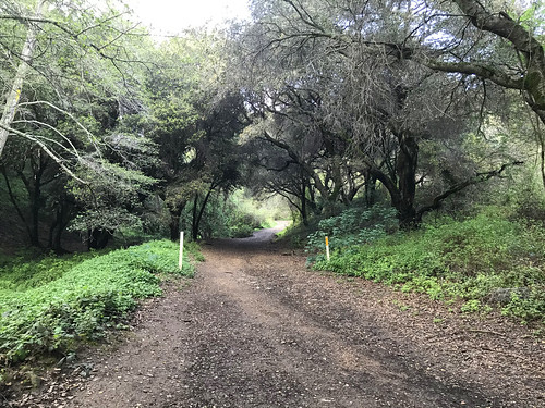
At first, I tried to enter from the north end, at Merritt College, but access to the trailhead is cut off there now, because the college is shut, due to Coronavirus, so I drove down to the south end, at the Canyon Oaks Apartments, and entered that way. It was party cloudy, cool, and 4:30 PM, good conditions, and just enough time for a jaunt before I lost the light. At the south end of the park, there is an earthen dam which must exist to control the flow of Rifle Range Branch (the creek that runs through the canyon), and forms a small pond there. Leona Trail is the main track which follows the floor of the canyon from one end to the other, and off I went, through a tree tunnel of oaks, next to the trickling Rifle Range Branch. Moss and ferns painted the canyon floor green on black.

FURTHER READING
• Oakland Geology Blog: Leona Canyon
• "Step back in time in Leona Canyon," SFGate
 |
| Map by East Bay Regional Parks District |
No comments:
Post a Comment